
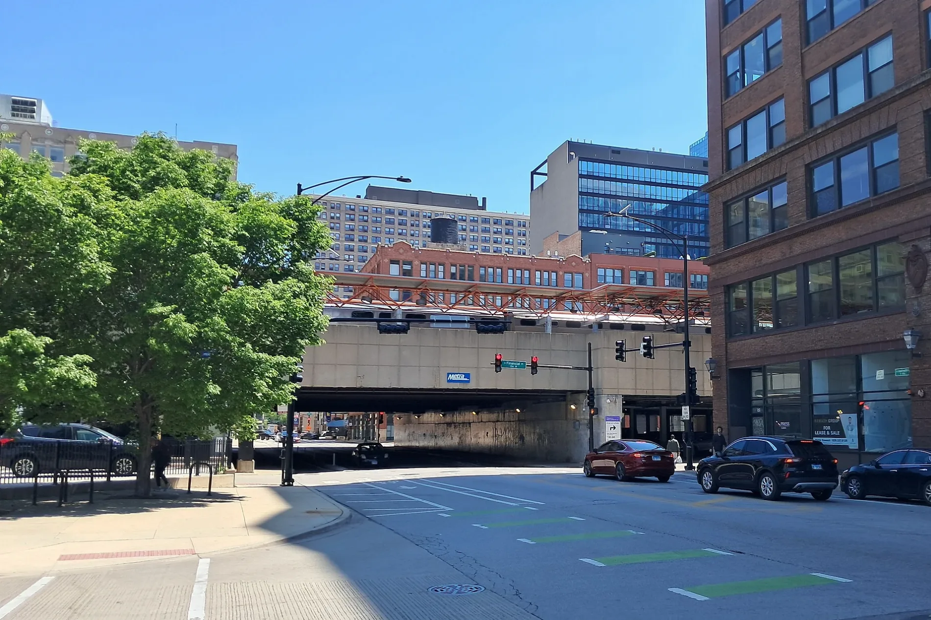
East Harrison Street in Chicago Loop
East Harrison Street in Loop in Chicago is a two-lane, asphalted secondary road. The street has bike paths. It runs in an east-west direction starting from South State Street and crosses South Holden Court, South Wabash Avenue and South Michigan Avenue and ends at East Congress Plaza Drive. East Harrison Street is also known as Harrison St.. Nearby you can find a cafe and a restaurant. The nearest bus stop is Michigan & Harrison (about 200 m away).
- Road Type
- secondary road
- Bicycle
- use side path
- Bike Lane
- separate
- Lanes
- 2
- Route
- east-west
Streets nearby
Harrison Street BikewayDunkin', Baskin-Robbins, Subway, Partners Animal Hopsital, Kids & Company, Sushi Plus Rotary Sushi Bar, Wingstop, Gong Cha, Printers Square Garage
100 ft
East Balbo AvenueBalbo & State, Tilly Bagel Shop, Market By The Blackstone, Mercat a la Planxa, Harrison
550 ft
East Balbo DriveBalbo & Michigan, Balbo & Columbus
0.2 mi
McCormick Place BuswayTerzo Piano, Cafe Moderno
0.3 mi
Wabash Avenue BikewayTrader Joe's, Shang Noodle, The Now, Burger Alley, Eleven City Diner, Molly’s Cupcakes, Five Guys, Sweet Bean, Peet's Coffee, Burnham Mart, Paradise Unisex Spa, Lowcountry South Loop, Jet's Pizza, Chipotle, Glass Curtain Gallery, Chase
0.3 mi
East 9th StreetGolas & Sons Bike Shop, Niu B, New City Bank, Astoria Marketplace
0.3 mi
South Michigan AvenueMichigan & Monroe, The Museum of Contemporary Photography, Michigan & Van Buren/Ida B Wells Drive, Studebaker Theater, The Dial Boomshop, Dunkin', Van Buren Street Station RTA Information Board, Groundswell Coffee, Michigan & Jackson, Michigan & Balbo, Michigan & 8th Street, 720 South Bar & Grill, Herb N’ Kitchen, Kitty O’Shea’s, Conrad Hilton, Michigan & Harrison, Michigan & Roosevelt, Jollibee, Chick-fil-A, Iarca, Pritzker Military Museum & Library, Sugary Chicago, Route 66, Michigan Ave & Jackson Blvd, Michigan & Ida B Wells Drive, Chicago, Chicagoland, Michigan Ave & 8th St, Michigan & 9th Street, Columbia College Chicago Library, Michigan & Van Buren, Aaron Ward Montgomery Bust, Michigan & 11th Street, Burger Bar Chicago - South Loop, Art Institute’s Gardens, Yolk - South Loop, Grant Park Bistro, Potbelly, Le Petit Cafe
0.4 mi
Apartment buildings nearby
30 East Apartments450 ft
Seven 7 Seven0.2 mi
41 East 8th Street0.2 mi
One Place0.2 mi
Essex on the Park0.2 mi
Astoria Tower0.2 mi
Burnham Park Plaza0.2 mi
Crane Company Building0.3 mi
1000M0.3 mi
Artworks nearby
Equestrian Indians (The Spearman)0.2 mi
John Alexander Logan Monument0.3 mi
Event venues nearby
Hilton Conference Hall0.2 mi
Fountains nearby
8th Street Fountain0.2 mi
Hotels nearby
Travelodge Chicago400 ft
Congress Plaza Hotel0.1 mi
The Blackstone, Autograph Collection0.1 mi
Hilton Loading Dock0.1 mi
Chicago Hilton & Towers0.2 mi
Le Méridien Essex0.2 mi
Nightclubs nearby
Buddy Guy's Legends550 ft
Office buildings nearby
Spertus Institute of Jewish Studies0.1 mi
Loftrium0.2 mi
Johnson Publishing Company Building0.3 mi
Graphic Arts Building0.3 mi
Parking lots nearby
Auditorium Parking400 ft
Hilton Parking0.1 mi
Impark0.2 mi
Recreation grounds nearby
Grant Pickleball Courts0.3 mi
Residential buildings nearby
Fairbanks Morse Building0.3 mi
Self storages nearby
U-Stor-It300 ft
Subway lines nearby
South Side Elevated50 ft
Technical colleges nearby
Columbia College 619 S. Wabash Building300 ft
Wabash Campus Building450 ft
Columbia College Chicago Alexandroff Campus Center0.1 mi
Columbia College 618 South Michigan Building0.1 mi
Columbia College South Campus Building0.1 mi
Columbia College Student Center0.2 mi
Columbia College Music Center0.4 mi
Theaters nearby
Merle Reskin Theatre0.1 mi
Getz Theater0.4 mi
University buildings nearby
East-West University Student Life Center0.2 mi
East-West University0.2 mi
| Named after | William Henry Harrison |
|---|---|
| Located in | Chicago |
| Country | United States |
Public transit map Loop Legend
| Railway | |
| Bus | |
| Streetcar |
Bicycle map Loop Legend
| Bike path | |
| Bike lane on roadway | |
| Cycling allowed on bus lane | |
| Bicycle street | |
| Open to cyclists | |
| Open to cyclists, good path | |
| Cycling prohibited | |
| Cobblestone |
| Long-distance bike route | (depending on scale) | |
| Long-distance bike route |
Pedestrian map Loop Legend
| Path |
| Long-distance hiking trail | (depending on scale) | |
| Long-distance hiking trail | ||
| Pedestrians prohibited |