
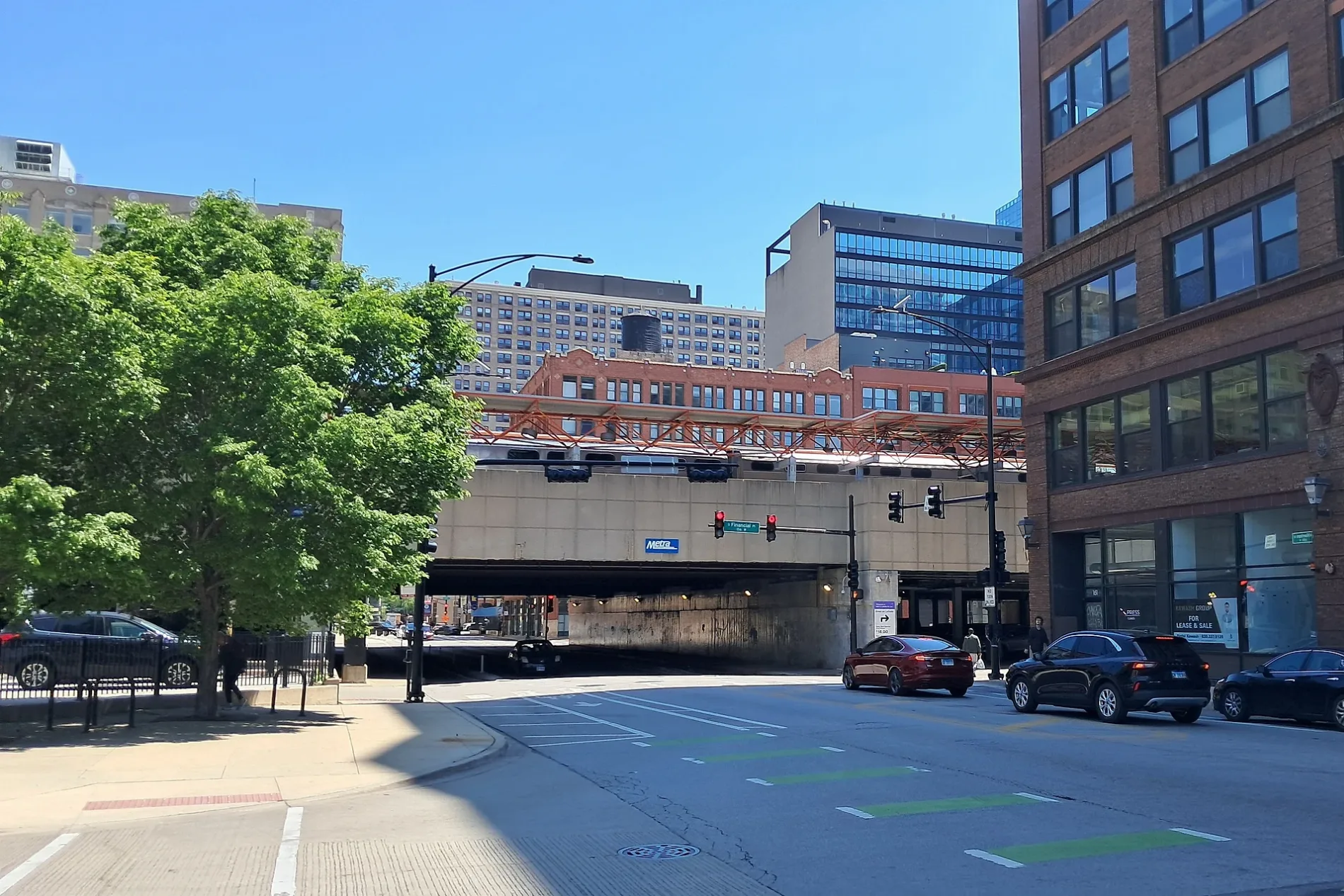
West Harrison Street in Chicago Loop
West Harrison Street in Loop in Chicago is a three-lane, asphalted secondary road. The street has bike paths. It runs in an east-west direction and crosses South Ashland Avenue, South Loomis Street, South Throop Street, South Racine Avenue, South Morgan Street, South Halsted Street, South Canal Street, South Clinton Street, South Jefferson Street, South Desplaines Street, South Paulina Street and South Wolcott Avenue. It connects Chicago, Near West Side, Loop, East Garfield Park and West Garfield Park. West Harrison Street is also known as Harrison St.. This street is part of the Bicycle route "Harrison Street". Nearby there is a cafe. The nearest bus stop is Dearborn & Harrison (about 100 m away).
- Road Type
- secondary road
- Bicycle
- use side path
- Bike Lane
- separate
- Lanes
- 3
- Route
- east-west
Image
Cafes
Streets nearby
South Dearborn StreetDearborn & Monroe, Dearborn & Monore, Ventra, Plymouth Court Cleaners, Dearborn & Harrison, Jackson, Brando’s Speakeasy, Taco Bell Cantina, Kasey's Tavern, Dearborn & Polk, Printers Row Wine Shop, Flaco's Tacos, Vitology, Chengdu Bistro, Cafe Deko, Dearborn & Adams, Dearborn & Ida B Wells Drive, Funk’s Barber Shop, Gotham Bagels, Gino's East, Dearborn & Jackson, Monroe
400 ft
South Federal StreetHarold Washington Library-State/Van Buren, Bistro Monadnock
550 ft
Dearborn Street BikewayDaley Center Plaza, Box Office, Flamingo, Potbelly, The Loop, Meli, Harry's Sandwich Shop, Optimo, Señoritas Cantina, 7-Eleven, Sandmeyer's, Sofi Restaurant, Amarit, Necessary Coffee, Roosevelt Cleaners, Embers + Apothecary
0.2 mi
Polk Street BikewayThe UPS Store, Pressbox
0.2 mi
South LaSalle StreetLaSalle Street Station, Ventra, LaSalle & Madison, Protein Bar & Kitchen, LaSalle & Quincy, 90th Meridian Kitchen & Bar, Bank of America, LaSalle & Adams, The LaSalle Chicago
0.2 mi
West Polk StreetUmai, Hops & Scotch, Federal St & Polk St, Half Sour, Totto's Market
0.2 mi
South Plymouth CourtGrace Episcopal Church, Printer's Row, The Loop Church of the Nazarene, Yarnify, Jazz Showcase
0.2 mi
South Park TerraceSouth Loop Montessori School
0.3 mi
Apartment buildings nearby
Moser Building250 ft
Terminals Building350 ft
Pope Building400 ft
Transportation Building0.1 mi
Rowe Building0.1 mi
Donohue Annex0.2 mi
New Franklin Building0.2 mi
Printers Square Condominium0.2 mi
Imprint0.2 mi
Straits Row0.2 mi
Burnham Pointe0.2 mi
Terraces of Dearborn Park0.2 mi
Folio Square0.2 mi
The Oaks0.2 mi
Patten Building0.3 mi
AMLI Lofts0.3 mi
Printer's Row Lofts0.3 mi
Elle Apartments0.3 mi
Printers Corner0.3 mi
Paper Place0.3 mi
AMLI 9000.3 mi
Banks nearby
Fifth Third Bank0.1 mi
Buildings nearby
Grace Place0.1 mi
Commercial buildings nearby
Digital Realty ORD110.1 mi
Dearborn Station0.2 mi
Dormitories nearby
Columbia College Chicago Plymouth Court0.1 mi
Event venues nearby
RESERV0.2 mi
Government buildings nearby
Chicago Federal Building0.2 mi
Hotels nearby
Wyndham Blake Hotel500 ft
Office buildings nearby
Pontiac Building450 ft
Donohue Building550 ft
AT&T0.1 mi
Artcraft Building0.2 mi
Brock and Rankin Building0.2 mi
Swigart Building0.3 mi
Parking lots nearby
Plymouth Court Garage500 ft
Parks nearby
Printers Row Park0.1 mi
Ferd Kramer Memorial Garden0.2 mi
Dearborn Park0.3 mi
Residential buildings nearby
Harrison Street Lofts0.1 mi
Dwight Lofts0.2 mi
School buildings nearby
Jones College Prep Annex0.1 mi
| Named after | William Henry Harrison |
|---|---|
| Located in | Chicago |
| Country | United States |
Public transit map Loop Legend
| Railway | |
| Bus | |
| Streetcar |
Bicycle map Loop Legend
| Bike path | |
| Bike lane on roadway | |
| Cycling allowed on bus lane | |
| Bicycle street | |
| Open to cyclists | |
| Open to cyclists, good path | |
| Cycling prohibited | |
| Cobblestone |
| Long-distance bike route | (depending on scale) | |
| Long-distance bike route |
Pedestrian map Loop Legend
| Path |
| Long-distance hiking trail | (depending on scale) | |
| Long-distance hiking trail | ||
| Pedestrians prohibited |