
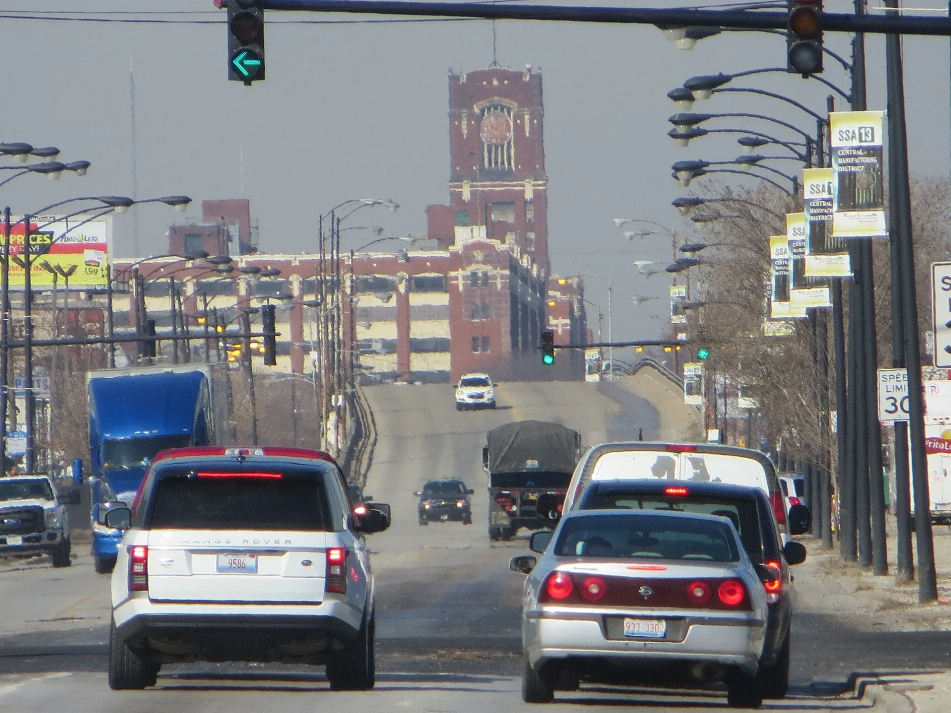
West Pershing Road in McKinley Park, Chicago, Illinois
West Pershing Road in McKinley Park in Chicago is a secondary road. It runs in an east-west direction and crosses South Western Boulevard, South Oakley Avenue, South Bell Avenue, South Irving Avenue, South Leavitt Street, South Hoyne Avenue, South Damen Avenue, South Winchester Avenue, South Wolcott Avenue, South Honore Street, South Wood Street and South Hermitage Avenue. It connects McKinley Park, New City, Armour Square, Brighton Park, Bridgeport and Grand Boulevard. West Pershing Road is also known as 39th Street (Chicago). Nearby there is among others a bike rental. The nearest stops include Pershing & Wood, Pershing & Wolcott, Pershing & Loomis, 1501 W Pershing and Pershing & Western Blvd. The bus line 39 stops here. Ⓦ.
- Road Type
- residential street
- Route
- east-west
Image
Bike rentals
Streets nearby
West Pershing Place0.2 mi
South Paulina Street0.2 mi
West 38th Place0.2 mi
South Winchester Avenue0.2 mi
South Wood StreetWood St & 35th St
0.2 mi
West 37th StreetArcher Ave & 37th St
0.2 mi
South Honore Street0.2 mi
South Wolcott AvenueCVS Pharmacy
0.3 mi
West 38th StreetFelician Sisters School
0.3 mi
South Damen AvenueLa Palapa Mariscos, Damen & Archer, Damen & 33rd Street, T Opera Cafe
0.3 mi
South Hermitage Avenue0.4 mi
South Hoyne Avenue0.4 mi
West 41st Street0.4 mi
West 36th Street0.4 mi
Lagoon path0.4 mi
South Ashland AvenueAshland & 42nd Street, Ashland & 53rd Street, Ashland & Garfield, Ashland & 49th Street, Chase, Ashland & Pershing, Ashland & 52nd Street, ACCESS Ashland Family Health Center, Ashland & 51st Street, Ashland Ave & 50th St, Back of the Yards
0.4 mi
West 42nd Street0.4 mi
South Laflin Place0.5 mi
South Seeley Avenue0.5 mi
West 42nd Place0.5 mi
South Marshfield Avenue0.5 mi
West 35th Street35th Street & Wolcott, 35th Street & Wood, 35th Street & Oakley, 35th Street & Leavitt, 35th Street & Western Blvd, 35th Street & Damen, 35th Street & Archer, Cadinho, Chile Toreado, 35th Street & Ashland, 1349 W 35th Street, 35th Street & Iron, Slice Factory, 35th Street & Paulina, Kristoffer’s Cakes, 35th Street & Artesian, 35th Street & Western Ave, Cafe Consume
0.5 mi
West 43rd StreetStanley’s, Baskin-Robbins
0.5 mi
Banks nearby
Bank of America0.5 mi
Byline Bank0.5 mi
Buildings nearby
NS Ashland Yard Office0.2 mi
Convenience stores nearby
Shell0.5 mi
Fast food restaurants nearby
McDonald's0.4 mi
Fire stations nearby
Chicago Fire Department Special Operations Section0.1 mi
Gardens nearby
McKinley Park Community Garden0.3 mi
Gas stations nearby
Marathon0.5 mi
Industrial buildings nearby
Aviation Institute of Maintenance (AIM)0.4 mi
Libraries nearby
McKinley Park Branch Library0.5 mi
Marketplaces nearby
Swap-O-Rama0.3 mi
Parks nearby
McKinley Park0.3 mi
Places of worship nearby
Saints Peter and Paul Roman Catholic Church0.2 mi
Saint Andrew Lutheran Church0.3 mi
Our Lady of Good Counsel Roman Catholic Church0.4 mi
Saint Maurice Roman Catholic Church0.5 mi
Railways nearby
Run Around0.2 mi
CR&I Industrial Track0.3 mi
NS CR&I IT Yard Lead0.4 mi
CR&I Industrial Track Yard Lead0.4 mi
Hump Lead0.4 mi
Stack Track0.4 mi
School buildings nearby
Nathanael Greene School0.5 mi
Velma Thomas Early Childhood Center0.5 mi
Self storages nearby
Public Storage0.4 mi
Sports centers nearby
Chicago Indoor Sports0.2 mi
| Named after | John J. Pershing |
|---|---|
| Located in | Chicago |
| Country | United States |
Public transit map McKinley Park Legend
| Railway | |
| Bus | |
| Streetcar |
Bicycle map McKinley Park Legend
| Bike path | |
| Bike lane on roadway | |
| Cycling allowed on bus lane | |
| Bicycle street | |
| Open to cyclists | |
| Open to cyclists, good path | |
| Cycling prohibited | |
| Cobblestone |
| Long-distance bike route | (depending on scale) | |
| Long-distance bike route |
Pedestrian map McKinley Park Legend
| Path |
| Long-distance hiking trail | (depending on scale) | |
| Long-distance hiking trail | ||
| Pedestrians prohibited |