
North Clark Street in Chicago
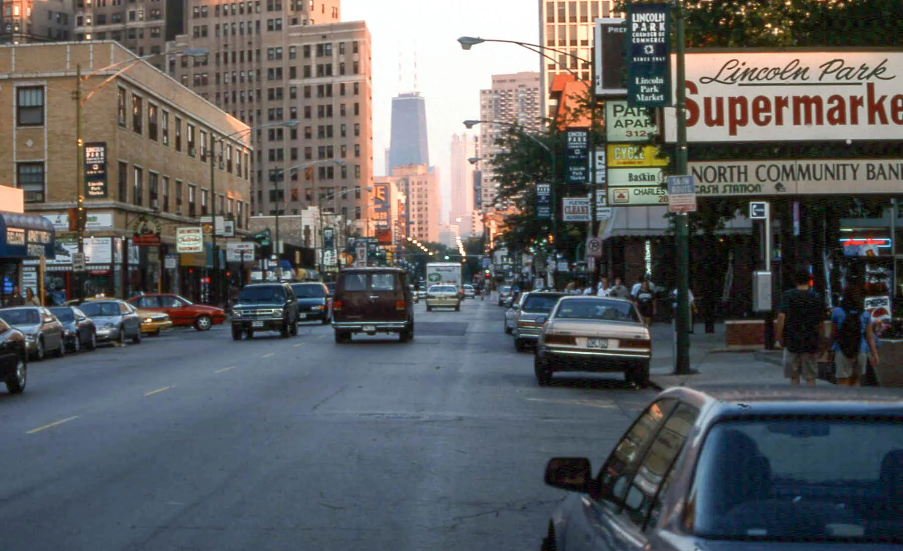
North Clark Street in Chicago is a two-lane, asphalted, lit secondary road. The street has bike paths (bike traffic on bus lane) in some sections. It runs in a north-south direction and crosses North Rogers Avenue, West Albion Avenue, North Ashland Avenue, West Devon Avenue, West Highland Avenue, West Rosemont Avenue, West Thome Avenue, West Granville Avenue, West Hood Avenue, West Glenlake Avenue, West Norwood Street and West Peterson Avenue. It connects Edgewater, Chicago, Near North Side, Rogers Park, Lake View and Uptown. North Clark Street is also known as Clark Street, Chicago. This street is part of the Bicycle routes Downtown - Evanston and Grand Illinois Trail - Maywood to Lansing. Nearby you can find among others 18 restaurants, 4 fast food restaurants, 4 bars and 4 cafes. The nearest stops include Clark & Arlington, Clark & Fullerton, Clark & Deming, Clark & Belden and Clark & LaSalle. The bus lines 22, 36, 72, 73 and N22 serve this stop. Ⓦ.
- Road Type
- secondary road
- Lanes
- 2
- Route
- north-south
Image
Fast food restaurants
Bars
Bike rentals
Cafes
Clothing stores
Restaurants
Bus stops
- bus lines 22, 36, 72, 73, N22
Hair salons
Bakeries
Pharmacies
Parcel lockers
Parcel shops
Streets nearby
West Saint James PlaceApartment buildings nearby
The Park LincolnBars nearby
Galway ArmsBuildings nearby
The CobdenCafes nearby
Serai Cafe & DeliClinics nearby
Outpatient Center in Lincoln ParkCommercial buildings nearby
The Belden CentreConstruction sites nearby
2600 North ClarkHouses nearby
Theurer-Wrigley HouseOffice buildings nearby
Former North Chicago Hospital BuildingParking lots nearby
Park Lincoln GarageParks nearby
Shrine Meditation GardenPlaces of worship nearby
Church of Our SaviourPlaygrounds nearby
The CourtyardResidential buildings nearby
The Brighton Condos of Lincoln Park WestSelf storages nearby
Reebie Storage & Moving CoShelters nearby
Rustic ShelterWaters nearby
North Pond| Named after | George Rogers Clark |
|---|---|
| Located in | Chicago |
| Country | United States |
| Railway | |
| Bus | |
| Streetcar |
| Bike path | |
| Bike lane on roadway | |
| Cycling allowed on bus lane | |
| Bicycle street | |
| Open to cyclists | |
| Open to cyclists, good path | |
| Cycling prohibited | |
| Cobblestone |
| Long-distance bike route | (depending on scale) | |
| Long-distance bike route |
| Path |
| Long-distance hiking trail | (depending on scale) | |
| Long-distance hiking trail | ||
| Pedestrians prohibited |