
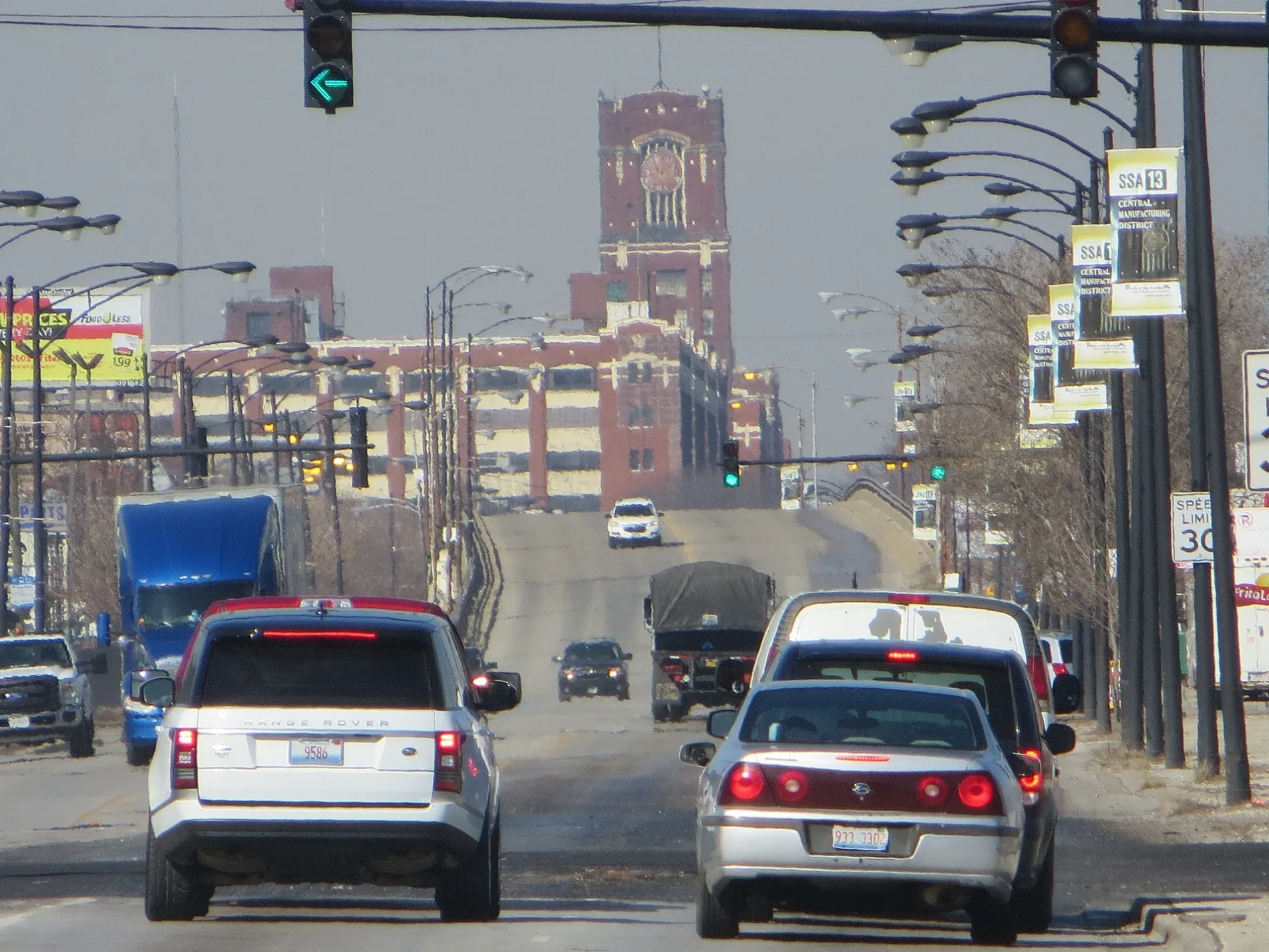
East Pershing Road in Oakland, Chicago, Illinois
East Pershing Road in Oakland in Chicago is an asphalted, lit secondary road. It runs in an east-west direction and crosses South Lake Park Avenue, South Langley Avenue, South Vincennes Avenue, South Rhodes Avenue, South Doctor Martin Luther King Junior Drive, South Calumet Avenue, South Giles Avenue, South Prairie Avenue, South Indiana Avenue, South Michigan Avenue, South Wabash Avenue and South State Street. It connects Douglas, Oakland and Grand Boulevard. East Pershing Road is also known as 39th Street (Chicago). The nearest stops are Pershing & Cottage Grove and Pershing & Langley. The bus line 39 stops here. Ⓦ.
- Road Type
- residential street
- Route
- east-west
Image
Bus stops
- bus lines 39
Streets nearby
South Lake Park AvenueLake Park & Oakwood, Lake Park & 40th Street
500 ft
South Cottage Grove AvenueCottage Grove & 36th Street, Cottage Grove & 42nd Street, Cottage Grove & 41st Street, Cleo's Southern Cuisine, Small Shop Cycles & Service, Metro by T-Mobile, DaVita Dialysis, Cottage Grove & Pershing, Cottage Grove & 37th Street, Cottage Grove & 35th Street, Cottage Grove & 38th Street, Mercy Care Center, Cottage Grove & Oakwood, Cottage Grove & 40th Street, Cottage Grove Ave & Oakwood Blvd
0.1 mi
East 38th Place0.1 mi
East Oakwood BoulevardCottage Grove & Oakwood, Oakland
0.2 mi
South Drexel Boulevard0.2 mi
South Evans Avenue0.2 mi
East 38th StreetOakwood Shores
0.2 mi
South Ellis AvenueEllis & Oakwood
0.2 mi
East 37th Place0.2 mi
South DuSable Lake Shore Drive0.2 mi
South Langley Avenue0.3 mi
East 40th Place0.3 mi
Bronzeville Trail (Proposed)0.3 mi
East 40th StreetCottage Grove & 40th Street
0.3 mi
East 41st Street0.3 mi
South Maryland Avenue0.3 mi
South Oakenwald AvenueOakenwald & 43rd Street
0.4 mi
41st Street Access Path0.4 mi
East 41st Place0.4 mi
South Berkeley AvenueBerkeley & 43rd Street
0.4 mi
East Bowen Avenue0.4 mi
41st Street Pedestrian Bridge0.4 mi
East 42nd Place42nd Place & Lake Park
0.5 mi
Apartment buildings nearby
Lake Parc Place0.2 mi
Judge Green Apartments0.2 mi
Oakwood Shores Senior Residence0.2 mi
The Ellis0.2 mi
Lake Park Apartments0.3 mi
Sullivan Station0.4 mi
Grant Village0.4 mi
Lake Park Crescent0.4 mi
Artworks nearby
Letter to Bessie Coleman Sculpture0.4 mi
Restoration0.4 mi
Buildings nearby
South Park Board0.2 mi
Ellis & Lake Park Station0.4 mi
Churches nearby
Grant Memorial AME Church0.2 mi
Dog parks nearby
Park No. 591300 ft
Industrial areas nearby
Chicago Park District Central Shop0.2 mi
Parks nearby
Holly Park0.3 mi
Places of worship nearby
Monumental Baptist Church0.2 mi
South Central Church of Christ0.3 mi
Blackwell-Israel Samuel A.M.E. Zion Church0.3 mi
Razed railways nearby
Chicago Junction Railway0.3 mi
Kenwood branch0.3 mi
Retail buildings nearby
Beauty Supply0.2 mi
Row houses nearby
Hearts United Apartments0.4 mi
School buildings nearby
Holy Angels Catholic School0.2 mi
Sports centers nearby
Mandrake Park Fieldhouse0.1 mi
University buildings nearby
Abraham Lincoln Center0.2 mi
| Named after | John J. Pershing |
|---|---|
| Located in | Chicago |
| Country | United States |
Public transit map Oakland Legend
| Railway | |
| Bus | |
| Streetcar |
Bicycle map Oakland Legend
| Bike path | |
| Bike lane on roadway | |
| Cycling allowed on bus lane | |
| Bicycle street | |
| Open to cyclists | |
| Open to cyclists, good path | |
| Cycling prohibited | |
| Cobblestone |
| Long-distance bike route | (depending on scale) | |
| Long-distance bike route |
Pedestrian map Oakland Legend
| Path |
| Long-distance hiking trail | (depending on scale) | |
| Long-distance hiking trail | ||
| Pedestrians prohibited |