
South Stony Island Avenue in Chicago
South Stony Island Avenue in Chicago is a three-lane expressway. It runs in a north-south direction and crosses South Cornell Drive, East Midway Plaisance, East 61st Street, East 62nd Street, East 63rd Street, East 64th Street, East 65th Place, East Marquette Drive, East 67th Street, East 68th Street, East 69th Street and East 69th Place. It connects South Shore, Avalon Park, Woodlawn, Chicago, South Deering and Hyde Park. Nearby you can find among others a fast food restaurant, a bar, a pharmacy and a motel. The nearest stops include Stony Island & 94th Street, Stony Island & 93rd Street, Stony Island & 88th Street, Stony Island & 90th Street and Stony Island & 92nd Street. The bus lines 28, 95 and N5 serve this stop. Ⓦ.
- Road Type
- expressway
- Lanes
- 3
- Route
- north-south
Image
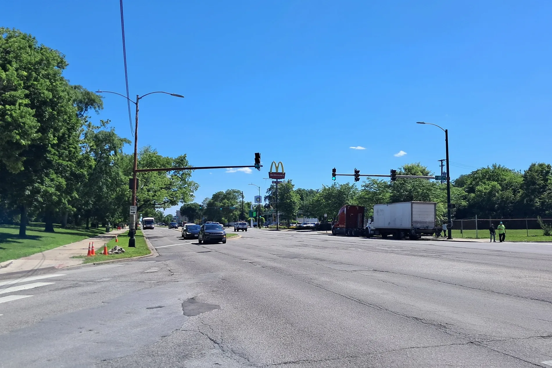
Motels
Bus stops
- bus lines 28, 95, N5
Fast food restaurants
Bars
Pharmacies
Auto parts stores
Streets nearby
South Harper AvenueSouth Side Baptist Church, Saint Ailbe School
450 ft
South Cornell AvenueDaVita Dialysis
0.1 mi
South East End AvenueEast End Ave & 87th St
0.2 mi
East 93rd Street93rd Street & Escanaba, 93rd Street & Marquette, 93rd Street & Manistee, 93rd Street & Colfax, Spiritual Love Missionary Baptist Church, 93rd Street & Stony Island, 93rd Street & Bennett, 93rd Street & Cregier, 93rd Street & East End, 93rd Street & Jeffery, 93rd Street & Paxton, 93rd Street & Clyde, South Chicago Heights, 93rd Street & Oglesby, 93rd Street & Essex, 93rd Street & Yates, Yates Blvd & 93rd St
0.2 mi
East 94th Street0.2 mi
East 95th Street95th Street & Dorchester, 1500 E 95th Street, 1300 E 95th Street
0.2 mi
East 92nd PlacePill Hill
0.2 mi
South Ridgeland Avenue0.2 mi
Stony Island ExpresswaySnipes
0.2 mi
South Cregier AvenueStony Island Heights
0.3 mi
East 91st Place0.3 mi
East 96th Street0.3 mi
East 92nd StreetCitgo, Stony Island & 92nd Street, C&T Auto Services
0.3 mi
East 91st StreetSaint Ailbes Roman Catholic Church, Sherwin-Williams
0.3 mi
South Constance AvenueMobil Mart, Constance Ave & 95th St
0.4 mi
South Van Vlissingen RoadVan Vlissingen & 99th Street
0.4 mi
South Bennett Avenue0.4 mi
South Jeffery BoulevardJeffery & 90th Street, Jeffery & 91st Street, Jeffery & 89th Street, Jeffery & 87th Street, Jeffery & 93rd Street, Jeffery & 88th Street, Jeffery & 92nd Street
0.5 mi
South Euclid AvenueFellowship Christian Academy, Western Union
0.5 mi
South Chappel Avenue0.6 mi
East 97th Street0.6 mi
Abandoned railways nearby
Chicago District0.3 mi
Banks nearby
Bank of America0.2 mi
Car washes nearby
Buddy Bear Car Wash0.1 mi
Convenience stores nearby
Circle K0.2 mi
Currency exchanges nearby
95th & Jeffrey Currency Exchange0.5 mi
Fast food restaurants nearby
Burger King0.2 mi
KFC0.2 mi
White Castle0.5 mi
McDonald's0.5 mi
Gas stations nearby
Shell0.2 mi
Citgo0.2 mi
Mobil0.4 mi
Industrial areas nearby
Finkl Steel0.2 mi
Motels nearby
Stony Island Motel0.2 mi
Museums nearby
Bronzeville Children's Museum400 ft
Places of worship nearby
Fireball Faith Church0.5 mi
Bethany Lutheran Church0.6 mi
Railways nearby
Kenton Line Subdivision500 ft
Finkl Lead0.2 mi
Verson Lead0.2 mi
Pullman Branch0.3 mi
Residential areas nearby
Universal City0.4 mi
Retail areas nearby
Stony Island Plaza0.2 mi
School buildings nearby
Former Burnham Elementary School0.5 mi
Social facilities nearby
Montclare Senior Residences of Calumet Heights500 ft
Variety stores nearby
Dollar General0.5 mi
Dollar Tree0.6 mi
Other nearby
Finkl Steel Substation0.2 mi
| Located in | Illinois |
|---|---|
| Country | United States |
Public transit map Chicago Legend
| Railway | |
| Bus | |
| Streetcar |
Bicycle map Chicago Legend
| Bike path | |
| Bike lane on roadway | |
| Cycling allowed on bus lane | |
| Bicycle street | |
| Open to cyclists | |
| Open to cyclists, good path | |
| Cycling prohibited | |
| Cobblestone |
| Long-distance bike route | (depending on scale) | |
| Long-distance bike route |
Pedestrian map Chicago Legend
| Path |
| Long-distance hiking trail | (depending on scale) | |
| Long-distance hiking trail | ||
| Pedestrians prohibited |