
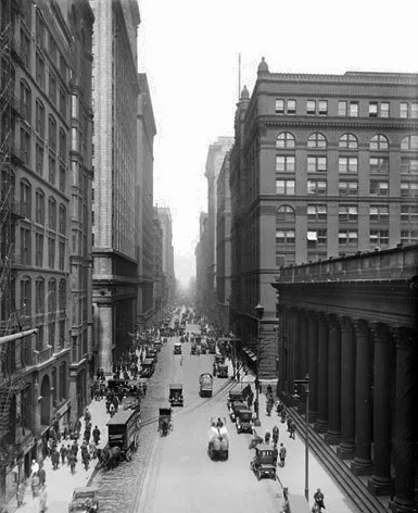
South LaSalle Street in West Pullman, Chicago, Illinois
South LaSalle Street in West Pullman in Chicago is a residential street. It runs in a north-south direction and crosses West 116th Street, West 117th Street, West 118th Street, West 119th Street and West 120th Street and ends at West 121st Street. South LaSalle Street is also known as La Salle Street. South LaSalle Street also exists in Near South Side, Fuller Park, Armour Square, Chatham and Roseland. Ⓦ.
- Road Type
- residential street
- Route
- north-south
Bus stops
Places of worship
Streets nearby
South Wentworth Avenue350 ft
West 117th StreetHalsted & 117th Street
400 ft
South Yale Avenue0.1 mi
West 118th StreetPlacerdale
0.2 mi
West 116th StreetDTLR, Cricket Wireless, Baskin-Robbins
0.2 mi
South Princeton Avenue0.2 mi
East 117th StreetSaint Louis School, Bethel Apostolic Faith Church, Pilgrim Church of God in Christ
0.2 mi
South Wabash Avenue0.3 mi
South Perry AvenueGrace Temple Church of God Established in Christ, Roseland
0.3 mi
West 119th Street119th Street & Perry, 119th Street & State, 119th Street & Wentworth, 119th Street & Ashland, 119th Street & Halsted, 119th Street & Peoria, House of Prayer Missionary Baptist Church, Bunnyland Developmental Day Care Center, Home Mission Pentecostal Tabernacle Church, 119th Street & Stewart, 119th Street & Normal, 119th Street & Union, 119th Street & Wallace, 119th Street & Princeton, 119th Street & Ada, 119th Street & Morgan, 119th Street & Elizabeth, 119th Street & Loomis, 119th Street & Laflin, 119th Street & Justine
0.3 mi
East 118th PlaceSaint Salomeas School
0.3 mi
East 117th Place0.3 mi
East 116th Street0.3 mi
South Lafayette AvenueGreater Canaan Missionary Baptist Church
0.3 mi
South Michigan AvenueSound of Praise Evangelistic Center, Michigan & 118th Street, Michigan & 116th Street, Michigan & 117th Street, Michigan & 122nd Street, Michigan & 121st Street (Metra), Michigan & 123rd Street, Michigan & 126th Street, Michigan & 124th Place, Michigan & 120th Street, Michigan & 124th Street, Michigan & 125th Place, Michigan & 119th Street, Michigan & Kensington, Michigan & 115th Street, Michigan
0.3 mi
West 115th Street115th Street & State, Tabernacle of Zion of the Apostolic Faith, 115th Street & Normal, 115th Street & Wallace, 115th Street & Union, 115th Street & Princeton, 115th Street & Wentworth, 115th Street & Stewart, 115th Street & Perry
0.3 mi
South State StreetState & 92nd Street, State & 91st Street, 95th/Dan Ryan Red Line Station, State & 95th Street (Red Line), Hephzibah Christian Academy, Bethel House of Prayer, State & 94th Street, State & 93rd Street, 87th St Crash Investigation Site
0.3 mi
West 114th Place0.3 mi
East 118th StreetMichigan Ave & 118th St
0.3 mi
West 114th StreetPure in Heart Missionary Baptist Church
0.4 mi
East 115th Street115th Street & Michigan, United Bibleway Community Missionary Baptist Church, 115th Street & Forest, 115th Street & Indiana, 115th Street & King Drive (Metra), 115th Street & State
0.4 mi
East 114th StreetMichigan & 114th Street, Michigan Ave & 114th St
0.4 mi
South Indiana Avenue0.4 mi
West 113th PlaceSaint Nicholas School
0.4 mi
East 114th Place0.5 mi
East Kensington AvenueSaint Peters Spiritual Church of Faith
0.5 mi
West 113th Street0.5 mi
East 113th PlaceHouse of Inspiration Church of God in Christ
0.5 mi
East 113th StreetMartin Luther Educational Center
0.6 mi
Clinics nearby
Roseland Public Health Center0.5 mi
Commercial buildings nearby
Greater Canaan Baptist Church Administration Building0.3 mi
Fast food restaurants nearby
Sharks Fish & Chicken0.3 mi
Fire stations nearby
Chicago Fire Department Engine Company 620.5 mi
Gas stations nearby
Citgo0.3 mi
Hardware stores nearby
Plaza True Value Hardware0.4 mi
Industrial buildings nearby
Dept Of Streets and Sanitation Yard0.4 mi
Office buildings nearby
AT&T Pullman Central Office0.4 mi
Parks nearby
Park No. 5840.2 mi
Places of worship nearby
Reeds Temple Church of God in Christ0.2 mi
Greater Canaan Baptist Church0.3 mi
Saint Salomea Catholic Church0.4 mi
First Corinthians Baptist Church0.4 mi
Saint Anthony Catholic Church0.5 mi
Starlight Saint James Missionary Baptist Church0.5 mi
St. John Missionary Baptist Church0.5 mi
Evangelism Outreach Ministries Full Gospel Pentecostal Church0.5 mi
Railways nearby
Villa Grove Subdivision0.3 mi
School buildings nearby
Former Songhai Learning Institute500 ft
Social facilities nearby
Roseland Senior Housing Center0.2 mi
| Named after | René-Robert Cavelier, Sieur de La Salle |
|---|---|
| Located in | Chicago |
| Country | United States |
| Has part | North LaSalle Street, South LaSalle Street |
Public transit map West Pullman Legend
| Railway | |
| Bus | |
| Streetcar |
Bicycle map West Pullman Legend
| Bike path | |
| Bike lane on roadway | |
| Cycling allowed on bus lane | |
| Bicycle street | |
| Open to cyclists | |
| Open to cyclists, good path | |
| Cycling prohibited | |
| Cobblestone |
| Long-distance bike route | (depending on scale) | |
| Long-distance bike route |
Pedestrian map West Pullman Legend
| Path |
| Long-distance hiking trail | (depending on scale) | |
| Long-distance hiking trail | ||
| Pedestrians prohibited |