
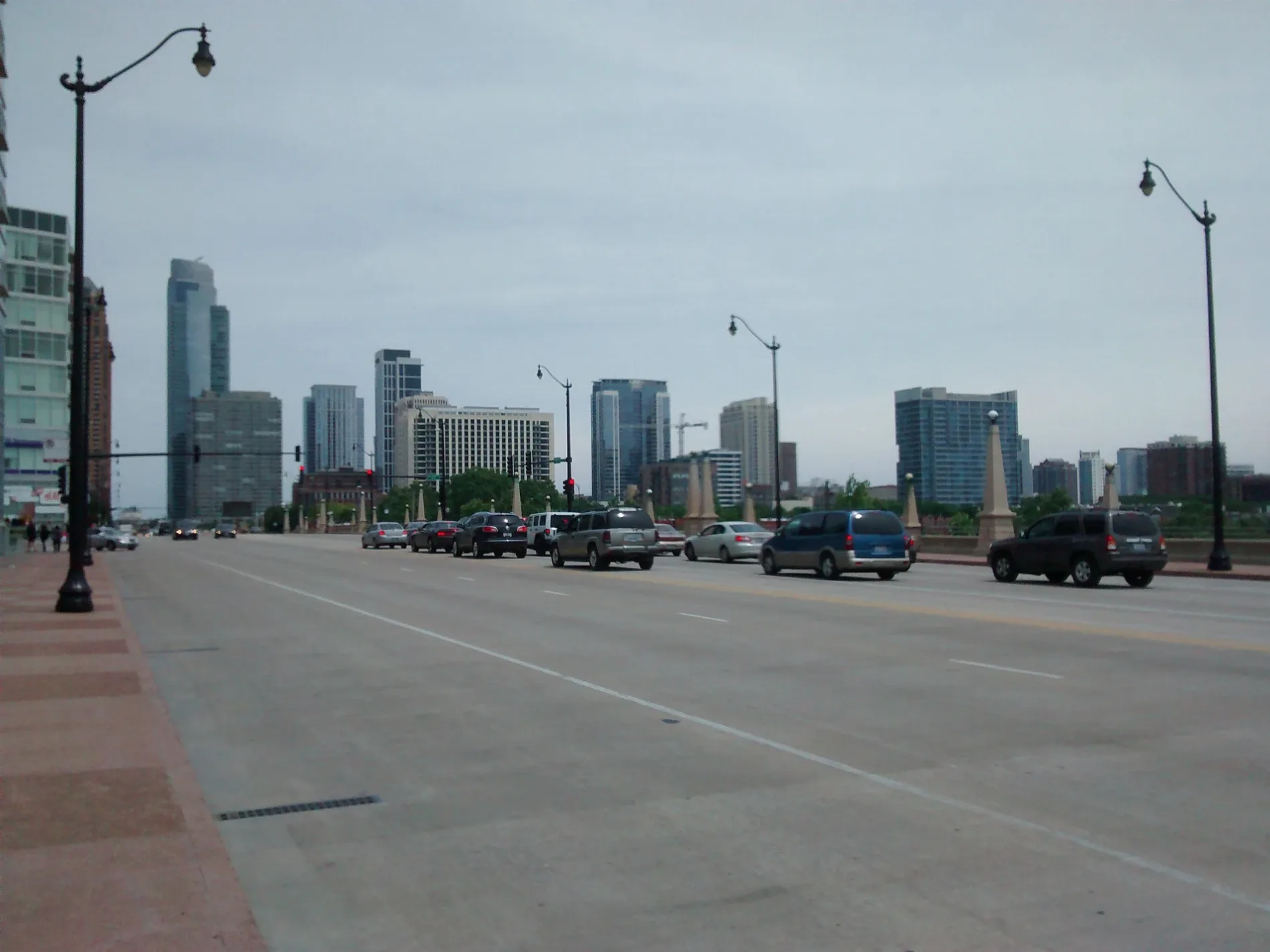
West Roosevelt Road in Austin, Chicago, Illinois
West Roosevelt Road in Austin in Chicago is a four-lane, asphalted secondary road. It runs in an east-west direction and crosses South Mason Avenue and ends at South Mayfield Avenue, while the other end is a cul-de-sac. Nearby you can find among others a money transfer service, a cell phone store and a car wash. The nearest stops include Roosevelt & Central, 5500 W Roosevelt, 5300 W Roosevelt, Roosevelt & 54th Avenue and Roosevelt & 47th Avenue. The bus lines 12, 91, 305 and 316 serve this stop. West Roosevelt Road also exists in North Lawndale, Loop and Near South Side. Ⓦ.
- Road Type
- secondary road
- Lanes
- 4
- Route
- east-west
Image
Bus stops
- bus lines 12, 91, 305, 316
Streets nearby
South Mayfield AvenueMayfield Ave & Roosevelt Rd
400 ft
West Fillmore StreetFillmore & Mason
0.1 mi
South Monitor Avenue0.1 mi
13th Street0.1 mi
South Humphrey Avenue0.2 mi
South Menard Avenue0.2 mi
South Mason AvenueMason & Roosevelt
0.3 mi
South Austin BoulevardAustin & Harvard/Arthington, Austin & Fillmore, Austin & Jackson, Austin & Van Buren, Austin & Harrison, Austin Blue Line Station, Austin & Roosevelt, Austin & Adams, Austin & Madison
0.3 mi
Harvard StreetChrist School, West Suburban School
0.3 mi
South 59th Avenue0.3 mi
West Arthington Street0.3 mi
West Roosevelt RoadRoosevelt & 58th Avenue/Menard, Roosevelt & Mayfield/59th Avenue, Roosevelt & Waller/57th Avenue, Roosevelt & Menard/58th Avenue, Roosevelt & 57th Avenue/Waller, BP Shop, Subway, Little Caesars, Total by Verizon, Roosevelt & Austin, Roosevelt & Central
0.3 mi
South 60th Court0.3 mi
South Taylor AvenueOak Park Police Department
0.3 mi
South 61st AvenueFaith Lutheran Church
0.3 mi
South Lyman Avenue0.3 mi
South Lombard AvenueThe Actors Garden, The Music Garden, Oak Park Arts District, Lombard Entrance CTA
0.3 mi
South 58th AvenueDunkin'
0.3 mi
West 14th Street0.3 mi
Fillmore Street0.3 mi
South 61st Court0.4 mi
15th Street0.4 mi
14th Street0.4 mi
Highland Avenue0.4 mi
South Highland Avenue0.5 mi
South 58th Court0.5 mi
South 59th Court0.5 mi
West 16th Street16th Street & 46th Court, 16th Street & 47th Court Terminal, Advance Auto Parts, Baskin-Robbins
0.5 mi
South Harvey Avenue0.5 mi
Shops nearby
PLS300 ft
Convenience stores nearby
Clark's Pump-N-Shop0.6 mi
Dry cleaners nearby
Cicero Cleaners100 ft
Fast food restaurants nearby
Albano's Pizzeria250 ft
Lucky Dog0.2 mi
Gas stations nearby
BP0.2 mi
Clark0.6 mi
Industrial areas nearby
Cicero School District 99 Service Center500 ft
Laundries nearby
Laundry World350 ft
Parks nearby
North Warren Park0.2 mi
Places of worship nearby
Trinity United Methodist Church0.1 mi
St. George Antiochian Orthodox Church0.2 mi
West Side Reformed Church0.2 mi
Saint Francis of Rome Church0.3 mi
First Baptist Church of Cicero0.3 mi
Ebenezer Christian Reformed Church0.4 mi
Playgrounds nearby
Island Oasis Nature Play Garden500 ft
Restaurants nearby
Paisans Pizzeria0.5 mi
Self storages nearby
Extra Space Storage0.2 mi
Sports fields nearby
Sledding Hill0.4 mi
Variety stores nearby
Dollar Tree0.4 mi
| Named after | Theodore Roosevelt |
|---|---|
| Located in | Chicago |
| Country | United States |
Public transit map Austin Legend
| Railway | |
| Bus | |
| Streetcar |
Bicycle map Austin Legend
| Bike path | |
| Bike lane on roadway | |
| Cycling allowed on bus lane | |
| Bicycle street | |
| Open to cyclists | |
| Open to cyclists, good path | |
| Cycling prohibited | |
| Cobblestone |
| Long-distance bike route | (depending on scale) | |
| Long-distance bike route |
Pedestrian map Austin Legend
| Path |
| Long-distance hiking trail | (depending on scale) | |
| Long-distance hiking trail | ||
| Pedestrians prohibited |