
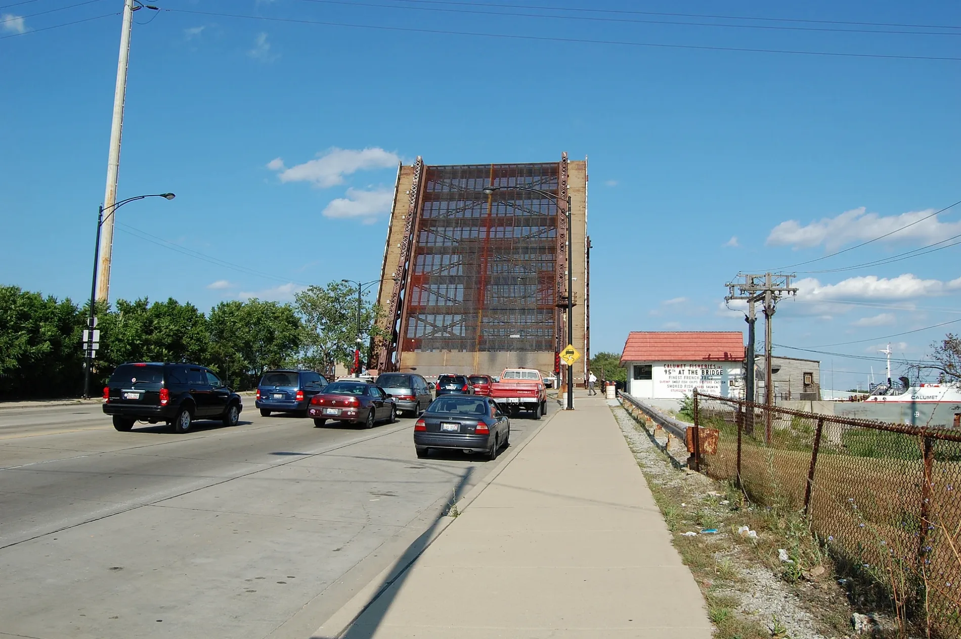
East 95th Street in Burnside, Chicago, Illinois
East 95th Street in Burnside in Chicago is a five-lane main road (Road number US 12;US 20). It runs in an east-west direction and crosses South Langley Avenue, South Champlain Avenue, CSU Drive, South Rhodes Avenue, South Eberhart Avenue, South Vernon Avenue, South Doctor Martin Luther King Junior Drive, South Calumet Avenue, South Forest Avenue, South Prairie Avenue, South Indiana Avenue and South Michigan Avenue. It connects Roseland, South Deering, Calumet Heights, Pullman, Burnside and East Side. This street is part of the highways 12 and 20 as well as the Bicycle route "Cottage Grove Avenue". The nearest stop is 95th Street & Woodlawn. The bus lines 4, 95, 100, 115, 353 and N5 serve this stop. Ⓦ.
- Road Type
- main road
- Lanes
- 5
- Route
- east-west
Image
Bus stops
- bus lines 4, 95, 100, 115, 353, N5
Streets nearby
South Woodlawn AvenueWoodlawn & 94th Street
250 ft
East 95th Place500 ft
East 96th Street0.1 mi
East 95th Street95th Street & Greenwood, 930 E 95th Street, 95th Street & Dorchester, 1500 E 95th Street, 1300 E 95th Street, Extra Space Storage
0.2 mi
East 96th Place0.2 mi
East 94th StreetWoodlawn & 94th Street, Pullman Junction
0.2 mi
South Avalon Avenue0.2 mi
South University Avenue0.2 mi
East 97th StreetGreenwood Ave & 97th St, Cottage Grove Heights
0.2 mi
South Dorchester Avenue0.3 mi
East 93rd Place0.3 mi
South Kimbark Avenue0.3 mi
South Kenwood Avenue0.3 mi
South Dobson Avenue0.3 mi
East 97th Place0.3 mi
East 92nd Street0.4 mi
South Greenwood AvenueGreenwood Ave & 91st St
0.4 mi
South Harper Avenue0.4 mi
South Ellis Avenue0.5 mi
East 92nd Place0.5 mi
South Drexel Avenue0.5 mi
East 91st Street91st Street (Chesterfield), Metra
0.5 mi
East 93rd Street93rd Street & Escanaba, 93rd Street & Marquette, 93rd Street & Manistee, 93rd Street & Colfax, Spiritual Love Missionary Baptist Church, 93rd Street & Stony Island, 93rd Street & Bennett, 93rd Street & Cregier, 93rd Street & East End, 93rd Street & Jeffery, 93rd Street & Paxton, 93rd Street & Clyde, South Chicago Heights, 93rd Street & Oglesby, 93rd Street & Essex, 93rd Street & Yates, Yates Blvd & 93rd St
0.5 mi
South Stony Island AvenueStony Island & 94th Street, Stony Island & 93rd Street, Stony Island & 88th Street, Stony Island & 90th Street, Stony Island & 92nd Street, WingStreet, Family Den, Stony Island & 89th Street, CVS Pharmacy, Stony Island & 87th Street, Stony Island & 91st Street, Skyway Motel, O'Reilly Auto Parts
0.5 mi
East 91st Place0.5 mi
East 90th Place0.6 mi
Abandoned railways nearby
Chicago District0.4 mi
Apartment buildings nearby
St. Ailbe Apartments0.4 mi
Car washes nearby
Buddy Bear Car Wash0.5 mi
Construction sites nearby
Future Gas Station150 ft
Industrial areas nearby
Finkl Steel0.3 mi
Parks nearby
Burnside Park0.2 mi
Places of worship nearby
Outreach Missionary Baptist Church300 ft
New Hope Christian Missionary Baptist Church0.2 mi
Upright MB Church0.2 mi
Kingdom Hall of Jehova Witness0.3 mi
Tree of Life Missionary Baptist Church0.3 mi
Saint Mark Church of God in Christ0.4 mi
Hosea Temple Church0.4 mi
Wallace Temple0.4 mi
Railways nearby
Kenton Line Subdivision500 ft
Third Rail Siding0.3 mi
Pullman Branch0.3 mi
Finkl Lead0.4 mi
Verson Lead0.4 mi
Chicago Subdivision0.5 mi
University Park Sub District0.5 mi
Retail areas nearby
95th Woodlawn Plaza200 ft
Schools nearby
Our Lady of Hungary School0.3 mi
Other nearby
Finkl Steel Substation0.4 mi
| Located in | Illinois |
|---|---|
| Country | United States |
Public transit map Burnside Legend
| Railway | |
| Bus | |
| Streetcar |
Bicycle map Burnside Legend
| Bike path | |
| Bike lane on roadway | |
| Cycling allowed on bus lane | |
| Bicycle street | |
| Open to cyclists | |
| Open to cyclists, good path | |
| Cycling prohibited | |
| Cobblestone |
| Long-distance bike route | (depending on scale) | |
| Long-distance bike route |
Pedestrian map Burnside Legend
| Path |
| Long-distance hiking trail | (depending on scale) | |
| Long-distance hiking trail | ||
| Pedestrians prohibited |