
West 31st Street in Douglas, Chicago
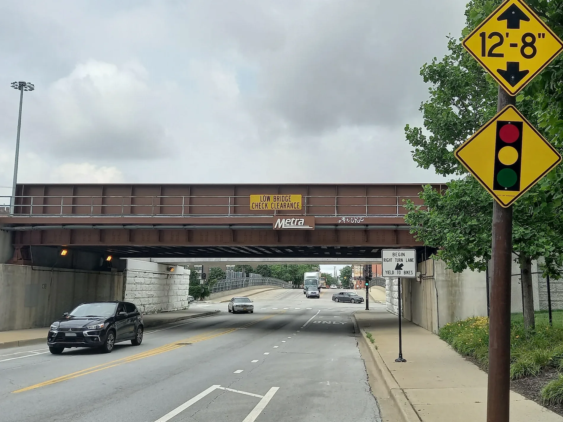
West 31st Street in Douglas in Chicago is an asphalted secondary road. The street has bike paths (separated bike path). It runs in an east-west direction and crosses South Pitney Court, South Benson Street, South Broad Street, South Lock Street, South Throop Street, South Arch Street, South Racine Avenue, South Haynes Court, South May Street, South Loomis Street, South Aberdeen Street and South Gratten Avenue. It connects Bridgeport, Armour Square and Douglas. West 31st Street is also known as East 31st Street. This street is part of the Bicycle route "Loomis Street - Lakefront". West 31st Street also exists in Lower West Side.
- Road Type
- secondary road
- Route
- east-west
Image
Streets nearby
South State StreetState & 31st Street, State & 27th Street, State & 30th Street, State & 29th Street, State & 28th Street, State & 36th Street, PNC Bank, State & 37th Street, State & 38th Street, State & 33rd Street, State & 32nd Street, State & 35th Street, 3400 S State, 35th-Bronzeville-IIT, State & 34th Street, State St & 29th St, WIIT-FM, 7-Eleven, Chicago Bee Branch Library
350 ft
East 31st StreetPaul Laurence Dunbar Monument, 31st Street & Giles, 31st Street & Rhodes, 31st Street & Michigan, Bronzeville Animal Clinic, 31st Street & King Drive
400 ft
West 30th Street500 ft
South Federal Street35th Street
0.2 mi
East 30th Street0.2 mi
South Wabash AvenueCenter Court, IIT Campus Bookstore, 6, IIT Campus Business Center, The Renaissance Collaborative
0.2 mi
South Michigan AvenueMidwest Pre-School-South Commons, Michigan & 31st Street, Michigan & 32nd Street, Michigan & 29th Street, 3000 S Michigan, Michigan & 26th Street, Napleton Downtown, Michigan & 34th Street, Michigan & 28th Street, Michigan & 33rd Street, Bronzeville Renaissance Mural
0.2 mi
East 33rd StreetState St & 33rd St, Global Grounds Cafe, Douglas, Calumet Ave & 33rd St
0.3 mi
East 32nd Street0.3 mi
East 34th Street35th-Bronzeville-IIT, 35th-Bronzewille-IIT (34th Street Entrance)
0.4 mi
Convenience stores nearby
BP Shop0.3 mi
Dormitories nearby
Kacek Hall0.2 mi
Cunningham Hall0.2 mi
Gunsaulus Hall0.2 mi
Rowe Village North0.3 mi
McCormick Student Village0.3 mi
Rowe Village Middle0.3 mi
Rowe Village South0.4 mi
Gas stations nearby
BP0.3 mi
Grasslands nearby
Gunsaulus Lawn0.2 mi
The Quad0.4 mi
Houses nearby
Unity Hall0.3 mi
Industrial buildings nearby
IIT (Automotive Lab)0.2 mi
Music schools nearby
Vandercook College Of Music0.1 mi
Parks nearby
Park No. 4740.2 mi
Farr Field0.3 mi
Places of worship nearby
Mount Carmel Baptist Church0.2 mi
Carr Memorial Chapel0.2 mi
Playgrounds nearby
Catholic Community of St. James Playlot0.2 mi
Residential areas nearby
South Commons0.3 mi
Restaurants nearby
The Commons0.2 mi
Sports centers nearby
Arthur S. Keating Sports Center0.1 mi
Sports fields nearby
Ed Glancy Field0.2 mi
University buildings nearby
Stuart Hall200 ft
Pritzker Science Center200 ft
Rettaliata Engineering Center0.1 mi
Kaplan Institute0.1 mi
Alumni Memorial Hall0.2 mi
Carmen Hall0.2 mi
Grover M. Herman Hall0.2 mi
Wishnick Hall0.2 mi
Siegel Hall0.3 mi
Pi Kappa Phi0.3 mi
Sigma Phi Epsilon0.4 mi
Farr Hall0.4 mi
Kappa Phi Delta0.4 mi
Delta Tau Delta0.4 mi
Alpha Sigma Alpha Sorority0.4 mi
Alpha Sigma Phi0.4 mi
| Located in | Chicago |
|---|---|
| Country | United States |
Public transit map Douglas Legend
| Railway | |
| Bus | |
| Streetcar |
Bicycle map Douglas Legend
| Bike path | |
| Bike lane on roadway | |
| Cycling allowed on bus lane | |
| Bicycle street | |
| Open to cyclists | |
| Open to cyclists, good path | |
| Cycling prohibited | |
| Cobblestone |
| Long-distance bike route | (depending on scale) | |
| Long-distance bike route |
Pedestrian map Douglas Legend
| Path |
| Long-distance hiking trail | (depending on scale) | |
| Long-distance hiking trail | ||
| Pedestrians prohibited |