
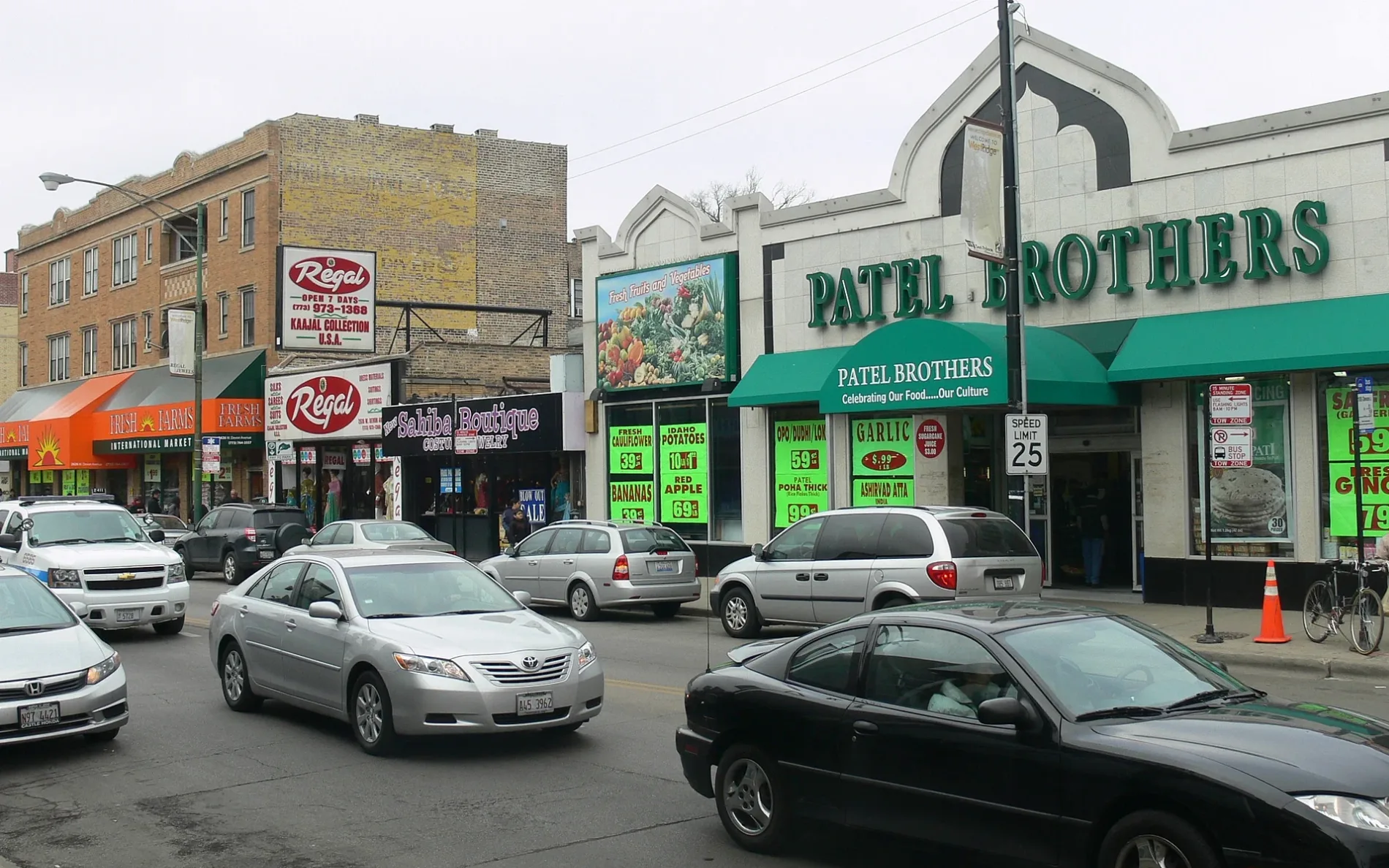
West Devon Avenue in Jefferson Park, Chicago, Illinois
West Devon Avenue in Jefferson Park in Chicago is an asphalted, lit secondary road and it crosses a bridge. It runs in an east-west direction and crosses North Kinzua Avenue, North Central Avenue, North Minnehaha Avenue, North Spokane Avenue, North Nokomis Avenue, North Navajo Avenue, North Le Mai Avenue, North Leona Avenue, North Lenox Avenue, North Cicero Avenue, North Keating Avenue and North Kilpatrick Avenue. It connects Forest Glen, Norwood Park, Edison Park, North Park and Jefferson Park. West Devon Avenue is also known as Devon. West Devon Avenue also exists in Rogers Park, West Ridge and Edgewater. Ⓦ.
- Road Type
- secondary road
- Route
- east-west
Image
Beauty salons
Bike rentals
Fast food restaurants
Bus stops
Bakeries
Dentist offices
- Smiles on Elston at N Elston Ave 5780 (60646). Smiles on Elston is a compassionate dental practice in Chicago, IL, led by Dr. Alin Alkass. The clinic offers a wide range of services, including preventive, restorative, cosmetic, orthodontic, and emergency dentistry. Patients can expect transparent tr – approx. 0.9 mi.
Cell phone stores
Restaurants
Streets nearby
North Branch Red Paved TrailNorth Branch Trail System Map, Edgebrook Golf Course
0.1 mi
North Indian Road0.1 mi
North Moody Avenue0.2 mi
Whealan Pool Aquatic Center Access Road0.2 mi
West Raven StreetNorwood Park, Raven Street Salon, U.S. Bank
0.2 mi
North McVicker Avenue0.2 mi
North Merrimac Avenue0.3 mi
North Melvina Avenue0.3 mi
North Branch Green Paved Spur (South)Caldwell Woods Picnic Grove 2, North Branch Green Paved Spur (South)
0.3 mi
North Mobile Avenue0.3 mi
West Huntington Street0.3 mi
Caldwell Woods Access Road0.3 mi
North Milwaukee AvenueMilwaukee & Devon, Milwaukee & Raven, The Garage Bar & Sandwiches, Baskin-Robbins, Dunkin', Milwaukee & Elston, Milwaukee & Holbrook, Amitabul, Filonek’s, Burrito House, Pasta D'Arte, Highland Ave & Milwaukee Ave, Milwaukee & Imlay, Forest View Bakery, Milwaukee & Imlay Terminal, Milwaukee & Peterson, Milwaukee & Austin, Kazik Bakery
0.3 mi
West Hermione Street0.3 mi
West Highland AvenuePNC Bank, Sky Liquors
0.3 mi
West Matson Avenue0.3 mi
West Haft Street0.3 mi
North Meade Avenue0.4 mi
North Nagle AvenueNagle & Avondale/Somerset, Nagle & Northwest Hwy, Nagle & Newburg, Nagle & Hyacinth, Nagle & Raven, Nagle & Naples, Nagle & Rosedale, Nagle & Perterson, Nagle & Devon, Nagle & Palatine, Nagle & Haft, City Edge Dental
0.4 mi
West Devon AvenueCaldwell Preserves, Devon & Odell/Avondale, Devon & Olcott, Milwaukee & Devon, Devon & Canfield, Devon & Oriole, Devon & Overhill
0.4 mi
Bunker Hill Access Road0.4 mi
North Elston Avenue0.4 mi
North Austin AvenueGladstone Park, Austin Ave & Milwaukee Ave
0.4 mi
West Miami Avenue0.4 mi
North Mason Avenue0.4 mi
North Edgebrook Terrace0.4 mi
North Lightfoot Avenue0.4 mi
North Tonty AvenueWilewood, Wildwood
0.5 mi
North Loron AvenueLoron Circle
0.5 mi
North Loleta Avenue0.6 mi
North Leoti Avenue0.6 mi
Banks nearby
Liberty Bank0.3 mi
Wintrust Bank - Gladstone Park0.4 mi
Beauty salons nearby
Top Nails0.4 mi
Mademoiselle Salon0.4 mi
Buildings under construction nearby
Caldwell Woods Warming Shelter / Wellness Studio0.3 mi
Convenience stores nearby
7-Eleven0.4 mi
Copy shops nearby
The UPS Store0.4 mi
Fast food restaurants nearby
McDonald's0.3 mi
Superdawg0.3 mi
Subway0.4 mi
Funeral homes nearby
Colonial-Wojciechowski Funeral Home0.3 mi
Motels nearby
Esquire Motel0.3 mi
Parks nearby
Indian Road Park0.3 mi
Mary Berkmeier Quinn Park of Trees0.5 mi
Picnic areas nearby
Caldwell Woods Picnic Shelter Grove 10.3 mi
Bunker Hill Picnic Shelter Grove 10.4 mi
Bunker Hill Picnic Shelter Grove 20.5 mi
Restaurants nearby
Chikago Pizza0.3 mi
Retail buildings nearby
Chicago Community Acupuncture0.4 mi
| Named after | Devon |
|---|---|
| Located in | Chicago, West Ridge |
| Postal code | 60645 |
| Country | United States |
Public transit map Jefferson Park Legend
| Railway | |
| Bus | |
| Streetcar |
Bicycle map Jefferson Park Legend
| Bike path | |
| Bike lane on roadway | |
| Cycling allowed on bus lane | |
| Bicycle street | |
| Open to cyclists | |
| Open to cyclists, good path | |
| Cycling prohibited | |
| Cobblestone |
| Long-distance bike route | (depending on scale) | |
| Long-distance bike route |
Pedestrian map Jefferson Park Legend
| Path |
| Long-distance hiking trail | (depending on scale) | |
| Long-distance hiking trail | ||
| Pedestrians prohibited |