
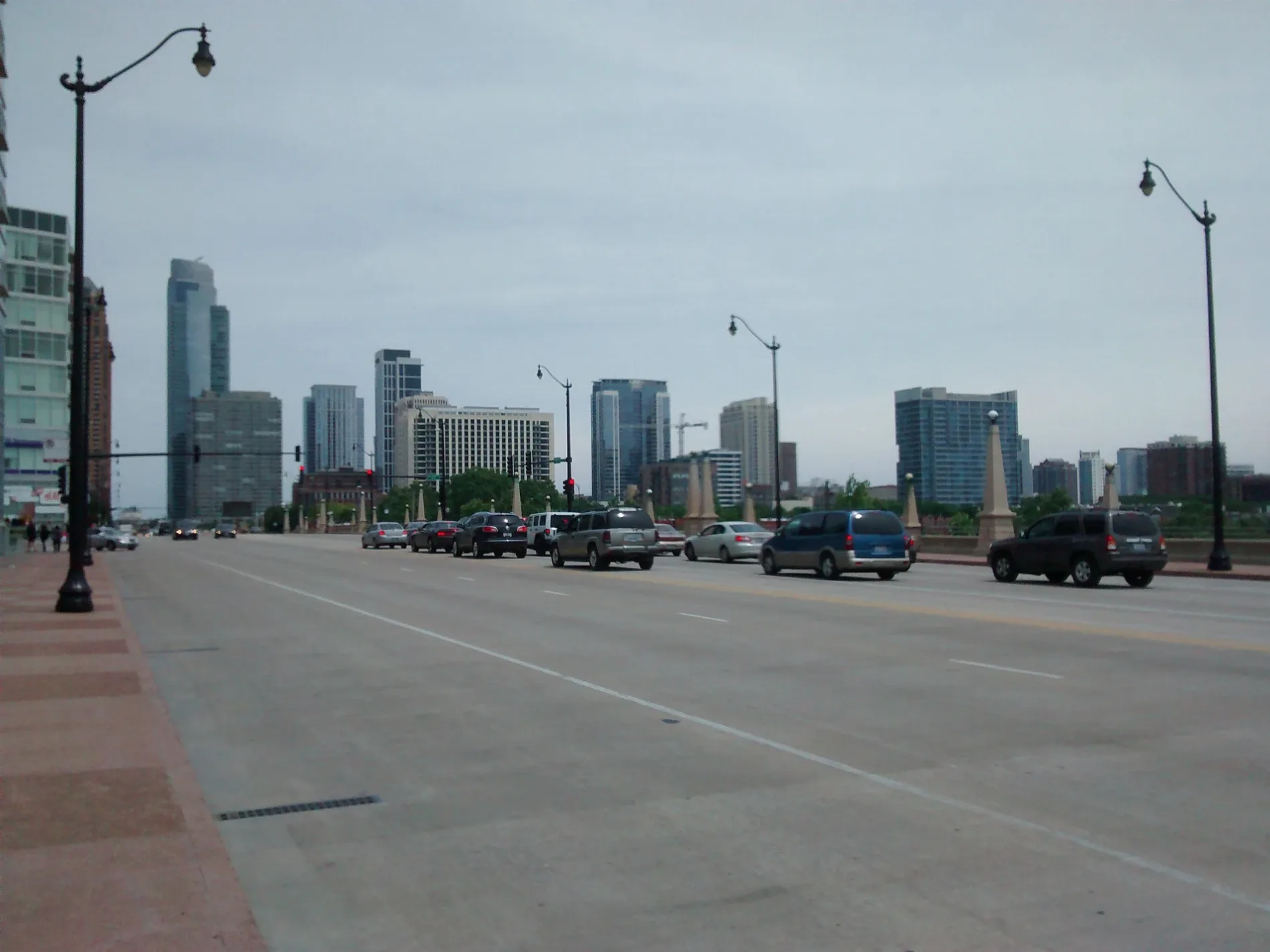
East Roosevelt Road in Chicago Loop
East Roosevelt Road in Loop in Chicago is a three-lane, asphalted secondary road. The street has a bike lane in some sections. It crosses a bridge. It runs in an east-west direction starting from South DuSable Lake Shore Drive and crosses South Columbus Drive, South Indiana Avenue, South Michigan Avenue, South Wabash Avenue and South State Street and ends at West Roosevelt Road. It connects Near South Side and Loop. This street is part of the Bicycle route "Roosevelt Road". Nearby you can find among others a cannabis dispensary, a massage therapy clinic, a drugstore and a cafe. The nearest stops are Roosevelt & Michigan and Roosevelt Orange/Red/Green Line Station. The bus lines 12, 18, 130, 146 and 192 serve this stop. Ⓦ.
- Road Type
- secondary road
- Lanes
- 3
- Route
- east-west
Image
Fast food restaurants
Bus stops
- bus lines 12, 18, 130, 146, 192
Drugstores
Stations
- bus lines 12, 18, 130, 146, 192
Streets nearby
South Prairie AvenueLittle Branch Cafe, McCormick Place Transportation Center, Showroom Food Hall, Woven + Bound Restaurant
450 ft
Museum Campus Access PathMuseum Campus/11th Street, South Shore Line, Metra, Indiana Ave & Roosevelt Rd
500 ft
South DuSable Lake Shore DriveBrachiosaurus Replica
0.1 mi
East 13th StreetFlo & Santos, Kai Sushi, Roosevelt Interlocking, Alfa Foods, LA Tan, South Loop, The Scout Waterhouse + Kitchen, Dentologie, Sumi Japanese Restaurant, Nepal House, Go Grocer
0.1 mi
South Columbus Drive0.1 mi
South Indiana AvenueIndiana & 13th Street, 1440 S Indiana, Indiana & 15th Place, Indiana & 14th Street, Indiana & 16th Street, Four Seasons Dry Cleaners & Tailoring, Il Culaccino
0.2 mi
South Indiana Parkway0.2 mi
East McFetridge DriveField Museum, Soldier Field & Field Museum, Culture Earth and Earth's Moon
0.2 mi
East 14th StreetCentral Station, Michigan Ave & 14th St, 14th Interlocking, Go Grocer
0.2 mi
McCormick Place BuswayMuseum Campus/11th Street, McCormick Place, Metra
0.2 mi
Lakefront TrailUrban Kyaks, 3rd Coast Cycles, Magma, Museum Campus, Buckingham Fountain, Shoreline Water Taxi, Monroe Harbor Tender Service, Cafe Michelle
0.2 mi
North Garage Access0.2 mi
Ramp 410.3 mi
Blue StaircaseSea Lion, Penguins
0.4 mi
Green Staircase0.4 mi
Sick Family Lakefront TerraceSoundings Cafe, Sea Otter
0.4 mi
South Museum Campus Drive0.4 mi
Service Road Shedd Acquarium0.4 mi
East Solidarity DriveSolidarity Drive & Shedd Aquarium, Solidarity Drive & Lynn White Drive, Solidarity Drive & Adler Planetarium, Spiral Galaxy
0.4 mi
South Special Olympics DriveGeography Earth, Museum Campus
0.4 mi
Lakefront Trail (bike)0.4 mi
Apartment buildings nearby
One Museum Park East200 ft
The Grant500 ft
Museum Tower0.1 mi
Lakeside on the Park0.1 mi
NEMA Chicago0.1 mi
Museum Park Tower 10.1 mi
Sky550.2 mi
Aquariums nearby
Rice Amplitheater & Abbott Oceanarium0.4 mi
Buildings nearby
9th Street Landscape Office0.2 mi
9th Street Landscape Garage0.2 mi
Dog parks nearby
Grant Bark Park0.2 mi
Fast food restaurants nearby
Museum Campus Cafe0.3 mi
Fountains nearby
Rosenberg Fountain (Hebe)0.2 mi
Gardens nearby
Welcome Garden0.4 mi
Museums nearby
Field Museum0.3 mi
Parks nearby
Daniel Webster Park0.2 mi
Playgrounds nearby
Soldier Field Children's Garden0.3 mi
Public restrooms nearby
11th Street Comfort Station0.1 mi
Railway areas nearby
18th Street (Weldon) Yard0.3 mi
Railways nearby
University Park Sub District0.3 mi
Recreation grounds nearby
Arvey Field0.2 mi
Lower Hutchinson Field0.2 mi
Grant Tennis Courts0.2 mi
Grant Pickleball Courts0.2 mi
Residential areas nearby
Museum Park0.2 mi
Sports fields nearby
Grant Skate Park0.1 mi
Stadiums nearby
Soldier Field0.3 mi
Ticket offices nearby
Shoreline Water Taxi0.3 mi
| Named after | Theodore Roosevelt |
|---|---|
| Located in | Chicago |
| Country | United States |
 Public transit map Loop Legend
| Railway | |
| Bus | |
| Streetcar |
 Bicycle map Loop Legend
| Bike path | |
| Bike lane on roadway | |
| Cycling allowed on bus lane | |
| Bicycle street | |
| Open to cyclists | |
| Open to cyclists, good path | |
| Cycling prohibited | |
| Cobblestone |
| Long-distance bike route | (depending on scale) | |
| Long-distance bike route |
 Pedestrian map Loop Legend
| Path |
| Long-distance hiking trail | (depending on scale) | |
| Long-distance hiking trail | ||
| Pedestrians prohibited |