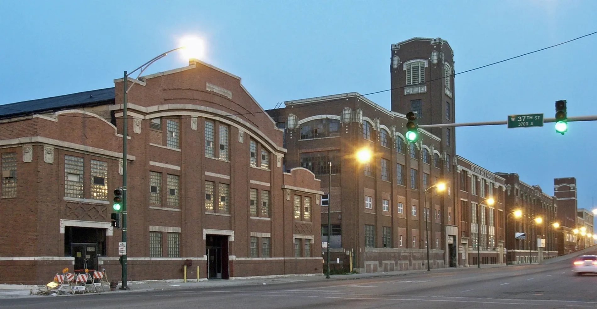
South Ashland Avenue in Chicago

South Ashland Avenue in Chicago is a two-lane secondary road. It runs in a north-south direction starting from North Ashland Avenue and crosses West Harrison Street, West Roosevelt Road, West 13th Street, West 14th Street, West 14th Place, West 15th Street, West 16th Street, West 17th Street, West 18th Street, West 18th Place and West 19th Street. It connects West Englewood, Near West Side, Chicago, Lower West Side, Auburn Gresham and McKinley Park. South Ashland Avenue is also known as Ashland Ave.. Nearby you can find among others 2 bakeries, 2 fast food restaurants, 2 cell phone stores and 2 clothing stores. The nearest stops include Ashland & 53rd Street, Ashland & Garfield, Ashland & 46th Street, Ashland & 43rd Street and Ashland & 49th Street. The bus lines 9, N9 and X9 serve this stop. South Ashland Avenue also exists in Palatine Township, Lyons Township, Thornton Township and Calumet Township. Ⓦ.

Road Type
secondary road
Lanes
2
Route
north-south

Image

Cmd East (2548608982)
Ashland Ave frontage, north of Pershing, of CMD East. The first phase of the CMD (1905-1915) employed S. Scott Joy as project architect – Payton Chung from DCA, USA, CC BY 2.0 – Wikimedia Commons

Cell phone stores

  • T-Mobile at South Ashland Avenue 4309 (60609).
  • Cricket Wireless at South Ashland Avenue 4320 (60609).

Banks

  • Chase (with ATM, opening hours: Mon–Fri 9–17; Sat 9–14; Sun closed) at South Ashland Avenue 4809 (60609).

Social facilities

  • Casa Catalina (Food bank) at South Ashland Avenue 4537 (60609).

Variety stores

  • Dollar Tree (opening hours: Mon–Sun 9–20) at South Ashland Avenue 4909 (60609).

Bus stops

  • Ashland & 53rd Street.
  • Ashland & Garfield.
  • Ashland & 46th Street.
  • Ashland & 43rd Street.
  • Ashland & 49th Street.
  • Ashland & 48th Street.
  • Ashland & 45th Street.
  • Ashland & 42nd Street.
  • Ashland & 47th Street.
  • Ashland & Pershing.
  • Ashland & 52nd Street.
  • Ashland & 51st Street.
  • bus lines 9, N9, X9

Bakeries

  • La Baguette Bakery at South Ashland Avenue 4321 (60609).
  • Central Bakery at South Ashland Avenue 4523 (60609).

Fast food restaurants

  • Domino's (Pizza, takeout, opening hours: Mon–Thu 10:30–24; Fri–Sat 10:30–1; Sun 10:30–24) at South Ashland Avenue 4323 (60609).
  • Subway (Sandwich, takeout) at South Ashland Avenue 4316 (60609).

Clothing stores

  • Midwest Ink Bros (opening hours: Mon–Fri 9–17; Sat 11–15) at South Ashland Avenue 4735 (60609).
  • Rainbow at South Ashland Avenue 4701 (60609).

Shoe stores

  • Foot Locker (opening hours: Mon–Sat 10–19; Sun 12–18) at South Ashland Avenue 4715 (60609).

Clinics

  • ACCESS Ashland Family Health Center at South Ashland Avenue 5159 (60609).

Streets nearby

South Laflin Street
0.2 mi
South Bishop Street
Beijing 88, University of Illinois - Mile Square Health Center at Back of The Yards
0.2 mi
West 49th Place
0.2 mi
West 51st Street
NS 55th Street Yard, 51st Street & Halsted, 51st Street & Union, 51st Street & Oakley, 51st Street & Western Blvd, First Christian Charismatic Church La Nueva Uncion, 51st Street & Campbell, 51st Street & Western Ave, 51st Street & Rockwell, Boost Mobile, 51st Street & Sacramento, 51st Street & Francisco, 51st Street & California, 51st Street & Albany, 51st Street & Kedzie, Acero Jovita Idár Elementary School, 51st Street & Morgan, 51st Street & Aberdeen, 51st Street & Racine, 51st Street & Loomis, 51st Street & Throop, 51st Street & Wolcott, 51st Street & Wood, 51st Street & Damen, 2135 W 51st Street, 51st Street & Hoyne, 51st Street & Peoria, CT Nails, S2 Express Grill, 51st Street & Lowe, 601 W 51st Street, 51st Street & Laflin, 51st Street & Ashland, 51st Street & Paulina, Teddy Bear Pre-School, 51st Street & Washtenaw, Grecias Bakery, Iglesia del Evangelio de Cristo, El Publano, International, Iglesia Christina Alcance Victoria, Tecnophone, Chavez Unisex
0.3 mi
South McDowell Avenue
Homer’s, Ashland Ave & McDowell Ave, PLS
0.3 mi
West 50th Street
Racine & 50th Street
0.3 mi
West 47th Street
47th Street & Wood, Back of the Yards Coffeehouse, 47th Street & Western Blvd, 47th Street & Oakley, 47th Street & Wallace, 47th Street & Normal, 47th Street & Damen, Rainbow, 47th Street & Aberdeen, 47th Street & Morgan, 47th Street & Wolcott, Citgo, 47th Street & Racine, 47th Street & Throop, 47th Street & Loomis, 47th Street & Ashland, 47th Street & Hoyne, Boost Mobile, DTLR, Back of The Yards Coffeehouse and Roastery, Cricket Wireless, 47th Street & Halsted, 47th Street & Union, Bell Heir’s BBQ, 47th Street & Laflin, Tom's Place Pancake House, Little Caesars, America's Best Contacts & Eyeglasses, Birrieria y Taqueria El Arandas
0.3 mi
South Wood Street
Paul Cornell
0.3 mi
South Loomis Boulevard
0.3 mi
South Hermitage Avenue
0.3 mi
South Marshfield Avenue
0.3 mi
West 49th Street
0.3 mi
South Justine Street
0.4 mi
South Wolcott Avenue
0.4 mi
South Paulina Street
0.4 mi
West 46th Street
Halsted & 46th Street, Whiner Beer Co.
0.4 mi
West 52nd Street
Damen & 52nd Street, Kedzie & 52nd Street, Don Pan Bakery, Kedzie Ave & 52nd St, Throop St & 52nd St
0.5 mi
South Winchester Avenue
Benitez Bakery
0.5 mi
South Honore Street
0.5 mi
West 48th Street
Racine & 48th Street, Fruteria Favela, FFHC-Ashland
0.5 mi
South Damen Avenue
Damen & 53rd Street, Damen & 52nd Street, Damen & 54th Street, Damen & 50th Street, Damen & Garfield, Damen & 51st Street, Damen Ave & 51st St, Damen & 48th Street, Damen & 49th Street
0.6 mi
Named after Ashland
Located in Chicago
Country United States