
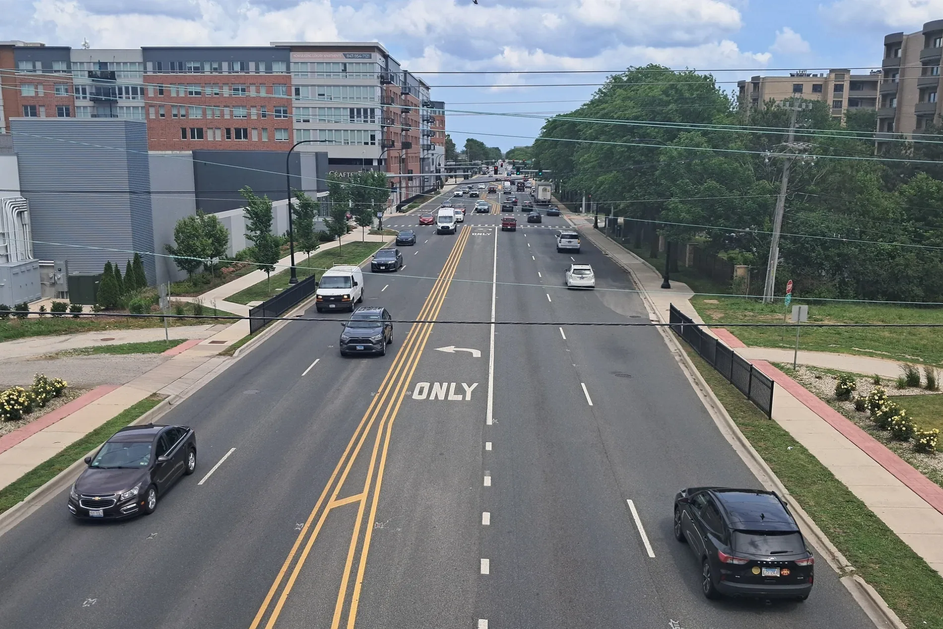
East Touhy Avenue in Des Plaines, Illinois
East Touhy Avenue in Des Plaines is a three-lane secondary road (Road number IL 72). It runs in an east-west direction and crosses Mount Prospect Road, West Touhy Avenue, Greco Avenue, Mannheim Road, South Wolf Road, Westview Drive, Webster Lane, Eastview Drive, Lee Street, Frontage Road, Dale Avenue and Buckingham Drive. This street is part of the highway "72". Nearby you can find among others 4 restaurants, a place of worship, a beauty salon and a bakery. The nearest stops include Touhy & Wolf (Upper Express Drive), 404 E Touhy Ave, Touhy & Higgins, Touhy & Mannheim and Touhy & Scott. The bus lines 221, 223-E, 223-W, 223-X, 250 and Pulse Dempster Line serve this stop. East Touhy Avenue also exists in Rosemont. Ⓦ.
- Road Type
- main road
- Lanes
- 3
- Route
- east-west
Image
Places of worship
Beauty salons
Hair salons
Artworks
Bus stops
- bus lines 221, 223-E, 223-W, 223-X, 250, Pulse Dempster Line
Restaurants
Bakeries
Tobacco shops
Charging stations
Streets nearby
Jarlath Avenue550 ft
Upper Express DriveDHL
0.1 mi
South Wolf RoadWolf & Greenview, Wolf & Columbia, Wolf & Wieboldt, Wolf & Thacker, Wolf & Hoffman, Wolf & Algonquin, Wolf & Oakton, 7-Eleven, Wolf & Forest, Taiwan Christian Church, 1755 S Wolf Rd, Wolf & Howard, Wolf & Jarvis, Wolf & Seegers/Golf
0.2 mi
Middle Express Drive0.2 mi
Santa Rose Drive0.3 mi
Elmira Avenue0.3 mi
Sprucewood Avenue0.3 mi
Webster Lane0.3 mi
Lower Express RoadSecurity Gate 24
0.3 mi
Douglas Avenue0.3 mi
Jarvis AvenueWolf & Jarvis, OZINGA
0.3 mi
Westview Drive0.3 mi
Oxford Road0.4 mi
Eastview Drive0.4 mi
Birchwood Avenue0.4 mi
North Perimeter Road0.5 mi
Burn Pit Circle0.6 mi
Banks nearby
Alliant Credit Union0.2 mi
Buildings nearby
FAA RTR Building0.2 mi
FAA Building0.4 mi
FAA Glide Slope Site 27R0.4 mi
FAA Midpoint RVR0.4 mi
ARFF Training Tower0.7 mi
Construction sites nearby
North ASDE SMR0.6 mi
Convenience stores nearby
7-Eleven0.1 mi
Gas stations nearby
Shell400 ft
Mobil0.1 mi
Speedway0.3 mi
Industrial areas nearby
FAA North Radar Facility200 ft
FAA RTR Facility0.3 mi
FAA Airport Beacon0.4 mi
Industrial buildings nearby
FAA ASR-11 Building150 ft
Asteroid Precision0.2 mi
ABF Freight0.3 mi
Nippon Express0.3 mi
Nu Way Industries, Inc.0.5 mi
Willoe-Higgins Pump Station0.6 mi
Landfills nearby
CDA Material Stockpile 890.6 mi
CDA Material Stockpile 900.6 mi
Office buildings nearby
United Airlines0.2 mi
Bulding 8990.2 mi
Commerce Center at O'Hare0.4 mi
Streams nearby
Willow Creek0.5 mi
Warehouses nearby
Building 8950.2 mi
Building 8930.4 mi
C.H. Robinson0.5 mi
Building 8910.5 mi
Waters nearby
Williow-Higgins Intake Wier0.3 mi
Other nearby
ARFF0.6 mi
| Named after | Patrick L. Touhy |
|---|---|
| Located in | Illinois |
| Country | United States |
Public transit map Des Plaines Legend
| Railway | |
| Bus | |
| Streetcar |
Bicycle map Des Plaines Legend
| Bike path | |
| Bike lane on roadway | |
| Cycling allowed on bus lane | |
| Bicycle street | |
| Open to cyclists | |
| Open to cyclists, good path | |
| Cycling prohibited | |
| Cobblestone |
| Long-distance bike route | (depending on scale) | |
| Long-distance bike route |
Pedestrian map Des Plaines Legend
| Path |
| Long-distance hiking trail | (depending on scale) | |
| Long-distance hiking trail | ||
| Pedestrians prohibited |