
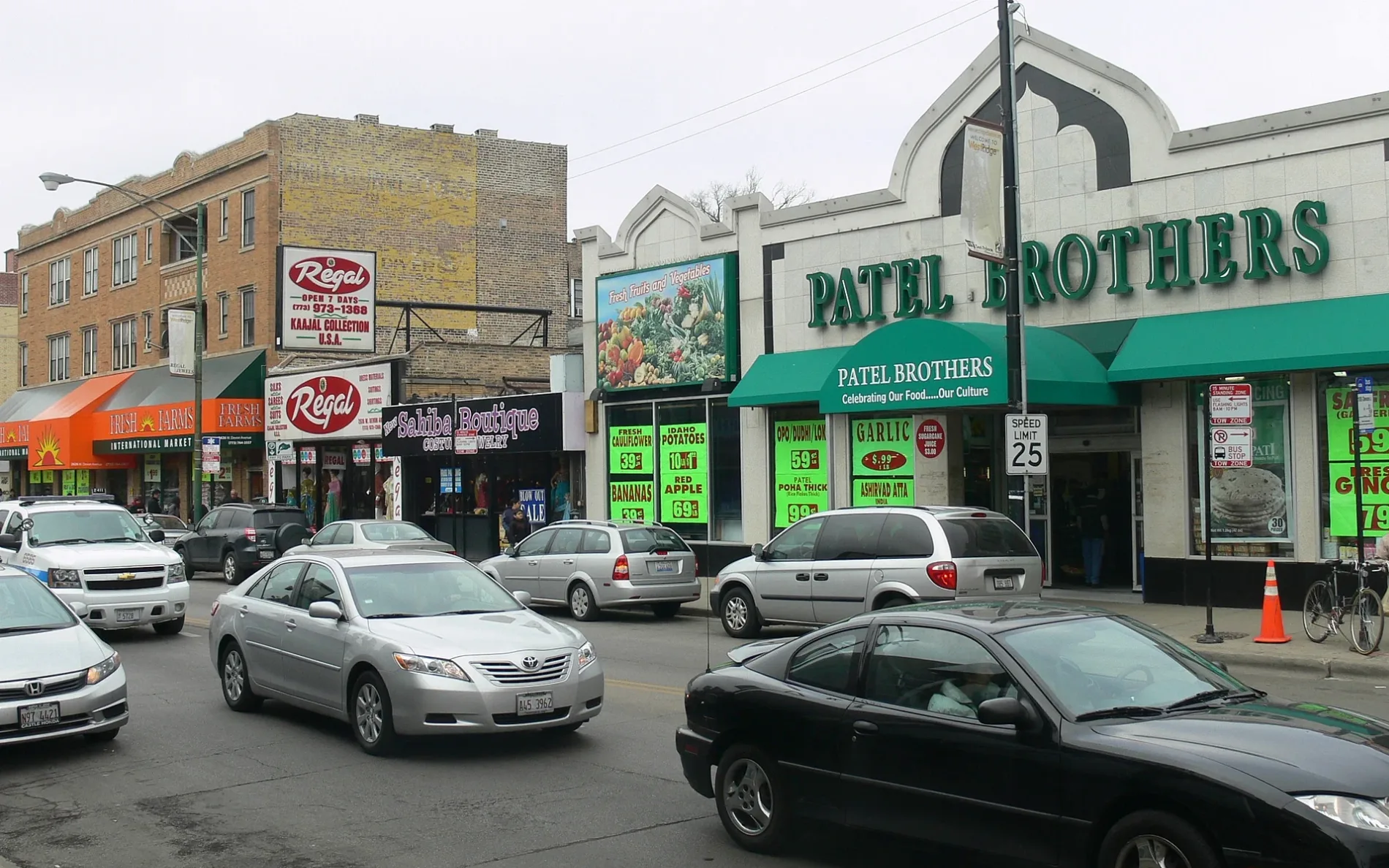
Devon Avenue in Park Ridge, Illinois
Devon Avenue in Park Ridge is an asphalted, lit local road. No sidewalks. It runs in an east-west direction and crosses South Rose Avenue, South Broadway Avenue, South Hamlin Avenue, South Home Avenue, South Seminary Avenue, South Aldine Avenue, South Western Avenue, South Knight Avenue, South Lincoln Avenue, South Delphia Avenue and South Greenwood Avenue and ends at South Dee Road. Devon Avenue is also known as Devon. Nearby you can find among others 2 hair salons, an ATM and a pharmacy. The nearest stops include Devon & Western, Devon & Lincoln, Devon & Fairview, Devon & Greenwood and Devon & Clifton. The bus lines 240 and 290 serve this stop. Devon Avenue also exists in Leyden Township. Ⓦ.
- Road Type
- secondary road
- Route
- east-west
Image
Pharmacies
Bus stops
- bus lines 240, 290
Streets nearby
Blue Beech Family Picnic Area Access RoadBlue Beech Family Picnic Area
0.2 mi
South Dee RoadDee & Talcott, Dee & Touhy
0.2 mi
Des Plaines River Trail YellowUnavedDam No. 4 Woods-East Trail Access
0.2 mi
South Rose Avenue0.3 mi
Blandings Grove Family Picnic Area Access RoadBlandings Grove Family Picnic Area
0.3 mi
Dam No. 4 Woods-East Access Road0.3 mi
North River Road2800 S River Rd, 2980 S River Rd, 2720 S River Rd, 2950 S River Rd, 2600 S River Rd, River Road & Devon, 3000 S River Rd
0.4 mi
West Higgins RoadHiggins & Mannheim, FedEx Office, Cilantro Taco Grill, Higgins & Patton, Stan's Donuts & Coffee, Big Chicken, 9700 W Higgins Rd, Higgins & River Road, Rosemont Post Office, Museum of Hummels, Higgins & Gage
0.4 mi
South Broadway Avenue0.4 mi
Arthur Street0.4 mi
Willow Creek Drive7-Eleven
0.4 mi
Rivers Way0.4 mi
Maple Drive0.4 mi
South Hamlin Avenue0.4 mi
Shafer CourtHiggins & Shafer/Gage
0.4 mi
Gage StreetMoretti's Pizza, Subway
0.4 mi
Devon Avenue2400 Devon Ave, Rosemont Police Department, Devon & Shafer, 2300 Devon Avenue, Donald E. Stephens
0.5 mi
Tri-State TollwayBalmoral Northbound Toll Plaza, China Wok, Mari Pari, Charleys Philly Steaks
0.5 mi
Glenlake Avenue0.5 mi
Des Plaines River Trail Yellow UnpavedDes Plaines River Trail, Forest Preserve District of Cook County
0.6 mi
Jane Addams Memorial TollwayRiver Road Toll Plaza
0.6 mi
Banks nearby
U.S. Bank0.4 mi
Casinos nearby
Rivers Casino0.4 mi
Commercial areas nearby
Riverway0.4 mi
Community centers nearby
Dunne Park Recreation Center0.5 mi
Convenience stores nearby
Mobil Mart0.4 mi
Fast food restaurants nearby
Taco Bell0.4 mi
Small Cheval0.4 mi
McDonald's0.4 mi
Gas stations nearby
Mobil0.4 mi
Hotels nearby
Hyatt Rosemont0.2 mi
Hampton Inn & Suites Rosemont Chicago O’Hare0.3 mi
The Westin O'Hare0.5 mi
Chicago Marriott Suites O'Hare0.5 mi
Office buildings nearby
One O'Hare Center0.2 mi
6300 River Road0.2 mi
Rosemont Center0.3 mi
Pointe O'Hare0.4 mi
DHL0.4 mi
Parks nearby
Monument Park0.3 mi
Dunne Park0.5 mi
Picnic areas nearby
Dam No. 4 Woods-East Grove #20.3 mi
Places of worship nearby
All Saints Cathedral0.6 mi
Playgrounds nearby
Stephens Isle Park0.5 mi
Preschools nearby
Bright Horizons0.6 mi
Restaurants nearby
Giordano's Pizzeria0.4 mi
Rivers nearby
Des Plaines River0.1 mi
School buildings nearby
Maine Township School District 2070.2 mi
Streams nearby
Willow Creek0.6 mi
Town halls nearby
Rosemont Village Hall0.3 mi
| Named after | Devon |
|---|---|
| Located in | Chicago, West Ridge |
| Postal code | 60645 |
| Country | United States |
Public transit map Park Ridge Legend
| Railway | |
| Bus | |
| Streetcar |
Bicycle map Park Ridge Legend
| Bike path | |
| Bike lane on roadway | |
| Cycling allowed on bus lane | |
| Bicycle street | |
| Open to cyclists | |
| Open to cyclists, good path | |
| Cycling prohibited | |
| Cobblestone |
| Long-distance bike route | (depending on scale) | |
| Long-distance bike route |
Pedestrian map Park Ridge Legend
| Path |
| Long-distance hiking trail | (depending on scale) | |
| Long-distance hiking trail | ||
| Pedestrians prohibited |