
South James Street in Carbondale, Illinois
South James Street in Carbondale is a residential street. It runs in a north-south direction starting from West Walnut Street and crosses West Cherry Street, West Schwartz Street and West Freeman Street and ends at West Mill Street. South James Street also exists in Will County, Kendall County, Tazewell County, Randolph County and Champaign County.
- Road Type
- residential street
- Route
- north-south
Image
Restaurants
Studios
Outdoor stores
Places of worship
Museums
- Sharp Museum (Web) at Faner Drive 1000 (62901) – approx. 0.6 mi.
Bus stops
Fire stations
Schools
Theaters
Florists
Ice cream shops
Cafes
Fast food restaurants
Funeral homes
Kindergartens
Shelters
Massage therapy clinics
Streets nearby
West Schwartz Street0.1 mi
Hayes Avenue0.1 mi
South Curtis Place0.1 mi
West College StreetWinkler Elementary School, Sam's Cafe
0.2 mi
West Freeman StreetShawnee Trail Outfitters, Quatro's Pizza, Jerrys Flower Boutique, Traxx, Q Massage, Freeman Street Trailhead
0.2 mi
South Elizabeth Street0.2 mi
West Elm Street0.2 mi
West Walnut StreetPhoenix Cycles
0.2 mi
South Benwood Drive0.2 mi
West Whitney Street0.2 mi
South Eason Drive0.3 mi
South Rawlings Street0.3 mi
Lincoln DriveEast Campus Shuttle, Communications Building, Tedrick Welcom Center
0.3 mi
South Springer Street0.3 mi
South Orchard Drive0.3 mi
South Twisdale Avenue0.3 mi
West Cherry Street0.3 mi
West Mill StreetPoplar @ Mill, Underground Barrel Room & Grill, Blend Tea & Crepe
0.3 mi
South Murrie Drive0.3 mi
South Brook Lane0.3 mi
West Carter Street0.3 mi
South Maple Street0.3 mi
West Grand AvenueMorris Library, Troutt Tea House, School of Music
0.3 mi
North Oakland Avenue0.3 mi
South Oakland AvenueLittle Caesars
0.3 mi
Clocktower Drive0.3 mi
South Forest Avenue0.3 mi
Wham Drive0.4 mi
West Main StreetCarbondale Fire Station #1, Scooter's Coffee, First United Methodist Church, Thai Taste, Ninas Panadería
0.4 mi
South Beveridge Street0.4 mi
South Poplar StreetWalker Funeral Home
0.4 mi
West High Street0.4 mi
Apartment buildings nearby
Elizabeth Street Apartments0.2 mi
Banks nearby
Mid Country Bank0.3 mi
Buildings nearby
Northwest Annex B0.2 mi
Ambassador Hall0.3 mi
Fast food restaurants nearby
Burger King0.3 mi
Houses nearby
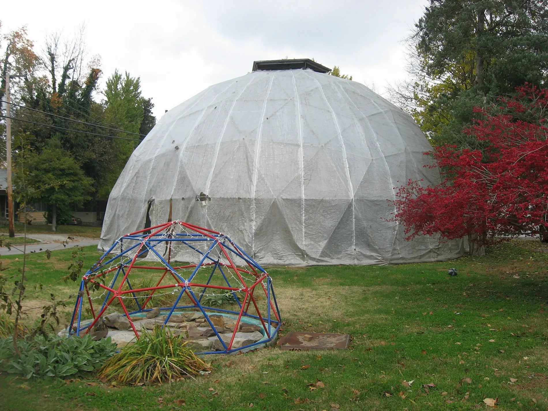
Fuller Dome Home0.1 mi
Parks nearby
Oakland Field0.4 mi
Places of worship nearby
Saint Francis Xavier Catholic Church0.4 mi
School buildings nearby
Trinity Christian School0.3 mi
Sports fields nearby
Stehr Field0.4 mi
Supermarkets nearby
Schnucks0.2 mi
University buildings nearby
HR - Employ Benefits0.2 mi
Northwest Annex C0.2 mi
Northwest Annex A0.3 mi
04370.3 mi
04780.3 mi
Variety stores nearby
Family Dollar0.3 mi
Public transit map Carbondale Legend
| Railway | |
| Bus | |
| Streetcar |
Bicycle map Carbondale Legend
| Bike path | |
| Bike lane on roadway | |
| Cycling allowed on bus lane | |
| Bicycle street | |
| Open to cyclists | |
| Open to cyclists, good path | |
| Cycling prohibited | |
| Cobblestone |
| Long-distance bike route | (depending on scale) | |
| Long-distance bike route |
Pedestrian map Carbondale Legend
| Path |
| Long-distance hiking trail | (depending on scale) | |
| Long-distance hiking trail | ||
| Pedestrians prohibited |