
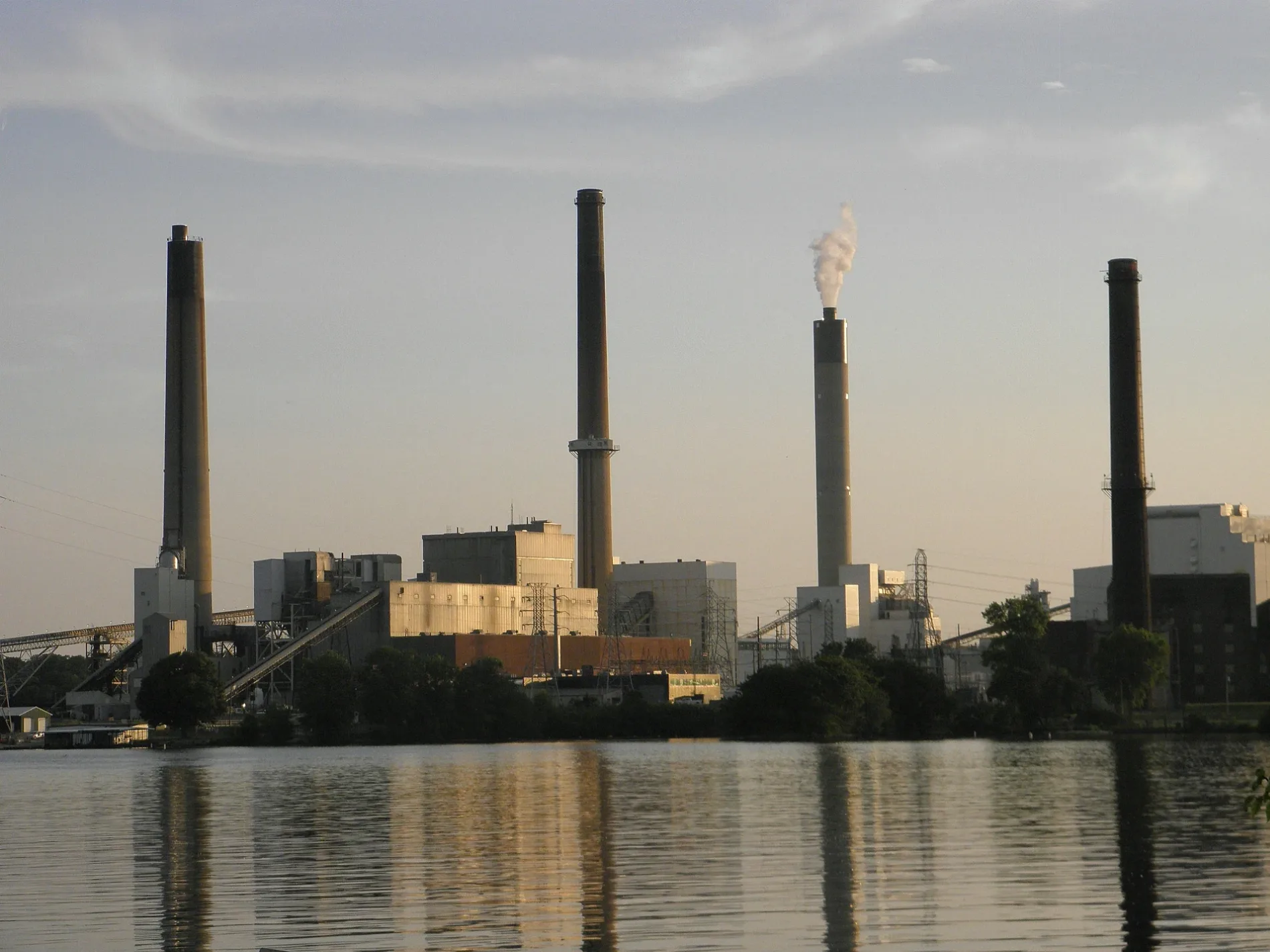
Dallman Power Station in Springfield, Illinois
Dallman Power Station in Springfield is a power plant (City Water, Light and Power, Coal, Combustion), Stevenson Drive 3100 (62703). Ⓦ.
- House Number
- 3100
- Postal Code
- 62703
- Street
- Stevenson Drive
- Land Use
- industrial area
- Operator
- City Water, Light and Power
Image
Convenience stores
Bus stops
Community centers
Department stores
Fast food restaurants
Variety stores
Cafes
Car washes
Fire stations
Hotels
Restaurants
Tourist information centers
Auto repair shops
Streets nearby
East Hazel Dell Lane0.4 mi
Hawthorne Lane0.6 mi
Moorgate Drive0.6 mi
East Stevenson DriveStevenson & St. Francis, Taco Bell, Starbucks, Stevenson & Stanton, Tjelmeland Laketown Automotive, Subway, CVS Pharmacy, Stevenson & Taylor, Circle K, Laketown Barber Shop, Yanni's Gyros, 217 Comics, Cards & Games, Stevenson & Woodward, Stevenson at Laketown Shopping Center, Stevenson & Baker, Stevenson & 11th, La Fiesta, Tai Pan Chinese, Jiffi Stop, Fire Station #2, Stevenson & Warner, Walgreens, Big Red's Bait & Tackle, VIP Fashion, Midas, Bank of Springfield, Papa John's, Stevenson & Lake Plaza, Hardee's, Security Bank, Rent One, Little Caesars, United Community Bank, Stevenson & 6th Street Road, True Value, Stevenson & Palmer
0.6 mi
Lincoln Greens Lane0.7 mi
Adloff LaneWilkerson's Service Center, Circle K, Adloff & Carl Prairie, Adloff & Stanford, Adloff @ CCSC
0.7 mi
South Dirksen ParkwayDirksen & Nicholls/Cook, Dirksen & Cook/First Student, Dirksen & Nicholls, Super 8 by Wyndham Springfield East, Chase, Dirksen & Cook, Dirksen & Singer, Subway, Hunan Express, Boost Mobile, Dirksen & Cook/Nicholls, Angry Meals, Red Lobster, Panera Bread, McDonald's, Yummy Crab, Marathon, Jolly Tamale, Dirksen & Cook/Singer, Dirksen & Singer/Cook, Dirksen & S. Grand/Singer, Long John Silver's, Arby's, Dirksen @ Arby's
0.7 mi
Hoylake Drive0.7 mi
Rita Road0.7 mi
Bel Aire Drive0.8 mi
Kent Drive0.8 mi
Queensway RoadSouthlawn
0.8 mi
Hazel Lane0.8 mi
Huntington Road0.8 mi
Warner DriveFirst Church of God
0.8 mi
Rochester Road0.8 mi
Lytham Drive0.8 mi
Linden Lane0.8 mi
Carnoustie Drive0.9 mi
Troon Drive0.9 mi
Birkdale Drive0.9 mi
Teakwood Drive0.9 mi
Buckeye DriveLake Forest Estates
0.9 mi
Satinwood Drive0.9 mi
East Lake Shore Drive0.9 mi
Saint Annes Drive0.9 mi
Laconwood DriveTimberlane
0.9 mi
Markwood Lane0.9 mi
Greencastle Circle0.9 mi
Persimmon Drive1.0 mi
Delmar Drive1.0 mi
Bowwood Drive1.0 mi
Brittany StreetForest Park Hills
1.0 mi
Columbine Lane1.0 mi
White Birch Road1.0 mi
Abandoned railways nearby
Illinois Central Railroad0.5 mi
Commercial buildings nearby
Cedar House0.7 mi
Dogwood House0.7 mi
Elm House0.7 mi
Birch House0.8 mi
Dams nearby
Spaulding Dam0.7 mi
Drugstores nearby
CVS Pharmacy0.9 mi
Golf courses nearby
Lincoln Greens Golf Course0.6 mi
Hotels nearby
Hilton Garden Inn Springfield, IL0.7 mi
Parks nearby
Tom Madonia Park East0.7 mi
Tom Madonia Park West0.7 mi
Residential areas nearby
West Lake Apartments0.8 mi
Forest Park Hills1.0 mi
Retail areas nearby
Capital City Shopping Center0.6 mi
| Located in | Sangamon County |
|---|---|
| Country | United States |
| Power output | 437.4 |
 Public transit map Springfield Legend
| Railway | |
| Bus | |
| Streetcar |
 Bicycle map Springfield Legend
| Bike path | |
| Bike lane on roadway | |
| Cycling allowed on bus lane | |
| Bicycle street | |
| Open to cyclists | |
| Open to cyclists, good path | |
| Cycling prohibited | |
| Cobblestone |
| Long-distance bike route | (depending on scale) | |
| Long-distance bike route |
 Pedestrian map Springfield Legend
| Path |
| Long-distance hiking trail | (depending on scale) | |
| Long-distance hiking trail | ||
| Pedestrians prohibited |