
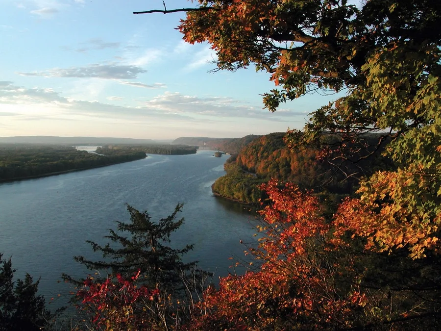
Lock Canal No. 11 in Dubuque, Iowa
Lock Canal No. 11 in Dubuque is a canal. Lock Canal No. 11 is also known as The Mississippi. Ⓦ.
- Waterway Type
- canal
Image
Schools
Fire stations
Fast food restaurants
Campgrounds
Places of worship
Restaurants
Social facilities
Viewpoints
Gas stations
Vacation apartments
Museums
Nursing homes
Streets nearby
Memorial Lane0.2 mi
Bluff's Edge PromenadeRiver Viewing Point, Allison Point, Shiras Point
0.2 mi
Eagle Point Drive0.4 mi
Trolley Line Trail0.5 mi
Volunteer DriveEagle Point
0.5 mi
Southern Gate Road0.5 mi
Shiras AvenueHam House Museum
0.5 mi
Rhomberg AvenueKick it
0.5 mi
Kramer Circle Drive0.6 mi
Lincoln Avenue0.6 mi
Cobalt Court0.6 mi
Zephyr Drive0.6 mi
Sumner Street0.6 mi
Hawthorne Street0.7 mi
Bandstands nearby
Band Shell0.2 mi
Bays nearby
Slough Impoundment0.1 mi
Buildings nearby
Central Control Station0.1 mi
Workshop0.2 mi
Riverfront Pavilion0.2 mi
Emergency Generator Building0.2 mi
Control Stand Shelter0.2 mi
Nicholas J. Sutton0.7 mi
Dams nearby
Dam No. 110.3 mi
Industrial areas nearby
Upstream Guide Wall100 ft
Guard Wall350 ft
Lock & Dam No. 110.1 mi
Land Wall0.1 mi
Downstream Guide Wall0.4 mi
Lock gates nearby
Auxiliary Lock0.1 mi
Outdoor seatings nearby
Riverfront Pavilion East Porch0.2 mi
Parks nearby
Eagle Point Park0.2 mi
Lock & Dam No. 11 Park0.3 mi
Eagle Valley Park0.5 mi
O'Leary's Lake Recreation Area0.7 mi
Playgrounds nearby
Yellow playground0.2 mi
Blue Playground0.3 mi
Public restrooms nearby
Riverfront Restrooms0.2 mi
Restaurants nearby
The Point0.7 mi
Rivers nearby
Mississippi River0.1 mi
Sheds nearby
Scooter Shed0.2 mi
Shelters nearby
Eagle's View Pavilion0.2 mi
Open Air Pavilion0.2 mi
Shiras Memorial Pavilion0.3 mi
Tri-State View Pavilion0.4 mi
Log Cabin Pavilion0.7 mi
Sports centers nearby
Nicholas J. Sutton Swimming Pool0.7 mi
Swimming pools nearby
Nicholas J. Sutton Pool0.7 mi
Tourist information centers nearby
Visitor Center0.2 mi
Waters nearby
Lock No. 110.2 mi
| Length | 3766 |
|---|---|
| Located in | United States |
| Country | United States |
| Source | Lake Itasca |
| Mouth | Gulf of Mexico |
| Tributary | Black River, Arkansas River, Ohio River, Saint Croix River, Wisconsin River, Rock River, Illinois River, Kaskaskia River, Minnesota River, Des Moines River, White River, Apple River, Big Muddy River, St. Francis River, Yazoo River, Big Black River, Maquoketa River, Wolf River, Rice Creek, Iowa River, Turkey River, Loosahatchie River, Meramec River, Wapsipinicon River, Chippewa River, River des Peres, Bayou Pierre, Catfish Creek, Crow River, Duck Creek, Hatchie River, Henderson Creek, Little Maquoketa River, Marys River, Obion River, Prairie River, Rum River, Rush River, Salt River, Schoolcraft River, Skunk River, Swan River, Trempealeau River, Turtle River, Upper Iowa River, Vermillion River, Wind River, Yellow River, Village Creek, Brazeau Creek, Cinque Hommes Creek, Nokasippi River, Apple Creek, Coles Creek, River aux Vases, Minnehaha Creek, Fox River, Bassett Creek, Sucker Creek, Missouri River |
| Native name | Mississippi River |
| Described by | Sytin Military Encyclopedia, Small Brockhaus and Efron Encyclopedic Dictionary, Brockhaus and Efron Encyclopedic Dictionary, Jewish Encyclopedia of Brockhaus and Efron, The Nuttall Encyclopædia, Great Soviet Encyclopedia (1926–1947), The Encyclopedia Americana, The American Cyclopædia, Encyclopædia Britannica 11th edition, Collier's New Encyclopedia, 1921, The New Student's Reference Work, New International Encyclopedia, Meyer’s Universum, Fünfzehnter Band, Meyer’s Universum, Siebzehnter Band, Meyer’s Universum, Achtzehnter Band, Granat Encyclopedic Dictionary |
 Public transit map Dubuque Legend
| Railway | |
| Bus | |
| Streetcar |
 Bicycle map Dubuque Legend
| Bike path | |
| Bike lane on roadway | |
| Cycling allowed on bus lane | |
| Bicycle street | |
| Open to cyclists | |
| Open to cyclists, good path | |
| Cycling prohibited | |
| Cobblestone |
| Long-distance bike route | (depending on scale) | |
| Long-distance bike route |
 Pedestrian map Dubuque Legend
| Path |
| Long-distance hiking trail | (depending on scale) | |
| Long-distance hiking trail | ||
| Pedestrians prohibited |