
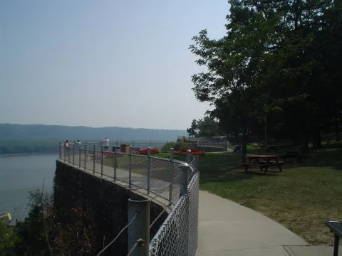
Eagle Point Park in Dubuque, Iowa
Eagle Point Park in Dubuque is a park (City of Dubuque), Shiras Avenue 2601 (52001) 🌐. Eagle Point Park is also known as Eagle Point Park Historic District. Ⓦ.
- House Number
- 2601
- Street
- Shiras Avenue
- Operator
- City of Dubuque
- Website
- https://www.cityofdubuque.org/573/Eagle-Point-Park
- Postal Code
- 52001
- Leisure
- park
Places of worship
Restaurants
Fast food restaurants
Hotels
Viewpoints
Gas stations
Vacation apartments
Nursing homes
Schools
Fire stations
Social facilities
Museums
Campgrounds
Streets nearby
Memorial Lane0.2 mi
Eagle Point Drive0.2 mi
Bluff's Edge PromenadeRiver Viewing Point, Allison Point, Shiras Point
0.3 mi
Cobalt Court0.4 mi
Zephyr Drive0.4 mi
Harpy Eagle Court0.4 mi
Southern Gate Road0.4 mi
Shiras AvenueHam House Museum
0.4 mi
Trolley Line Trail0.4 mi
Baldwin Drive0.5 mi
Bald Eagle Court0.5 mi
Stellar Eagle Drive0.5 mi
Orchard Drive0.5 mi
Golden Eagle Drive0.5 mi
Eagle Valley Drive0.5 mi
Jonathan Lane0.5 mi
Sky Blue Drive0.5 mi
Delicia Drive0.6 mi
Roosevelt Street West0.6 mi
Cider Ridge0.6 mi
Bandstands nearby
Band Shell0.2 mi
Bays nearby
Slough Impoundment0.2 mi
Buildings nearby
Riverfront Pavilion0.2 mi
Workshop0.3 mi
Central Control Station0.3 mi
Emergency Generator Building0.3 mi
Control Stand Shelter0.4 mi
Canals nearby
Lock Canal No. 110.2 mi
Industrial areas nearby
Upstream Guide Wall0.2 mi
Lock & Dam No. 110.2 mi
Guard Wall0.3 mi
Land Wall0.3 mi
Downstream Guide Wall0.5 mi
Lock gates nearby
Auxiliary Lock0.3 mi
Outdoor seatings nearby
Riverfront Pavilion East Porch0.2 mi
Parks nearby
Eagle Valley Park0.3 mi
Lock & Dam No. 11 Park0.5 mi
Playgrounds nearby
Blue Playground0.2 mi
Yellow playground0.3 mi
Public restrooms nearby
Riverfront Restrooms0.3 mi
Residential areas nearby
Eagle Valley0.5 mi
Rivers nearby
Mississippi River0.3 mi
Sheds nearby
Scooter Shed0.3 mi
Shelters nearby
Open Air Pavilion0.2 mi
Eagle's View Pavilion0.3 mi
Shiras Memorial Pavilion0.4 mi
Tri-State View Pavilion0.5 mi
Tourist information centers nearby
Visitor Center0.3 mi
Waters nearby
Lock No. 110.4 mi
| Located in | Dubuque |
|---|---|
| Country | United States |
Public transit map Dubuque Legend
| Railway | |
| Bus | |
| Streetcar |
Bicycle map Dubuque Legend
| Bike path | |
| Bike lane on roadway | |
| Cycling allowed on bus lane | |
| Bicycle street | |
| Open to cyclists | |
| Open to cyclists, good path | |
| Cycling prohibited | |
| Cobblestone |
| Long-distance bike route | (depending on scale) | |
| Long-distance bike route |
Pedestrian map Dubuque Legend
| Path |
| Long-distance hiking trail | (depending on scale) | |
| Long-distance hiking trail | ||
| Pedestrians prohibited |