
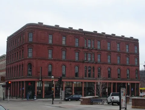
East 4th Street in Dubuque, Iowa
East 4th Street in Dubuque is a residential street and it runs in an east-west direction starting from Ice Harbor Drive and crosses Adams Street and ends at East 5th Street.
- Road Type
- residential street
- Route
- east-west
Image
Bars
Auto repair shops
Copy shops
Museums
- National Rivers Hall of Fame (Web) – approx. 0.2 mi.
Bus stops
Artworks
Restaurants
Car dealerships
Social facilities
Fast food restaurants
Streets nearby
Adams Street250 ft
Ice Harbor Drive450 ft
East 5th StreetPort of Dubuque, Dottie's Cafe
0.1 mi
East 3rd Street0.1 mi
East 6th StreetKen's Auto Body, Kingdom Car Center
0.2 mi
Central AvenueJulien Dubuque, Schumacher Pool & Spa, Rapids Reproductions, Holy Ghost Catholic Church, Hartig Drug, FasMart, Domino's, Family Dollar, Marco's Italian & American, BP, Sinclair, Foodie Garage Eatery, River City Hair Co., Smith Cycle, Dubuque Police Department, The Fate of Santa Clara, Portal, Coretta Scott King
0.2 mi
Mississippi RiverwalkNational Rivers Hall of Fame, Mark Twain Statue, John C Culver Floodwall, Dubuque Sister Cities, Tony Roma's, Native Americans at the Mississippi, Leaf Skeleton, Upper Mississippi River National Wildlife And Fish Refuge
0.2 mi
Bell StreetContinuum
0.2 mi
Mississippi Plaza0.3 mi
East 1st Street0.3 mi
Locust Street ConnStatue of Liberty
0.3 mi
Apartment buildings nearby
Bishop's Block Apartments0.3 mi
Artworks nearby
Paddlewheel0.1 mi
Attractions nearby
Towboat Logsdon0.2 mi
Tavern0.2 mi
William M. Black0.3 mi
Buildings nearby
Dubuque Train Depot0.1 mi
Flexsteel Industries0.2 mi
Black Smith0.2 mi
PBS Systems0.2 mi
CS Technologies0.3 mi
U.S. Coast Guard0.3 mi
Cabins nearby
Frentress Log Cabin0.2 mi
Casinos nearby
Diamond Jo Casino0.1 mi
Commercial buildings nearby
McDonald & Associates CPAs0.2 mi
Construction sites nearby
The Stacks350 ft
Convenience stores nearby
Port of Dubuque Marina Store0.3 mi
Fabric stores nearby
Canvas Products Co.0.3 mi
Gardens nearby
Dubuque Rescue Mission Garden0.2 mi
Grasslands nearby
Boatyard0.2 mi
Hotels nearby
Canfield Hotel0.2 mi
Ice cream shops nearby
Ice Cream U Scream0.3 mi
Industrial areas nearby
Buoy Yard0.3 mi
Lighting stores nearby
Heritage Lighting and Fireplace0.1 mi
Locksmiths nearby
The Locksmith Express0.1 mi
Marinas nearby
Port of Dubuque Marina0.2 mi
Military areas nearby
U.S. Coast Guard - Dubuque Moorings0.3 mi
Museums nearby
National Mississippi River Museum & Aquarium0.2 mi
Diamond Jo National River Center0.2 mi
Office buildings nearby
MSA Professional Servies150 ft
Parking lots nearby
Port of Dubuque Parking Ramp350 ft
Holiday Inn Parking Ramp0.2 mi
Five Flags Parking Ramp0.2 mi
Railways nearby
Marquette Subdivision450 ft
Dubuque Subdivision0.1 mi
Restaurants nearby
Sunshine Family Restaurant0.1 mi
Tourist information centers nearby
Iowa Welcome Center0.2 mi
Warehouses nearby
Dubuque Supply Co0.2 mi
Waters nearby
Wetland0.2 mi
Public transit map Dubuque Legend
| Railway | |
| Bus | |
| Streetcar |
Bicycle map Dubuque Legend
| Bike path | |
| Bike lane on roadway | |
| Cycling allowed on bus lane | |
| Bicycle street | |
| Open to cyclists | |
| Open to cyclists, good path | |
| Cycling prohibited | |
| Cobblestone |
| Long-distance bike route | (depending on scale) | |
| Long-distance bike route |
Pedestrian map Dubuque Legend
| Path |
| Long-distance hiking trail | (depending on scale) | |
| Long-distance hiking trail | ||
| Pedestrians prohibited |