
Brucemore in Cedar Rapids, Iowa
Brucemore in Cedar Rapids is a museum (fee required). Brucemore is also known as T.M. Sinclair Mansion. Brucemore is located near Guildford Southeast. Brucemore is built in the Queen Anne style style. Ⓦ.
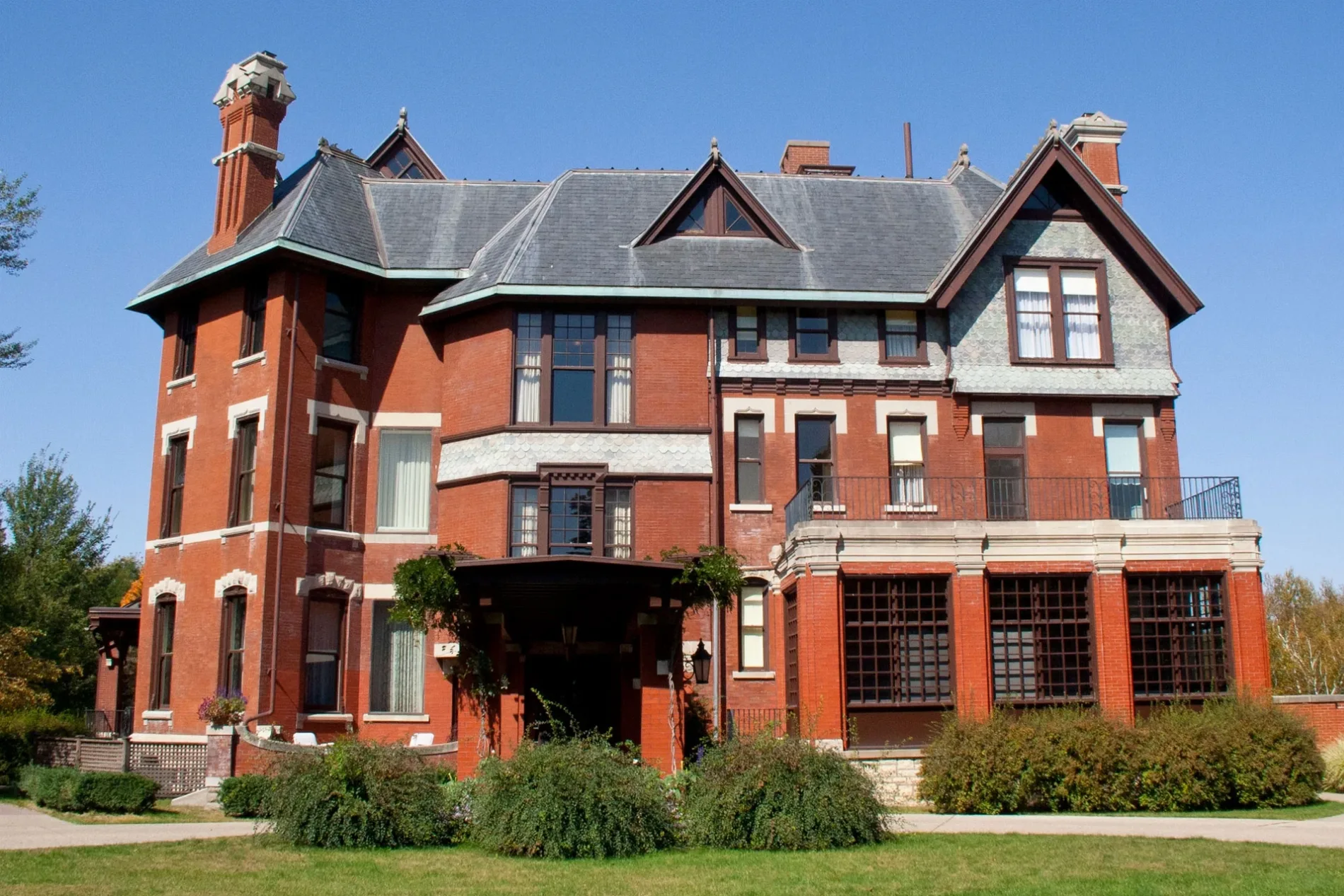
- Alternate Name
- T.M. Sinclair Mansion
- Tourism
- museum
- Building Type
- building
Dentist offices
Clinics
Supermarkets
Bars
Banks
Libraries
Hair salons
Nursing homes
Pharmacies
Cell phone stores
Fast food restaurants
Opticians
Restaurants
Places of worship
Sporting goods stores
Specialty stores
Arts centers
Social facilities
Streets nearby
Linden Drive Southeast0.1 mi
Guildford Southeast0.1 mi
2nd Avenue SoutheastBalloons etc., Izumi Sushi and Hibachi, Rock Bar American Grill, Allure
0.1 mi
Kyrie Southeast0.2 mi
Dows Lane Southeast0.2 mi
20th Street Northeast0.2 mi
Ashcombe Southeast0.2 mi
Nassau Street Southeast0.2 mi
Cottage Grove Avenue Southeast0.2 mi
1st Avenue EastManor Care Health Services Center, Milio's Sandwiches, Mercy Home Care, Optix Eye Design, The Blind Factory, Secret Nails, Siegel's, Parks & Schmit, Rejuven8 Spa, Lion, DougEE's, Flooring and Lighting Solutions, Irish Democrat, Salon Blonde, Maria's Salon and Spa, Metro by T-Mobile, Stay Sharp, Fun City Sports, K.A.F.F. Oriental & African Market, Jimmy John's, Midwest Mattress, Panchero's Mexican Grill, Boyson Jewelry, Great Clips, Diamond Nails & Spa, Aspen Dental, FedEx Office, The History Center, Moose McDuffy's, UnityPoint Health Work Well Clinic Therapy Plus, Prince Albert Tuxedos, Cedar Rapids Day School, Subway, Urban Vintage Hair Stuido, Copyworks, Mattress Firm, LensCrafters, Cedar Rapids Police, Oreck, West Side Sewing, Doubletree Hilton, Dermatology Clinic of Iowa, Katie Milden DDS Family Dentistry, Pizza Daddy, Shawnie's Beauty Bar
0.2 mi
3rd Avenue SoutheastGilded Pear Gallery, Kor
0.2 mi
19th Street Southeast0.2 mi
Interurban Trail0.2 mi
Foxbourne Southeast0.3 mi
Crescent Street Southeast0.3 mi
A Avenue NortheastHy-Vee Pharmacy, Medical Lending Closet, 350 First, Saint Lukes Surgery Center
0.3 mi
Ryecroft Southeast0.3 mi
Forest Drive Southeast0.3 mi
Sedgeford Southeast0.3 mi
Braybrook Southeast0.3 mi
Sinclair Avenue Southeast0.3 mi
B Avenue Northeast0.3 mi
22nd Street Northeast0.4 mi
Linn Boulevard Southeast0.4 mi
Linden Terrace Southeast0.4 mi
Liberty Drive Southeast0.4 mi
Blake Boulevard Southeast0.4 mi
Thompson Drive Southeast0.4 mi
21st Street Northeast0.4 mi
Mitvalsky Court Southeast0.4 mi
Eastern Boulevard Southeast0.4 mi
Indian Road Southeast0.5 mi
23rd Street Drive Southeast0.5 mi
Apartment buildings nearby
Blair House0.4 mi
Buildings nearby
State Farm0.2 mi
Weland Clinical Laboratories0.2 mi
Coldwell Banker0.3 mi
Clinics nearby
RCI0.2 mi
Commercial areas nearby
Brucemore Historical Site0.3 mi
Dentist's offices nearby
CR Pediatric Dentistry0.4 mi
Parks nearby
Northview Park0.4 mi
Places of worship nearby
Bahai Center0.2 mi
Bethany Lutheran Church0.4 mi
St Matthew Catholic Church0.5 mi
Residential areas nearby
Crescent Place0.2 mi
Grande Avenue Place0.2 mi
Ridgewood0.2 mi
Sutherland Square0.4 mi
Social facilities nearby
Four Oaks0.3 mi
| Architectural style | Queen Anne style |
|---|---|
| Heritage designation | National Register of Historic Places listed place |
| Located in | Iowa |
| Country | United States |
Public transit map Cedar Rapids Legend
| Railway | |
| Bus | |
| Streetcar |
Bicycle map Cedar Rapids Legend
| Bike path | |
| Bike lane on roadway | |
| Cycling allowed on bus lane | |
| Bicycle street | |
| Open to cyclists | |
| Open to cyclists, good path | |
| Cycling prohibited | |
| Cobblestone |
| Long-distance bike route | (depending on scale) | |
| Long-distance bike route |
Pedestrian map Cedar Rapids Legend
| Path |
| Long-distance hiking trail | (depending on scale) | |
| Long-distance hiking trail | ||
| Pedestrians prohibited |