
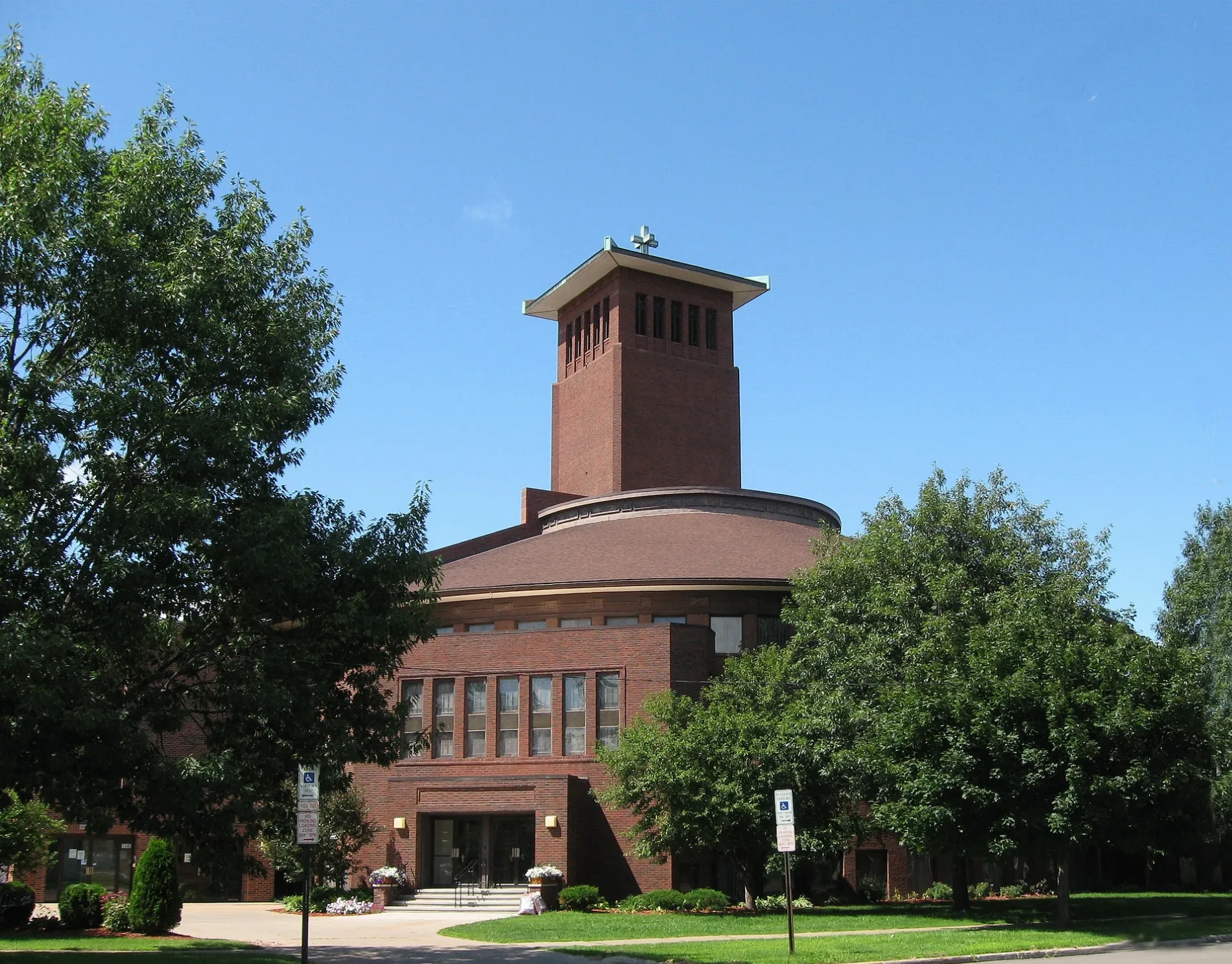
Saint Pauls United Methodist Church in Cedar Rapids, Iowa
Saint Pauls United Methodist Church in Cedar Rapids is a Methodista Church, 3rd Avenue Southeast 1340 (52403). It is a protected historic site. Ⓦ.
- Amenity
- place of worship
- House Number
- 1340
- Street
- 3rd Avenue Southeast
- Postal Code
- 52403
- Building Type
- church
Image
Hair salons
Restaurants
Cell phone stores
Artworks
Galleries
Clinics
Fast food restaurants
Police stations
Pharmacies
Clothing stores
Places of worship
Nursing homes
Supermarkets
Sporting goods stores
Social facilities
Interior decorators
Streets nearby
Bever Avenue SoutheastCedar Rapids Zen Center
200 ft
14th Street Southeast400 ft
13th Street Southeast450 ft
3rd Avenue SoutheastGilded Pear Gallery, Kor
500 ft
1st Avenue EastMetro by T-Mobile, Stay Sharp, Fun City Sports, K.A.F.F. Oriental & African Market, Jimmy John's, Milio's Sandwiches, Mercy Home Care, Optix Eye Design, The Blind Factory, Secret Nails, Siegel's, Parks & Schmit, Rejuven8 Spa, Lion, DougEE's, Flooring and Lighting Solutions, Irish Democrat, Salon Blonde, Maria's Salon and Spa, Midwest Mattress, Panchero's Mexican Grill, Boyson Jewelry, Great Clips, Diamond Nails & Spa, Aspen Dental, FedEx Office, The History Center, Moose McDuffy's, UnityPoint Health Work Well Clinic Therapy Plus, Prince Albert Tuxedos, Cedar Rapids Day School, Subway, Urban Vintage Hair Stuido, Manor Care Health Services Center, Copyworks, Mattress Firm, LensCrafters, Cedar Rapids Police, Oreck, West Side Sewing, Doubletree Hilton, Dermatology Clinic of Iowa, Katie Milden DDS Family Dentistry, Pizza Daddy, Shawnie's Beauty Bar
0.1 mi
14th Street Northeast0.2 mi
College Drive Northeast0.3 mi
Coe Road Northeast0.3 mi
B Avenue Northeast0.3 mi
12th Street SoutheastHouse of Prayer
0.3 mi
5th Avenue SoutheastSaint Lukes Living Center East, Family Practice Associates, Tanager Place, UI Urgent Care - Cedar Rapids, 10th Street
0.3 mi
Voorhees CircleSquares
0.3 mi
11th Street Northeast0.3 mi
Art galleries nearby
Art Cellar0.2 mi
Arts centers nearby
Dows Fine Arts Center0.2 mi
Banks nearby
Alliant Credit Union0.1 mi
Buildings nearby
Peterson Hall0.2 mi
Margaret Bock Housing0.3 mi
Cafes nearby
Starbucks0.1 mi
Car washes nearby
Johnny Boy's0.1 mi
Clinics nearby
Helen G. Nassif Center for Woman's & Children's Health0.3 mi
Physicians Clinic of Iowa0.3 mi
Convenience stores nearby
Casey's General Store0.2 mi
Fast food restaurants nearby
Arby's0.1 mi
Wendy's0.2 mi
Gas stations nearby
Fas Fuel0.2 mi
Parks nearby
Wellington Park0.2 mi
Places of worship nearby
Westminster Presbyterian Church500 ft
First Evangelical Lutheran Church0.3 mi
Recreation grounds nearby
Dan Lehn Patio and Pergola0.3 mi
Residential areas nearby
Coe Apartments0.2 mi
Restaurants nearby
Uptown Live0.1 mi
China Inn0.1 mi
Brewed Awakenings0.1 mi
Via Sofia's0.3 mi
Theaters nearby
Cherry Auditorium0.2 mi
Sinclair Auditorium0.2 mi
University buildings nearby
West Hampton Apartments0.2 mi
East Hampton Apartments0.2 mi
McCabe House0.2 mi
Stuart Hall0.2 mi
Clark Alumni House0.2 mi
Marquis Hall0.2 mi
Nassif Admissions House0.2 mi
Morris House0.3 mi
Spivey House0.3 mi
Voorhees Hall0.3 mi
Hickok Hall0.3 mi
Brandt House0.3 mi
| Heritage designation | National Register of Historic Places listed place |
|---|---|
| Located in | Iowa |
| Country | United States |
Public transit map Cedar Rapids Legend
| Railway | |
| Bus | |
| Streetcar |
Bicycle map Cedar Rapids Legend
| Bike path | |
| Bike lane on roadway | |
| Cycling allowed on bus lane | |
| Bicycle street | |
| Open to cyclists | |
| Open to cyclists, good path | |
| Cycling prohibited | |
| Cobblestone |
| Long-distance bike route | (depending on scale) | |
| Long-distance bike route |
Pedestrian map Cedar Rapids Legend
| Path |
| Long-distance hiking trail | (depending on scale) | |
| Long-distance hiking trail | ||
| Pedestrians prohibited |