
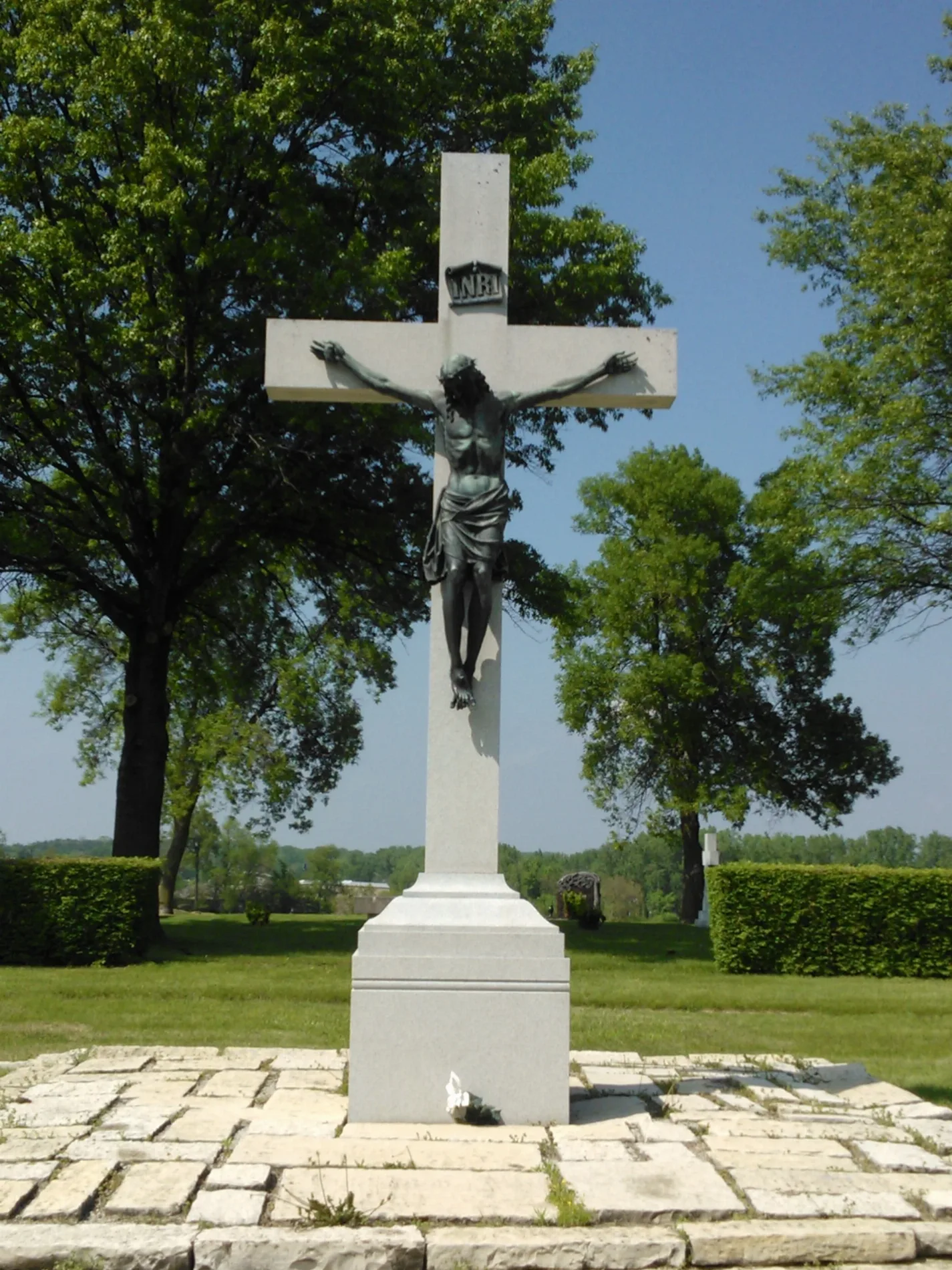
Calvary Cemetery in Davenport, Iowa
Calvary Cemetery in Davenport is a cemetery. Calvary Cemetery is also known as Mount Calvary Catholic Cemetery. Ⓦ.
- Land Use
- cemetery
Restaurants
Paint stores
Gift shops
Places of worship
Convenience stores
Bike shops
Banks
Fast food restaurants
Cell phone stores
Video game stores
Gas stations
Tourist information centers
Auto parts stores
Tattoo studios
Variety stores
Funeral homes
Car dealerships
Cafes
Bookstores
Streets nearby
Goose Creek Bike Path200 ft
East 46th Street0.3 mi
Grand Avenue0.3 mi
East 47th Street0.3 mi
Brady StreetCafe One Eleven, Christian Science Reading Room, GreenState Credit Union
0.3 mi
East 42nd Street0.5 mi
Welcome Way0.5 mi
East 53rd StreetBig 10 Mart, BP, Enterprise, DXL Men's Apparel, AutoZone, Natural Grocers, Smart Toyota, Flavors of India, Great Clips, Mission BBQ, Cactus Restaurant, Hy-Vee Gas, Bubba's 33, Jersey Mike's Subs, Starbucks
0.5 mi
East 50th StreetSherwin-Williams, Dollar General
0.5 mi
West 47th Street0.6 mi
West 50th Street0.6 mi
East Kimberly RoadPanera Bread, Innovative Dentistry, AT&T, Starbucks, Famous Dave's, Los Portales, America, BP
0.6 mi
Shops nearby
Campers Inn RV of Davenport0.5 mi
Auto repair shops nearby
Jiffy Lube0.5 mi
Buildings nearby
Social Security Administration0.3 mi
Handicapped Development Center0.4 mi
State Farm0.4 mi
The Salvation Army Adult Rehabilitation Center0.4 mi
H&R Block0.6 mi
Northtown Plaza0.6 mi
Car dealerships nearby
Davenport Used Car Superstore0.4 mi
Car washes nearby
Tommy's Express Car Wash0.5 mi
Carpet stores nearby
Carpetland USA0.3 mi
Cemeteries nearby
Davenport Memorial Park0.3 mi
Coffee shops nearby
Atomic Coffee Bar0.4 mi
Commercial areas nearby
Hillcrest Commons0.5 mi
Commercial buildings nearby
Scouting America0.4 mi
Department stores nearby
Von Maur0.6 mi
Door stores nearby
Barron Equipment and Overhead Doors0.5 mi
Fast food restaurants nearby
McDonald's0.6 mi
Forests nearby
Nims Acres0.4 mi
Furniture stores nearby
Slumberland0.6 mi
Massage therapy clinics nearby
Carnation Massage0.3 mi
Pawn shops nearby
Premier Jewlery & Loan0.4 mi
Places of worship nearby
Community of Christ Latter Day Saints0.4 mi
Rental services nearby
Enterprise0.3 mi
Residential areas nearby
Ashford Condos0.2 mi
46th Street Condos0.2 mi
Grand Ashford Condominiums0.3 mi
Lyngholm0.3 mi
Restaurants nearby
Mo Brady's Steakhouse0.5 mi
Happy Joe's0.6 mi
Retail areas nearby
Lyngholm Park0.4 mi
Rivers nearby
Goose Creek0.1 mi
Self storages nearby
StorageMart0.4 mi
Specialty stores nearby
Grainger0.5 mi
Streams nearby
Candlelight Creek0.6 mi
Thrift stores nearby
The Salvation Army0.3 mi
Tobacco shops nearby
Tobacco Outlet Plus Grocery0.3 mi
| Located in | Davenport |
|---|---|
| Country | United States |
Public transit map Davenport Legend
| Railway | |
| Bus | |
| Streetcar |
Bicycle map Davenport Legend
| Bike path | |
| Bike lane on roadway | |
| Cycling allowed on bus lane | |
| Bicycle street | |
| Open to cyclists | |
| Open to cyclists, good path | |
| Cycling prohibited | |
| Cobblestone |
| Long-distance bike route | (depending on scale) | |
| Long-distance bike route |
Pedestrian map Davenport Legend
| Path |
| Long-distance hiking trail | (depending on scale) | |
| Long-distance hiking trail | ||
| Pedestrians prohibited |