
Johnson School in Davenport, Iowa
Johnson School in Davenport is a school building. Johnson School is located near Frisco Drive. Ⓦ.
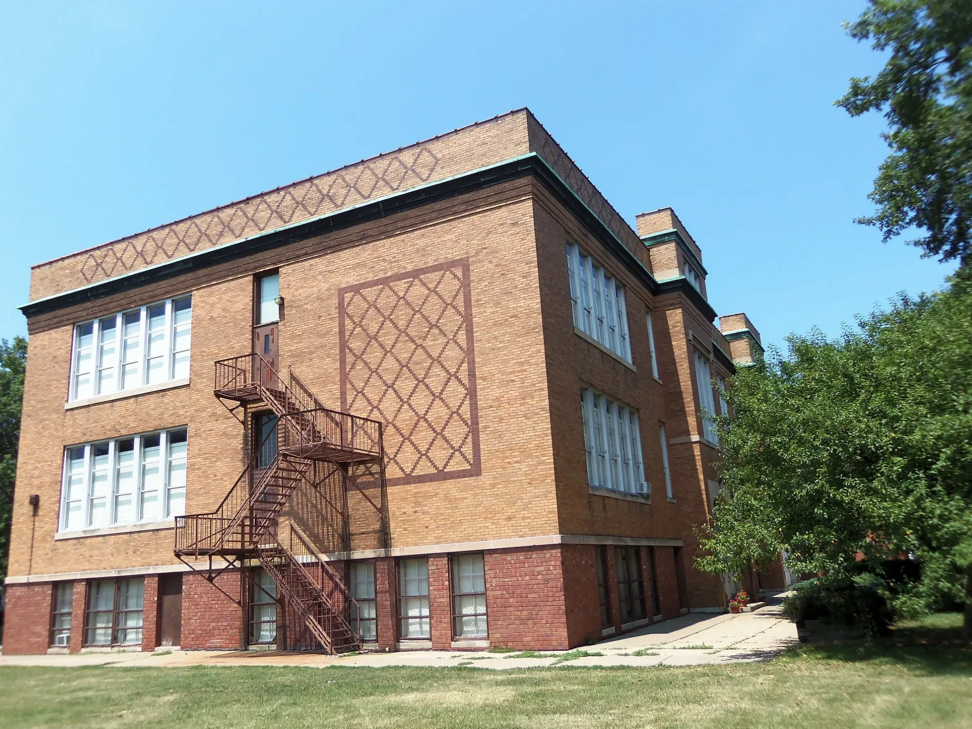
- Building Type
- school building
Places of worship
Bus stops
Artworks
Schools
Bars
Nursing homes
Auto repair shops
Restaurants
Pharmacies
Arts centers
Charging stations
Streets nearby
Pacific Street0.1 mi
West Locust StreetHappy Joe's
0.1 mi
Dunkin Drive Thru0.1 mi
Wilkes Avenue0.1 mi
North Howell Street0.2 mi
Lookout Lane0.2 mi
West 15th Street0.2 mi
West 16th Street0.2 mi
West 17th Street0.2 mi
Frisco Drive0.3 mi
West Lombard StreetNorthpark Church of God
0.3 mi
Grove Street0.3 mi
Cedar Street0.3 mi
Crescent Avenue0.3 mi
West High Street0.3 mi
West Pleasant Street0.4 mi
North Pine StreetCalvary Temple Baptist Church
0.4 mi
Madison Street0.4 mi
Davie Street0.4 mi
West Rusholme Street0.5 mi
West Dover Court0.5 mi
Hickory Grove Court0.5 mi
North Lincoln Avenue0.5 mi
West Central Park AvenueHappy Day School, Trinity Lutheran Church
0.6 mi
Kelling Street0.6 mi
Columbia Court Northwest0.6 mi
Shops nearby
Check Into Cash0.1 mi
Auto repair shops nearby
Wallicks Auto Repair0.2 mi
Buildings nearby
American Family Insurance500 ft
Commercial buildings nearby
Veteran's Choice Contracting0.4 mi
Dentist's offices nearby
Mueller Gene DR DDS0.3 mi
Drugstores nearby
CVS Pharmacy0.2 mi
Fast food restaurants nearby
Dunkin'0.1 mi
Fire stations nearby
Davenport Fire Department Station 60.1 mi
Massage therapy clinics nearby
YU Spa Massage0.2 mi
Pharmacies nearby
Walgreens0.2 mi
Pubs nearby
Off Point Pub0.2 mi
Railways nearby
Iowa Interstate Railroad0.2 mi
Residential areas nearby
Golden Gate Park0.1 mi
Homestead0.3 mi
Richland Park0.3 mi
Cherry Lane0.4 mi
Sunset Hill0.5 mi
Englehart0.5 mi
Sun Valley0.6 mi
Restaurants nearby
Don Juan Mexican Cocina0.1 mi
Big JJ Fish and Chicken0.1 mi
Firehouse Bar and Grill0.1 mi
Supermarkets nearby
Hy-Vee0.4 mi
| Year built | 1910 |
|---|---|
| Heritage designation | Davenport Register of Historic Properties |
| Located in | Davenport |
| Country | United States |
Public transit map Davenport Legend
| Railway | |
| Bus | |
| Streetcar |
Bicycle map Davenport Legend
| Bike path | |
| Bike lane on roadway | |
| Cycling allowed on bus lane | |
| Bicycle street | |
| Open to cyclists | |
| Open to cyclists, good path | |
| Cycling prohibited | |
| Cobblestone |
| Long-distance bike route | (depending on scale) | |
| Long-distance bike route |
Pedestrian map Davenport Legend
| Path |
| Long-distance hiking trail | (depending on scale) | |
| Long-distance hiking trail | ||
| Pedestrians prohibited |