Kentucky

This page is the City map of Kentucky, a map with streets, paths and places across the United States. Kentucky covers approximately 104,659 square kilometres and lies at an elevation of about 230 metres. The state had 4,505,836 residents in 2020, compared with 4,339,367 in 2010. Kentucky was founded as a state of the United States in 1792 and is divided into 131 subregions in the underlying map data.

City map Kentucky
NASA/Ross Walter, Public domain – Wikimedia Commons
City map Prospect
Nyttend, Public domain – Wikimedia Commons

Prospect

Prospect is mapped as a city-level settlement in Kentucky with OSM administrative level 8. The place is part of the Kentucky settlement structure represented on this regional map.

The map records Prospect among the local urban subregions of a state covering about 104,659 square kilometres. Streets, paths and places in Prospect are shown within the wider Kentucky map.

City map Muldraugh
Jamesmac96, CC BY 3.0 – Wikimedia Commons

Muldraugh

Muldraugh is a city-level settlement in Kentucky with OSM administrative level 8. The mapped population is 1,040, the area is 1,355,882 square metres, and the elevation is 225 metres.

Muldraugh was recorded as established in 1952. Its streets and paths are located within Kentucky, the United States state that had 4,505,836 residents in 2020.

City map Fayette County
FloNight (Sydney Poore) and Russell Poore, CC BY-SA 4.0 – Wikimedia Commons

Fayette County

Fayette County is a county-level administrative unit in Kentucky with OSM administrative level 6. It has a mapped population of 322,570 and an area of 739,000,000 square metres.

The county was established in 1780. Its urban centre is Lexington, and the county forms part of the Kentucky map with roads, paths and settlements.

City map Corinth
Brian Stansberry, CC BY 4.0 – Wikimedia Commons

Corinth

Corinth is a city-level settlement in Kentucky with OSM administrative level 8. The mapped population is 226, the area is 5,532,616 square metres, and the elevation is 295 metres.

Corinth is represented as a local place within the Kentucky regional map. The settlement’s streets and paths belong to a state covering approximately 104,659 square kilometres.

City map Upton
Brian Stansberry, CC BY 4.0 – Wikimedia Commons

Upton

Upton is mapped as a city-level settlement in Kentucky with OSM administrative level 8. It is one of the local places included in the Kentucky regional map.

The map places Upton within a state of the United States covering about 104,659 square kilometres. Its streets, paths and surrounding places are represented in the state-wide map.

City map Walton
Dwight Burdette, CC BY 3.0 – Wikimedia Commons

Walton

Walton is a city-level settlement in Kentucky with OSM administrative level 8. The place is included among the local urban subregions shown on the Kentucky map.

Walton belongs to the settlement network of a state with 4,505,836 residents in 2020. The regional map records its streets, paths and nearby places.

City map Junction City
Brian Stansberry, CC BY 4.0 – Wikimedia Commons

Junction City

Junction City is mapped as a city-level settlement in Kentucky with OSM administrative level 8. Its name identifies a local place within the state’s mapped settlement structure.

The city is shown within Kentucky, which covers approximately 104,659 square kilometres. Streets and paths in Junction City are included in the wider regional map.

City map Eubank
Brian Stansberry, CC BY 4.0 – Wikimedia Commons

Eubank

Eubank is a city-level settlement in Kentucky with OSM administrative level 8. The mapped population is 313, the area is 2,206,097 square metres, and the elevation is 367 metres.

Eubank is recorded as a city in the United States state of Kentucky. Its local streets and paths are mapped within a region founded in 1792.

City map Sardis
Michael Rivera, CC BY-SA 3.0 – Wikimedia Commons

Sardis

Sardis is mapped as a city-level settlement in Kentucky with OSM administrative level 8. The recorded population is 103.

The place forms part of the local settlement pattern shown on the Kentucky map. Kentucky had 4,505,836 residents in 2020 and includes Sardis among its mapped subregions.

City map Pleasureville
Danwalker88, Public domain – Wikimedia Commons

Pleasureville

Pleasureville is a city-level settlement in Kentucky with OSM administrative level 8. It is included as a local place in the regional map of the state.

The map shows Pleasureville together with streets, paths and nearby settlements. Kentucky extends across approximately 104,659 square kilometres in the United States.

City map Germantown
Unknown author Unknown author, Public domain – Wikimedia Commons

Germantown

Germantown is mapped as a city-level settlement in Kentucky with OSM administrative level 8. The place is one of the local urban subregions represented in the state map.

Germantown is shown within Kentucky, a state founded in 1792. Its streets and paths are part of the mapped transport and settlement network.

City map Sparta
Missvain, CC BY 4.0 – Wikimedia Commons

Sparta

Sparta is a city-level settlement in Gallatin and Owen counties, Kentucky, with OSM administrative level 8. The mapped population is 236, the area is 16,302,937 square metres, and the elevation is 155 metres.

Sparta is represented within the Kentucky map as a place spanning two counties. The state recorded 4,505,836 residents in 2020.

City map Boone County
W.marsh, CC BY-SA 3.0 – Wikimedia Commons

Boone County

Boone County is a county-level administrative unit in Kentucky with OSM administrative level 6. Its mapped population is 127,712.

The county lies in the northern part of Kentucky near the Ohio River and the Cincinnati metropolitan area. It is included in a state covering approximately 104,659 square kilometres.

City map Kenton County
W.marsh, CC BY-SA 3.0 – Wikimedia Commons

Kenton County

Kenton County is a county-level unit in Kentucky with OSM administrative level 6. It has a mapped population of 169,064 and an area of 426,000,000 square metres.

The county was established in 1840 and includes Covington, one of the principal cities opposite Cincinnati across the Ohio River. Its roads and settlements are shown on the Kentucky map.

City map Campbell County
The original uploader was Rdikeman at English Wikipedia ., CC BY-SA 3.0 – Wikimedia Commons

Campbell County

Campbell County is a county-level administrative unit in Kentucky with OSM administrative level 6. The mapped population is 92,066.

The county borders the Ohio River and includes Newport and other communities in the Cincinnati metropolitan area. It is represented in the state map with its streets, paths and places.

City map Pendleton County
W.marsh, CC BY-SA 3.0 – Wikimedia Commons

Pendleton County

Pendleton County is a county-level unit in Kentucky with OSM administrative level 6. It has 14,644 mapped residents and covers 730,000,000 square metres.

The county was established in 1798. Its location in northern Kentucky is shown together with the local road network and settlements.

City map Bracken County
W.marsh, CC BY-SA 3.0 – Wikimedia Commons

Bracken County

Bracken County is a county-level administrative unit in Kentucky with OSM administrative level 6. The county is included among the mapped subregions of the state.

Bracken County lies along the Ohio River in northeastern Kentucky. Its streets, paths and places are represented in the regional map.

City map Crittenden County
Nyttend, Public domain – Wikimedia Commons

Crittenden County

Crittenden County is a county-level unit in Kentucky with OSM administrative level 6. The mapped population is 8,990 and the area is 961,000,000 square metres.

The county was established in 1842. It lies in western Kentucky, where the regional map records roads, paths and settlements within the state.

City map Livingston County
Nyttend, Public domain – Wikimedia Commons

Livingston County

Livingston County is a county-level administrative unit in Kentucky with OSM administrative level 6. It has 8,888 mapped residents and an area of 886,000,000 square metres.

The county was established in 1798 and lies in western Kentucky near the Ohio and Cumberland river systems. Its places and transport routes appear on the Kentucky map.

City map Union County
Bedford at English Wikipedia, Public domain – Wikimedia Commons

Union County

Union County is a county-level unit in Kentucky with OSM administrative level 6. The mapped population is 13,668 and the area is 941,000,000 square metres.

Union County was established in 1811. The county is part of western Kentucky and is shown with its local streets, paths and settlements.

City map Bullitt County
W.marsh, CC BY-SA 3.0 – Wikimedia Commons

Bullitt County

Bullitt County is a county-level administrative unit in Kentucky with OSM administrative level 6. It has a mapped population of 82,217 and an area of 778,000,000 square metres.

The county was established in 1796 and lies south of Louisville. Its communities and road network are included in the Kentucky regional map.

City map Carroll County
W.marsh, CC BY-SA 3.0 – Wikimedia Commons

Carroll County

Carroll County is a county-level unit in Kentucky with OSM administrative level 6. The mapped population is 10,810 and the area is 356,000,000 square metres.

The county was established in 1838 and borders the Ohio River in northern Kentucky. Its places, streets and paths are represented in the state map.

City map Gallatin County
W.marsh, CC BY-SA 3.0 – Wikimedia Commons

Gallatin County

Gallatin County is a county-level administrative unit in Kentucky with OSM administrative level 6. It is included among the county subregions shown on the regional map.

The county lies along the Ohio River in northern Kentucky and includes the city of Sparta together with Owen County. Its local roads and settlements are mapped within the state.

City map Hardin County
Nyttend, Public domain – Wikimedia Commons

Hardin County

Hardin County is a county-level unit in Kentucky with OSM administrative level 6. It has 110,702 mapped residents and covers 1,631,000,000 square metres.

The county was established in 1792 and includes Elizabethtown and Fort Knox. Hardin County is shown with its streets, paths and places on the Kentucky map.

City map Jefferson County
Bedford at English Wikipedia, Public domain – Wikimedia Commons

Jefferson County

Jefferson County is a county-level administrative unit in Kentucky with OSM administrative level 6. The mapped population is 782,969 and the area is 1,032,000,000 square metres.

The county was established in 1780 and contains Louisville, Kentucky’s largest city. The Ohio River, urban streets and surrounding places are represented on the regional map.

City map Oldham County
W.marsh, CC BY-SA 3.0 – Wikimedia Commons

Oldham County

Oldham County is a county-level unit in Kentucky with OSM administrative level 6. Its mapped population is 64,875.

The county lies north of Louisville and is included in the northern Kentucky map. Streets, paths and settlements are shown within its county boundary.

City map Shelby County
W.marsh, CC BY-SA 3.0 – Wikimedia Commons

Shelby County

Shelby County is a county-level administrative unit in Kentucky with OSM administrative level 6. It has 48,065 mapped residents and covers 999,000,000 square metres.

The county was established in 1792 and includes Shelbyville. Its position between Louisville and Lexington is represented through the mapped road and settlement network.

City map Spencer County
Nyttend, Public domain – Wikimedia Commons

Spencer County

Spencer County is a county-level unit in Kentucky with OSM administrative level 6. The mapped population is 19,490 and the area is 497,000,000 square metres.

The county was established in 1824 and lies southeast of Louisville. Its streets, paths and places form part of the Kentucky regional map.

City map Trimble County
Nyttend, Public domain – Wikimedia Commons

Trimble County

Trimble County is a county-level administrative unit in Kentucky with OSM administrative level 6. It is included among the mapped counties of the state.

The county borders the Ohio River in northern Kentucky. Its local places and transport routes are shown on the regional map.

City map Hancock County
Ryan Emmick, CC BY-SA 4.0 – Wikimedia Commons

Hancock County

Hancock County is a county-level unit in Kentucky with OSM administrative level 6. The county is represented as one of the administrative subregions in the Kentucky map.

It lies along the Ohio River in western Kentucky. Streets, paths and settlements within Hancock County are included in the state-wide map.

City map Adair County
W.marsh, CC BY-SA 3.0 – Wikimedia Commons

Adair County

Adair County is a county-level administrative unit in Kentucky with OSM administrative level 6. It has 18,903 mapped residents and covers 1,068,000,000 square metres.

The county was established in 1801 and includes Columbia. Its local roads and places are shown within the central Kentucky regional map.

City map Allen County
Bedford at English Wikipedia, Public domain – Wikimedia Commons

Allen County

Allen County is a county-level unit in Kentucky with OSM administrative level 6. The mapped population is 20,588 and the area is 912,000,000 square metres.

The county was established in 1815 and lies on Kentucky’s southern border with Tennessee. Its settlements and roads are represented on the state map.

City map Ballard County
Nyttend, Public domain – Wikimedia Commons

Ballard County

Ballard County is a county-level administrative unit in Kentucky with OSM administrative level 6. It is included among the western Kentucky counties shown on the regional map.

The county lies near the confluence of the Ohio and Mississippi rivers. Its local streets, paths and places are mapped within Kentucky.

City map Barren County
Bedford at en.wikipedia, Public domain – Wikimedia Commons

Barren County

Barren County is a county-level unit in Kentucky with OSM administrative level 6. It has 44,485 mapped residents and covers 1,272,000,000 square metres.

The county was established in 1796 and includes Glasgow. Barren County is part of the south-central Kentucky map, with its roads and settlements recorded there.

City map Bell County
W.marsh, CC BY-SA 3.0 – Wikimedia Commons

Bell County

Bell County is a county-level administrative unit in Kentucky with OSM administrative level 6. The mapped population is 24,097 and the area is 936,000,000 square metres.

The county was established in 1867 and lies in southeastern Kentucky along the Tennessee and Virginia borders. The Cumberland Mountains and local settlements are represented in the regional map.

City map Bourbon County
W.marsh, CC BY-SA 3.0 – Wikimedia Commons

Bourbon County

Bourbon County is a county-level unit in Kentucky with OSM administrative level 6. Its mapped population is 20,116.

The county lies in the Bluegrass region of central Kentucky and includes Paris. Its streets, paths and places are included in the state map.

City map Boyd County
Tim Kiser ( w:User:Malepheasant ), CC BY-SA 3.0 us – Wikimedia Commons

Boyd County

Boyd County is a county-level administrative unit in Kentucky with OSM administrative level 6. It has 48,261 mapped residents and covers 419,000,000 square metres.

The county was established in 1860 and borders the Ohio River in northeastern Kentucky. Ashland and other local places are represented with their roads and paths.

Boyle County

Boyle County is a county-level unit in Kentucky with OSM administrative level 6. The mapped population is 30,614 and the area is 474,000,000 square metres.

The county was established in 1842 and includes Danville. It lies in central Kentucky and is shown with its local streets, paths and settlements.

City map Breathitt County
W.marsh, CC BY-SA 3.0 – Wikimedia Commons

Breathitt County

Breathitt County is a county-level administrative unit in Kentucky with OSM administrative level 6. It has 13,718 mapped residents and covers 1,283,000,000 square metres.

The county was established in 1839 and lies in the Appalachian region of eastern Kentucky. The Kentucky River and local mountain settlements are represented on the regional map.

City map Breckinridge County
W.marsh, CC BY-SA 3.0 – Wikimedia Commons

Breckinridge County

Breckinridge County is a county-level unit in Kentucky with OSM administrative level 6. The mapped population is 20,432 and the area is 1,517,000,000 square metres.

The county was established in 1799 and extends across western Kentucky near the Ohio River. Its roads, paths and places are shown in the state map.

City map Butler County
Bedford at en.wikipedia, Public domain – Wikimedia Commons

Butler County

Butler County is a county-level administrative unit in Kentucky with OSM administrative level 6. It has 12,371 mapped residents and an area of 1,118,000,000 square metres.

The county was established in 1819 and lies in west-central Kentucky. Morgantown and the surrounding local road network are included in the regional map.

City map Caldwell County
Umbra Lab, Inc., CC BY 4.0 – Wikimedia Commons

Caldwell County

Caldwell County is a county-level unit in Kentucky with OSM administrative level 6. The mapped population is 12,649 and the area is 902,000,000 square metres.

The county was established in 1809 and includes Princeton in western Kentucky. Its streets, paths and settlements are represented on the state map.

City map Calloway County
Nyttend, Public domain – Wikimedia Commons

Calloway County

Calloway County is a county-level administrative unit in Kentucky with OSM administrative level 6. It has 37,103 mapped residents and covers 1,064,000,000 square metres.

The county was established in 1821 and includes Murray in southwestern Kentucky. The regional map records its roads, paths and places.

City map Carlisle County
Nyttend, Public domain – Wikimedia Commons

Carlisle County

Carlisle County is a county-level unit in Kentucky with OSM administrative level 6. It is included among the western Kentucky administrative subregions shown on the map.

The county lies in the Mississippi River region of far western Kentucky. Its streets, paths and settlements are represented within the state map.

City map Carter County
Umbra Lab, Inc., CC BY 4.0 – Wikimedia Commons

Carter County

Carter County is a county-level administrative unit in Kentucky with OSM administrative level 6. The mapped population is 26,627 and the area is 1,067,000,000 square metres.

The county was established in 1838 and lies in northeastern Kentucky. Its communities and roads are included in the regional map.

City map Casey County
Nyttend, Public domain – Wikimedia Commons

Casey County

Casey County is a county-level unit in Kentucky with OSM administrative level 6. It has 15,941 mapped residents and covers 1,154,000,000 square metres.

The county was established in 1806 and includes Liberty. Its central Kentucky streets, paths and places are represented on the state map.

City map Christian County
Michael Rivera, CC BY-SA 4.0 – Wikimedia Commons

Christian County

Christian County is a county-level administrative unit in Kentucky with OSM administrative level 6. The mapped population is 72,748 and the area is 1,875,000,000 square metres.

The county was established in 1796 and includes Hopkinsville near the Tennessee border. Its extensive road network and settlements are shown on the Kentucky map.

City map Clark County
Umbra Lab, Inc., CC BY 4.0 – Wikimedia Commons

Clark County

Clark County is a county-level unit in Kentucky with OSM administrative level 6. Its mapped population is 35,757.

The county lies in central Kentucky and includes Winchester. Streets, paths and places in Clark County are represented in the regional map.

City map Clay County
Harrison Keely, CC BY 4.0 – Wikimedia Commons

Clay County

Clay County is a county-level administrative unit in Kentucky with OSM administrative level 6. It has 20,345 mapped residents and covers 1,220,000,000 square metres.

The county was established in 1806 and lies in eastern Kentucky’s Appalachian area. The local mountain roads, settlements and waterways are included in the state map.

City map Clinton County
kenneth c zirkel, CC BY-SA 3.0 – Wikimedia Commons

Clinton County

Clinton County is a county-level unit in Kentucky with OSM administrative level 6. The mapped population is 9,253 and the area is 532,000,000 square metres.

The county was established in 1836 and lies on the Tennessee border. Albany and other local places are shown with their streets and paths on the regional map.

City map Cumberland County
Nyttend, Public domain – Wikimedia Commons

Cumberland County

Cumberland County is a county-level administrative unit in Kentucky with OSM administrative level 6. It is included among the south-central Kentucky subregions represented on the map.

The county lies along the Cumberland River and borders Tennessee. Its settlements, roads and paths are shown in the wider Kentucky map.
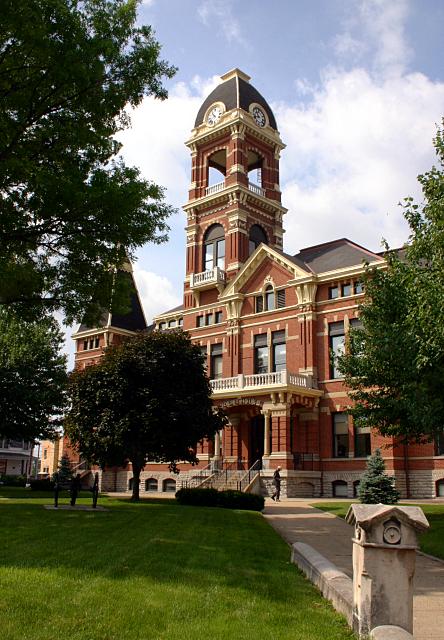
City map Daviess County
Nyttend, Public domain – Wikimedia Commons

Daviess County

Daviess County is a county-level unit in Kentucky with OSM administrative level 6. The mapped population is 99,259.

The county includes Owensboro on the Ohio River in western Kentucky. Its urban streets, rural roads and local places are represented on the state map.

City map Edmonson County
Nyttend, Public domain – Wikimedia Commons

Edmonson County

Edmonson County is a county-level administrative unit in Kentucky with OSM administrative level 6. It has 12,126 mapped residents and covers 798,000,000 square metres.

The county was established in 1825 and contains Mammoth Cave National Park, whose cave system is a UNESCO World Heritage Site. The Green River and local settlements are shown on the regional map.

City map Elliott County
Nyttend, Public domain – Wikimedia Commons

Elliott County

Elliott County is a county-level unit in Kentucky with OSM administrative level 6. The mapped population is 7,354 and the area is 609,000,000 square metres.

The county was established in 1869 and lies in eastern Kentucky. Its rural roads, paths and settlements are included in the state map.

City map Estill County
Nyttend, Public domain – Wikimedia Commons

Estill County

Estill County is a county-level administrative unit in Kentucky with OSM administrative level 6. Its mapped population is 14,375.

The county lies in eastern Kentucky and includes Irvine on the Kentucky River. Local streets, paths and places are represented on the regional map.

City map Fleming County
Capella Space, CC BY 4.0 – Wikimedia Commons

Fleming County

Fleming County is a county-level unit in Kentucky with OSM administrative level 6. It has 15,082 mapped residents and covers 910,000,000 square metres.

The county was established in 1798 and lies in northeastern Kentucky. Flemingsburg and the surrounding road network are shown in the Kentucky map.

City map Floyd County
Nyttend, Public domain – Wikimedia Commons

Floyd County

Floyd County is a county-level administrative unit in Kentucky with OSM administrative level 6. The mapped population is 37,756.

The county lies in the Appalachian mountains of eastern Kentucky and includes Prestonsburg. Its valleys, roads and settlements are represented on the regional map.

City map Franklin County
Michael Barera, CC BY-SA 4.0 – Wikimedia Commons

Franklin County

Franklin County is a county-level unit in Kentucky with OSM administrative level 6. It has 51,541 mapped residents and covers 549,000,000 square metres.

The county was established in 1794 and contains Frankfort, Kentucky’s state capital. The Kentucky River, state government district and local streets are shown on the map.

City map Anderson County
Jack Boucher, Public domain – Wikimedia Commons

Anderson County

Anderson County is a county-level administrative unit in Kentucky with OSM administrative level 6. The mapped population is 23,852 and the area is 529,000,000 square metres.

The county was established in 1827 and includes Lawrenceburg. It lies between Louisville and Lexington, with its roads, paths and settlements represented on the regional map.

City map Fulton County
Umbra Lab, Inc., CC BY 4.0 – Wikimedia Commons

Fulton County

Fulton County is a county-level unit in Kentucky with OSM administrative level 6. It has 6,515 mapped residents and covers 597,000,000 square metres.

The county was established in 1845 and occupies Kentucky’s far southwestern tip along the Mississippi River and the Tennessee border. Hickman and the county’s local streets, paths and places are included in the state map.

Data sources: OpenStreetMap (ODbL), Wikidata (CC0) · Image: Wikimedia Commons

Kentucky – Facts

Population 4505836
Area 104659 km²
Subregions 131
Named after Kentucky River, commonwealth
Year built 1792
Elevation 230 m
Located in United States
Country United States
Body of water Mississippi River, Ohio River, Big Sandy River
Nickname Bluegrass State
Native name Kentucky
Official name Commonwealth of Kentucky
Described by The Catholic Encyclopedia, Brockhaus and Efron Encyclopedic Dictionary, Jewish Encyclopedia of Brockhaus and Efron, The Nuttall Encyclopædia, 1922 Encyclopædia Britannica, Encyclopædia Britannica 11th edition, The American Cyclopædia, Collier's New Encyclopedia, 1921, Encyclopædia Britannica Ninth Edition, New International Encyclopedia, The New Student's Reference Work, Armenian Soviet Encyclopedia, vol. 5, Small Brockhaus and Efron Encyclopedic Dictionary, Meyer’s Universum, Neunzehnter Band
Part of contiguous United States

Data source: Wikidata (CC0)