
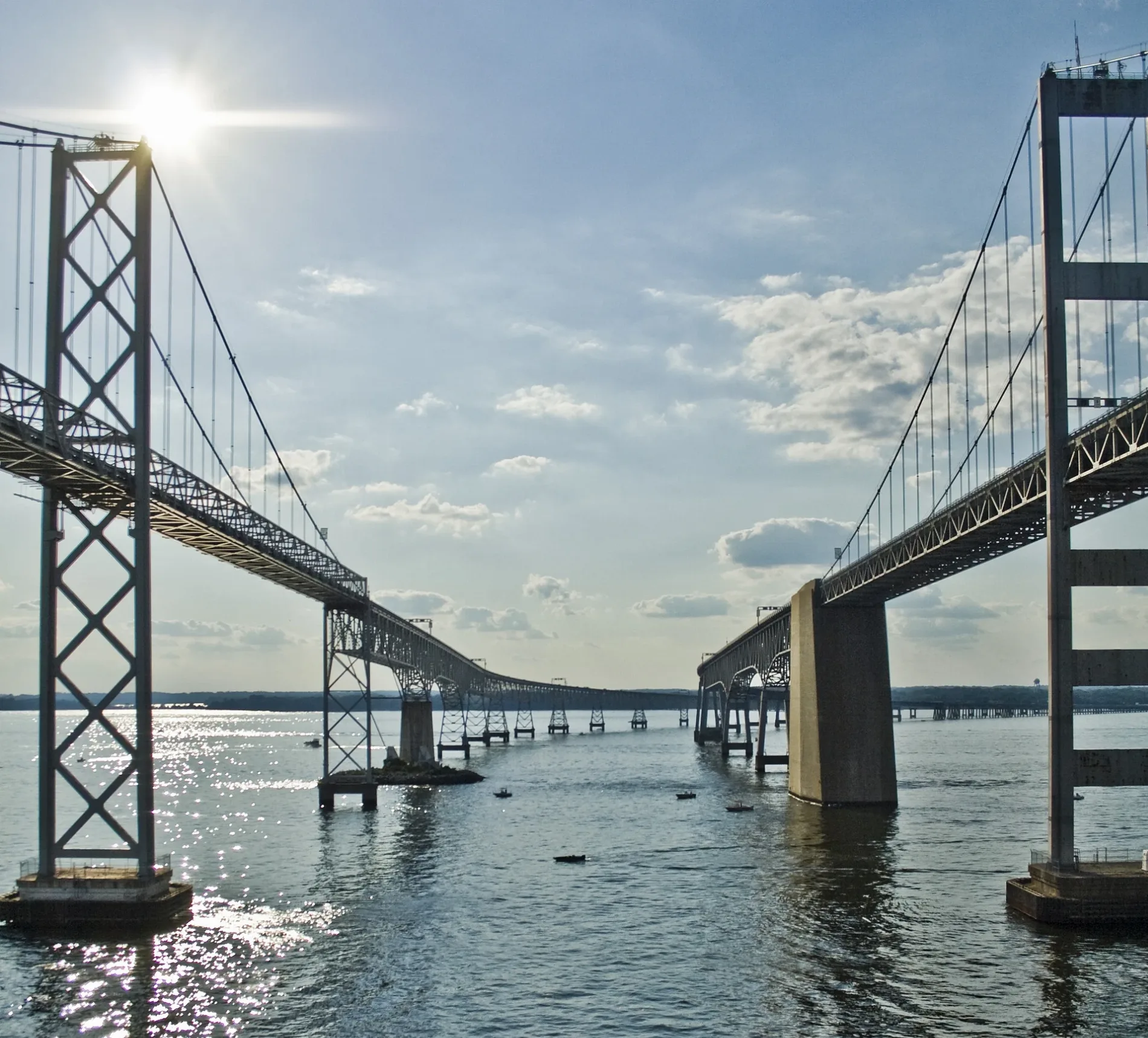
Chesapeake Bay Bridge in Anne Arundel County, Maryland
Chesapeake Bay Bridge in Anne Arundel County is a two-lane, concrete, unlit highway (also known as William Preston Lane, Jr. Memorial Bridge). It runs in a southeast-northwest direction starting from Blue Star Memorial Highway. Chesapeake Bay Bridge is also known as William Preston Lane, Jr. Memorial Bridge. This street is part of the highways 301 and 50 as well as the Hiking trail "ADT - Maryland - Seg 1". Ⓦ.
- Alternate Name
- William Preston Lane, Jr. Memorial Bridge
- Bicycle
- no
- Road Type
- highway
- Lanes
- 2
- Speed Limit
- 50 mph
- Route
- southeast-northwest
Image
Streets nearby
Oceanic Drive0.9 mi
Old Ferry Slip Road1.1 mi
South Beach Road1.2 mi
Holly Beach Farm Road1.3 mi
East Beach Road1.4 mi
Symbi Trail1.5 mi
Admin Service Road1.5 mi
River RoadKalmia Ridge, Training School Cemetery, Boli's Pizza
1.7 mi
Woodlyn RoadMeredith Homes
1.8 mi
Colbert Road1.8 mi
Carrs Road1.8 mi
Blue Star Memorial HighwayLand Rover, Jaguar
1.8 mi
Skidmore Drive1.8 mi
Col-Mar Lane1.8 mi
Argonne Road1.9 mi
Oceanic Road1.9 mi
Broadneck Peninsula TrailSeverna Park Park & Ride, Jones Station Road & Severna Park Park & Ride Mid-block Northbound
2.0 mi
Sandy Point Road2.1 mi
Beach Haven Road2.1 mi
Trawler Lane2.1 mi
Log Inn RoadSkidmore
2.1 mi
Emory Road2.1 mi
Cutter Place2.2 mi
Buoy Court2.2 mi
Trolling Way2.2 mi
Bulkhead Court2.2 mi
Fair Acres Road2.2 mi
Whitehall RoadDesign Solutions, Drama Decor, Planet Aid
2.2 mi
Porthole Court2.2 mi
Bay Drive2.4 mi
Rogers RoadSaint Marks United Methodist Church
2.4 mi
Basque Drive2.4 mi
Shops nearby
Exotic Lumber2.3 mi
Tourism nearby
Sandy Point Nature Center1.0 mi
Buildings nearby
Sandy Point Shoal Light1.4 mi
Whitehall1.9 mi
Richard's Tree Care2.0 mi
Car dealerships nearby
Volvo Cars Annapolis Certified Pre-Owned Outlet2.2 mi
Convenience stores nearby
Sandy Point Marina Store1.2 mi
Houses nearby
Sandy Point Mansion1.2 mi
Police stations nearby
Bay Bridge Police Station1.3 mi
Natural Resources Police Communications Center1.8 mi
Natural Resources Police Area 3 Office1.8 mi
Public restrooms nearby
South Beach Bathhouse1.0 mi
Retail areas nearby
Bay 50 Shopping Center2.3 mi
Whitehall Shopping Center2.3 mi
Shelters nearby
Osprey1.5 mi
Heron1.5 mi
Waters nearby
Westinghouse Bay1.2 mi
| Named after | William Preston Lane |
|---|---|
| Year built | 1952 |
| Material | steel |
| Height | 186 |
| Length | 6946 m |
| Located in | Anne Arundel County, Queen Anne's County |
| Country | United States |
| Crosses | Chesapeake Bay |
| Carries thoroughfare | U.S. Route 50, U.S. Route 301 |
| Location | Stevensville, Kent Island, Sandy Point State Park |
 Public transit map Anne Arundel County Legend
| Railway | |
| Bus | |
| Streetcar |
 Bicycle map Anne Arundel County Legend
| Bike path | |
| Bike lane on roadway | |
| Cycling allowed on bus lane | |
| Bicycle street | |
| Open to cyclists | |
| Open to cyclists, good path | |
| Cycling prohibited | |
| Cobblestone |
| Long-distance bike route | (depending on scale) | |
| Long-distance bike route |
 Pedestrian map Anne Arundel County Legend
| Path |
| Long-distance hiking trail | (depending on scale) | |
| Long-distance hiking trail | ||
| Pedestrians prohibited |