
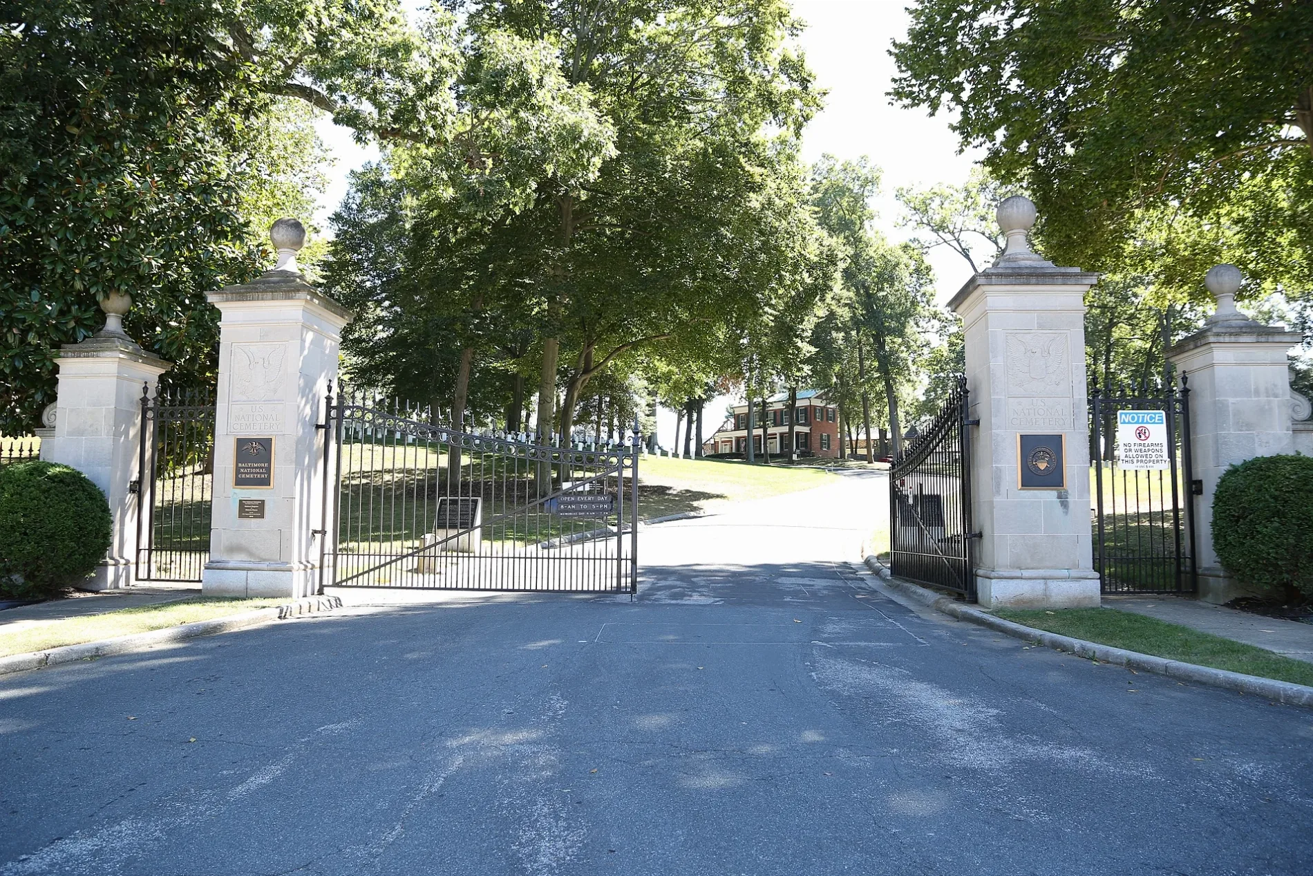
Baltimore National Cemetery in Baltimore County, Maryland
Baltimore National Cemetery in Baltimore County is a cemetery (Elevation 99 m). Ⓦ.
- Land Use
- cemetery
- Website
- https://www.cem.va.gov/cems/nchp/Baltimore.asp
Image
Streets nearby
Mount Ridge Road400 ft
1st Cross Drive450 ft
Rostrum Drive East500 ft
Rostrum Drive West0.1 mi
Garden Ridge Road0.1 mi
Taylor AvenueAmerica's Best Wings, Ez Storage, Taylor Avenue & Loch Raven Boulevard Eastbound, 8 Days Liquors, Sassy Divah Platinum Styles Beauty Salon, Damaskino Mediterranean Market, Graceland Bible Church & Ministries, Maria’s, Strohmers Paint & Hardware, Tienda Najarro’s, Rathell Motors Collision & Repair, Safeway Lock & Key, Chipotle, Kustom Tint, Giant, C - Mart, China Sea Carry Out, Parkville Crabs, Hip Hop Fish & Chicken, Taylor Avenue & Loch Raven Boulevard Far-side Westbound, Taylor Avenue & Collinsdale Road Opposite Westbound, Taylor Avenue & Loch Raven Boulevard Westbound, Taylor Avenue & Loch Raven Boulevard Far-side Eastbound, Taylor Avenue & Collinsdale Road Eastbound, Saint Andrews Lutheran Church
0.1 mi
Outer Drive0.2 mi
Cherrydell Road0.2 mi
2nd Cross Drive0.2 mi
Portal Drive0.2 mi
Sherring Court0.2 mi
Hillview Drive0.2 mi
South Belle Grove Road0.3 mi
Overbrook Road0.3 mi
Preston Court0.3 mi
Wyndholme Way0.3 mi
Frederick AvenueFrederick Road & Mallow Hill Road Westbound, Stillmeadow Community Fellowship, Frederick Avenue & Chapelgate Lane Eastbound, Frederick Avenue & Atholwood Lane Opposite Westbound, Frederick Avenue & Stonecroft Road Opposite Eastbound, Frederick Avenue & North Bend Road, Frederick Road & North Bend Road Far-side Westbound, Frederick Avenue & Overbrook Road Far-side Eastbound, Frederick Road & Boswell Road Westbound
0.3 mi
South Medwick Garth0.3 mi
North Belle Grove Road0.3 mi
East Medwick Garth0.3 mi
Woods Court0.3 mi
Wyndholme Circle0.3 mi
Carroll RoadCorbett Hill Farms
0.3 mi
South Symington Avenue0.3 mi
Arkla Court0.4 mi
Maiden Choice LaneKenwood, A-1 Pizza and Subs, Maiden Choice Lane & Westland Boulevard Northbound, Maiden Choice Lane & Westland Boulevard Southbound, Boost Mobile, Dunkin', WesBanco, Wingstop, Saint Charles School, Lamb of God Elementary School, Maiden Choice Lane & Wilkens Avenue Northbound, Maiden Choice Lane & Wilkens Avenue Far-side Southbound
0.4 mi
McTavish Avenue0.4 mi
Poplar AvenueLot 4, Poplar Avenue & Hilltop Circle Westbound, Poplar Avenue & Shelbourne Road Southbound, Poplar Avenue & Hilltop Circle Far-side Southbound, Lot 23
0.4 mi
Cedarwood Road0.4 mi
University Avenue0.4 mi
Erickson Way0.4 mi
Birchwood Road0.4 mi
Paradise Avenue0.5 mi
Merrill Road0.5 mi
Tanglewood Road0.5 mi
Newmarket Court0.5 mi
Frederick Road7-Eleven, Catonsville, Better World Imaginarium, Catonsville Custom Framing, El Guapo, AME Pharmacy, Frederick Road & Winters Lane Far-side Westbound, Frederick Road & Locust Drive Opposite Westbound, Frederick Road & Newburg Avenue Eastbound, Shell, Catonsville Scoops, Frederick Road & Five Oaks Pool Westbound, Frederick Road & Five Oaks Pool Eastbound, Frederick Road & Smithwood Avenue Eastbound, Frederick Road & Shadynook Avenue Opposite Westbound, Frederick Road & Shadynook Avenue Eastbound, Frederick Road & Rolling Road Opposite Westbound, Paradise Loop, Catonsville Pharmacy, Frederick Road & Paradise Avenue Westbound, Frederick Road & Paradise Avenue Eastbound, Frederick Road & Wade Avenue Eastbound, Walgreens, Dunkin', Frederick Road & Glenwood Avenue Mid-block Westbound, Frederick Road & Osbourne Avenue Westbound, Frederick Road & Beaumont Avenue Eastbound, Frederick Road & Saint Timothys Lane Westbound, Indian Delight, Piano Man, Frederick Rd & Ingleside Ave (EB), Frederick Rd & Ingleside Ave (WB), Frederick Road & Ingleside Avenue Far-side Eastbound, Frederick Road & Ingleside Avenue Westbound, Frederick Road & Symington Avenue Westbound, Frederick Road & Belle Grove Road Westbound, Frederick Road & Nunnery Lane Opposite Eastbound, Frederick Road & Paradise Avenue, BM20, Catonsville Mechantle1
0.5 mi
Short Line Railroad Trail0.5 mi
Kenwood AvenueCalled Out Gospel Church, R&Z Auto Sales, Hooptyman Auto LLC, Yege Autos, Yege Autos Car Rental, 7-Eleven, Kenwood Avenue & Sipple Avenue Opposite Eastbound, Kenwood Avenue & Sipple Avenue Far-side Westbound, Kenwood Avenue & Overlea High School Southbound, Kenwood Avenue & Overlea High School Far-side Northbound, Kenwood Avenue & Lillian Holt Drive Northbound, Shell, Kenwood Avenue & Weyburn Road Far-side Southbound, Kenwood Avenue & Shady Spring Avenue Northbound, Kenwood Avenue & Hazelwood Avenue Southbound, Dunkin', Kenwood Avenue & Weyburn Road Northbound
0.6 mi
Stafford Drive0.6 mi
Buildings nearby
Admin Office and Service Building0.1 mi
Lodge0.2 mi
Saint Martin's Home Assisted Living Center0.2 mi
New Carroll0.5 mi
Fountain Hill0.5 mi
Bus stations nearby
Paradise Loop0.5 mi
Places of worship nearby
Our Lady of the Angels Catholic Church0.5 mi
Shelters nearby
Committal Shelter0.2 mi
Streams nearby
East Branch Herbert Run0.4 mi
| Year built | 1807 |
|---|---|
| Heritage designation | National Register of Historic Places listed place |
| Located in | Baltimore, Baltimore County |
| Country | United States |
 Public transit map Baltimore County Legend
| Railway | |
| Bus | |
| Streetcar |
 Bicycle map Baltimore County Legend
| Bike path | |
| Bike lane on roadway | |
| Cycling allowed on bus lane | |
| Bicycle street | |
| Open to cyclists | |
| Open to cyclists, good path | |
| Cycling prohibited | |
| Cobblestone |
| Long-distance bike route | (depending on scale) | |
| Long-distance bike route |
 Pedestrian map Baltimore County Legend
| Path |
| Long-distance hiking trail | (depending on scale) | |
| Long-distance hiking trail | ||
| Pedestrians prohibited |