
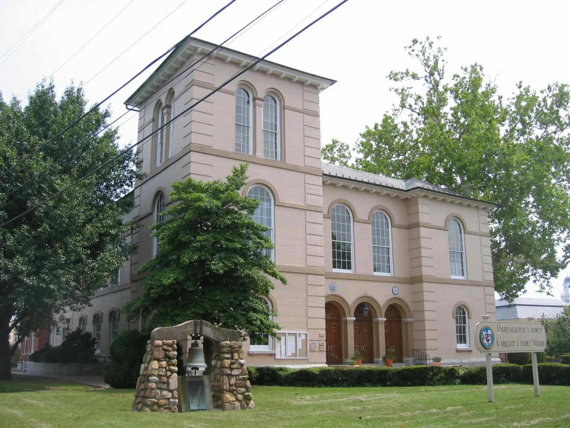
Dorchester County Courthouse in Cambridge, Maryland
Dorchester County Courthouse in Cambridge is a courthouse (Elevation 4 m). Dorchester County Courthouse is located near Locust Street. Ⓦ.
- Amenity
- courthouse
- Building Type
- public building
Restaurants
Arts centers
Beauty salons
Opticians
Hair salons
Places of worship
Art galleries
Pubs
Museums
- Harriet Tubman Museum (Harriet Tubman Organization, Web) – approx. 0.2 mi.
Clothing stores
Bus stops
Jewelry stores
Gift shops
Secondhand stores
Streets nearby
Court Lane100 ft
Spring StreetCambridge, Spring Valley/Library
200 ft
Muse Street0.1 mi
Market Street0.1 mi
William StreetRedeemer Lutheran Church
0.1 mi
Church Street0.1 mi
Commerce Street0.1 mi
Poplar StreetSunnyside Shop of Cambridge, Thomas’s Fine Jewelry, ReAleRevival Brewing, Gina's, Jimmie & Sook's, The Cutting Edge Salon, Bistro Poplar, Main Street Gallery, Choptank Charlie's Emporium, Katie Mae's Country Shoppe, Court Lane Emporium
0.2 mi
Market Square0.2 mi
Race StreetRace Street Gallery, Lutheran Mission Society, Hubbard's Custom Blinds, Black Anchor Tattoo, Mirror Mirror Salon, The Salvation Army, Black Water, Canvasback, Harriet Tubman Museum, W H Webb Oysters, Slick's Barber Shop, Cambridge Mart, Race Beauty Supply, Orchid Hair Salon, Mark's Mulch, Cambridge Collision Center, Wise Oil and Fuel, Race at Bradford House, Bradford House, The Cobbler's County Gift and Garden Shop, Cambridge Mercado Latino, Camino de Eseranza, Chesapeake Upholstery, 1st Impressions Hair Salon, Darth Vapors, Mane Attractions, Tolley Restaurant Equipment, Cambridge Row (coming soon), Tolley's
0.2 mi
Maryland AvenueKillarney Rd and Maryland Ave, Dorchester Ave and Maryland Ave, Neild Museum
0.2 mi
Locust Street0.2 mi
Gay StreetCambridge Family Eye Care
0.2 mi
Vue de Leau Street0.2 mi
High StreetDorchester Arts Center, High St and Park Ln, High St and Washington St, Robin Hood Thrift
0.2 mi
Mill StreetGarrettsons Chapel, Saint Marys Roman Catholic Church
0.2 mi
Cherry Street0.2 mi
Water StreetLong Wharf, Water St (Yacht Club)
0.3 mi
Short Street0.3 mi
Academy Street0.3 mi
Muir StreetStoked Wood Fired Eatery, Chesapeake College Cambridge Center, Fassett-Magee Center
0.3 mi
Hughes Court0.3 mi
Choptank Avenue0.3 mi
West End Avenue0.3 mi
Travers StreetChoptank Ave and Travers St
0.3 mi
Charles Street0.4 mi
School StreetSchool St and West End Ave, Belvedere Ave and School St
0.4 mi
Dobson Street0.4 mi
Skinners Court0.4 mi
Glasgow StreetFirst Baptist Church, Bay Country Church, Sei Bella Hair & Tanning Salon, Judy Center, Zip Mart Cambridge, Glasgow St and Somerset Ave
0.4 mi
Willis Street0.4 mi
Buildings nearby
Verizon0.2 mi
Artworks nearby
Black Lives Matter0.2 mi
Cemeteries nearby
Christ Cemetery250 ft
Funeral homes nearby
Thomas Funeral Home0.2 mi
Gardens nearby
Cambridge Community Garden0.3 mi
Gas stations nearby
Zip Mart0.2 mi
Libraries nearby
Central Library Branch350 ft
Museums nearby
Richardson Maritime Museum0.1 mi
Parks nearby
J. Edward Walter Park0.4 mi
Pharmacies nearby
Craig's Drugs0.2 mi
Places of worship nearby
Christ Episcopal Church350 ft
Zion United Methodist Church0.2 mi
Church of the Anointed One Ministries0.3 mi
Waugh Chapel United Methodist Church0.3 mi
Grace United Methodist Church0.3 mi
Post offices nearby
Cambridge Post Office500 ft
Pubs nearby
The High Spot450 ft
Town halls nearby
Cambridge City Hall500 ft
| Heritage designation | National Register of Historic Places listed place |
|---|---|
| Located in | Maryland |
| Country | United States |
Public transit map Cambridge Legend
| Railway | |
| Bus | |
| Streetcar |
Bicycle map Cambridge Legend
| Bike path | |
| Bike lane on roadway | |
| Cycling allowed on bus lane | |
| Bicycle street | |
| Open to cyclists | |
| Open to cyclists, good path | |
| Cycling prohibited | |
| Cobblestone |
| Long-distance bike route | (depending on scale) | |
| Long-distance bike route |
Pedestrian map Cambridge Legend
| Path |
| Long-distance hiking trail | (depending on scale) | |
| Long-distance hiking trail | ||
| Pedestrians prohibited |