
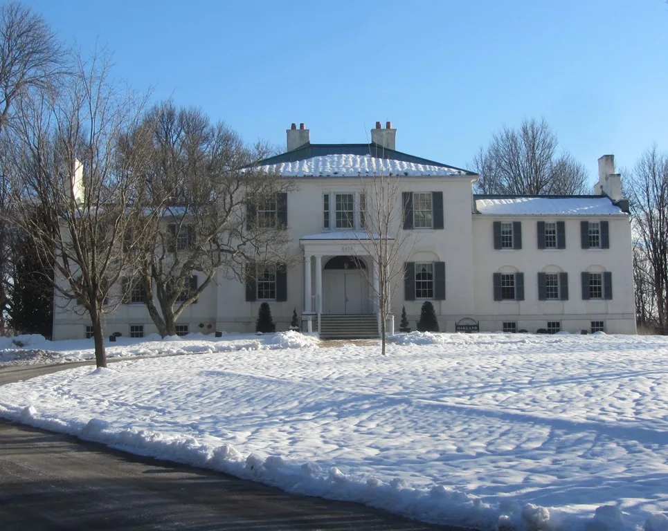
Oakland Manor in Howard County, Maryland
Oakland Manor in Howard County is a building, Vantage Point Road 5430 (21044). Ⓦ.
- House Number
- 5430
- Postal Code
- 21044
- Street
- Vantage Point Road
- Building Type
- building
- Website
- https://www.historic-oakland.com/
Image
Beauty salons
Museums
- Howard County Center of African American Culture (Web) at Vantage Point Road 5434 (21044) – approx. 150 ft.
Banks
Fast food restaurants
Clinics
Bus stops
Restaurants
Charging stations
Cafes
Music venues
Schools
Cell phone stores
Streets nearby
Ring Dove Lane0.2 mi
West Running Brook Road0.2 mi
Leaf Treader WayVantage Point
0.2 mi
Vantage Point RoadHoward County Center of African American Culture
0.2 mi
Little Patuxent ParkwayLittle Patuxent Parkway & Cedar Lane Eastbound, Little Patuxent Parkway & Vantage Point Road Northbound, Little Patuxent Pkwy / Vantage Point Rd, Columbia, The Hair Connoisseur - Tamara Taylor, 7-Eleven, Nothing Bundt Cakes, Gateway Pizza, First National Bank, Hangry Joe's Hot Chicken, Tropical Smoothie Cafe, Elegant Dental Care, Amore Nail Spa, Passport Health Columbia Travel Clinic, ChargePoint, United States Post Office, Little Patuxent Parkway & Vantage Point Road Opposite Westbound, Little Patuxent Pkwy / Running Brook Rd, Little Patuxent Parkway & Hickory Road Opposite Southbound, Little Patuxent Parkway & Cedar Lane Westbound, Firestone, Klotz Institute of Karate, Zips Dry Cleaning, First National Bank ATM, Waterloo Pizza & Subs, Mobile 1 Lube Express, Little Patuxent Parkway & Governor Warfield Parkway Northbound, Little Patuxent Parkway & Gray Star Way Opposite Eastbound, Little Patuxent Parkway & White Cord Way Opposite Eastbound, Little Patuxent Parkway & White Cord Way Westbound
0.2 mi
Smooth Meadow Way0.2 mi
Governor Warfield ParkwayLittle Patuxent Parkway & Governor Warfield Parkway Southbound
0.2 mi
Windstream DriveWindstream Dr / Mall In Columbia (Northbound), Windstream Dr / Mall In Columbia (Southbound)
0.2 mi
Wild Flower Terrace0.2 mi
Columbia Road0.3 mi
The Mending Wall0.3 mi
Sterrett PlaceCafe Columbia
0.3 mi
Columbia Mall CircleColumbia Cleaners & Tailoring, FedEx Office, Wells Fargo, Chase ATM, Cold Stone Creamery, Bubbles Salon, Bonchon Chicken, Kung Fu Tea, CT Wine and Spirits, NuClear Smiles, Columbia Mall & South Ring Road Eastbound, The Food Market, Mall In Columbia / AMC Theatre (Northbound), Mall In Columbia / Amc Theatre (Southbound), Columbia Mall & Ring Road Westbound, Union Jacks, Columbia Town Center, European Wax Center, Village Nail Bar
0.3 mi
Wincopin CircleSushi Sono, GrillMarx, The Columbia Collective Encore, The Columbia Collective Offshore
0.3 mi
Hermit Path0.4 mi
Spring Pools Lane0.4 mi
Old Columbia RoadPet+ER, RB Dental, Gorman Park Trail Parking, Scaggsville Park & Ride
0.4 mi
Brook Way0.4 mi
Silas Choice0.4 mi
Wandering Way0.5 mi
North Crisscross Court0.5 mi
Oven Bird Green0.5 mi
Honeysalt Row0.5 mi
Flowertuft Court0.5 mi
Downwest Ride0.6 mi
Rouse Parkway0.6 mi
Homecoming Lane0.6 mi
Pinecone Row0.6 mi
Darting Bird Lane0.6 mi
Columbia PikeZips Dry Cleaning, Lost In Time Vintage Toy Store
0.7 mi
Apartment buildings nearby
Lakehouse0.4 mi
Buildings nearby
Vantage House450 ft
Watermark Place Condominiums0.2 mi
Wilde Lake Boathouse0.3 mi
One Columbia Center0.3 mi
Columbia Union Conference0.6 mi
Convenience stores nearby
Town Center Exxon0.3 mi
7-Eleven0.4 mi
Dams nearby
Wilde Lake Dam0.2 mi
Gas stations nearby
Exxon0.3 mi
Museums nearby
Howard County Center of African-American Culture200 ft
Office buildings nearby
Little Patuxent Square0.4 mi
Parking lots nearby
Pine Garage0.4 mi
Parks nearby
Lake Kittamaqundi Park0.5 mi
Places of worship nearby
Kittamaqundi Community Church0.1 mi
Residential areas nearby
Autumn Crest0.5 mi
Rivers nearby
Little Patuxent River0.3 mi
Swimming pools nearby
Running Brook Pool0.4 mi
Waters nearby
Wilde Lake0.3 mi
| Year built | 1811 |
|---|---|
| Located in | Maryland |
| Country | United States |
 Public transit map Howard County Legend
| Railway | |
| Bus | |
| Streetcar |
 Bicycle map Howard County Legend
| Bike path | |
| Bike lane on roadway | |
| Cycling allowed on bus lane | |
| Bicycle street | |
| Open to cyclists | |
| Open to cyclists, good path | |
| Cycling prohibited | |
| Cobblestone |
| Long-distance bike route | (depending on scale) | |
| Long-distance bike route |
 Pedestrian map Howard County Legend
| Path |
| Long-distance hiking trail | (depending on scale) | |
| Long-distance hiking trail | ||
| Pedestrians prohibited |