
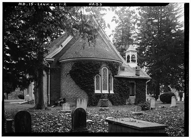
Saint Pauls Church in Kent County, Maryland
Saint Pauls Church in Kent County is a Church. It is near Sandy Bottom Road and is a protected historic site. Saint Pauls Church also exists in Somerset County, Caroline County, Talbot County, Saint Mary's County and Washington County. Ⓦ.
- Amenity
- place of worship
- Building Type
- church
Image
Streets nearby
Sandy Bottom RoadSandy Bottom, McCleans Corner
0.2 mi
Ricauds Branch Road0.2 mi
Wood Yard Lane0.5 mi
Remington Drive0.7 mi
Hynson Rogers Road0.7 mi
Caulks Field Road1.7 mi
Shipyard LaneShipyard Landing
1.7 mi
Tolchester Beach Road1.8 mi
Broad Neck RoadLangford
1.9 mi
Elizabeths Lane2.1 mi
Reeses Corner RoadReeses Corner
2.2 mi
James Lane2.2 mi
Fox Point Farm Lane2.4 mi
Jones Cutoff Road2.4 mi
Tooey Lane2.5 mi
Parsons Road2.5 mi
Fairlee Road2.5 mi
Old Fairlee Road2.5 mi
Centr LaneFairlee
2.5 mi
Cross Road2.5 mi
Martin Wagner Road2.6 mi
Ralegh Road2.6 mi
Bay Shore Spur2.6 mi
Georgetown RoadGeorgetown, Asbury United Methodist Church
2.6 mi
Ecker Road2.7 mi
Bakers Lane2.7 mi
Lovers Lane2.7 mi
Bay Shore Road2.8 mi
Johnson Avenue2.8 mi
Obama RoadHoly Trinity AME Church
2.8 mi
Tolchester Road2.8 mi
Walnut Point Lane2.8 mi
Rock Hall RoadWesley Chapel
2.9 mi
Dorlon Drive2.9 mi
Cedar Point Road3.0 mi
Pine Acres Road3.1 mi
Mount Pleasant Road3.1 mi
Upper Creek Lane3.2 mi
Fish Hatchery Road3.3 mi
Woods Edge DriveWoods Edge, Woodsedge Dr
3.3 mi
Dams nearby
Saint Pauls Millpond Dam500 ft
Carpenter Farm Pond Dam2.8 mi
Parks nearby
Edesville Park2.6 mi
Places of worship nearby
Mount Pleasant Church3.1 mi
Rivers nearby
Bungay Creek3.2 mi
Streams nearby
West Fork Langford Creek0.2 mi
Shipyard Creek0.8 mi
Swan Creek2.7 mi
Waters nearby
Saint Pauls Millpond500 ft
| Heritage designation | National Register of Historic Places listed place |
|---|---|
| Located in | Chestertown |
| Country | United States |
| Location | Fairlee |
 Public transit map Kent County Legend
| Railway | |
| Bus | |
| Streetcar |
 Bicycle map Kent County Legend
| Bike path | |
| Bike lane on roadway | |
| Cycling allowed on bus lane | |
| Bicycle street | |
| Open to cyclists | |
| Open to cyclists, good path | |
| Cycling prohibited | |
| Cobblestone |
| Long-distance bike route | (depending on scale) | |
| Long-distance bike route |
 Pedestrian map Kent County Legend
| Path |
| Long-distance hiking trail | (depending on scale) | |
| Long-distance hiking trail | ||
| Pedestrians prohibited |