This page is the City map of Massachusetts, a state map showing streets, paths, and places across the Commonwealth of the United States. Massachusetts covers about 27,336 square kilometres and had approximately 7,029,917 residents in 2020, compared with 6,547,629 in 2010. The state was founded in 1788 and extends from the Berkshire Mountains in the west to the Atlantic islands of Nantucket and Martha’s Vineyard in the east. Massachusetts contains 14 counties, including the metropolitan area of Boston, the Connecticut River Valley, Cape Cod, and the historic South Coast.
Department of Commerce. Bureau of the Census. 1913-1/1/1972, Public domain – Wikimedia Commons
Berkshire County occupies the western part of Massachusetts and covers about 2,451 square kilometres. The county had 129,026 residents and was established in 1761, with Pittsfield as its largest city and administrative centre.
The landscape includes the Berkshire Mountains, Mount Greylock at 1,064 metres the highest point in Massachusetts, and the headwaters of the Housatonic River. Williamstown, Lenox, and Stockbridge are notable communities connected with institutions such as the Clark Art Institute and Tanglewood.
Essex County lies on Massachusetts Bay and the New Hampshire border, covering about 2,146 square kilometres and containing 809,829 residents. It was established in 1643 and includes the cities of Salem, Lawrence, Haverhill, and Newburyport.
Salem is known for its colonial maritime history and the Salem witch trials of 1692, while Newburyport stands on the Merrimack River near the Atlantic coast. The county also includes Cape Ann, with Gloucester and Rockport, and the Parker River National Wildlife Refuge near Newbury.
Hampden County is located in the Connecticut River Valley of western Massachusetts and had 470,690 residents. Springfield, founded beside the Connecticut River, is the county seat and the largest city in western New England.
The city is associated with the Springfield Armory National Historic Site and the Naismith Memorial Basketball Hall of Fame. Holyoke lies north of Springfield along the Connecticut River and is known for its historic canal system and former paper-mill district.
Hampshire County lies in the central Connecticut River Valley, covers about 1,413 square kilometres, and had 162,308 residents. The county was established in 1662 and includes Northampton, Amherst, and the town of Hadley.
Amherst is home to the University of Massachusetts Amherst, while Northampton is a cultural and commercial centre on the Connecticut River. Mount Holyoke forms part of the Metacomet Ridge along the county’s eastern side, and the Connecticut River runs through the valley between Northampton and Hadley.
Department of Agriculture. Commodity Stabilization Service. Aerial Photography Field Office. ca. 1953-1961, Public domain – Wikimedia Commons
Worcester County occupies central Massachusetts and had 862,111 residents; Worcester is its county seat and the second-largest city in New England after Boston. The county was established in 1731 and contains cities including Fitchburg, Leominster, and Gardner.
Worcester stands at the meeting area of several transport routes between Boston and the Connecticut River Valley, while the Blackstone River flows south toward Rhode Island. Wachusett Mountain rises near Princeton, and the Quabbin Reservoir extends into the western part of the county.
Franklin County is the northernmost county in western Massachusetts and covers about 1,877 square kilometres. It had 71,029 residents and includes Greenfield, the county seat, as well as Deerfield, Northfield, and Turners Falls.
The Connecticut River crosses the county from north to south, while the town of Deerfield contains Historic Deerfield, a major collection of preserved colonial buildings. The northern landscape includes the southern Green Mountains and the route of the Mohawk Trail through the town of Shelburne.
Bristol County lies on the South Coast of Massachusetts, covers about 1,790 square kilometres, and had 579,200 residents. It was established in 1685 and includes the cities of New Bedford, Fall River, and Taunton.
New Bedford developed as a major whaling port and is home to New Bedford Whaling National Historical Park. Fall River stands beside Mount Hope Bay and the Taunton River, while the Acushnet River separates New Bedford from the town of Fairhaven.
Middlesex County extends from the northern Boston suburbs to the Merrimack River and had 1,632,002 residents, the largest population of any Massachusetts county. Established in 1643, it includes Cambridge, Lowell, Newton, Waltham, and Somerville.
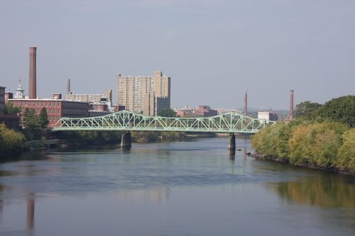
Cambridge contains Harvard University and the Massachusetts Institute of Technology along the Charles River. Lowell National Historical Park preserves the textile-mill and canal landscape created beside the Merrimack River during the Industrial Revolution.
Norfolk County lies south of Boston, covers about 1,150 square kilometres, and had 725,981 residents. It was established in 1793 and includes the municipalities of Quincy, Brookline, Weymouth, and Dedham.
Quincy is the birthplace of Presidents John Adams and John Quincy Adams and contains the Adams National Historical Park. The Neponset River forms part of the northern county boundary, while the Blue Hills Reservation rises near Milton and Canton.
Plymouth County occupies the southeastern mainland and covers about 2,832 square kilometres, with 530,819 residents. The county was established in 1685 and includes Plymouth, Brockton, Weymouth, and the coastal towns of Scituate and Marshfield.
Plymouth is associated with the 1620 arrival of the Mayflower and contains Plymouth Rock and Plimoth Patuxet Museums. The Taunton River forms part of the western county boundary, while Cape Cod Bay borders the coast near Plymouth and Duxbury.
Barnstable County comprises Cape Cod and had 214,333 residents. Barnstable is the largest municipality by area and contains several villages, including Hyannis, which is the principal commercial centre of Cape Cod.
Cape Cod extends eastward into the Atlantic and includes the Cape Cod National Seashore along the outer coast. Provincetown lies at the northern tip of the peninsula, while the Cape Cod Canal separates the peninsula from the mainland near Bourne and Sandwich.
Suffolk County is centred on Boston and had 797,936 residents, with an area of about 311 square kilometres. Established in 1643, it includes Boston, Chelsea, Revere, and Winthrop.
Boston is the capital of Massachusetts and contains the Freedom Trail, Boston Common, and the historic waterfront on Boston Harbor. Logan International Airport occupies part of East Boston, while the Charles River separates Boston from Cambridge and the Mystic River borders northern districts.
Nantucket is a consolidated town-county island south of Cape Cod with 14,255 residents. The island covers about 124 square kilometres and includes the historic town of Nantucket, established as a major whaling port in the eighteenth and nineteenth centuries.
Nantucket Sound separates the island from Martha’s Vineyard and Cape Cod, while the Atlantic Ocean borders its eastern and northern shores. The Nantucket Historic District contains hundreds of preserved nineteenth-century buildings, and the island’s settlements include Siasconset and Madaket.
Dukes County consists primarily of Martha’s Vineyard, the Elizabeth Islands, and the island of Gosnold, covering about 1,272 square kilometres. The county had 20,600 residents and was established in 1695, with Edgartown, Oak Bluffs, and Vineyard Haven among its best-known communities.
Martha’s Vineyard lies south of Cape Cod and includes the towns of Aquinnah, Chilmark, West Tisbury, Tisbury, Oak Bluffs, and Edgartown. Aquinnah is known for the Gay Head Cliffs, while the island’s coastal location places it between Vineyard Sound and the Atlantic Ocean.




 Public transit map Massachusetts Legend
  Bicycle map Massachusetts Legend
  Pedestrian map Massachusetts Legend