
M.A.C. Avenue in East Lansing, Michigan
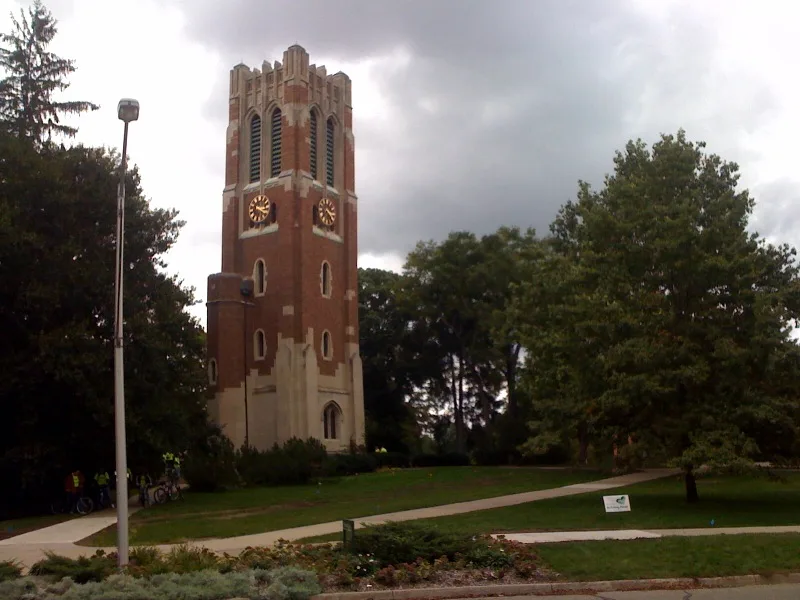
M.A.C. Avenue in East Lansing is a asphalt residential street. The Bus lines 24 and 26 run here. Nearby there are among others 2 restaurants, bike shop, parking entrance and tobacco shop. The nearest bus stop nearby is Westbound Grand River past M.A.C. Avenue (about 100 m away).
- Road Type
- residential street
Image
Hair salons
Restaurants
Tobacco shops
Streets nearby
Albert AvenueCVS Pharmacy, Jolly Pumpkin Cafe & Brewery, The Riv, Barrio Tacos, Foster Coffee, Albert Avenue Garage, Ink & Needle - East, Buffalo Wild Wings, Baps, Leo's Coney Island, MSUFCU
100 ft
East Grand River AvenueSparty's Express, Michigan State University Federal Credit Union, EBD Gr. River past Abbot Rd, Secure Bike Parking facility, Dero Fixit Bike Station, Twyla, Raising Cane's, Student Book Store (SBS), Panda Express, Curious Book Shop, Tin Can East Lansing, East Lansing, EBD Gr. River Ave past Farm Lane, D&D Bicycles, EBD Gr. River Ave past Bogue St, 7-Eleven, Mitten Raised, Domino's, EBD Gr. River Ave past River St, EBD Gr. River Ave before Spartan Av, Pita Way, YumYum Bento, EBD Gr. River Ave past Division St, Westbound Grand River past M.A.C. Avenue, Potbelly, Lankshark Bar, Noodles & Company, Target, Charlie Kang's, Rally House, Urban Outfitters, Capo's Cheesesteak Hoagies and Grill, EBD Gr. River Ave past S Hagadorn, Marathon, EBD Gr. River Ave at Maplewood Dr, The Peanut Barrel, Chipotle, Chase, Cottage Inn Pizza, Five Guys, Peking Express, Campus Barber, Campbell's Market Basket, Poké Fresh, H Tea Cafe, Grand River Barber Company, Cassiopeia, Anima Librata, Splash of Color Tattoo & Piercing Studio
400 ft
Grove StreetHopcat
450 ft
Linden StreetEast Lansing 54B District Court, East Lansing Police
0.1 mi
Division StreetUnicha Tea & Icecream
0.2 mi
Park Lane0.2 mi
Sycamore Lane0.2 mi
East Circle DriveOlin Pharmacy, Morrill Plaza, Bird
0.2 mi
Sunrise Court0.2 mi
Elizabeth Street0.2 mi
West Circle DriveHeritage Commons at Landon, North Neighborhood
0.2 mi
Bailey StreetInsomnia Cookies
0.3 mi
Ann Street0.3 mi
Charles StreetGeorgio's Pizza, Cardtronics
0.3 mi
Chittenden Drive0.3 mi
Beech Street0.3 mi
Farm LaneMATRIX: The Center for Digital Humanities and Social Sciences, NBD Farm past Auditorium, SBD Farm Lane before Auditorium Road, NBD Farm Lane before Green Way Drive, SBD Farm Lane past Green Way Drive, The Rock, SBD Farm past Wilson, NBD Farm past Trowbridge, NBD Farm past Wilson, SBD Farm past S Shaw
0.4 mi
Meadowlawn Avenue0.4 mi
Collingwood DriveJimmy John's
0.4 mi
Orchard Street0.4 mi
Butterfield Drive0.4 mi
Buildings nearby
Marshall-Adams Hall0.3 mi
Orchard St. Pump House0.4 mi
Clinics nearby
Olin Memorial Health Center0.2 mi
Convenience stores nearby
7-Eleven400 ft
Frame shops nearby
Saper Galleries and Custom Framing0.2 mi
Guest houses nearby
Wild Goose Inn Bed & Breakfast0.2 mi
Hotels nearby
Marriott East Lansing at University Place200 ft
Museums nearby
Eli and Edythe Broad Art Museum0.3 mi
Parking lots nearby
Charles Street Garage200 ft
Grove Street Garage350 ft
Division Street Garage550 ft
Grand River Avenue Ramp0.2 mi
Parks nearby
William B. Sharp Park0.1 mi
Bailey Park0.3 mi
Benefactors Plaza0.3 mi
Places of worship nearby
St John Catholic Student Center400 ft
Hillel Jewish Student Center0.2 mi
Restaurants nearby
El Azteco200 ft
Harper's Restaurant and Brewpub500 ft
Town halls nearby
East Lansing City Hall0.2 mi
University buildings nearby
Human Ecology0.1 mi
MSU Union0.1 mi
Eustace-Cole Hall0.2 mi
William Berkey Hall0.2 mi
Linton Hall0.2 mi
Old Botany0.3 mi
Chittenden Hall0.3 mi
Old Horticulture0.3 mi
 Public transit map East Lansing Legend
 | Railway | |
| Bus | |
| Streetcar |
 Bicycle map East Lansing Legend
 | Bike path | |
| Bike lane on roadway | |
| Cycling allowed on bus lane | |
| Bicycle street | |
| Open to cyclists | |
| Open to cyclists, good path | |
| Cycling prohibited | |
| Cobblestone |
| Long-distance bike route | (depending on scale) | |
| Long-distance bike route |
 Pedestrian map East Lansing Legend
 | Path |
| Long-distance hiking trail | (depending on scale) | |
| Long-distance hiking trail | ||
| Pedestrians prohibited |