
Mississippi

Mississippi
This City map of Mississippi shows streets, paths and places across the state in the southern United States. Mississippi covers approximately 125,443 square kilometres and lies at an average elevation of 91 metres above sea level. About 2,961,279 people live in the state, whose population declined from 2,967,297 in 2010 to 2,961,279 in 2020. Mississippi became a state of the United States in 1817 and is divided into 96 subregions, including counties, cities and towns.
Sherman

Sherman is a town in Lee County, Pontotoc County and Union County, Mississippi. The town has about 600 residents, covers 4,510,019 square metres and lies at an elevation of 111 metres.
To the mapHattiesburg

Hattiesburg is a city in Mississippi and the seat of Forrest County and Lamar County. The city is located in the southern part of the state near the Leaf River and the Bouie River.
To the mapWashington County

Washington County is a county in Mississippi with approximately 44,922 residents. It covers about 1,972 square kilometres and was established in 1827; Greenville, on the Mississippi River, is its county seat.
To the mapBolivar County

Bolivar County lies in the Mississippi Delta and has about 30,985 residents. The county covers approximately 2,346 square kilometres and was established in 1836; Cleveland and Rosedale are among its notable communities.
To the mapBenton County

Benton County is a county in northern Mississippi near the Tennessee border. Ashland is the county seat, and the county belongs to the wooded hill country north of Oxford.
To the mapCoahoma County

Coahoma County is located in the Mississippi Delta and has approximately 21,390 residents. It covers about 1,510 square kilometres and was established in 1836; Clarksdale is the county seat and a centre of Delta blues history.
To the mapDeSoto County

DeSoto County lies in the northwest corner of Mississippi beside Memphis, Tennessee. The county has about 185,314 residents, covers approximately 1,287 square kilometres and was established in 1836; Southaven and Hernando are its principal cities.
To the mapMarshall County

Marshall County in northern Mississippi has about 33,752 residents. It covers approximately 1,838 square kilometres and was established in 1836; Holly Springs is the county seat and contains the historic Hillcrest Cemetery.
To the mapTippah County

Tippah County is in northeastern Mississippi and has approximately 21,815 residents. The county covers about 1,191 square kilometres and was established in 1836; Ripley is the county seat.
To the mapTunica County

Tunica County occupies part of the northern Mississippi Delta along the Mississippi River. Tunica is the county seat, and the county is located south of DeSoto County and west of Tate County.
To the mapForrest County

Forrest County has approximately 78,158 residents and covers about 1,218 square kilometres. It was established in 1908, and Hattiesburg is the county seat near the Leaf River and Bouie River.
To the mapGeorge County

George County in southeastern Mississippi has about 24,350 residents. The county covers approximately 1,253 square kilometres and was established in 1910; Lucedale is the county seat.
To the mapGreene County

Greene County in southeastern Mississippi has approximately 13,530 residents. It covers about 1,861 square kilometres and was established in 1811; Leakesville is the county seat, and the Leaf River crosses the county.
To the mapHancock County

Hancock County occupies Mississippi’s Gulf Coast and has about 46,053 residents. The county covers approximately 1,431 square kilometres and was established in 1812; Bay St. Louis is the county seat on the Gulf of Mexico.
To the mapHarrison County

Harrison County lies on the Gulf of Mexico and has approximately 208,621 residents. It covers about 2,528 square kilometres and was established in 1841; Gulfport, Biloxi and Pass Christian are major coastal cities.
To the mapJackson County

Jackson County is located on the Mississippi Gulf Coast and has about 143,252 residents. The county covers approximately 2,702 square kilometres and was established in 1812; Pascagoula is the county seat and lies on the Pascagoula River.
To the mapLamar County

Lamar County in southern Mississippi has approximately 60,618 residents. Purvis is the county seat, while the city of Hattiesburg extends into the northern part of the county.
To the mapPearl River County

Pearl River County has about 56,145 residents and covers approximately 2,121 square kilometres. It was established in 1890; Poplarville is the county seat, and the Pearl River forms part of the county’s drainage system.
To the mapPerry County

Perry County in southeastern Mississippi has approximately 11,511 residents. The county covers about 1,684 square kilometres and was established in 1820; New Augusta is the county seat.
To the mapStone County

Stone County has about 18,333 residents and covers approximately 1,160 square kilometres. It was established in 1916, and Wiggins is the county seat; the county lies north of Harrison County.
To the mapCovington County
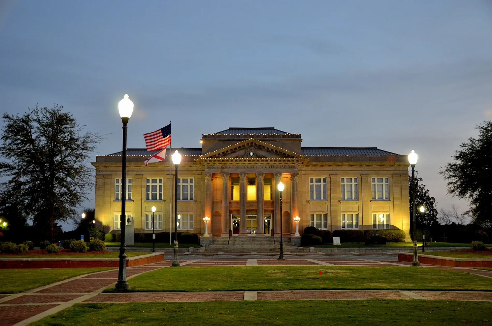
Covington County in south-central Mississippi has approximately 18,340 residents. It covers about 1,075 square kilometres and was established in 1819; Collins is the county seat and lies near the Okatoma River.
To the mapJefferson Davis County

Jefferson Davis County has about 11,321 residents and covers approximately 1,060 square kilometres. It was established in 1906; Prentiss is the county seat, and the county lies between Covington and Marion counties.
To the mapJones County
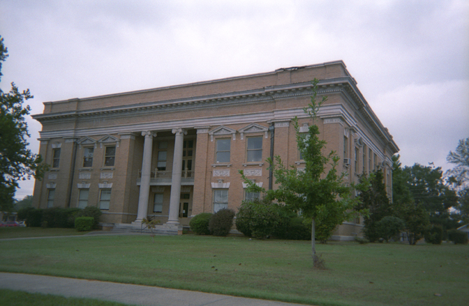
Jones County in southeastern Mississippi has approximately 67,246 residents. It covers about 1,812 square kilometres and was established in 1826; Laurel is the county seat and a historic timber-industry centre.
To the mapLawrence County
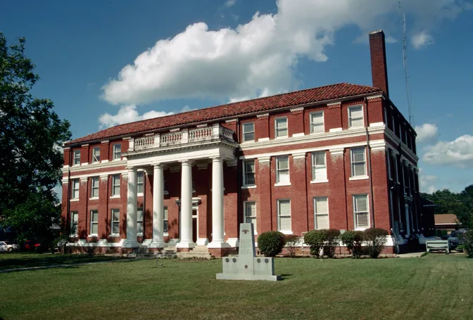
Lawrence County has about 12,016 residents and covers approximately 1,129 square kilometres. It was established in 1814; Monticello is the county seat on the Pearl River.
To the mapMarion County
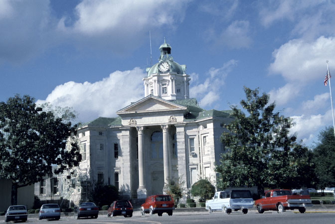
Marion County in southern Mississippi has approximately 25,563 residents. Columbia is the county seat, and the Pearl River runs through the county before continuing toward the Gulf Coast.
To the mapWayne County

Wayne County in southeastern Mississippi has about 19,779 residents. The county was established in 1809; Waynesboro is the county seat, and the Chickasawhay River crosses the area.
To the mapAdams County

Adams County lies along the Mississippi River and has approximately 29,538 residents. It covers about 1,259 square kilometres and was established in 1799; Natchez is the county seat and is known for its antebellum houses and river port.
To the mapAlcorn County
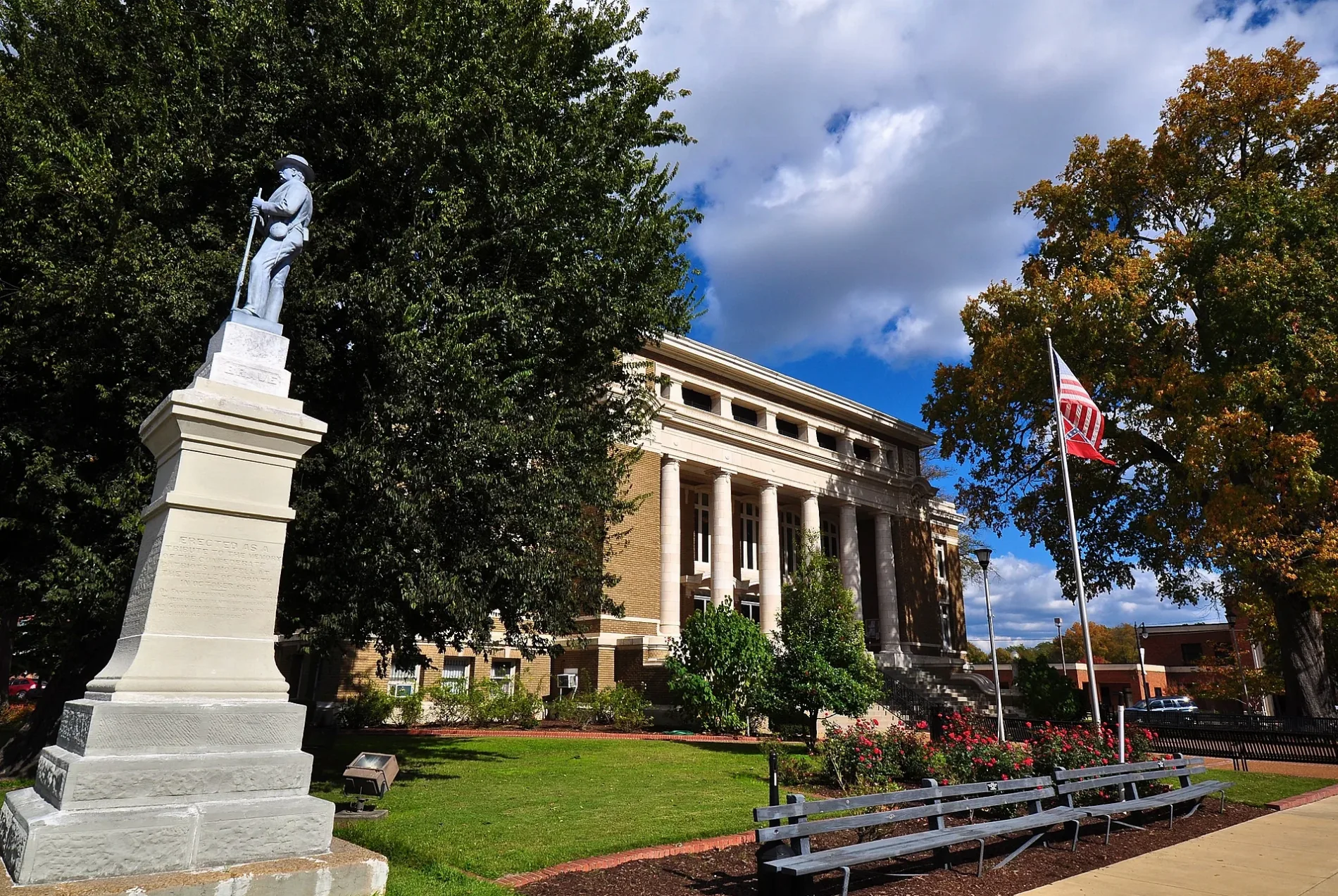
Alcorn County in northeastern Mississippi has about 34,740 residents. It covers approximately 1,039 square kilometres and was established in 1870; Corinth is the county seat and was a strategic railway junction during the American Civil War.
To the mapAmite County

Amite County is located in southwestern Mississippi near the Louisiana border. Liberty is the county seat, and the county is named for the Amite River, which flows through the region.
To the mapAttala County
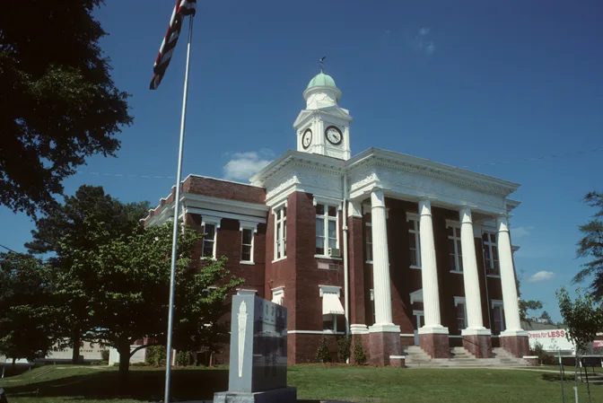
Attala County in central Mississippi has approximately 19,043 residents. Kosciusko is the county seat and the birthplace of civil-rights leader Oprah Winfrey.
To the mapCalhoun County

Calhoun County has about 13,266 residents and covers approximately 1,523 square kilometres. It was established in 1852; Pittsboro is the county seat, and the Yalobusha River passes through the county.
To the mapCarroll County

Carroll County in north-central Mississippi has approximately 9,998 residents. It covers about 1,643 square kilometres and was established in 1833; Carrollton is the county seat.
To the mapChickasaw County

Chickasaw County has about 17,106 residents and covers approximately 1,306 square kilometres. It was established in 1836; Houston is the county seat, and the county lies in the transition between the Prairie and northeastern hill regions.
To the mapChoctaw County

Choctaw County in central Mississippi has approximately 8,246 residents. It covers about 1,087 square kilometres and was established in 1833; Ackerman is the county seat.
To the mapClaiborne County

Claiborne County lies along the Mississippi River and has about 9,135 residents. It covers approximately 1,299 square kilometres and was established in 1802; Port Gibson is the county seat and contains the historic Windsor Ruins nearby in neighboring Claiborne County.
To the mapClarke County

Clarke County in eastern Mississippi has approximately 15,615 residents. It covers about 1,796 square kilometres and was established in 1833; Quitman is the county seat, and the Chickasawhay River runs through the county.
To the mapClay County

Clay County has about 18,636 residents and covers approximately 1,077 square kilometres. It was established in 1871; West Point is the county seat and lies near the Tombigbee River.
To the mapCopiah County

Copiah County in central Mississippi has approximately 28,368 residents. It covers about 2,019 square kilometres and was established in 1823; Hazlehurst is the county seat, and the Pearl River forms part of the county’s eastern boundary.
To the mapFranklin County

Franklin County is located in southwestern Mississippi near the Homochitto River. Meadville is the county seat, and the county borders Louisiana to the southwest.
To the mapGrenada County

Grenada County has approximately 21,629 residents and was established in 1870. Grenada is the county seat, and Grenada Lake lies on the Yalobusha River north of the city.
To the mapHinds County

Hinds County is Mississippi’s central county and has about 242,891 residents. Jackson, the state capital, is the county seat; the Pearl River flows east of the city.
To the mapHolmes County
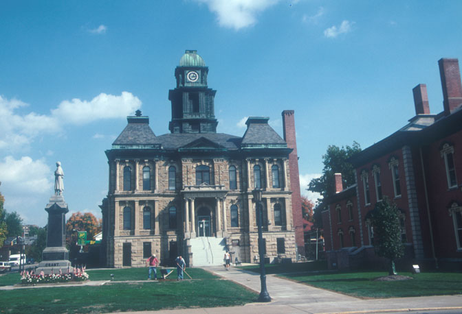
Holmes County in the Mississippi Delta has approximately 17,000 residents. It covers about 1,979 square kilometres and was established in 1833; Lexington is the county seat, and the Yazoo River lies to the west.
To the mapHumphreys County

Humphreys County is located in the Mississippi Delta between the Yazoo and Sunflower river systems. Belzoni is the county seat, and the county’s landscape includes the flat agricultural plain characteristic of the Delta.
To the mapIssaquena County

Issaquena County lies along the Mississippi River and has approximately 1,338 residents. It covers about 1,406 square kilometres and was established in 1844; Mayersville is the county seat.
To the mapItawamba County

Itawamba County in northeastern Mississippi has about 23,863 residents. It covers approximately 1,400 square kilometres and was established in 1836; Fulton is the county seat on the Tombigbee River.
To the mapJasper County

Jasper County in eastern Mississippi has approximately 16,367 residents. It covers about 1,755 square kilometres and was established in 1833; Bay Springs is the county seat.
To the mapJefferson County

Jefferson County lies in southwestern Mississippi between the Mississippi River and the Homochitto River. Fayette is the county seat, and the county borders Adams County to the south.
To the mapKemper County
Kemper County in eastern Mississippi has about 8,988 residents. It covers approximately 1,987 square kilometres and was established in 1833; De Kalb is the county seat, and the Tombigbee River lies east of the county.
Lafayette County

Lafayette County in northern Mississippi has approximately 55,813 residents. It covers about 1,759 square kilometres and was established in 1836; Oxford is the county seat and the home of the University of Mississippi.
To the mapLauderdale County

Lauderdale County in eastern Mississippi has about 78,524 residents. Meridian is the county seat and a major historic railway centre near the eastern border with Alabama.
To the mapLeake County

Leake County has approximately 21,275 residents and covers about 1,516 square kilometres. It was established in 1833; Carthage is the county seat, and the Pearl River flows through the county.
To the mapLee County

Lee County in northeastern Mississippi has about 83,343 residents. It covers approximately 1,174 square kilometres and was established in 1866; Tupelo is the county seat and the birthplace of Elvis Presley.
To the mapLeflore County

Leflore County lies in the Mississippi Delta and has approximately 28,339 residents. It covers about 1,570 square kilometres and was established in 1871; Greenwood is the county seat at the confluence of the Tallahatchie and Yalobusha rivers.
To the mapLincoln County

Lincoln County in south-central Mississippi has about 34,907 residents. It covers approximately 1,523 square kilometres and was established in 1870; Brookhaven is the county seat and a railway city.
To the mapLowndes County

Lowndes County in eastern Mississippi has approximately 58,879 residents. It covers about 1,338 square kilometres and was established in 1830; Columbus is the county seat on the Tombigbee River.
To the mapMadison County

Madison County near Jackson has about 109,145 residents. It covers approximately 1,922 square kilometres and was established in 1828; Canton is the county seat, while Ridgeland and Madison are major urban communities.
To the mapMonroe County

Monroe County in northeastern Mississippi has approximately 34,180 residents. It covers about 2,000 square kilometres and was established in 1821; Aberdeen is the county seat on the Tombigbee River.
To the mapMontgomery County

Montgomery County lies in north-central Mississippi near the Grenada and Winona areas. Winona is the county seat, and the Yalobusha River passes through the county.
To the mapNeshoba County

Neshoba County in east-central Mississippi has approximately 29,087 residents. It covers about 1,481 square kilometres and was established in 1833; Philadelphia is the county seat and hosts the annual Neshoba County Fair.
To the mapNewton County
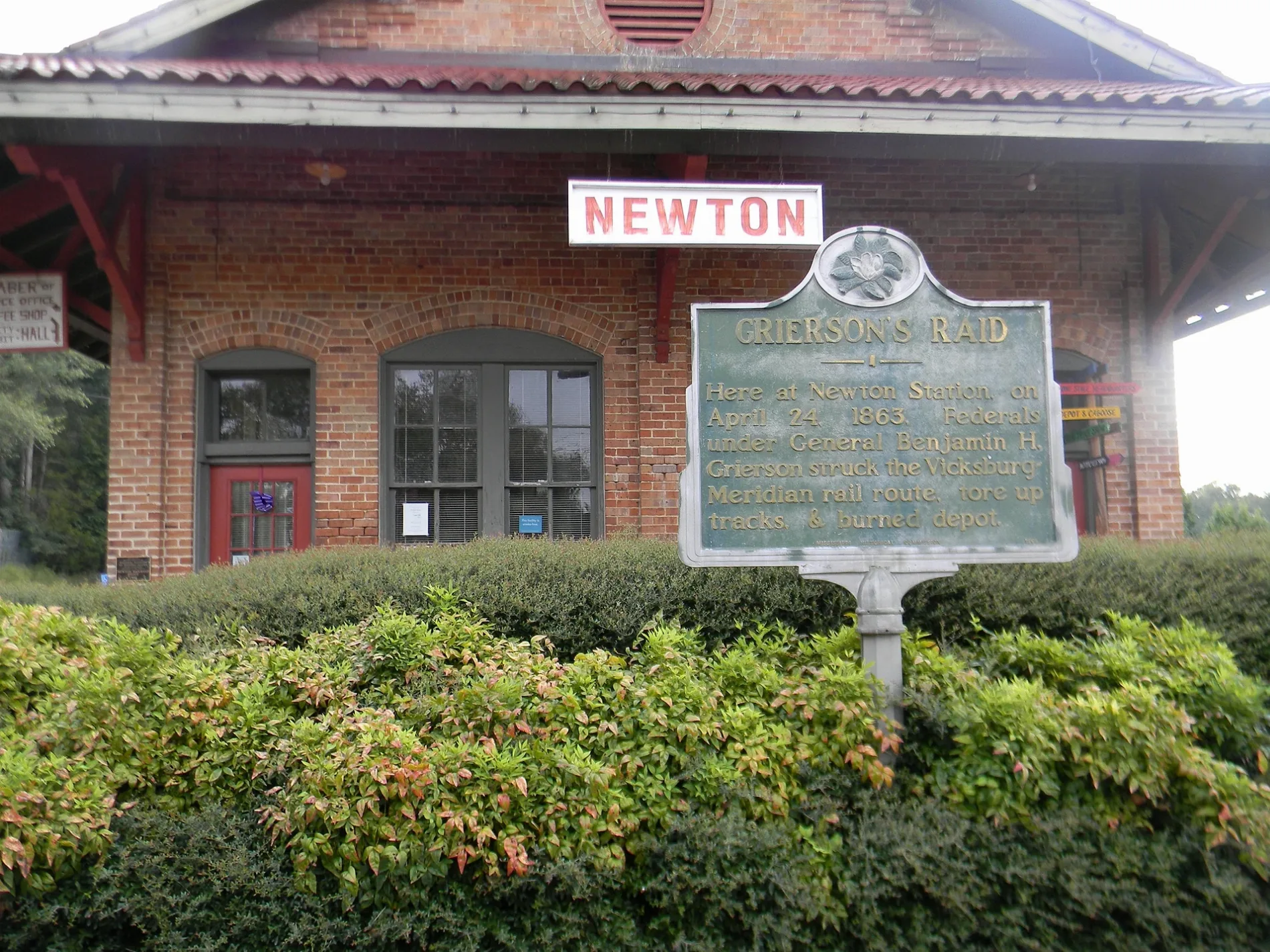
Newton County in eastern Mississippi has about 21,291 residents. It covers approximately 1,501 square kilometres and was established in 1836; Decatur is the county seat, and the Chunky River crosses the county.
To the mapData sources: OpenStreetMap (ODbL), Wikidata (CC0) · Image: Wikimedia Commons
| Named after | Mississippi River |
|---|---|
| Year built | 1817 |
| Area | 125443 km² |
| Elevation | 91 m |
| Located in | United States |
| Country | United States |
| Body of water | Gulf of Mexico, Mississippi River, Pearl River, Pickwick Lake |
| Population | 2961279 |
| Website | https://www.ms.gov/ |
| Nickname | The Magnolia State |
| Native name | Mississippi |
| Official name | State of Mississippi |

 Public transit map Mississippi Legend
 | Railway | |
| Bus | |
| Tram |
 Bicycle map Mississippi Legend
 | Bike path | |
| Bike lane on roadway | |
| Cycling allowed on bus lane | |
| Bicycle street | |
| Open to cyclists | |
| Open to cyclists, good path | |
| Cycling prohibited | |
| Cobblestone |
| Long-distance bike route | (depending on scale) | |
| Long-distance bike route |
 Pedestrian map Mississippi Legend
 | Path |
| Long-distance hiking trail | (depending on scale) | |
| Long-distance hiking trail | ||
| Pedestrians prohibited |