
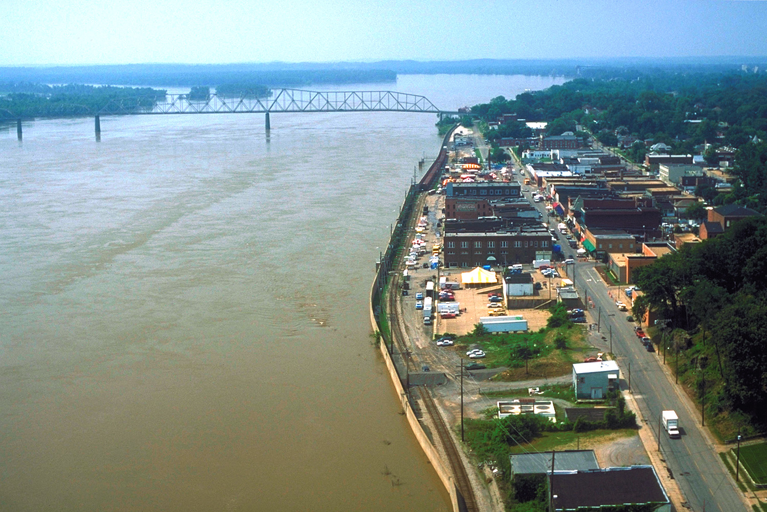
Water Street in Cape Girardeau, Missouri
Water Street in Cape Girardeau is a service road and runs in a north-south direction starting from North Water Street and ends in a cul-de-sac. Water Street also exists in Barry County, Bollinger County, Franklin County, Platte County and Saint Louis County.
- Road Type
- service road
- Route
- north-south
Image
Restaurants
Marketplaces
Post offices
Clinics
Tourist information centers
Variety stores
Schools
Bars
Courthouses
Cannabis dispensaries
Streets nearby
South Main Street300 ft
Independence StreetWalgreens, John's Pharmacy, Nunn Cemetery
300 ft
North Main StreetHotshots Sports Bar and Grill, Blue Diamond Sports Bar
300 ft
Merriweather Street0.1 mi
North Water StreetCape Girardeau, Port Cape Girardeau Restaurant and Lounge, South Freeze
0.1 mi
Themis Street0.2 mi
North Lorimier Street0.2 mi
Broadway StreetDollar General, Trio Restaurant, Burger King, Kenny's Flippin Burgers
0.2 mi
South Lorimier Street0.2 mi
South Fountain StreetLorimer School
0.2 mi
South Spanish StreetCape Riverfront Market, The Library
0.3 mi
William StreetWatami Sushi & Hibachi Steakhouse, Rhodes
0.3 mi
Good Hope StreetComputer 21
0.4 mi
Morgan Oak Street0.4 mi
Rivermont Drive0.4 mi
Aquamsi StreetCape Girardeau
0.4 mi
West Lorimer0.4 mi
Park Drive0.5 mi
North Middle Street0.5 mi
Bellevue Street0.5 mi
North Frederick StreetUnited States Post Office
0.5 mi
North Spanish StreetOld Common Pleas Courthouse
0.5 mi
North Fountain Street0.6 mi
Artworks nearby
Missouri Wall of Fame200 ft
Mississippi River Tales0.2 mi
Attractions nearby
Historic Cape Girardeau Bridge0.4 mi
Buildings nearby
The Arts Council of Southeast Missouri500 ft
Cafes nearby
Red Banner Coffee500 ft
Cemeteries nearby
Old Lorimier Cemetery0.5 mi
Clinics nearby
Community Counseling Center0.4 mi
Courthouses nearby
Rush Hudson Limbaugh Sr., United States Courthouse0.3 mi
Doctor's offices nearby
Charles Pewitt0.5 mi
Gardens nearby
May Greene Garden0.3 mi
Hotels nearby
Courtyard Cape Girardeau Downtown0.3 mi
Indoor playgrounds nearby
Discovery Playhouse0.4 mi
Museums nearby
Red House Interpretive Center0.1 mi
The Glenn House0.3 mi
Cape River Heritage Museum0.4 mi
Parks nearby
Murtaugh Park0.1 mi
Courthouse Park0.2 mi
Indian Park0.2 mi
Riverfront Park0.3 mi
Missouri Park0.5 mi
Pavilions nearby
Courthouse Park Bandstand0.2 mi
Places of worship nearby
Saint Vincents Church0.2 mi
First Presbyterian Church0.2 mi
Railways nearby
BNSF River Subdivision0.2 mi
Town halls nearby
Cape Girardeau City Hall0.3 mi
Other nearby
Cape Girardeau Flood Wall0.2 mi
Public transit map Cape Girardeau Legend
| Railway | |
| Bus | |
| Streetcar |
Bicycle map Cape Girardeau Legend
| Bike path | |
| Bike lane on roadway | |
| Cycling allowed on bus lane | |
| Bicycle street | |
| Open to cyclists | |
| Open to cyclists, good path | |
| Cycling prohibited | |
| Cobblestone |
| Long-distance bike route | (depending on scale) | |
| Long-distance bike route |
Pedestrian map Cape Girardeau Legend
| Path |
| Long-distance hiking trail | (depending on scale) | |
| Long-distance hiking trail | ||
| Pedestrians prohibited |