
Northeast Pence Avenue in Kansas City, Missouri
Northeast Pence Avenue in Kansas City is an asphalted residential street. It runs in a northeast-southwest direction starting from North Antioch Road and crosses North Wabash Avenue and ends at Northeast Gaddy Road.
- Road Type
- residential street
- Route
- northeast-southwest
Image
Cell phone stores
Secondhand stores
Post offices
Ice cream shops
Theaters
Bus stops
Pastry shops
Places of worship
Fast food restaurants
Restaurants
Supplement stores
Hair salons
Dentist offices
Streets nearby
North Wabash Avenue0.1 mi
Northeast Dean Lane0.1 mi
North Park Avenue0.2 mi
Northeast 50th StreetTower View Baptist Church
0.2 mi
North Antioch Road0.2 mi
North Olive Street0.2 mi
Northeast 51st Terrace0.2 mi
North Kansas Avenue0.2 mi
Northeast Gaddy Road0.3 mi
Northeast Antioch RoadFive Guys, Verizon, The UPS Store, Pepperjax Grill, Baskin-Robbins
0.3 mi
North Brooklyn Avenue0.3 mi
Northeast 47th Street0.3 mi
North Euclid Avenue0.3 mi
Northeast 48th StreetNorthland Christian Church, Roger Cemetery
0.3 mi
Northeast 49th Street0.3 mi
Northeast 52nd Street0.3 mi
Northeast Gladstone Avenue0.3 mi
Northeast 52nd TerraceDavinson Outdoor Classroom
0.4 mi
Northeast 47th Terrace0.4 mi
Northeast Vivion RoadBethany Baptist Chapel, Vivion at 2000 NE Vivion WB, Vivion at Garfield, Vivion at Garfield/Gaddy, Vivion at Olive, Red Racks
0.4 mi
Northeast Chouteau TrafficwayPapa John's
0.4 mi
Northeast 46th Terrace0.4 mi
North Agnes AvenueThe Rivers Edge
0.4 mi
North Gladstone Avenue0.4 mi
50th Street0.4 mi
North Bellefontaine Avenue0.5 mi
North College Avenue0.5 mi
Northeast 49th Terrace0.5 mi
Northeast 48th Terrace0.5 mi
Auto parts stores nearby
Advance Auto Parts0.2 mi
Auto repair shops nearby
Valvoline0.2 mi
Goodyear0.3 mi
Banks nearby
Bank of America0.4 mi
Buildings nearby
AT&T0.2 mi
Fast food restaurants nearby
Taco Bell0.3 mi
Zaxby's0.3 mi
Fitness centers nearby
Planet Fitness350 ft
Gas stations nearby
QuikTrip0.1 mi
Parks nearby
Golden Oaks Park0.3 mi
Pet stores nearby
PetSmart0.3 mi
Pharmacies nearby
Walgreens0.2 mi
Places of worship nearby
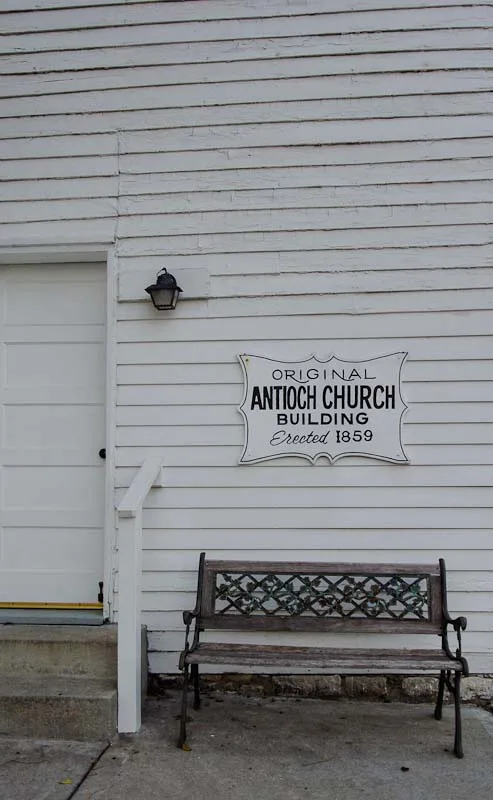
Antioch Church0.2 mi
Vivion Road Church of Christ0.3 mi
Residential areas nearby
Beulmar Acres0.2 mi
Glendale Heights0.3 mi
Restaurants nearby
Hayes Hamburger & Chili0.1 mi
Pizza Hut0.4 mi
School buildings nearby
Northgate Middle School0.3 mi
Supermarkets nearby
Walmart Neighborhood Market0.4 mi
Public transit map Kansas City Legend
| Railway | |
| Bus | |
| Streetcar |
Bicycle map Kansas City Legend
| Bike path | |
| Bike lane on roadway | |
| Cycling allowed on bus lane | |
| Bicycle street | |
| Open to cyclists | |
| Open to cyclists, good path | |
| Cycling prohibited | |
| Cobblestone |
| Long-distance bike route | (depending on scale) | |
| Long-distance bike route |
Pedestrian map Kansas City Legend
| Path |
| Long-distance hiking trail | (depending on scale) | |
| Long-distance hiking trail | ||
| Pedestrians prohibited |