
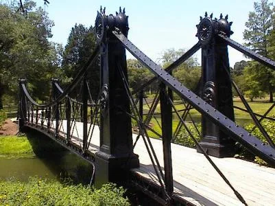
River Des Peres in The Hill, Missouri
River Des Peres in Saint Louis, The Hill is a river. River Des Peres also exists in Ellendale and Boulevard Heights. Ⓦ.
- Waterway Type
- river
Image
Bars
Supermarkets
Opticians
Clothing stores
Artworks
Bus stops
Restaurants
Cafes
Funeral homes
Streets nearby
Sulphur Avenue200 ft
Amanda Street0.1 mi
Manchester AvenueManchester at Sulphur, Manchester at Hampton, Manchester at Sproule, Manchester at Dale, Failoni's Restaurant, Manchester at Prather, Manchester at Mitchell
0.1 mi
Lloyd Avenue0.1 mi
Eveline Street0.2 mi
Knox Avenue0.2 mi
Officer Michael Barwick Memorial Highway0.2 mi
Hampton Avenue1900 Hampton
0.2 mi
Devlin Street0.2 mi
Famous Avenue0.2 mi
Dale Avenue0.2 mi
West Billon Avenue0.3 mi
Adeline Street0.3 mi
Sproule Avenue0.3 mi
Dyson Avenue0.3 mi
Ripple Street0.3 mi
Roberts AvenueHampton at Roberts
0.3 mi
Graham Street0.3 mi
Wade AvenueSaint James Church
0.3 mi
Gregg Avenue0.4 mi
Knox Industrial Drive0.4 mi
Wilson Avenue0.4 mi
Tamm AvenueMonument to A Boy and his Dog, Saint James the Greater School, Saint James the Greater Catholic School, Clayton-Tamm, Warm cookie vending machine
0.4 mi
Bakeries nearby
The Cakery0.4 mi
Bars nearby
Nick's Pub500 ft
Buildings nearby
Slay Industries0.2 mi
St. Louis Kansas City Carpenters Regional Council0.3 mi
Floor Layers Union 13100.3 mi
Arch Communications Inc0.3 mi
Car dealerships nearby
Ackerman Toyota0.1 mi
Clinics nearby
DaVita Dialysis0.2 mi
Total Access Urgent Care0.2 mi
Commercial buildings nearby
Southampton Dental LLC0.2 mi
Fast food restaurants nearby
Slim Chickens0.2 mi
McDonald's0.2 mi
Hardee's0.3 mi
Taco Bell0.3 mi
Wendy's0.3 mi
Gas stations nearby
Circle K0.2 mi
Phillips 660.4 mi
Hardware stores nearby
E&B Granite0.2 mi
Hotels nearby
Holiday Inn0.2 mi
Red Roof Inn0.3 mi
Drury Inn0.3 mi
Office buildings nearby
St. Louis Office for Developmental Disability Resources0.3 mi
Railways nearby
UP Jefferson City Subdivision400 ft
Hannibal Subdivision0.1 mi
School buildings nearby
Saint James the Greater School0.4 mi
Tattoo studios nearby
Electric Mayhem Tattoo0.1 mi
| Length | 15 |
|---|---|
| Heritage designation | Historic Civil Engineering Landmark |
| Located in | Missouri |
| Country | United States |
| Mouth | Mississippi River |
 Public transit map The Hill Legend
| Railway | |
| Bus | |
| Streetcar |
 Bicycle map The Hill Legend
| Bike path | |
| Bike lane on roadway | |
| Cycling allowed on bus lane | |
| Bicycle street | |
| Open to cyclists | |
| Open to cyclists, good path | |
| Cycling prohibited | |
| Cobblestone |
| Long-distance bike route | (depending on scale) | |
| Long-distance bike route |
 Pedestrian map The Hill Legend
| Path |
| Long-distance hiking trail | (depending on scale) | |
| Long-distance hiking trail | ||
| Pedestrians prohibited |