
Montana

Montana
This City map of Montana presents streets, paths, and places across the state of the United States. Montana covers approximately 381,154 square kilometres and lies at an average elevation of 1,035 metres. The state had 1,084,225 residents in 2020, compared with 989,415 in 2010. Montana was admitted to the United States in 1889 and is divided into 67 subregions, including counties, cities, towns, and villages.
Deer Lodge County

Deer Lodge County is a county-level administrative area in Montana with a population of 9,421. Its area is approximately 1,920 square kilometres, and the county was established in 1865.
The county is located in western Montana and is represented in the map by county roads, local paths, and settled places.
To the mapBelgrade

Belgrade is a city-level place in Montana. It lies in the Gallatin Valley near Bozeman and is connected to the regional road network.
The city is one of the urban subregions shown on the Montana map. Its administrative classification in OpenStreetMap is place=city.
To the mapBozeman

Bozeman is a city in Gallatin County and serves as the county seat. It had a population of 53,293, covers approximately 49.6 square kilometres, and stands at an elevation of 1,461 metres.
The city was established in 1864 and is one of Montana’s principal urban centres. The map shows Bozeman together with its streets, paths, and surrounding places in Gallatin County.
To the mapManhattan

Manhattan is a town-level place in Montana’s Gallatin Valley. It is located within the agricultural and settlement area around the Gallatin River.
The town forms part of the network of smaller communities between Belgrade, Bozeman, and Three Forks. Its OpenStreetMap classification is place=town.
To the mapThree Forks

Three Forks is a village-level place in Gallatin County, Montana. The community had 1,989 residents, covers approximately 3.86 square kilometres, and lies at an elevation of 1,242 metres.
The name refers to the nearby confluence of the Jefferson, Madison, and Gallatin rivers, which form the Missouri River. Three Forks was recorded in the supplied data as a city description although its place classification is village.
To the mapWest Yellowstone

West Yellowstone is a town in western Montana at the western entrance to Yellowstone National Park. The community is located near the boundary with Yellowstone National Park and the state of Wyoming.
Its streets and paths provide access to a major gateway area of the Greater Yellowstone region. West Yellowstone is classified as place=town in OpenStreetMap.
To the mapBig Horn County

Big Horn County is located in southeastern Montana and had a population of 13,124. The county covers approximately 12,998 square kilometres and was established in 1913.
The county includes landscapes associated with the Bighorn River and the northern extension of the Bighorn Basin. Its county-level boundaries and roads are included in the Montana map.
To the mapBeaverhead County

Beaverhead County is a county in southwestern Montana with 9,371 residents. It covers approximately 14,432 square kilometres and was established in 1865.
The county contains the broad Beaverhead Valley and reaches toward the Continental Divide. Dillon is the county seat and a major mapped settlement in the area.
To the mapMineral County

Mineral County lies in western Montana and had a population of 4,535. Its area is approximately 3,169 square kilometres, and the county was established in 1914.
The county is crossed by the Clark Fork and includes communities such as Superior, the county seat. Its location places it near the Idaho border and the Lolo National Forest.
To the mapFlathead County

Flathead County had 104,357 residents and covers approximately 13,614 square kilometres. It was established in 1893 in northwestern Montana.
The county includes Flathead Lake, the largest natural freshwater lake west of the Mississippi River in the contiguous United States, and the city of Kalispell. Glacier National Park occupies part of the county’s northern area.
To the mapGlacier County

Glacier County is located in northwestern Montana along the Canadian border and had 13,778 residents. The county covers approximately 7,866 square kilometres and was established in 1919.
Its western area includes Glacier National Park and the eastern front of the Rocky Mountains. Browning is the county seat and an important community of the Blackfeet Reservation.
To the mapSweet Grass County

Sweet Grass County is a county-level administrative area in south-central Montana. The county seat is Big Timber, located near the Yellowstone River.
The county extends between the Crazy Mountains and the Absaroka Range. Its roads, paths, and settlements are included in the Montana City map.
To the mapPark County

Park County had 17,191 residents and covers approximately 7,287 square kilometres. The county was established in 1887.
Livingston is the county seat, while the southern part includes Gardiner and the northern entrance to Yellowstone National Park. The Yellowstone River crosses Park County from the Yellowstone Plateau toward Livingston.
To the mapStillwater County

Stillwater County is located in Montana and had a population of 8,963. It covers approximately 4,674 square kilometres and was established in 1913.
The county lies in south-central Montana along the Stillwater River and includes the community of Columbus. Its map area connects agricultural settlements with the Beartooth and Absaroka mountain region.
To the mapCarbon County

Carbon County is located in south-central Montana and had 10,473 residents. The county covers approximately 5,341 square kilometres and was established in 1895.
Red Lodge is the county seat, situated near the Beartooth Mountains and the Beartooth Highway. The Yellowstone River valley and the Clarks Fork Yellowstone are major geographic features of the county.
To the mapLincoln County

Lincoln County in northwestern Montana had 19,677 residents and covers approximately 9,518 square kilometres. It was established in 1909.
Libby is the county seat, and the county includes the Kootenai River and the Cabinet Mountains. The western boundary follows Montana’s border with Idaho.
To the mapCarter County

Carter County is a county-level administrative area in eastern Montana. Ekalaka is the county seat and the principal named settlement in the county.
The county belongs to the Great Plains region east of the Powder River. Its county roads and local places are represented on the Montana map.
To the mapFallon County

Fallon County had 3,049 residents and covers approximately 4,204 square kilometres. The county was established in 1913.
Baker is the county seat and lies near the eastern Montana oil and agricultural region. The county is located north of the Powder River and west of the North Dakota border.
To the mapRichland County

Richland County is a county-level administrative area in eastern Montana. Sidney is the county seat and lies near the Yellowstone River.
The county borders North Dakota and forms part of the agricultural country around the lower Yellowstone. Its settlements and roads are included in the regional map.
To the mapRoosevelt County

Roosevelt County had 10,794 residents and covers approximately 6,137 square kilometres. It was established in 1919 in northeastern Montana.
Wolf Point is the county seat and stands near the Missouri River. The county borders North Dakota and includes lands of the Fort Peck Indian Reservation.
To the mapSheridan County

Sheridan County is a county-level administrative area in northeastern Montana. Plentywood is the county seat and a principal community near the Canadian border.
The county belongs to the northern Great Plains and borders Saskatchewan, Canada. Its local roads and settlements are shown within the Montana map.
To the mapWibaux County

Wibaux County had 937 residents and covers approximately 2,305 square kilometres. The county was established in 1914.
Wibaux is the county seat, and the county lies along the eastern edge of Montana beside North Dakota. The Little Missouri River passes through the wider regional landscape.
To the mapBlaine County

Blaine County is located in northern Montana and had 7,044 residents. It covers approximately 10,979 square kilometres and was established in 1912.
Chinook is the county seat, and the Milk River crosses the county from west to east. The southern portion includes land associated with the Fort Belknap Indian Reservation.
To the mapBroadwater County

Broadwater County is located in south-central Montana and had 6,774 residents. The county covers approximately 3,209 square kilometres and was established in 1897.
Townsend is the county seat and lies along the Missouri River south of Canyon Ferry Lake. The Big Belt Mountains form a prominent landscape in the western part of the county.
To the mapCascade County

Cascade County had 84,414 residents and covers approximately 7,023 square kilometres. It was established in 1887 in central Montana.
Great Falls is the county seat and is named for the series of waterfalls on the Missouri River. The city is a major urban centre between the Rocky Mountain Front and the Great Plains.
To the mapChouteau County

Chouteau County is a county-level administrative area in north-central Montana. Fort Benton is the county seat and lies on the Missouri River.
The county includes sections of the Great Plains and the Missouri River corridor. County roads, paths, and settlements are included in the Montana map.
To the mapCuster County

Custer County is located in eastern Montana. Miles City is the county seat and stands on the Yellowstone River.
The county belongs to the Northern Great Plains and includes the lower Tongue River area. Its administrative boundaries and local transport network are shown on the map.
To the mapDaniels County

Daniels County is a county-level administrative area in northeastern Montana. Scobey is the county seat and lies close to the Canadian border.
The county is part of the northern Great Plains and borders Saskatchewan. Its roads and settled places appear in the regional City map.
To the mapDawson County

Dawson County had 8,940 residents and covers approximately 6,172 square kilometres. The county was established in 1865 and has a recorded elevation of 782 metres.
Glendive is the county seat and lies on the Yellowstone River in eastern Montana. The Makoshika State Park badlands are located near Glendive.
To the mapFergus County

Fergus County is a county-level administrative area in central Montana. Lewistown is the county seat and lies between the Judith Mountains and the Little Belt Mountains.
The county contains a transition zone between the central Montana plains and mountain ranges. Its local roads, paths, and settlements are included on the map.
To the mapGarfield County

Garfield County had 1,173 residents and covers approximately 12,555 square kilometres. It was established in 1919 in eastern Montana.
Jordan is the county seat, and the county is centred on the open plains around the Musselshell and Missouri drainage areas. The extensive county territory is represented by roads and rural places on the map.
To the mapGolden Valley County

Golden Valley County is a county-level administrative area in central Montana. Ryegate is the county seat and lies near the Musselshell River.
The county includes rolling prairie between the Crazy Mountains and the central Montana plains. Its administrative area and local roads are shown on the regional map.
To the mapGranite County

Granite County had 3,309 residents and covers approximately 4,489 square kilometres. The county was established in 1893.
Philipsburg is the county seat, and the county includes the Flint Creek Range and parts of the Sapphire Mountains. Historic silver-mining sites are associated with Philipsburg and Granite ghost town.
To the mapHill County

Hill County had 16,309 residents and covers approximately 7,553 square kilometres. It was established in 1912 in north-central Montana.
Havre is the county seat and lies near the Milk River. The county extends toward the Rocky Mountain Front and the Canadian border region.
To the mapJefferson County

Jefferson County had 12,085 residents and covers approximately 4,296 square kilometres. The county was established in 1865.
Clancy is the county seat, while Boulder and Whitehall are notable communities in the county. The Boulder and Jefferson river valleys connect the area with the Helena region.
To the mapJudith Basin County

Judith Basin County is a county-level administrative area in central Montana. Stanford is the county seat and lies near the Judith River.
The county occupies prairie and foothill country between the Little Belt Mountains and the Moccasin Mountains. Its roads and rural settlements are represented on the Montana map.
To the mapLake County

Lake County had 31,134 residents and covers approximately 4,283 square kilometres. The county was established in 1923 in western Montana.
Polson is the county seat on the southern shore of Flathead Lake. The county also includes parts of the Mission Mountains and the Flathead Indian Reservation.
To the mapLewis and Clark County

Lewis and Clark County had 66,418 residents and is centred on Helena, the capital of Montana. The county lies in west-central Montana along the Missouri River and its tributaries.
Helena developed near the Last Chance Gulch gold-mining district and remains the state capital. The county includes the Helena Valley and the eastern slopes of the Continental Divide.
To the mapLiberty County

Liberty County is a county-level administrative area in north-central Montana. Chester is the county seat and lies near the Marias River.
The county belongs to the agricultural plains east of the Rocky Mountain Front. Its roads, paths, and rural places are recorded on the Montana map.
To the mapMadison County

Madison County had 8,623 residents and covers approximately 9,331 square kilometres. The county was established in 1865.
Virginia City and Ennis are notable communities, while the Madison River flows through the county toward Three Forks. The western area reaches into the Madison Range and the Gravelly Range.
To the mapMcCone County

McCone County had 1,729 residents and covers approximately 6,948 square kilometres. It was established in 1919.
Circle is the county seat in eastern Montana. The county includes prairie landscapes between the Yellowstone and Missouri river systems.
To the mapMeagher County

Meagher County had 1,927 residents and covers approximately 6,203 square kilometres. The county was established in 1867.
White Sulphur Springs is the county seat and lies near the Smith River and the Big Belt Mountains. The county also reaches toward the Little Belt Mountains and the Castle Mountains.
To the mapMissoula County

Missoula County had 114,181 residents and is centred on the city of Missoula. The county lies in western Montana at the junction of the Clark Fork, Bitterroot, and Blackfoot river valleys.
Missoula is a major regional city and the home of the University of Montana. The county includes parts of the Lolo and Rattlesnake mountain areas.
To the mapMusselshell County

Musselshell County had 4,730 residents and covers approximately 4,846 square kilometres. The county was established in 1911.
Roundup is the county seat and lies on the Musselshell River. The county extends across central Montana prairie between the Little Belt Mountains and the Yellowstone River basin.
To the mapPetroleum County

Petroleum County is a county-level administrative area in central Montana. Winnett is the county seat and the principal named community in the county.
The county lies between the Musselshell River and the Missouri River. Its rural roads and open prairie are included in the Montana map.
To the mapPhillips County
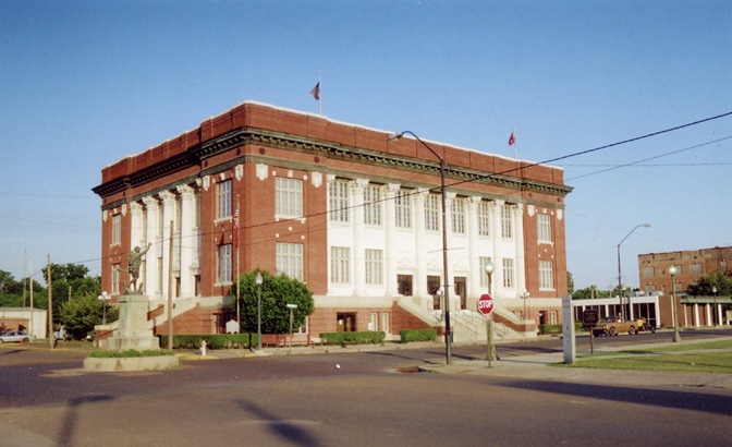
Phillips County had 4,217 residents and covers approximately 13,499 square kilometres. The county was established in 1915 in north-central Montana.
Malta is the county seat and lies along the Milk River. The county includes prairie country south of the Missouri River and the northern edge of the Bear Paw Mountains.
To the mapPondera County

Pondera County had 5,898 residents and covers approximately 4,247 square kilometres. The county was established in 1919.
Conrad is the county seat and lies east of the Rocky Mountain Front. The Marias River and agricultural plains define much of the county’s mapped landscape.
To the mapPowder River County

Powder River County is a county-level administrative area in southeastern Montana. Broadus is the county seat and lies near the Powder River.
The county forms part of the Great Plains and includes the river valleys of southeastern Montana. Its rural roads and settlements are shown on the regional map.
To the mapPowell County

Powell County had 6,946 residents and covers approximately 6,042 square kilometres. It was established in 1901.
Deer Lodge is the county seat, and the county includes the upper Clark Fork valley. The Continental Divide and the Garnet Range shape the surrounding mountain landscape.
To the mapPrairie County

Prairie County had 1,088 residents and covers approximately 4,513 square kilometres. The county was established in 1915 in eastern Montana.
Terry is the county seat and lies near the Yellowstone River. The county consists largely of rolling prairie and badland formations in the eastern Montana region.
To the mapRavalli County

Ravalli County had 44,174 residents and covers approximately 6,217 square kilometres. The county was established in 1893.
Hamilton is the county seat in the Bitterroot Valley, west of the Bitterroot Range. The Bitterroot River flows through the valley toward the Clark Fork.
To the mapRosebud County

Rosebud County had 8,329 residents and covers approximately 13,020 square kilometres. The county was established in 1901 in eastern Montana.
Forsyth is the county seat and lies on the Yellowstone River. The county extends across prairie and river country between the Musselshell and Tongue river regions.
To the mapSanders County

Sanders County had 12,400 residents and covers approximately 7,226 square kilometres. The county was established in 1905 in northwestern Montana.
Thompson Falls is the county seat and lies on the Clark Fork River. The county includes the Clark Fork Valley and parts of the Cabinet Mountains.
To the mapSilver Bow County

Silver Bow County had 35,133 residents and covers approximately 1,862 square kilometres. The county was established in 1881.
Butte is the county seat and a historic copper-mining city on the Continental Divide. The Butte-Anaconda area contains major industrial and mining heritage sites of western Montana.
To the mapTeton County

Teton County is a county-level administrative area in north-central Montana. Choteau is the county seat and lies near the Rocky Mountain Front.
The county includes the Teton River valley and agricultural plains east of the Rocky Mountains. Its roads and rural settlements are represented on the Montana map.
To the mapToole County

Toole County is a county-level administrative area in northern Montana. Shelby is the county seat and lies near the Marias River.
The county borders Alberta, Canada, and includes the northern Great Plains east of the Rocky Mountain Front. Its transport network and settlements are included in the City map.
To the mapTreasure County

Treasure County is a county-level administrative area in south-central Montana. The county seat is Hysham, located near the Yellowstone River.
The county contains prairie and river landscapes between Rosebud County and Big Horn County. Its roads and local places are shown on the regional map.
To the mapValley County

Valley County had 7,578 residents and covers approximately 13,110 square kilometres. The county was established in 1893 in northeastern Montana.
Glasgow is the county seat and lies near the Missouri River and Fort Peck Lake. The county extends across northern prairie and the Milk River drainage area.
To the mapWheatland County

Wheatland County is a county-level administrative area in central Montana. Harlowton is the county seat and lies near the Musselshell River.
The county is situated between the Crazy Mountains and the Little Belt Mountains. Its agricultural roads, paths, and settlements are included in the Montana map.
To the mapYellowstone County

Yellowstone County had 157,048 residents and is centred on Billings, Montana’s largest city. The county lies along the Yellowstone River in south-central Montana.
Billings is an important regional centre near the Rimrocks and the Bighorn Basin. The map covers the city’s streets and paths together with communities and roads throughout Yellowstone County.
To the mapData sources: OpenStreetMap (ODbL), Wikidata (CC0) · Image: Wikimedia Commons
| Named after | mountain |
|---|---|
| Year built | 1889 |
| Area | 381154 km² |
| Elevation | 1035 m |
| Located in | United States |
| Country | United States |
| Body of water | Clark Fork, Flathead River, Missouri River, Flathead Lake |
| Population | 1084225 |
| Website | https://www.mt.gov/ |
| Nickname | Big Sky Country |
| Native name | Montana |
| Official name | State of Montana |

 Public transit map Montana Legend
 | Railway | |
| Bus | |
| Tram |
 Bicycle map Montana Legend
 | Bike path | |
| Bike lane on roadway | |
| Cycling allowed on bus lane | |
| Bicycle street | |
| Open to cyclists | |
| Open to cyclists, good path | |
| Cycling prohibited | |
| Cobblestone |
| Long-distance bike route | (depending on scale) | |
| Long-distance bike route |
 Pedestrian map Montana Legend
 | Path |
| Long-distance hiking trail | (depending on scale) | |
| Long-distance hiking trail | ||
| Pedestrians prohibited |