
Image
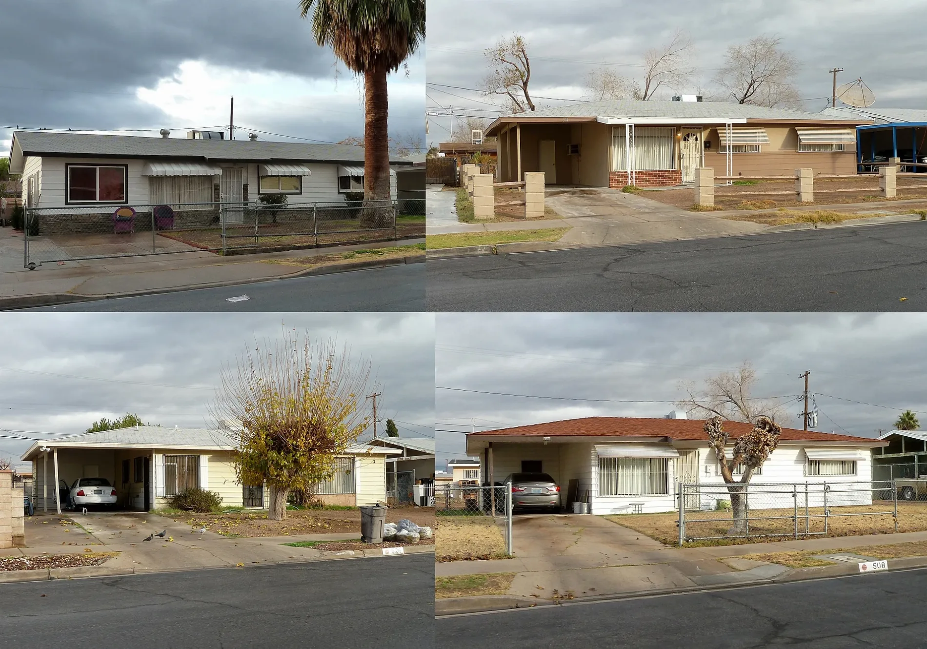
Streets nearby
Freeman Avenue250 ft
Wyatt Avenue300 ft
Paul Avenue350 ft
George Place500 ft
Leonard Avenue0.1 mi
Bowman Avenue0.2 mi
Holmes Street0.2 mi
G StreetNew Hope Christian Church
0.2 mi
F Street0.2 mi
Byrnes Avenue0.2 mi
Alexander Avenue0.2 mi
Frederick Avenue0.2 mi
Cadillac Lane0.2 mi
West Van Buren AvenueNew Revelation Baptist Church
0.3 mi
Leona Street0.3 mi
Susan Street0.3 mi
Walker Street0.3 mi
Curran Way0.3 mi
Holland Avenue0.3 mi
Harrison AvenueEastbound Harrison after D
0.3 mi
Debra Street0.3 mi
Gregory Street0.3 mi
Mike Circle0.3 mi
Perkins Circle0.3 mi
Losee RoadNorthbound Losee after Craig, Tesla Supercharger, Southbound Losee after Lone Mountain, Bahama Buck's, Southbound Losee after Azure, Southbound Losee after Centennial, (Maybe closed) Tacos El Gordo, Tacos El Gordo, Northbound Losee after Ann, Northbound Losee before Tropical, Northbound Losee after Tropical, Northbound Losee before Azure, Northbound Losee after Plumeria, Northbound Losee after Lone Mountain, Northbound Losee after Washburn, Northbound Losee after Shadow Creek, Southbound Losee before Winder, Southbound Losee after Washburn, Southbound Losee before Lone Mountain, Southbound Losee after Ann, Southbound Losee after Tropical
0.3 mi
Jackson Avenue0.3 mi
Elliott Avenue0.3 mi
Silverman Way0.3 mi
B Street0.3 mi
Las Vegas Freeway0.3 mi
Kasper Avenue0.3 mi
West Lake Mead BoulevardEastbound Lake Mead before D, Eastbound Lake Mead after H, Westbound Lake Mead after Englestad, Childrens Choice Kindergarten, Eastbound Lake Mead after Rancho, Eastbound Lake Mead at Texas Station, Eastbound Lake Mead before Tonopah, Westbound Lake Mead after Tonopah, Mega Tom's Burger, Eastbound Lake Mead after Simmons, Westbound Lake Mead after Simmons, Westbound Lake Mead before Victor, Westbound Lake Mead at 3950 W. Lake Mead, Eastbound Lake Mead after Allen, Eastbound Lake Mead after Losee, Westbound Lake Mead before Allen, Westbound Lake Mead before Rancho, Eastbound Lake Mead before Stella Lake
0.4 mi
Weaver Drive0.4 mi
Doolittle Avenue0.4 mi
H StreetSouthbound H before Monroe, Northbound H before Harrison, Northbound H after Monroe, Northbound H after Washington, Southbound H after Doolittle, Southbound H after Lake Mead, Northbound H after Byrnes, Southbound H after Owens, Northbound H after Bonanza
0.4 mi
A Street0.4 mi
West Monroe Avenue0.4 mi
C StreetDivine Providence Variety Day Home, Greater Saint James Baptist Church, Praise Temple Church of God in Christ
0.4 mi
Madison Avenue0.5 mi
Jefferson AvenueMadison Sixth Grade Center School, Pilgrim Rest Missionary Baptist Church, Powerhouse Church of God in Christ
0.5 mi
Cunningham DriveFaith Temple of Church of God in Christ True Holiness
0.6 mi
E StreetSecond Baptist Church, Victory Missionary Baptist Church
0.6 mi
D StreetNorthbound D after Alexander, Northbound D before Paul, Southbound D after Frederick, Variety Early Learning Center, Bethel Baptist Church, Greater New Jerusalem Church, Neway Church of God in Christ, Northbound D after Madison, Southbound D before Adams, Northbound D before Jefferson, Southbound D after Owens, Northbound D before Owens
0.6 mi
Buildings nearby
The Walker African-American Museum & Research Center0.3 mi
Churches nearby
True Love Missionary Baptist Church0.4 mi
Gas stations nearby
Bells Gas0.3 mi
Parks nearby
James Gay Park0.5 mi
Places of worship nearby
Pentecostal Temple Church of God in Christ Children's Center0.5 mi
Social facilities nearby
The Salvation Army0.4 mi
| Named after | Thomas L. Berkley |
|---|---|
| Heritage designation | National Register of Historic Places listed place |
| Located in | Nevada |
| Country | United States |
| Location | West Las Vegas |
 Public transit map Las Vegas Legend
| Railway | |
| Bus | |
| Streetcar |
 Bicycle map Las Vegas Legend
| Bike path | |
| Bike lane on roadway | |
| Cycling allowed on bus lane | |
| Bicycle street | |
| Open to cyclists | |
| Open to cyclists, good path | |
| Cycling prohibited | |
| Cobblestone |
| Long-distance bike route | (depending on scale) | |
| Long-distance bike route |
 Pedestrian map Las Vegas Legend
| Path |
| Long-distance hiking trail | (depending on scale) | |
| Long-distance hiking trail | ||
| Pedestrians prohibited |