
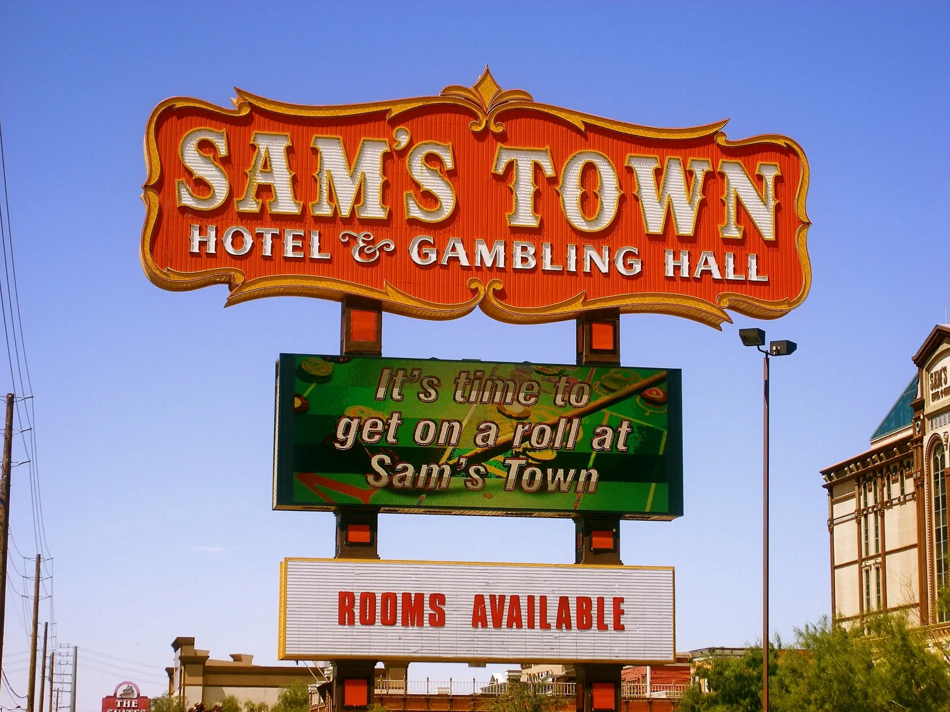
Sam's Town Hotel & Gambling Hall in Clark County, Nevada
Sam's Town Hotel & Gambling Hall in Clark County is a hotel. Sam's Town Hotel & Gambling Hall is located near Petal Avenue. Ⓦ.
- Building Type
- building
- Tourism
- hotel
- Website
- https://www.samstownlv.com/
Image
Streets nearby
Crater Street550 ft
Petal Avenue0.1 mi
Canal Street0.1 mi
Fremont Drive0.1 mi
Stardust Drive0.1 mi
Canal Circle0.1 mi
Perry Street0.2 mi
Crater Circle0.2 mi
Mary's Court0.2 mi
Bay Circle0.2 mi
Farndale Avenue0.2 mi
Koa Avenue0.2 mi
Bingo Boulevard0.2 mi
Dance Hall Circle0.2 mi
Sam's Way0.2 mi
Twilight Street0.2 mi
General Dodge Drive0.2 mi
Boyd Boulevard0.2 mi
Van Street0.2 mi
Byrne Avenue0.3 mi
Della Avenue0.3 mi
Treasure Avenue0.3 mi
Virdine Court0.3 mi
California Drive0.3 mi
Baldwin Street0.3 mi
Uptown Court0.3 mi
General Garfield Drive0.3 mi
General Miles Way0.3 mi
Carmine Street0.3 mi
Chartreuse Court0.3 mi
General Hood Drive0.3 mi
Cabana DriveSouthbound Cabana after Vegas Valley, Southbound Cabana before Desert Inn
0.3 mi
Paxton Way0.3 mi
East Harmon AvenueLife Care Center of South Las Vegas, Eastbound Harmon after Boulder, Eastbound Harmon before Jimmy Durante, H2O Poke & Sushi Burrito, White Castle, 7-Eleven, Entrance, Walgreens, Panda Express, McDonald's, Subway, Bubba Gump Shrimp Company, Taco Bell Cantina, Rainforest Cafe, Sugar Factory, Pizza d'Italia, Magnet Max, Breathe Oxygen Bar, Agora, Breeze Daiquiri Bar, Viva Las Vegas, Cocolini, Fat Tuesday, Vegas Ink, Tex mex tequila bar & grill, Chuck Wagon Restaurant, Nacho Daddy, Buffalo Wild Wings, Walmart Tire & Lube Express
0.3 mi
Zone Avenue0.3 mi
Crinoline Avenue0.4 mi
Boulder HighwayLonghorn Casino, U-Haul, Southbound Boulder after Harmon, Southbound Boulder before Missouri, Southbound Boulder before Twain, UMC Quick Care, Jackpot Joanie's, China a Go Go, AT&T, GameStop, Papa John's, Northbound Boulder after Indios, Glacier Water, Redbox, Burger King, 7-Eleven, Southbound Boulder before Tropicana, Northbound Boulder before Lamb, Northbound Boulder at Boulder Station, Southbound Boulder before Desert Inn, Subway, Extended Stay America, Southbound Boulder after Desert Inn, Southbound Boulder at 3650 Boulder Highway, El Monte rv rental, Southbound Boulder before Flamingo, Northbound Boulder after Tropicana, Northbound Boulder before Harmon, Northbound Boulder before Nellis, Northbound Boulder before Dalhart, Southbound Boulder after Indios, Apollo RV Rental, Northbound Boulder before Missouri, Southbound Boulder after Russell, Southbound Boulder after Boulder Ranch, Southbound Boulder before Tulip Falls, Northbound Boulder before Desert Horizons, Northbound Boulder after Hamilton, Northbound Boulder before Russell, Northbound Boulder after Lamb, Bus stop, Southbound Boulder after Kentucky, Southbound Boulder before Kentucky, Northbound Boulder after Flamingo, Chase, Southbound Boulder after Nellis, Northbound Boulder after Broadbent
0.4 mi
Chocolate Street0.4 mi
Orange Mist Way0.4 mi
Cordonbleu Court0.4 mi
Palisades Quad Avenue0.4 mi
Spanish Barb Street0.4 mi
Casinos nearby
Longhorn Casino0.4 mi
Cell phone stores nearby
T-Mobile0.3 mi
Convenience stores nearby
General store0.1 mi
Fast food restaurants nearby
Original Tommy's World Famous Hamburgers0.3 mi
Viva El Taco Express0.3 mi
Movie theaters nearby
Century 18 Sam's Town150 ft
Rv parks nearby
Las Vegas KOA at Sam's Town0.2 mi
| Year built | 1979 |
|---|---|
| Located in | Nevada |
| Country | United States |
 Public transit map Clark County Legend
| Railway | |
| Bus | |
| Streetcar |
 Bicycle map Clark County Legend
| Bike path | |
| Bike lane on roadway | |
| Cycling allowed on bus lane | |
| Bicycle street | |
| Open to cyclists | |
| Open to cyclists, good path | |
| Cycling prohibited | |
| Cobblestone |
| Long-distance bike route | (depending on scale) | |
| Long-distance bike route |
 Pedestrian map Clark County Legend
| Path |
| Long-distance hiking trail | (depending on scale) | |
| Long-distance hiking trail | ||
| Pedestrians prohibited |