
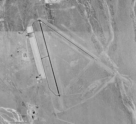
Tonopah Airport in Nye County, Nevada
Tonopah Airport in Nye County is an airfield (IATA: TPH, ICAO: KTPH). Tonopah Airport is also known as TPH. Ⓦ.
- Operator
- Nye County, Nevada
Image
Schools
Drinking water fountains
Convenience stores
Bars
Casinos
Fire stations
Tourist information centers
Restaurants
Doctor's offices
Pubs
Gift shops
Fast food restaurants
Cafes
Viewpoints
Artworks
Parking lots
Motels
Vape shops
Clinics
Streets nearby
Airway Drive0.1 mi
Corsair Drive0.7 mi
Defiant Circle0.7 mi
Bearcat Drive0.7 mi
Liberator DriveTonopah Airport Estates
0.8 mi
Hurricane Drive0.8 mi
Airport Road0.8 mi
Lightning Circle0.8 mi
Scott Drive0.8 mi
Corsair Circle0.8 mi
Liberator Circle0.8 mi
Tonopah Speedway0.8 mi
Mosquito Circle0.8 mi
Typhoon Circle0.8 mi
Wildcat Circle0.8 mi
Mustang Drive0.8 mi
Kittyhawk Circle0.8 mi
Ralston Valley Road0.9 mi
End of Airport Road1.1 mi
Donnels Drive1.1 mi
Grand Army of the Republic HighwayWarm Springs, Lunar Crater, Lockes, Currant
1.8 mi
Tonopah-Austin RoadCarvers
1.9 mi
Tonopah Dump Road3.5 mi
East Tonopah Road3.7 mi
South Booker Mountain Road5.5 mi
Waterline Road5.6 mi
Goldfinch Lane5.7 mi
Unnamed Road5.7 mi
Apache Avenue5.7 mi
Halifax Avenue5.8 mi
Mann Lane5.9 mi
| Named after | Tonopah |
|---|---|
| Elevation | 1655 m |
| Located in | Nevada |
| Country | United States |
| Website | http://www.tonopahnevada.com/airport/ |
 Public transit map Nye County Legend
| Railway | |
| Bus | |
| Streetcar |
 Bicycle map Nye County Legend
| Bike path | |
| Bike lane on roadway | |
| Cycling allowed on bus lane | |
| Bicycle street | |
| Open to cyclists | |
| Open to cyclists, good path | |
| Cycling prohibited | |
| Cobblestone |
| Long-distance bike route | (depending on scale) | |
| Long-distance bike route |
 Pedestrian map Nye County Legend
| Path |
| Long-distance hiking trail | (depending on scale) | |
| Long-distance hiking trail | ||
| Pedestrians prohibited |