
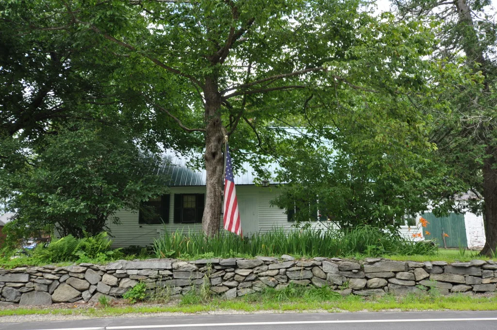
Bethlehem Road in Bethlehem, New Hampshire
Bethlehem Road in Bethlehem is a two-lane, asphalted main road (Road number US 302;NH 18;NH 116). It runs in a southeast-northwest direction and ends at Main Street, while the other end is a cul-de-sac. This street is part of the highways 302, 18 and 116.
- Road Type
- main road
- Lanes
- 2
- Route
- southeast-northwest
Image
Farm stores
Gas stations
Vacation homes
Movie theaters
Post offices
Hotels
Campgrounds
Restaurants
Galleries
Sewing supply stores
Cafes
Tourist information centers
Parking lots
Fast food restaurants
Places of worship
Ice cream shops
Picnic areas
Streets nearby
Morrow Drive0.2 mi
Badger Street0.2 mi
Remich Street0.2 mi
Kelley Lane0.3 mi
Morrison Hill Drive0.4 mi
Eastgate0.4 mi
Styles Bridges Highway0.5 mi
Crane Street0.5 mi
MacIver Road0.5 mi
Cottage StreetVeteran Affairs Outpatent Clinic, Beattie House, Littleton Historical Museum
0.5 mi
Grove Street0.6 mi
Herbert Lane0.6 mi
Lewis Lane0.6 mi
South Grove Street0.6 mi
Valley Vista Court0.7 mi
Mount Eustis RoadLittleton Transfer Station and Recycling Center
0.7 mi
Willow Street0.7 mi
Joe Lahout Lane0.7 mi
Spring Valley Road0.7 mi
Keeler Road0.7 mi
Julias Way0.8 mi
Reardon Road0.8 mi
West Farm Road0.8 mi
Newton's Mobile Home Park0.9 mi
Main StreetPierce Bridge, Presby Energy, Colonial Theatre, LYS Love. Yarn. Shop, Cold Mountain Café, Doogan's, Local Works Marketplace at WREN, The Maia Papaya, Bethlehem Post Office, The Millburn Inn, Super Secret Ice Cream, Wayside Inn
0.9 mi
Guider Lane1.1 mi
Banks nearby
Woodsville Guaranty Savings Bank0.6 mi
Buildings nearby
Vaillant House0.9 mi
Cemeteries nearby
Wallace Horse Cemetary0.7 mi
Commercial buildings nearby
Exit 41 Travel Inn0.4 mi
Community centers nearby
Elks Lodge300 ft
VFW Post0.5 mi
Convenience stores nearby
Circle K0.5 mi
Dentist's offices nearby
Dr. Hugh's Dental0.6 mi
Cottage Street Dental0.7 mi
Doctor's offices nearby
Ammonoosuc Family Health Services0.7 mi
Farmyards nearby
Meadowstone Farm0.6 mi
Gas stations nearby
Irving0.5 mi
Industrial buildings nearby
Appalachian Stitching Company0.2 mi
WTO - Granite Industires0.8 mi
Monasteries nearby
Mount Sacred Heart0.5 mi
Motels nearby
Eastgate Motor Inn0.5 mi
Nature reserves nearby
Sleeping Astronomer Forest0.6 mi
Residential areas nearby
Crane Sreet Court0.7 mi
Toneys Mobile Home Park0.7 mi
Newtons Mobile Park0.8 mi
Restaurants nearby
Baltic Kitchen0.7 mi
Streams nearby
Baker Brook0.9 mi
Supermarkets nearby
Littleton Food Co-op0.5 mi
Public transit map Bethlehem Legend
| Railway | |
| Bus | |
| Streetcar |
Bicycle map Bethlehem Legend
| Bike path | |
| Bike lane on roadway | |
| Cycling allowed on bus lane | |
| Bicycle street | |
| Open to cyclists | |
| Open to cyclists, good path | |
| Cycling prohibited | |
| Cobblestone |
| Long-distance bike route | (depending on scale) | |
| Long-distance bike route |
Pedestrian map Bethlehem Legend
| Path |
| Long-distance hiking trail | (depending on scale) | |
| Long-distance hiking trail | ||
| Pedestrians prohibited |