
Franconia, New Hampshire
Franconia is located in Grafton County. About 1,083 people live here (as of 2020). Between 2010 and 2020, the population declined from 1,104 to 1,083. The region is at 283 meters above sea level. The area covers about 170.9 square kilometers. There are about 530 streets in Franconia. The region was founded in 1764. The ZIP codes are 03580. The dialing code is 603. Franconia is town in Grafton County, New Hampshire, United States. Among other things, Franconia has public Transport, hotels, restaurants, cafés, supermarkets, clothing Stores, museums, schools and banks. More information at www.franconianh.org.
Franconia – Facts
| Population | 1083 |
|---|---|
| Area | 170.9 km² |
| Year built | 1764 |
| Elevation | 283 m |
| Located in | Grafton County |
| Postal code | 03580 |
| Country | United States |
| Official name | Franconia |
| Website | http://www.franconianh.org/ |
Data source: Wikidata (CC0)
Photos from Franconia
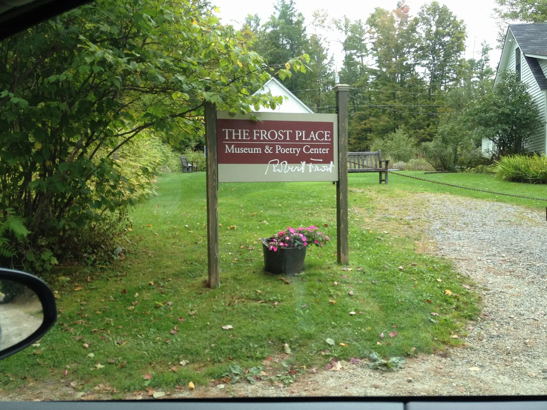
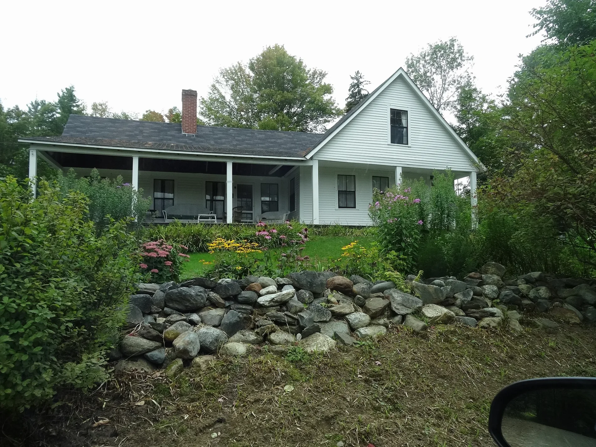
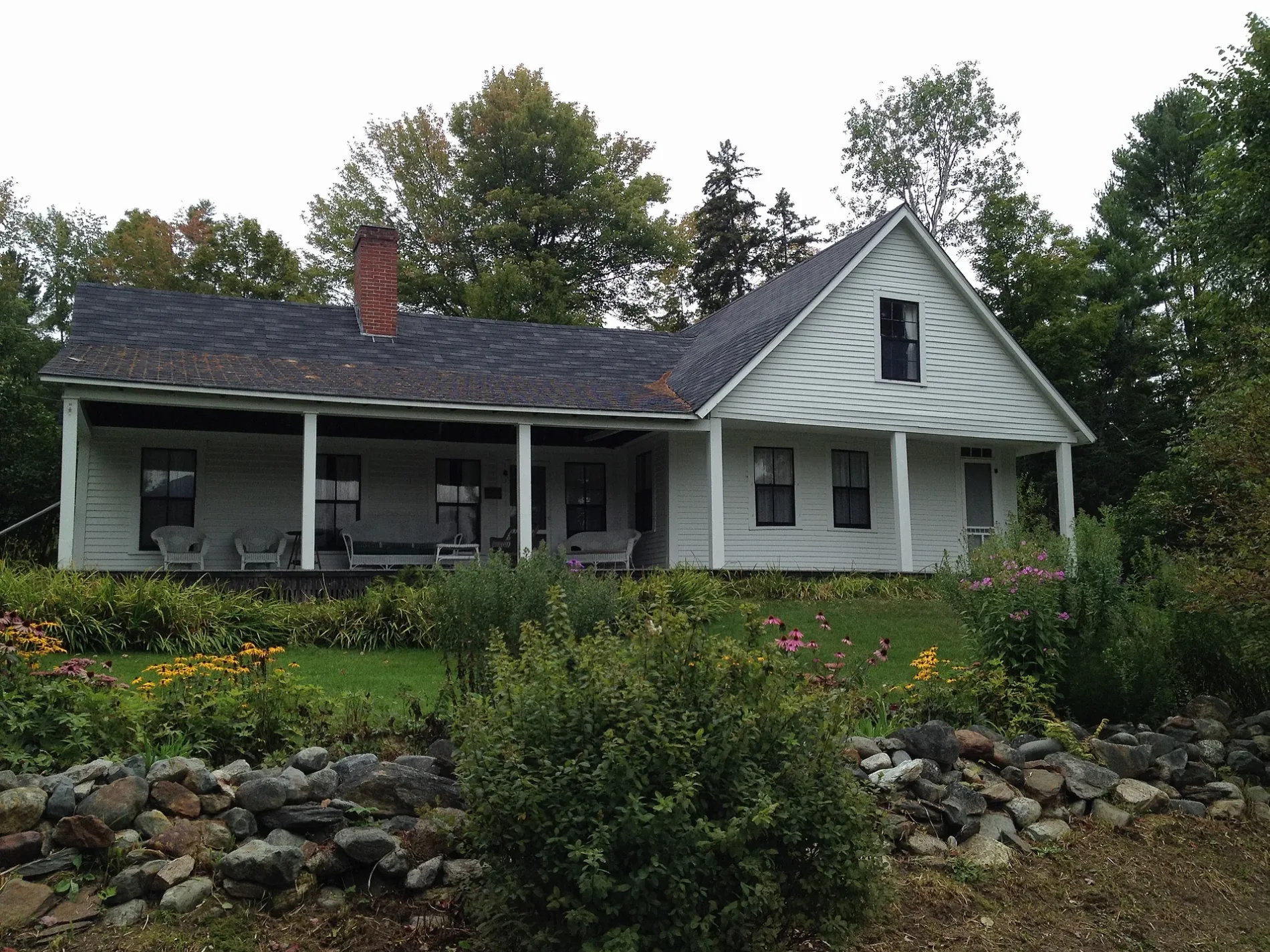
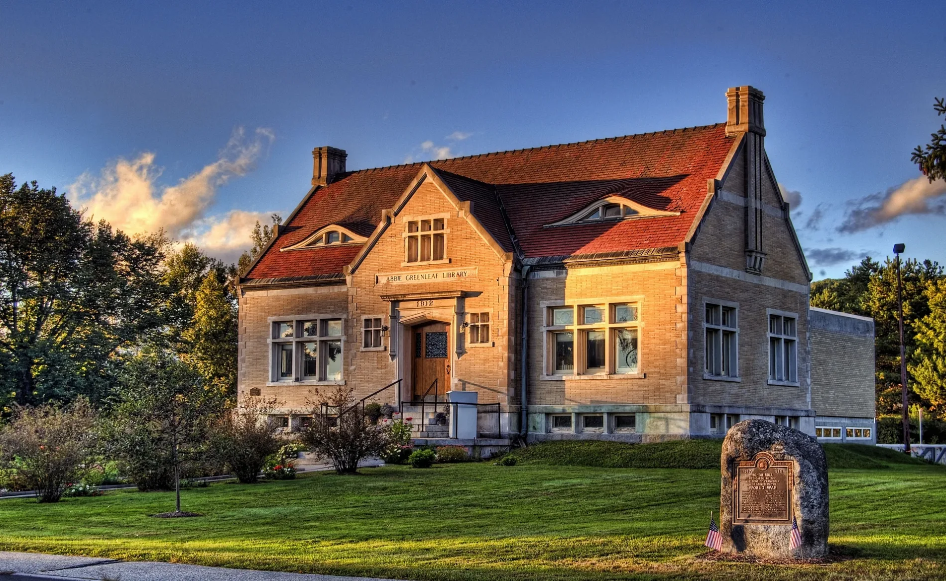
Streets in Franconia, New Hampshire
Streets
Academy Street
Hearhstone Road
Sunset Ridge Road
Wallace Hill Road
Alpen Hill Road
Dow Avenue Extended
Hillwinds Motel
Tramway DriveTramway Country Store, Cannon Mountain Aerial Tramway
Split Rock Drive
Circle Drive
Overbrook Road
Notch-Way TrailLafayette XC ski parking
Hubertus Ring
Morristown Road
Lafayette Drive
Old County Road
Lady Slipper Lane
Slalom Circle
Sawmill Lane
Coal Hill
Coal Hill Road
Plantation Road
Kinsman Road
Rockwood Road
Coppermine RoadCoppermine Trailhead Parking
Butter Hill Road
Jonathan Livingston Circle
Fiddlehead Road
Pioneer Road
Garfield Close
Foxglove Lane
Mittersill RoadMittersill, Mittersill Alpine Resort
Timber Lane
Franconia Mountains
Anneie's Moonlight Drive
Harvard Street
Windago Lane
Bickford Hill Road
Fobes Road
Oaks Road
Raven Lane
Ridgecut Road
Forest Road
Bridalveil Road
River Road
Skyline Drive
Wright's WayCommunity Church of Christ
Kerr Road
Dow Avenue
Fox Hill Park parking
Delage Farm Road
Woodbine Lane
Water Works Road
Indian Pipe Road
Slalom Lane
Forest Hill Road
Eaton Road
Berwick Court
Meadow Rue Lane
Main StreetFranconia, Stone Iron Furnace Museum, Presby Fuel, Franconia Market & Deli, Dutch Treat Bar & Grill, Franconia Village Store, Woodsville Guarantee, Hungry Bear Cafe, F.A.S.T, Franconia Hardware Store, Franconia Childrens Center, Tru North Salon And Spa, Franconia Coffee House, Garnet Hill
Profile Club Road
Evergreen Drive
Fox Hill Lane
Profile RoadWestwind Cottages, Abbie Greenleaf Memorial Library, Franconia Fire Department, Seasonal Information, Franconia Police Dept, Stoney Brook Motel
Iron Foundry Road
Balancing Rock Road
Sunset Lane
Wintergreen Lane
Scrag Mt Road
Deer Pass Road
Wells Road
Woodchuck Trail
Mountain View Road
Toad Hill Road
Ridge RoadRobert Frost Museum
Lafayette Road
Aspen Road
Beechwood Lane
Tucker Brook Road
Franconia Mountains Road
Magowan Hill Road
Ski Pines Club Road
Foxglove
Pennyroyal Lane
Falling Waters TrailThe alpine zone
Greenleaf Trail
Old Bridle Path
Franconia Notch ParkwayProfiler Plaza
Styles Bridges Highway
Daniel Webster Highway
Garfield Ridge TrailSpring
Skookumchuck TrailSkookumchuck Trailhead
Pemi TrailOld Man of the Mountain Museum
Frost Trail
Gale River Trail
Mount Garfield Trail
North Twin Spur
Twinway
Franconia Ridge Trail
Easton Road
Kinsman Ridge Trail
Twin Brook TrailThirteen Falls
Franconia Brook Trail
Bickford XC ski trail
Scarface XC ski trail
Bog Trail
Snowmobile Trail NHSA 11
Franconia Notch Bike Path
Lincoln Brook Trail
Bald Mtn - Artists Bluff Path
Bald Mt Spur
Sugar Hill Road
Coventery Ridge Road
Meadow Crest Drive
Notchway Drive
Powder Hill DriveSouth Franconia
Point of View Drive
Park View Drive
Upper Ravine
Fleitman Trail
Coyote Crossing
Nature Drive
Summit Drive
McKenzie Woods Road
Owls Head Path
Brutus Bushwhack
FR 92A
FR 92C
FR 6211
FR 6209
Fat Lip
High Plains Drifter
FR 182
Black Pond Bushwhack
Goat Path
Loop Trail
Coppermine TrailCoppermine Trailhead
Larkspur Lane
Coventry Ridge Road
Short Trail
Rim TrailCafe 4080
Access Trail
Tucker's Trail
Wild & Wooley
Holy Moley
Fox Hill Loop
Old Mittersill Road
Red Flyer
Ian's Trail
Kettle Trail
Social Distancing
The Dark Side
Home Run
Home Owners
Stone Henge
Tuckers Connector
Peepers
Lower Rough Cut
Press Play
Birch Run
Boundary Trail
Vernal Pool
Doctor No
Ronnie's Ramble
Ham Branch Trail
Corner Office
Rough Cut
Ridge Run
Pebble Beach
Chainlink
Prelude
Lightning Strike
Hardwood Heaven
Infinity Glade
S & L
Von Ryans Express
Sling Shot
DH Trail
Tucker Brook Trail
Little Jackson
Doctor No Connector
Fiji
Pipeline
Pebble Beach 2.0
The Kings Highway
Bridesmaids Falls Trail
Doctor Slab
Hillwinds Connector
Ham Branch
River Run
FR 92B
Hoffman's Drive
Sundew Lane
Old Butterhill Road
Champions Way
FR 7023
FR 6204
unknown trailunknown trail
Profile Cliff climbers' approach
Hermit Haven climbers' approach
Echo Crag climbers' approachAttractions
Beaches
Cabins
Cemeteries
Cliffs
Commercial buildings
Fire stations
Golf courses
Guest houses
Mountain huts
Nature reserves
Places of worship
Post offices
Ranger stations
Retail buildings
Rivers
Rv parks
Shelters
Social facilities
Streams
Tourist information centers
Town halls
Winter sports areas
Other
 Public transit map Franconia Legend
| Railway | |
| Bus | |
| Streetcar |
 Bicycle map Franconia Legend
| Bike path | |
| Bike lane on roadway | |
| Cycling allowed on bus lane | |
| Bicycle street | |
| Open to cyclists | |
| Open to cyclists, good path | |
| Cycling prohibited | |
| Cobblestone |
| Long-distance bike route | (depending on scale) | |
| Long-distance bike route |
 Pedestrian map Franconia Legend
| Path |
| Long-distance hiking trail | (depending on scale) | |
| Long-distance hiking trail | ||
| Pedestrians prohibited |