
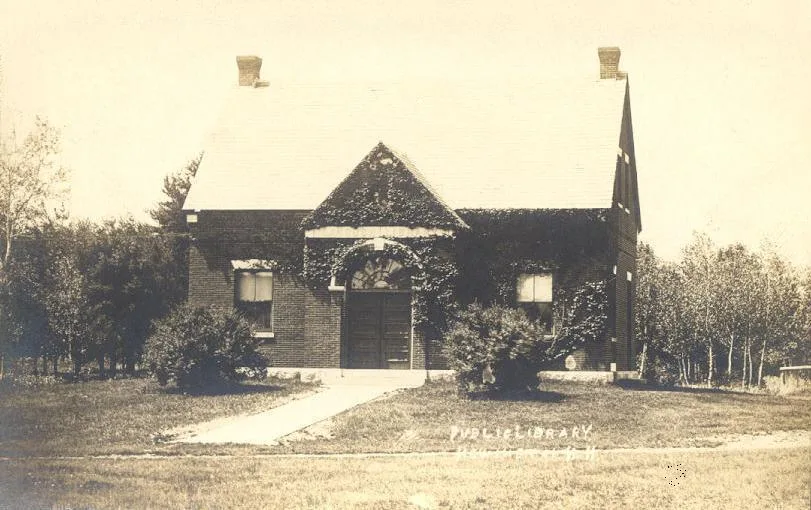
Langdon Library in Newington, New Hampshire
Langdon Library in Newington is a library (Elevation 33 m), Nimble Hill Road 328 🌐.
- House Number
- 328
- Street
- Nimble Hill Road
- Amenity
- library
- Building Type
- building
- Website
- https://www.langdonlibrary.org/
Image
Clinics
Tourist information centers
Self storages
Cell phone stores
Accessory shops
Bus stops
Music stores
Beauty salons
Cosmetics stores
Clothing stores
Museums
Gas stations
Shoe stores
Candy stores
Jewelry stores
Streets nearby
Arboretum DriveGreat Bay NWR Main Gate, Pease International Tradeport
0.2 mi
Short Street0.2 mi
The Point0.3 mi
Trickey's Ferry Road0.3 mi
Portsmouth Municipal Airport Road0.3 mi
Hannah Lane0.3 mi
Morning Dew0.3 mi
Pickering Brook Road0.4 mi
Gnome Way0.4 mi
New Speedway Boggie0.4 mi
MIddle Road0.4 mi
Gnome Hill0.4 mi
Old School Road0.4 mi
Hornets0.4 mi
PMA Spur0.5 mi
Linda Lane0.5 mi
Snake0.5 mi
Lost Road0.5 mi
Stellla Blue0.5 mi
Turtle0.5 mi
Camel Humps0.5 mi
Born Cross Eyed0.6 mi
Old Post Road0.6 mi
Nimble Hill RoadNewington Town Hall, Old Parsonage Museum, Nimble Hill Road / Shattuck Way
0.6 mi
Fox Point Road0.6 mi
Little Bay RoadNewington Center Historic District
0.6 mi
Little Bay0.6 mi
TaTonka0.6 mi
Mc Intyre Road0.6 mi
Rabbit0.6 mi
Airforce Road0.6 mi
Bone Spur0.7 mi
Captains Landing0.7 mi
Rollin' Bones0.7 mi
Peverly Pond Trail0.7 mi
Ferry Way Trail0.8 mi
Newmarket Street0.8 mi
Buildings nearby
Old Newington0.1 mi
Dams nearby
Upper Peverly Pond Dam0.8 mi
Nature reserves nearby
Newington Town Forest0.4 mi
Newington Town Conservation Area0.6 mi
Parks nearby
Newington Town Park0.2 mi
Places of worship nearby
Newington Town Church250 ft
Streams nearby
Peverly Brook0.4 mi
Pickering Brook Rd0.6 mi
Pickering Brook0.6 mi
Town halls nearby
Newington Town Hall0.6 mi
Waters nearby
Upper Peverly Pond0.6 mi
Other nearby
North Apron0.8 mi
| Year built | 1892 |
|---|---|
| Located in | New Hampshire |
| Country | United States |
| Part of | Langdon Library |
 Public transit map Newington Legend
| Railway | |
| Bus | |
| Streetcar |
 Bicycle map Newington Legend
| Bike path | |
| Bike lane on roadway | |
| Cycling allowed on bus lane | |
| Bicycle street | |
| Open to cyclists | |
| Open to cyclists, good path | |
| Cycling prohibited | |
| Cobblestone |
| Long-distance bike route | (depending on scale) | |
| Long-distance bike route |
 Pedestrian map Newington Legend
| Path |
| Long-distance hiking trail | (depending on scale) | |
| Long-distance hiking trail | ||
| Pedestrians prohibited |