
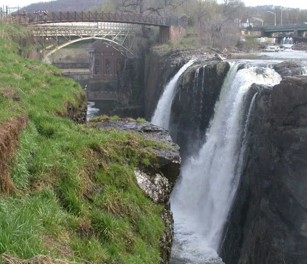
Passaic River in Lyndhurst, New Jersey
Passaic River in Lyndhurst is a river. Ⓦ.
- Waterway Type
- river
Image
Gas stations
Platforms
Police stations
Clinics
Hair salons
Schools
Places of worship
Stations
Libraries
Housewares stores
Bakeries
Bus stops
Restaurants
Fast food restaurants
Cafes
Variety stores
Pet stores
Streets nearby
Peabody Avenue0.2 mi
Kearney Street0.2 mi
Court AvenueLyndhurst
0.2 mi
Rutherford AvenueShell, 7-Eleven
0.2 mi
Century Drive0.2 mi
Kingsland Avenue0.2 mi
Webster Avenue0.3 mi
Preble Place0.3 mi
Stuyvesant AvenueRoosevelt Elementary School
0.3 mi
Lake AvenueColumbus Elementary School
0.3 mi
Jay Avenue0.3 mi
Park AvenueRutherford, Song E Napule, Paisano's, Park Floral Designs, Mikayla's Thiftique, Sweet Avenue Bake Shop, Cafe Matisse, Ice cream charlies, BCB bank, Steve and Andrea's, Salon valerie, Bagel Supreme, Le Petique Atelier, Rutherford Dry Cleaners, Rutherford Wine and Spirits, The Lottery Shop, Salad House, Bank of America, 30 burgers, Boom Boom chicken, Yellowtail Japanese bistro, Azteca, Sherwin-Williams, Nails Plaza, Rutherford Pancake House, The Risotto House, Yamada Sushi, Taqueria Nacho Libre, Ames Barbershop, Sonoma Bistro, Roll Thai'd creamery, Crest Jewelers, greek town Gyros, Rutherford Florist, Fabulous Stylz 2, Ondubu, Playa Bowls, Suprema, Fiorentini Restaurant, Sara's Children's Boutique, Yan Asian, Jim Dandy's, Painting On Park, Rutherford Coffee Co., Kabob on the Cliff, Hallmark, Rutherford Pharmacy, Varrelman's Bake Shop, Dunkin'
0.3 mi
Tontine Avenue0.3 mi
Livingston Avenue0.3 mi
Oriental Place0.4 mi
College Place0.4 mi
Manor Court0.4 mi
Edgewood Place0.4 mi
Myrtle Avenue0.4 mi
River Road0.4 mi
Watson Avenue0.4 mi
West Gouverneur Avenue0.4 mi
Lyndhurst Avenue0.4 mi
Johnson Street0.4 mi
Willow Avenue0.5 mi
Marginal Road0.5 mi
Riverside Terrace0.5 mi
East Gouverneur Avenue0.5 mi
Delafield AvenueMy Salad, Dollar Tree, Lyndhurst
0.5 mi
2nd Avenue0.5 mi
Travers Place0.5 mi
New York AvenueAFC Urgent Care Lyndhurst
0.5 mi
Apartment buildings nearby
Columbia Court0.4 mi
Buildings nearby
Lyndhurst Community Center0.4 mi
Ghost Hawk Brewing Company0.4 mi
Lyndhurst Station0.5 mi
Cafes nearby
Starbucks0.3 mi
Community centers nearby
American Legion Hall0.2 mi
Drugstores nearby
Levy's Pharmacy & Surgical0.5 mi
Fairways nearby
Rutherford Reach50 ft
Nutley Reach200 ft
Gas stations nearby
Sunoco0.3 mi
Parks nearby
Lyndhurst Municipal Park0.5 mi
Places of worship nearby
Lyndhurst United Methodist Church0.4 mi
Saint Matthew's Lutheran Church0.5 mi
Railways nearby
Main Line0.4 mi
Residential areas nearby
River Walk Condominium0.3 mi
Restaurants nearby
Rutt's Hut0.4 mi
Sports fields nearby
Lyndhurst Little League0.3 mi
| Length | 129 |
|---|---|
| Located in | New Jersey |
| Country | United States |
| Mouth | Newark Bay |
| Tributary | Pompton River, Diamond Brook, First River, Goffle Brook, McDonalds Brook, Molly Ann Brook, Peckman River, Slippery Rock Brook |
 Public transit map Lyndhurst Legend
| Railway | |
| Bus | |
| Streetcar |
 Bicycle map Lyndhurst Legend
| Bike path | |
| Bike lane on roadway | |
| Cycling allowed on bus lane | |
| Bicycle street | |
| Open to cyclists | |
| Open to cyclists, good path | |
| Cycling prohibited | |
| Cobblestone |
| Long-distance bike route | (depending on scale) | |
| Long-distance bike route |
 Pedestrian map Lyndhurst Legend
| Path |
| Long-distance hiking trail | (depending on scale) | |
| Long-distance hiking trail | ||
| Pedestrians prohibited |