
BOMARC Site RW-01 in Plumsted Township, New Jersey
BOMARC Site RW-01 in Plumsted Township is a military area. Ⓦ.
- Land Use
- military area
Image
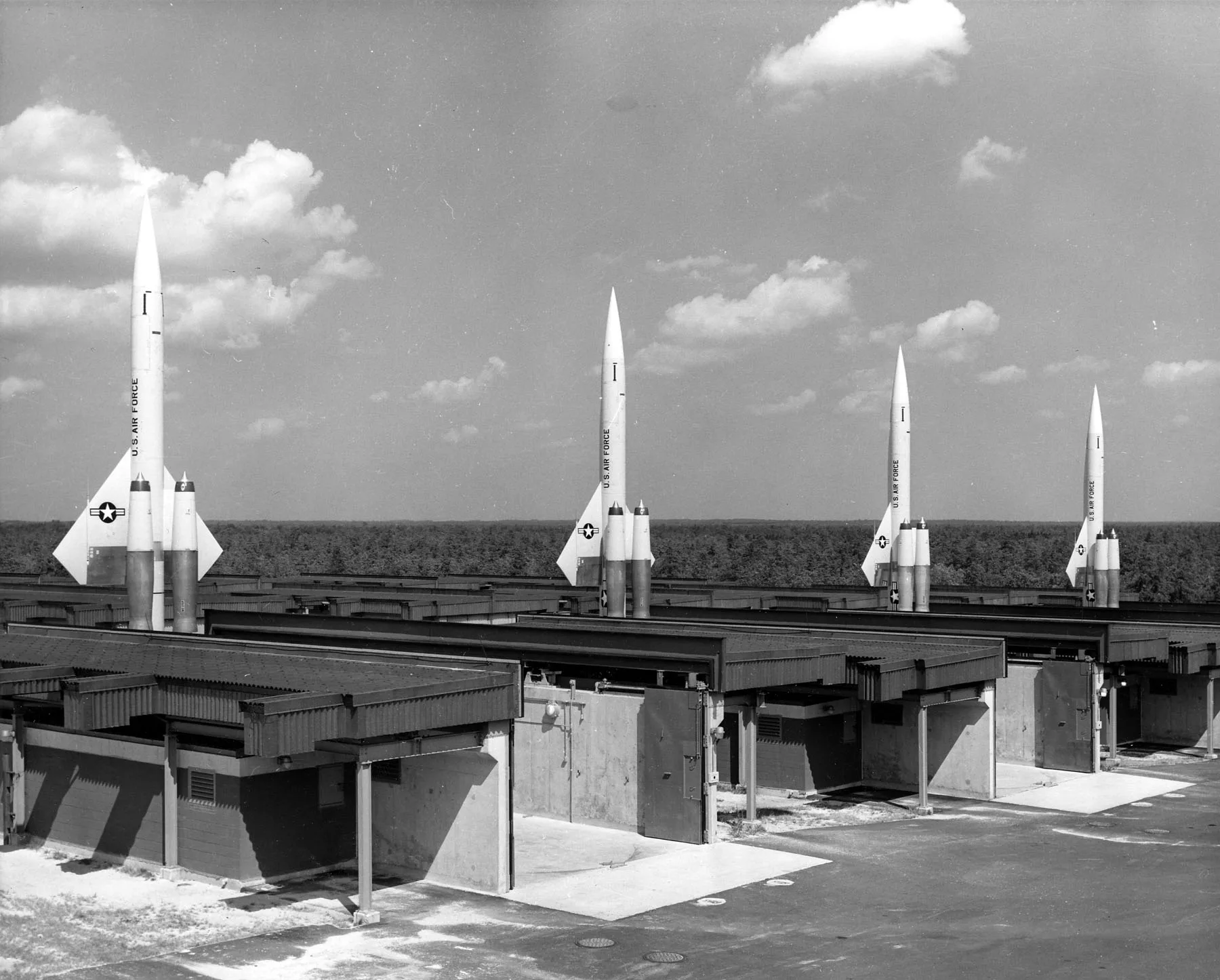
Bus stops
Streets nearby
Hawkin Road0.4 mi
Archertown RoadArchertown
1.6 mi
Interior Road1.7 mi
Buckalew Drive1.7 mi
North and South Road1.8 mi
Holmes Road1.8 mi
Circle Drive1.9 mi
North A P C Road1.9 mi
Woodside Road1.9 mi
NJ State Long Trail1.9 mi
Woodruff RoadWoodruff
2.0 mi
West Clubhouse Road2.0 mi
West Clubhouse Lake Road2.3 mi
East Colliers Mills Road2.3 mi
North Camp Road2.4 mi
Scout Road2.5 mi
Lakehurst Naval Air Center2.6 mi
Success RoadColliers Mills
2.6 mi
Whiting-New Egypt Road2.7 mi
New Egypt Speedway2.7 mi
South Boundary Road2.8 mi
Long Swamp RoadBrindletown
2.9 mi
WMA Access Road3.0 mi
Union Avenue3.1 mi
Hockamic Road3.1 mi
Fort Dix Military Reservation3.3 mi
West Colliers Mills Road3.4 mi
Bunches Street3.5 mi
Joyce Morris Road3.5 mi
Foxs Lane3.5 mi
Cordwell Street3.6 mi
Blanche Drive3.6 mi
West Veterans HighwayArchers Corner, Rt 528 at Hawkin Rd - Rt 317, Cassville, Subway
3.6 mi
Pinehurst Road3.6 mi
Country Woods Drive3.7 mi
Brookwood Drive3.7 mi
Lakewood RoadRt 528 at Hawkin Rd - Rt 317
3.7 mi
Hanover Furnace Manchester Road3.8 mi
Hornbeam Lane3.8 mi
Hazlenut Lane3.8 mi
Huckleberry Lane3.9 mi
Dams nearby
Bass Lake Dam1.8 mi
Farmland nearby
Emery's Farm2.0 mi
Farmyards nearby
Saratoga Farms2.8 mi
Recreation grounds nearby
Central Jersey Rifle and Pistol Club3.7 mi
Streams nearby
Gaunts Brook3.9 mi
Shannoc Brook4.0 mi
Waters nearby
Colliers Lake2.4 mi
Success Lake2.8 mi
| Country | United States |
|---|
 Public transit map Plumsted Township Legend
| Railway | |
| Bus | |
| Streetcar |
 Bicycle map Plumsted Township Legend
| Bike path | |
| Bike lane on roadway | |
| Cycling allowed on bus lane | |
| Bicycle street | |
| Open to cyclists | |
| Open to cyclists, good path | |
| Cycling prohibited | |
| Cobblestone |
| Long-distance bike route | (depending on scale) | |
| Long-distance bike route |
 Pedestrian map Plumsted Township Legend
| Path |
| Long-distance hiking trail | (depending on scale) | |
| Long-distance hiking trail | ||
| Pedestrians prohibited |