
New Mexico

New Mexico
This page is the City map of New Mexico, a map with streets, paths and places in the United States. New Mexico covers approximately 315,194 square kilometres and had 2,117,522 residents in 2020, compared with 2,059,179 in 2010. The state lies at an average elevation of about 1,735 metres and was admitted to the United States in 1912. Its geography includes the Rio Grande, the Rocky Mountains, the Chihuahuan Desert and the high plains of eastern New Mexico. OpenStreetMap records one long-distance cycling route in New Mexico.
Mosquero

Mosquero is a village in New Mexico classified as an administrative level 8 locality. It lies in the northeastern part of the state, within the open plains and grasslands of eastern New Mexico. The village is associated with Harding County, one of New Mexico’s least populated counties. The surrounding landscape differs from the mountainous areas near Santa Fe and Taos because broad prairie dominates the region.
To the mapRio Rancho

Rio Rancho is a city in New Mexico classified as an administrative level 8 locality. It lies northwest of Albuquerque in Sandoval County, on the western side of the Rio Grande valley. The city belongs to the rapidly urbanised central New Mexico corridor around Albuquerque. The nearby Sandia Mountains form a prominent geographic reference east of the Rio Grande.
To the mapEspanola

Española is a city in New Mexico classified as an administrative level 8 locality. It stands in the upper Rio Grande valley between Santa Fe and the communities of northern New Mexico. The city is connected with Rio Arriba County and Santa Fe County, where the Rio Grande flows through a high-elevation basin. Nearby landscapes include the Sangre de Cristo Mountains and the historic settlements of the Española Valley.
To the mapSan Juan County

San Juan County is a county in New Mexico with an administrative level 6 boundary and a recorded population of 121,661. Its area is approximately 14,281 square kilometres, and the county was established in 1887. Farmington is the main city in the county, which occupies the northwest corner of New Mexico near the Colorado and Arizona borders. The San Juan River crosses the county, while Chaco Culture National Historical Park lies in its wider archaeological region.
To the mapColfax County

Colfax County is a county in New Mexico classified as administrative level 6. Its county seat is Raton, a city near the Colorado border and the southern end of Raton Pass. The county includes the Sangre de Cristo Mountains and the high-elevation community of Angel Fire. The Canadian River drains parts of the eastern county before continuing across the New Mexico plains.
To the mapTaos County

Taos County is a New Mexico county with administrative level 6 status, a population of 34,489 and an area of approximately 5,710 square kilometres. The county was established in 1852 and includes Taos, Taos Pueblo and the mountain community of Questa. The Rio Grande cuts through the Rio Grande Gorge west of Taos, forming one of northern New Mexico’s most prominent canyons. Taos Pueblo is a UNESCO World Heritage Site and has been continuously inhabited for many centuries.
To the mapSanta Fe County

Santa Fe County is a county in New Mexico with administrative level 6 status, 154,823 residents and an area of approximately 4,944 square kilometres. It was established in 1852 and contains Santa Fe, the capital of New Mexico. Santa Fe’s historic Plaza and adobe architecture reflect the city’s Spanish colonial and territorial history. The county extends from the Rio Grande valley toward the Sangre de Cristo Mountains and the Santa Fe National Forest.
To the mapSan Miguel County

San Miguel County is a New Mexico county with administrative level 6 status, a population of 27,201 and an area of approximately 12,265 square kilometres. The county was established in 1852, and Las Vegas is its county seat. The Gallinas River passes through Las Vegas before joining the Pecos River system. San Miguel County includes foothills of the Sangre de Cristo Mountains and broad plains east of the mountain front.
To the mapMora County

Mora County is a county in New Mexico classified as administrative level 6. The county lies in northern New Mexico between the Sangre de Cristo Mountains and the plains east of the mountain range. Mora is the county seat and is located in the Mora Valley near the Mora River. The county’s landscapes include mountain forests, irrigated valley land and high-elevation grasslands.
To the mapLos Alamos County
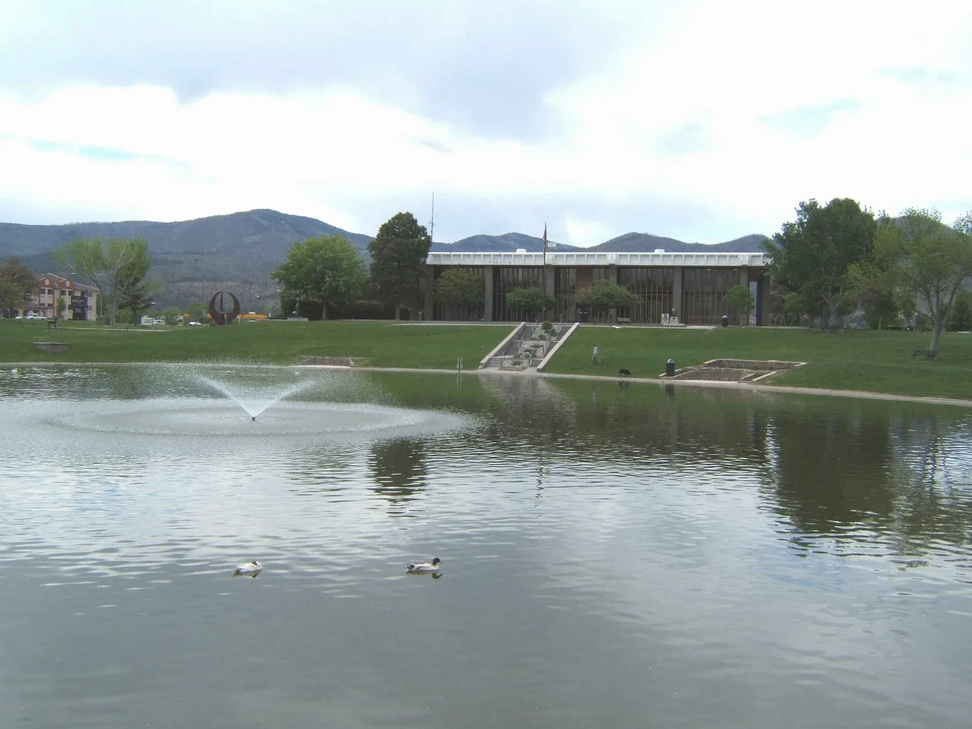
Los Alamos County is a New Mexico county with administrative level 6 status, 19,419 residents and an area of approximately 283 square kilometres. It was established in 1949 on the Pajarito Plateau above the Rio Grande. Los Alamos is internationally associated with the Manhattan Project and the Los Alamos National Laboratory. Bandelier National Monument lies nearby and protects ancestral Puebloan sites in canyon country.
To the mapSandoval County

Sandoval County is a New Mexico county classified as administrative level 6 with a recorded population of 139,394. Rio Rancho is the county’s largest city and lies immediately northwest of Albuquerque. The county stretches from the Rio Grande valley to the Jemez Mountains and includes parts of the Valles Caldera region. Pueblo communities such as Zia, Jemez and Santa Ana are located within or near Sandoval County.
To the mapUnion County

Union County is a county in northeastern New Mexico classified as administrative level 6. Clayton is the county seat and lies near the Oklahoma and Texas borders. The county is part of the High Plains, where open grassland and agricultural land surround the communities along U.S. Route 56 and U.S. Route 87. The Rita Blanca National Grassland extends into the wider border region.
To the mapRio Arriba County

Rio Arriba County is a New Mexico county with administrative level 6 status, 40,363 residents and an area of approximately 15,171 square kilometres. It was established in 1852 and includes Tierra Amarilla, Española and parts of the upper Rio Grande valley. The Rio Grande and the Chama River cross the county, while the northern landscape rises into the San Juan and Sangre de Cristo Mountains. El Vado Lake and Heron Lake are major reservoirs on the Chama River system.
To the mapBernalillo County

Bernalillo County is a New Mexico county with administrative level 6 status, 676,444 residents and an area of approximately 3,027 square kilometres. It was established in 1852 and contains Albuquerque, the largest city in New Mexico. The Rio Grande runs north to south through the county, with the Sandia Mountains rising east of the metropolitan area. Albuquerque’s Old Town, the Rio Grande Nature Center and the Sandia Peak area are prominent local landmarks.
To the mapCatron County

Catron County is a New Mexico county with administrative level 6 status, 3,579 residents and an area of approximately 17,946 square kilometres. It was established in 1921 and is the largest county in New Mexico by area. The county includes the Gila Wilderness, the first designated wilderness area in the United States, and extensive parts of the Gila National Forest. The Gila River and its tributaries cut through forested mountain country in western New Mexico.
To the mapChaves County

Chaves County is a New Mexico county classified as administrative level 6 with a recorded population of 65,764. Roswell is the county seat and the principal city in the southeastern county. The Pecos River flows through the county, supporting the irrigated Pecos Valley around Roswell and Hagerman. The county extends toward the mesas and desert plains of the southeastern New Mexico oil and gas region.
To the mapCibola County

Cibola County is a New Mexico county with administrative level 6 status, 27,172 residents and an area of approximately 11,756 square kilometres. It was established in 1981 and includes Grants and the community of Milan. The county contains parts of El Malpais National Monument, where lava flows and volcanic formations cover the west-central landscape. Mount Taylor rises north of Grants and is a prominent landmark for the region’s Indigenous communities.
To the mapCurry County

Curry County is a New Mexico county with administrative level 6 status, 48,430 residents and an area of approximately 3,646 square kilometres. It was established in 1909 and contains Clovis, the county seat and a major city on the eastern plains. The Blackwater Draw archaeological site near Clovis is associated with the Paleoindian Clovis culture. The county’s flat High Plains terrain supports cattle ranching and irrigated agriculture.
To the mapDe Baca County

De Baca County is a New Mexico county classified as administrative level 6 with 1,698 residents and an area of approximately 6,045 square kilometres. It was established in 1917 and has Fort Sumner as its county seat. The Pecos River passes through Fort Sumner, where the Bosque Redondo reservation and the Fort Sumner Historic Site are located. The county lies in the transition between the Pecos Valley and the eastern New Mexico plains.
To the mapDoña Ana County

Doña Ana County is a New Mexico county with administrative level 6 status, 219,561 residents and an area of approximately 9,888 square kilometres. It was established in 1852 and includes Las Cruces, the county seat and second-largest city in New Mexico. The Rio Grande crosses the Mesilla Valley, where irrigated fields and vineyards surround Las Cruces. The Organ Mountains rise east of the city and are protected within Organ Mountains–Desert Peaks National Monument.
To the mapEddy County

Eddy County is a New Mexico county with administrative level 6 status, 62,314 residents and an area of approximately 10,872 square kilometres. It was established in 1891 and contains Carlsbad, the county seat, on the Pecos River. Carlsbad Caverns National Park protects one of the world’s best-known limestone cave systems in the Guadalupe Mountains. The county also includes desert plains and the productive oil and gas fields of the Permian Basin.
To the mapGrant County

Grant County is a New Mexico county with administrative level 6 status, 28,185 residents and an area of approximately 10,276 square kilometres. It was established in 1868 and includes Silver City, the county seat, near the southwestern mountains. The Gila National Forest covers large parts of the county, including the Mogollon Mountains and the headwaters of the Gila River. Mining history is visible around Silver City and the former copper-mining district of Santa Rita.
To the mapGuadalupe County
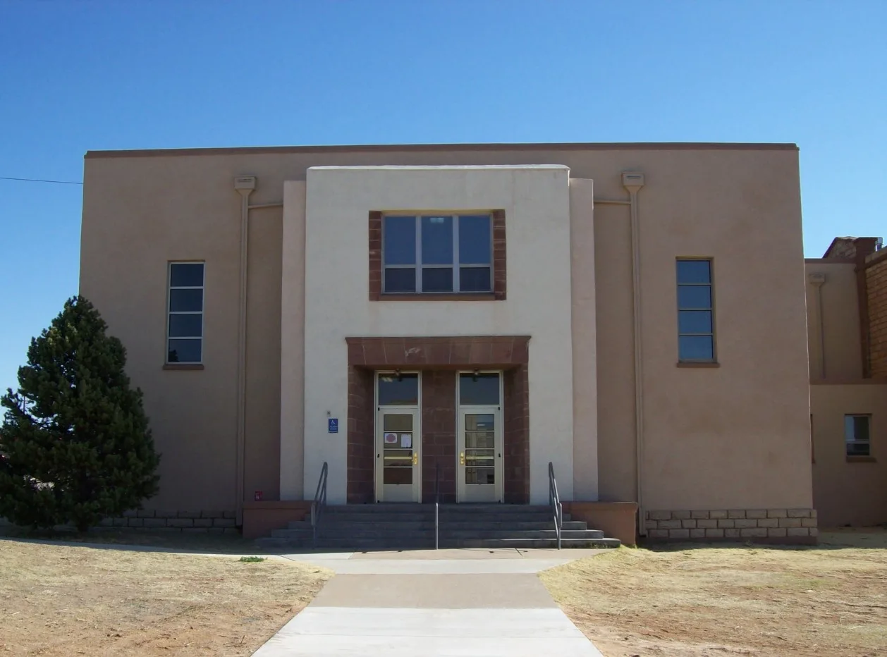
Guadalupe County is a county in New Mexico classified as administrative level 6. Santa Rosa is the county seat and lies along the Pecos River in central eastern New Mexico. The city is known for Blue Hole, a deep natural spring used for diving and supplied by the regional groundwater system. Interstate 40 and historic Route 66 cross the county near Santa Rosa.
To the mapHarding County

Harding County is a county in New Mexico with administrative level 6 status, 657 residents and an area of approximately 5,506 square kilometres. It was established in 1921 and is one of the least populated counties in the United States. Mosquero and Roy are small communities in the county’s open grassland landscape. The Canadian River forms part of the regional drainage pattern south of the High Plains.
To the mapHidalgo County

Hidalgo County is a New Mexico county with administrative level 6 status, 4,178 residents and an area of approximately 8,925 square kilometres. It was established in 1919 and includes Lordsburg, the county seat, near the Arizona border. The Animas Mountains occupy the eastern part of the county, while desert basins extend toward the international border with Mexico. Interstate 10 crosses Lordsburg and connects southern New Mexico with Arizona and Texas.
To the mapLea County

Lea County is a New Mexico county with administrative level 6 status, 74,455 residents and an area of approximately 11,380 square kilometres. It was established in 1917 and contains Hobbs, the county’s largest city, and Lovington, the county seat. Lea County lies on the Permian Basin, one of North America’s major oil-producing regions. The landscape consists largely of level plains and semi-arid grassland near the Texas border.
To the mapLincoln County

Lincoln County is a New Mexico county with administrative level 6 status, 20,269 residents and an area of approximately 12,513 square kilometres. It was established in 1869 and includes Ruidoso, Lincoln and parts of the Sacramento Mountains. The county is closely associated with Billy the Kid, who was involved in the Lincoln County War of 1878. The Lincoln National Forest covers mountain slopes above the Tularosa Basin and the Pecos Valley.
To the mapLuna County

Luna County is a New Mexico county with administrative level 6 status, 25,427 residents and an area of approximately 7,680 square kilometres. It was established in 1901 and contains Deming, the county seat, in the southwestern desert. The county lies between the Florida Mountains and the Mimbres Valley, with the Mimbres River forming a historic watercourse. The annual Great American Duck Race in Deming is a distinctive local event.
To the mapMcKinley County

McKinley County is a New Mexico county with administrative level 6 status, 72,902 residents and an area of approximately 14,129 square kilometres. It was established in 1901 and includes Gallup, the county seat, near the Arizona border. The county contains parts of the Navajo Nation and the Zuni Reservation, as well as mesas and red-rock landscapes of the Colorado Plateau. Interstate 40 and historic Route 66 cross Gallup and connect the county with central New Mexico.
To the mapOtero County

Otero County is a New Mexico county with administrative level 6 status, 67,839 residents and an area of approximately 17,162 square kilometres. It was established in 1899 and includes Alamogordo, the county seat, at the western foot of the Sacramento Mountains. White Sands National Park protects a large field of white gypsum dunes in the Tularosa Basin. The county also contains parts of Lincoln National Forest and the high mountain community of Cloudcroft.
To the mapQuay County

Quay County is a New Mexico county with administrative level 6 status, 8,746 residents and an area of approximately 7,464 square kilometres. It was established in 1887 and includes Tucumcari, the county seat, on the eastern plains. U.S. Route 66 passes through Tucumcari, where historic roadside buildings remain associated with the highway era. The Canadian River and Ute Lake are important geographic features in the northern part of the county.
To the mapRoosevelt County

Roosevelt County is a New Mexico county with administrative level 6 status, 19,191 residents and an area of approximately 6,358 square kilometres. It was established in 1903 and includes Portales, the county seat, and parts of the Llano Estacado. Eastern New Mexico State University is located in Portales and is a major regional institution. Irrigated agriculture, including peanut production, is supported by groundwater from the Ogallala Aquifer.
To the mapSierra County

Sierra County is a New Mexico county with administrative level 6 status, 11,576 residents and an area of approximately 10,972 square kilometres. It was established in 1884 and includes Truth or Consequences, the county seat, near Elephant Butte Lake. The Rio Grande flows through the county and forms Elephant Butte Reservoir, New Mexico’s largest reservoir. The Black Range and the Gila National Forest occupy the western part of Sierra County.
To the mapSocorro County

Socorro County is a New Mexico county classified as administrative level 6 with a recorded population of 17,256. Socorro is the county seat and lies along the Rio Grande between the Magdalena Mountains and the San Andres Mountains. The Very Large Array radio astronomy observatory is located on the Plains of San Agustin west of Socorro. Bosque del Apache National Wildlife Refuge protects wetlands along the Rio Grande south of the city.
To the mapTorrance County

Torrance County is a New Mexico county with administrative level 6 status, 15,045 residents and an area of approximately 8,666 square kilometres. It was established in 1903 and includes Estancia, the county seat, in the Estancia Valley. The Manzano Mountains rise along the western edge of the county, while the valley extends east toward the high plains. Salinas Pueblo Missions National Monument preserves three Spanish colonial mission sites in the wider central New Mexico region.
To the mapValencia County

Valencia County is a New Mexico county with administrative level 6 status, 76,205 residents and an area of approximately 2,765 square kilometres. It was established in 1852 and includes Los Lunas, the county seat, south of Albuquerque. The Rio Grande runs through the county, supporting the agricultural lands of the Middle Rio Grande Valley. The Manzano Mountains rise east of the river, while Interstate 25 connects Los Lunas with Albuquerque and central New Mexico.
To the mapData sources: OpenStreetMap (ODbL), Wikidata (CC0) · Image: Wikimedia Commons
| Named after | Santa Fe de Nuevo México |
|---|---|
| Year built | 1912 |
| Area | 315194 km² |
| Elevation | 1735 m |
| Located in | United States |
| Country | United States |
| Body of water | Rio Grande |
| Population | 2117522 |
| Website | https://www.newmexico.gov/ |
| Nickname | Land of Enchantment |
| Native name | New Mexico |
| Official name | State of New Mexico |
| Described by | New Encyclopedic Dictionary, The American Cyclopædia, Encyclopædia Britannica 11th edition, Collier's New Encyclopedia, 1921, New International Encyclopedia, The New Student's Reference Work |
| Part of | contiguous United States, Southwestern United States, Mountain States |

 Public transit map New Mexico Legend
 | Railway | |
| Bus | |
| Tram |
 Bicycle map New Mexico Legend
 | Bike path | |
| Bike lane on roadway | |
| Cycling allowed on bus lane | |
| Bicycle street | |
| Open to cyclists | |
| Open to cyclists, good path | |
| Cycling prohibited | |
| Cobblestone |
| Long-distance bike route | (depending on scale) | |
| Long-distance bike route |
 Pedestrian map New Mexico Legend
 | Path |
| Long-distance hiking trail | (depending on scale) | |
| Long-distance hiking trail | ||
| Pedestrians prohibited |