Oklahoma

This page is the City map of Oklahoma, a state of the United States with streets, paths and places. Oklahoma covers approximately 181,195 square kilometres and lies at an elevation of about 395 metres above sea level. The state had 3,959,353 residents in 2020, compared with 3,751,351 in 2010, and its population is now around 3,963,516. Oklahoma was established as a state in 1907 and is divided into 85 administrative subregions, including towns, cities and counties. The map includes locations from the Great Plains and the Red River to the Arkansas River and the Ouachita Mountains.

City map Orlando
Samantha Gades srosinger3997, CC0 – Wikimedia Commons

Orlando

Orlando is a town in Oklahoma recorded at administrative level 8. The town has a population of 130 and an elevation of 335 metres. Its mapped area is 1,014,118 square metres.

Orlando lies in the central part of Oklahoma, within the wider Great Plains region. The city map identifies the town together with its local streets, paths and surrounding places.

City map Allen
George Grantham Bain Collection (Library of Congress), Public domain – Wikimedia Commons

Allen

Allen is a town in Oklahoma at administrative level 8. It has 805 residents, an elevation of 265 metres and a mapped area of 2,293,742 square metres. The town was established in 1883.

Allen is located in southeastern Oklahoma, where the landscape transitions from prairie to the wooded terrain of the Ouachita region. The map records Allen as a separate town with its connected streets and local paths.

City map Cashion
NPS, Public domain – Wikimedia Commons

Cashion

Cashion is a town in Oklahoma and is mapped at administrative level 8. It lies in the central part of the state, north of the Oklahoma City metropolitan area. The town is situated in the agricultural landscape of the southern Great Plains.

The Cashion map shows the town’s streets, paths and nearby places. Its position places it within the network of settlements between the Cimarron River and the Canadian River.

City map Maud
The Plaza Gallery, Los Angeles, Public domain – Wikimedia Commons

Maud

Maud is a city in Oklahoma recorded at administrative level 8. It is located in the central-eastern part of the state, south of the Oklahoma City area. The surrounding region belongs to the prairie and woodland transition zone of central Oklahoma.

The city map of Maud shows local streets, paths and places within the settlement. Nearby landscapes are connected with the North Canadian River basin and the broad plains of central Oklahoma.

City map Bromide
James St. John, CC BY 2.0 – Wikimedia Commons

Bromide

Bromide is a town in Oklahoma at administrative level 8. It lies in southeastern Oklahoma near the foothills of the Arbuckle and Ouachita regions. The settlement is associated with the wooded landscape of Johnston County and the surrounding hills.

The Bromide map records streets, paths and local places within the town. The area is part of the transition between the prairie of central Oklahoma and the forested terrain farther east.

City map Sweetwater
Jeffrey Beall, CC BY 3.0 – Wikimedia Commons

Sweetwater

Sweetwater is a town in Oklahoma mapped at administrative level 8. It is located in western Oklahoma, where open prairie and agricultural land extend toward the Texas Panhandle. The town belongs to the sparsely settled western part of the state.

The city map shows Sweetwater’s streets, paths and nearby places. The surrounding region is connected with the watershed of the North Canadian River and the level plains of western Oklahoma.

City map Geary
Platemaker, CC BY 3.0 – Wikimedia Commons

Geary

Geary is a city in Oklahoma at administrative level 8. It stands in western Oklahoma near the Canadian River and west of the Oklahoma City metropolitan area. The town is part of the Great Plains landscape of central-western Oklahoma.

The Geary map includes streets, paths and places within the city. The area is linked to Custer and Canadian counties and to the historic route across the central Oklahoma plains.

City map Hydro
Upjav, CC0 – Wikimedia Commons

Hydro

Hydro is a town in Oklahoma recorded at administrative level 8. It has a population of 927, an elevation of 474 metres and a mapped area of 1,741,751 square metres. The settlement lies in western Oklahoma within the agricultural Great Plains.

The Hydro map shows local streets, paths and places. Its position near the Canadian River places the town within the broad drainage and transport landscape of central-western Oklahoma.

City map LeFlore County
Clinton Steeds, CC BY 2.0 – Wikimedia Commons

LeFlore County

LeFlore County is a county in southeastern Oklahoma at administrative level 6. It has 49,605 residents and includes parts of the Ouachita Mountains and the Poteau River valley. The county borders Arkansas along Oklahoma’s eastern edge.

The county map covers towns, roads, paths and rural places around Poteau and Talihina. The Ouachita National Forest and the Winding Stair Mountains are major geographic features of the area.

City map Cimarron County
DrunkDriver, Public domain – Wikimedia Commons

Cimarron County

Cimarron County is an Oklahoma county at administrative level 6 with 2,296 residents. Its mapped area is 4,769,000,000 square metres, making it one of the state’s largest counties by area. The county was established in 1907.

Cimarron County occupies the far western tip of Oklahoma, where Oklahoma, Colorado, New Mexico and Texas meet. Black Mesa, Oklahoma’s highest point, and the Cimarron River are located in this High Plains landscape.

City map Adair County
Omnedon, Public domain – Wikimedia Commons

Adair County

Adair County is a county in eastern Oklahoma at administrative level 6. It has 19,495 residents and covers 1,494,000,000 square metres. The county was established in 1907.

The county includes Stilwell and lies in the wooded Ozark foothills near the Arkansas border. The Illinois River and Baron Fork are important waterways in the local landscape.

City map Delaware County
cher1127, Public domain – Wikimedia Commons

Delaware County

Delaware County is an Oklahoma county at administrative level 6 with 40,397 residents. Its mapped area is 2,052,000,000 square metres, and the county was established in 1907. It occupies the northeastern corner of the state.

Grand Lake o’ the Cherokees extends across Delaware County, with Grove as a major local city. The county also includes portions of the wooded Ozark Plateau and the Neosho River basin.

City map Ottawa County
AbeEzekowitz, CC BY-SA 3.0 – Wikimedia Commons

Ottawa County

Ottawa County is a county in northeastern Oklahoma at administrative level 6. It has 30,285 residents and covers 1,255,000,000 square metres. The county was established in 1907.

The county includes Miami and the western shore of Grand Lake o’ the Cherokees. Its landscape belongs to the Ozark Plateau and is connected with the Neosho and Spring rivers.

City map Alfalfa County
JERRYE & ROY KLOTZ MD, CC BY-SA 3.0 – Wikimedia Commons

Alfalfa County

Alfalfa County is an Oklahoma county at administrative level 6 with 5,699 residents. It covers 2,283,000,000 square metres and was established in 1907. The county lies in north-central Oklahoma near the Kansas border.

The local landscape consists largely of open prairie and farmland around Cherokee and nearby settlements. The Salt Fork of the Arkansas River crosses the county’s wider region.

City map Beaver County
DrunkDriver, CC BY-SA 3.0 – Wikimedia Commons

Beaver County

Beaver County is an Oklahoma county at administrative level 6 with 5,049 residents. Its area is 4,708,000,000 square metres, and the county was established in 1890. It occupies the western Oklahoma Panhandle.

The county is part of the High Plains around Beaver and the Beaver River. Open rangeland, the Cimarron River basin and the nearby Texas and New Mexico borders define its geographic setting.

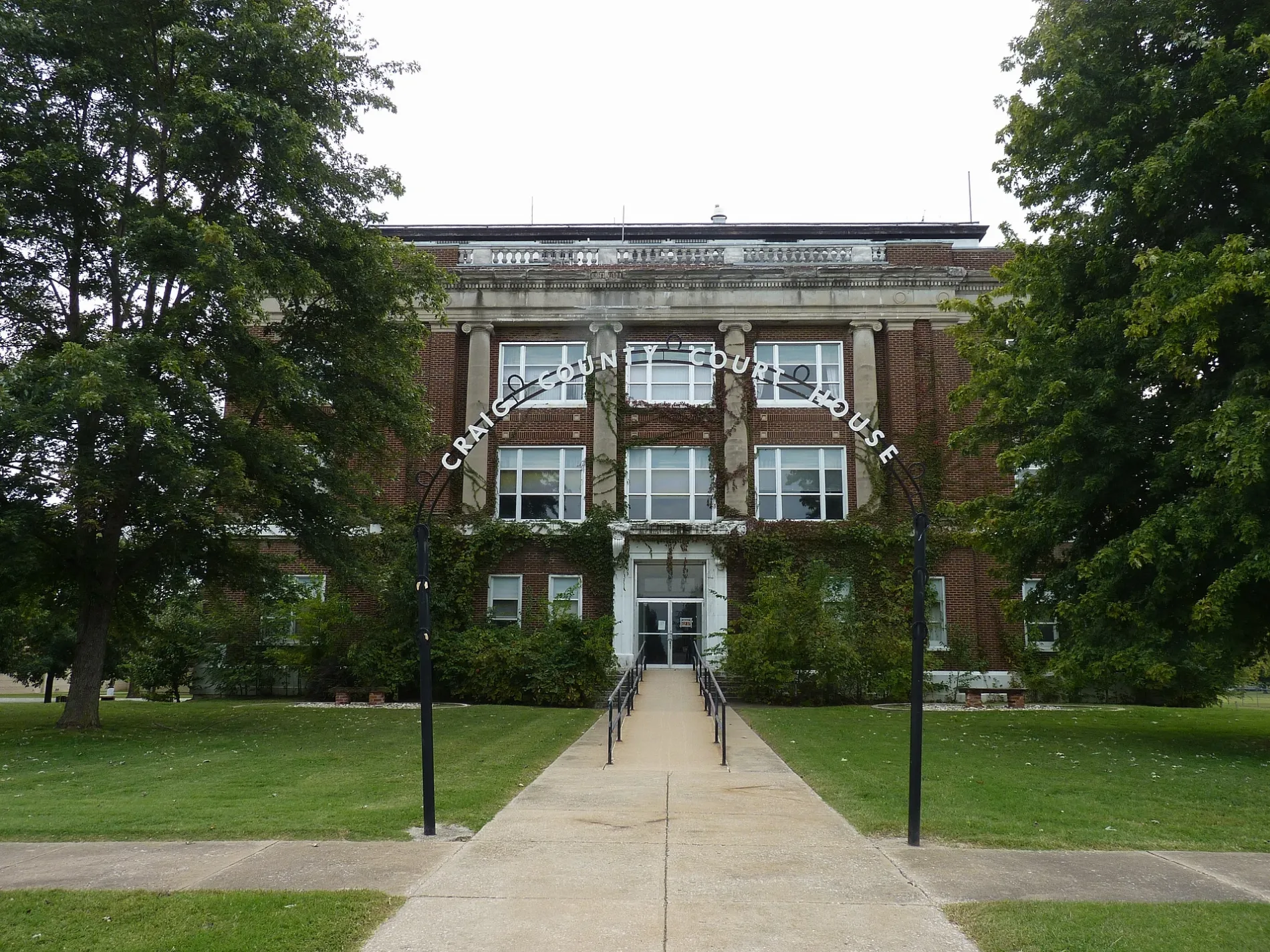
City map Craig County
AbeEzekowitz, CC BY-SA 3.0 – Wikimedia Commons

Craig County

Craig County is a northeastern Oklahoma county at administrative level 6. It has 14,107 residents and covers 1,975,000,000 square metres. The county was established in 1907.

Vinita is the county seat, and the Grand River forms part of the regional drainage system. Craig County lies between the wooded Ozark uplands and the prairie of northeastern Oklahoma.

City map Grant County
National Register Properties in Oklahoma, Public domain – Wikimedia Commons

Grant County

Grant County is an Oklahoma county at administrative level 6 with 4,169 residents. It covers 2,599,000,000 square metres and was established in 1893. The county lies in north-central Oklahoma along the Kansas border.

The area is dominated by agricultural plains around Medford and Pond Creek. The Salt Fork of the Arkansas River runs through the broader landscape of Grant County.

City map Harper County
JERRYE & ROY KLOTZ MD, CC BY-SA 3.0 – Wikimedia Commons

Harper County

Harper County is a county in northwestern Oklahoma at administrative level 6. It lies along the Kansas border in the southern Great Plains. The county seat is Buffalo.

The map covers Harper County’s roads, paths and rural settlements. The Cimarron River and the open prairie around Buffalo are defining geographic features of the county.

City map Kay County
Smallchief, CC BY 3.0 – Wikimedia Commons

Kay County

Kay County is an Oklahoma county at administrative level 6 with 45,366 residents. It lies in north-central Oklahoma along the Kansas border. Ponca City is the county’s largest city and a major settlement on the Arkansas River.

The county map includes Ponca City, Newkirk and the surrounding streets, paths and places. Kaw Lake and the Arkansas River are prominent water features in the local landscape.

City map Nowata County
Stugarrett, CC BY-SA 4.0 – Wikimedia Commons

Nowata County

Nowata County is a northeastern Oklahoma county at administrative level 6 with 9,320 residents. Its mapped area is 1,504,000,000 square metres, and the county was established in 1907. The county seat is Nowata.

The county lies in the transition between the Ozark uplands and the prairie near the Kansas border. The Caney River and Verdigris River are part of the regional water system.

City map Osage County
JERRYE & ROY KLOTZ MD, CC BY-SA 3.0 – Wikimedia Commons

Osage County

Osage County is an Oklahoma county at administrative level 6 with 45,818 residents. It covers 5,967,000,000 square metres and was established in 1907. Osage County is the largest county in Oklahoma by area.

The county includes Pawhuska and extensive tallgrass prairie in the Osage Hills. The Arkansas River forms part of its southern boundary, while the Tallgrass Prairie Preserve protects a large area of native grassland.

City map Texas County
Ammodramus, CC0 – Wikimedia Commons

Texas County

Texas County is an Oklahoma county at administrative level 6 with 21,384 residents. It covers 5,306,000,000 square metres and was established in 1907. The county occupies much of the western Oklahoma Panhandle.

Guymon is the county seat and a major regional centre in the High Plains. The North Canadian River crosses the county, which is bordered by Texas and New Mexico.

City map Washington County
David Marshall, CC BY-SA 3.0 – Wikimedia Commons

Washington County

Washington County is a county in northeastern Oklahoma at administrative level 6 with 52,021 residents. Bartlesville is the county seat and its largest city. The county borders Kansas and lies within the Verdigris River basin.

The map includes Bartlesville, Dewey and rural settlements along roads and paths. The Caney River and the Osage Hills connect Washington County with the wooded prairie landscape of northeastern Oklahoma.

City map Woods County
Zeugzeug, CC BY-SA 4.0 – Wikimedia Commons

Woods County

Woods County is an Oklahoma county at administrative level 6 with 8,624 residents. It was established in 1893 and lies in northwestern Oklahoma along the Kansas border. Alva is the county seat.

The county consists largely of open agricultural plains around the Salt Fork of the Arkansas River. Its city map records Alva, Waynoka and the surrounding rural roads and paths.

City map McCurtain County
Billy Hathorn, CC BY-SA 3.0 – Wikimedia Commons

McCurtain County

McCurtain County is a county in southeastern Oklahoma at administrative level 6 with 30,814 residents. It covers 4,924,000,000 square metres and was established in 1907. The county occupies the state’s forested southeastern corner.

Broken Bow and Idabel are major settlements, while Broken Bow Lake lies in the Ouachita Mountains. The Mountain Fork River and the Red River are important geographic features of McCurtain County.

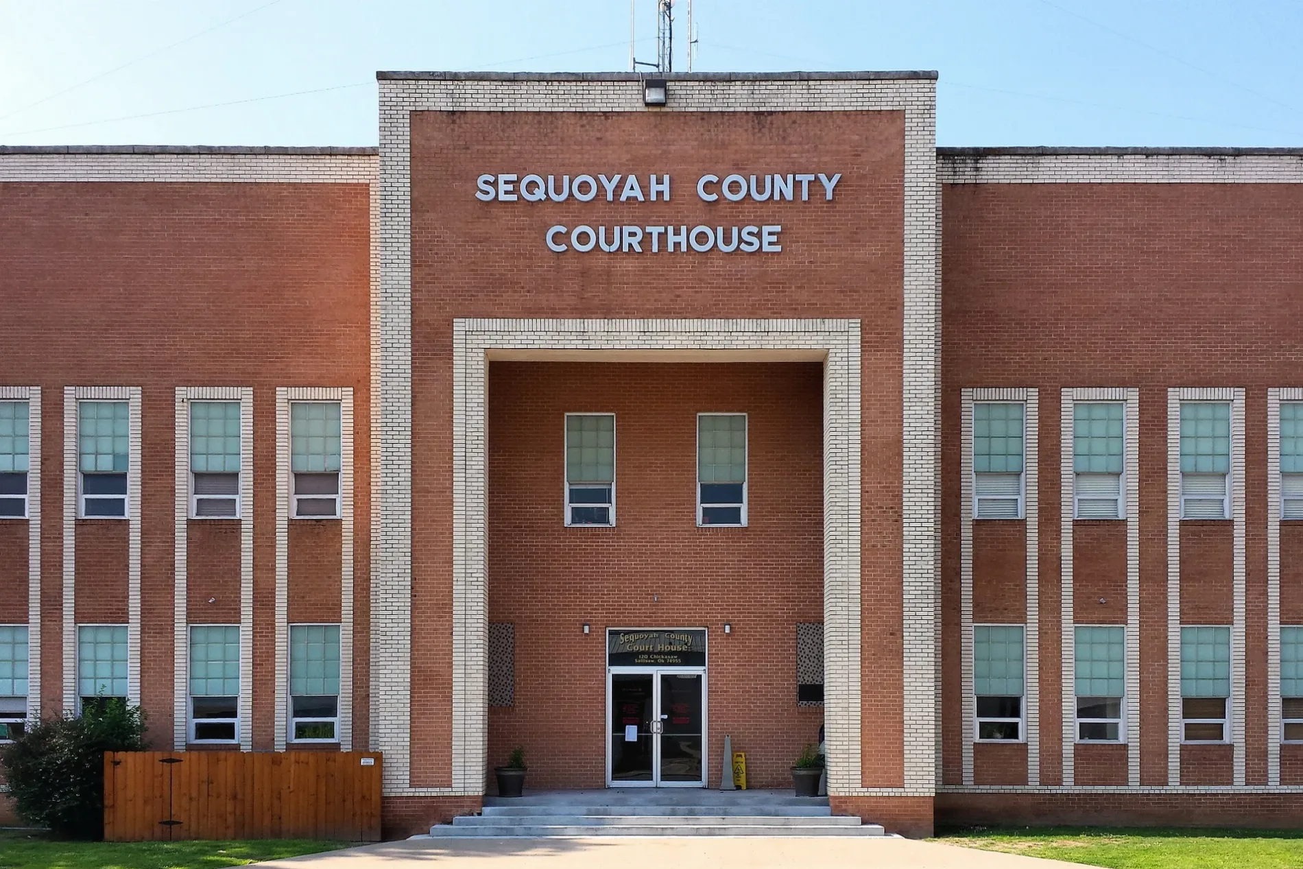
City map Sequoyah County
Larry D. Moore, CC BY 4.0 – Wikimedia Commons

Sequoyah County

Sequoyah County is an eastern Oklahoma county at administrative level 6 with 39,281 residents. It covers 1,852,000,000 square metres and was established in 1907. The county borders Arkansas and lies near the Arkansas River.

Sallisaw is the county seat, and Lake Tenkiller occupies part of the eastern county. The Illinois River, the Arkansas River and the Cookson Hills shape the local landscape.

City map Atoka County
Larry D. Moore This photo was taken with Samsung Galaxy S4, CC BY 4.0 – Wikimedia Commons

Atoka County

Atoka County is a southeastern Oklahoma county at administrative level 6 with 14,143 residents. It covers 2,564,000,000 square metres and was established in 1907. The county seat is Atoka.

Atoka County lies between the prairie of central Oklahoma and the forested hills of the Ouachita region. Atoka Lake and the Muddy Boggy Creek are notable water features in the county.

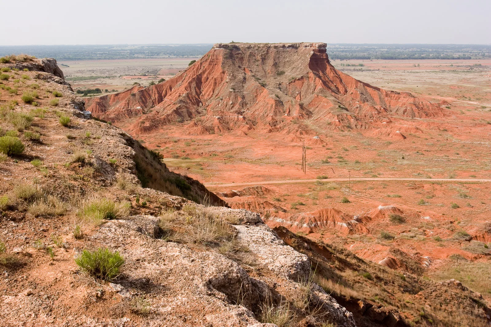
City map Beckham County
Crimsonedge34, CC BY-SA 3.0 – Wikimedia Commons

Beckham County

Beckham County is a western Oklahoma county at administrative level 6 with 22,410 residents. It covers 2,342,000,000 square metres and was established in 1907. Elk City and Sayre are the main settlements.

The county lies along the historic U.S. Route 66 corridor and includes open prairie around the North Fork of the Red River. Its map shows streets, paths and places across the western Oklahoma plains.

City map Blaine County
Umbra Lab, Inc., CC BY 4.0 – Wikimedia Commons

Blaine County

Blaine County is an Oklahoma county at administrative level 6 with 8,735 residents. It covers 2,432,000,000 square metres and was established in 1892. The county lies west of Oklahoma City.

Watonga is the county seat, and the North Canadian River crosses the regional landscape. Blaine County contains prairie, agricultural land and the gypsum hills of west-central Oklahoma.

City map Bryan County
Bubba73 (Jud McCranie), CC BY-SA 3.0 – Wikimedia Commons

Bryan County

Bryan County is a county in southern Oklahoma at administrative level 6 with 46,067 residents. It covers 2,443,000,000 square metres and was established in 1907. Durant is the county seat and a major city near the Texas border.

Lake Texoma lies along the Red River at the southern edge of the county. The map includes Durant, Lake Texoma and settlements connected by roads and paths across southern Oklahoma.

City map Caddo County
Uyvsdi, Public domain – Wikimedia Commons

Caddo County

Caddo County is an Oklahoma county at administrative level 6 with 26,945 residents. It covers 3,342,000,000 square metres and was established in 1901. Anadarko is the county seat.

The county includes the Wichita Mountains on its southwestern edge and the Washita River valley. Anadarko is known for the cultural institutions associated with the Southern Plains tribes, including the National Hall of Fame for American Indians.

City map Canadian County
Magpieturtle, CC BY 4.0 – Wikimedia Commons

Canadian County

Canadian County is an Oklahoma county at administrative level 6 with 154,405 residents. It covers 2,344,000,000 square metres and was established in 1889. Yukon, El Reno and Mustang are major cities in the county.

The county lies immediately west of Oklahoma City and includes the Canadian River. The historic Chisholm Trail crossed this area, which is now connected by extensive urban and rural road networks.

City map Carter County
Umbra Lab, Inc., CC BY 4.0 – Wikimedia Commons

Carter County

Carter County is a southern Oklahoma county at administrative level 6 with 48,003 residents. It covers 2,159,000,000 square metres and was established in 1907. Ardmore is the county seat and principal city.

The county lies near the Red River and includes parts of the Arbuckle Mountains. Lake Murray State Park and the Washita River are major geographic features around Ardmore and southern Carter County.

City map Cherokee County
Harrison Keely, CC BY 4.0 – Wikimedia Commons

Cherokee County

Cherokee County is an eastern Oklahoma county at administrative level 6 with 47,078 residents. It covers 2,011,000,000 square metres and was established in 1907. Tahlequah is the county seat and the capital of the Cherokee Nation.

The county contains Lake Tenkiller and sections of the Illinois River. The wooded hills of the Ozark Plateau surround Tahlequah and connect Cherokee County with northeastern Oklahoma.

City map Choctaw County
Official U.S. Navy Page from United States of America Thigpen Photography, Inc./U.S. Navy, Public domain – Wikimedia Commons

Choctaw County

Choctaw County is a county in southeastern Oklahoma at administrative level 6 with 14,204 residents. It covers 2,074,000,000 square metres and was established in 1907. Hugo is the county seat.

The county lies near the Red River and includes the Kiamichi River valley. Hugo Lake and the wooded terrain of southeastern Oklahoma are prominent features shown on the regional map.

City map Cleveland County
Umbra Lab, Inc., CC BY 4.0 – Wikimedia Commons

Cleveland County

Cleveland County is an Oklahoma county at administrative level 6 with 295,528 residents. It covers 1,446,000,000 square metres and was established in 1889. Norman is the county seat, while the northern part of the county borders Oklahoma City.

The county includes the University of Oklahoma in Norman and Lake Thunderbird. The South Canadian River and the urban corridors around Norman and Moore define much of the county’s mapped settlement pattern.

City map Coal County
Arthur Rothstein, Public domain – Wikimedia Commons

Coal County

Coal County is a county in southeastern Oklahoma at administrative level 6 with 5,266 residents. It covers 1,350,000,000 square metres and was established in 1907. Coalgate is the county seat.

The county lies in the wooded prairie transition of southeastern Oklahoma. The Muddy Boggy Creek and tributaries of the Canadian River cross a landscape historically associated with coal mining.

City map Comanche County
Lewis Hine, Public domain – Wikimedia Commons

Comanche County

Comanche County is an Oklahoma county at administrative level 6 with 121,125 residents. It covers 2,807,000,000 square metres and was established in 1901. Lawton is the county seat and the largest city in southwestern Oklahoma.

The county includes Fort Sill and the eastern Wichita Mountains. Lake Lawtonka, Mount Scott and the Wichita Mountains National Wildlife Refuge are prominent features near Lawton.

City map Cotton County
Michael Rivera, CC BY-SA 4.0 – Wikimedia Commons

Cotton County

Cotton County is a county in southern Oklahoma at administrative level 6 with 5,527 residents. It covers 1,663,000,000 square metres and was established in 1912. Walters is the county seat.

The county lies along the Red River near the Texas border and includes open agricultural plains. The Red River and the surrounding prairie are the main geographic features of the mapped area.

City map Creek County
Umbra Lab, Inc., CC BY 4.0 – Wikimedia Commons

Creek County

Creek County is an Oklahoma county at administrative level 6 with 71,754 residents. It covers 2,512,000,000 square metres and was established in 1907. Sapulpa is the county seat, and parts of the Tulsa metropolitan area extend into the county.

The county includes the Arkansas River and the historic oil town of Drumright. Rolling prairie, wooded creek valleys and urban settlements around Sapulpa form the local landscape.

City map Custer County
puroticorico, CC BY 2.0 – Wikimedia Commons

Custer County

Custer County is a western Oklahoma county at administrative level 6 with 28,513 residents. It covers 2,595,000,000 square metres and was established in 1892. Weatherford and Clinton are major settlements.

The county lies along the historic Route 66 corridor and includes the Washita River. The National Route 66 Museum in Clinton documents the road’s importance to western Oklahoma.

Dewey County

Dewey County is an Oklahoma county at administrative level 6 with 4,484 residents. It covers 2,611,000,000 square metres and was established in 1892. The county lies in northwestern central Oklahoma.

Taloga is the county seat, and the South Canadian River crosses the area. The county map records open prairie, agricultural land and rural roads around the river valley.

City map Ellis County
Larry D. Moore, CC BY 4.0 – Wikimedia Commons

Ellis County

Ellis County is a western Oklahoma county at administrative level 6 with 3,749 residents. It covers 3,190,000,000 square metres and was established in 1907. Arnett is the county seat.

The county lies in the High Plains near the Texas Panhandle. The Canadian River and its tributaries cut through the open prairie and agricultural landscape of Ellis County.

City map Garfield County
Calvin Beale, Public domain – Wikimedia Commons

Garfield County

Garfield County is an Oklahoma county at administrative level 6 with 63,569 residents. Enid is the county seat and the main urban centre of north-central Oklahoma. The county lies between the Salt Fork of the Arkansas River and the Kansas border.

The map includes Enid, rural communities and agricultural roads across the northern plains. The city’s location makes Garfield County a transport and service centre for north-central Oklahoma.

City map Garvin County
Umbra Lab, Inc., CC BY 4.0 – Wikimedia Commons

Garvin County

Garvin County is a southern Oklahoma county at administrative level 6 with 25,656 residents. It covers 2,107,000,000 square metres and was established in 1907. Pauls Valley is the county seat.

The county extends across the Washita River valley and the northern Arbuckle Mountains. The city map includes Pauls Valley, Lindsay and rural settlements connected by roads and paths.

City map Grady County
Department of Agriculture. Commodity Stabilization Service. Aerial Photography Field Office. ca. 1953-1961, Public domain – Wikimedia Commons

Grady County

Grady County is an Oklahoma county at administrative level 6 with 54,795 residents. It covers 2,863,000,000 square metres and was established in 1907. Chickasha is the county seat and the largest city.

The county lies southwest of Oklahoma City and includes the Washita River. Its landscape combines prairie, farmland and the northern edge of the Arbuckle region.

City map Greer County
Crimsonedge34, CC BY-SA 3.0 – Wikimedia Commons

Greer County

Greer County is a county in southwestern Oklahoma at administrative level 6. Mangum is the county seat, and the county lies near the Salt Fork of the Red River. The surrounding landscape consists of open prairie and agricultural land.

The county map shows Mangum and rural places connected by local roads and paths. Greer County is situated between the Wichita Mountains to the north and the Red River region to the south.

City map Harmon County
Department of Agriculture. Commodity Stabilization Service. Aerial Photography Field Office. ca. 1953-1961, Public domain – Wikimedia Commons

Harmon County

Harmon County is a county in southwestern Oklahoma at administrative level 6. Hollis is the county seat and the principal settlement. The county lies along the Texas border in the southern Great Plains.

The Red River forms part of the wider regional drainage system south of Harmon County. The map covers open prairie, agricultural land, streets and rural paths around Hollis.

City map Haskell County
Valis55, CC BY-SA 3.0 – Wikimedia Commons

Haskell County

Haskell County is an eastern Oklahoma county at administrative level 6 with 11,561 residents. It covers 1,619,000,000 square metres and was established in 1907. Stigler is the county seat.

The county lies in the wooded hills between the Arkansas River and the Ouachita region. Eufaula Lake and the Canadian River are major water features near Haskell County.

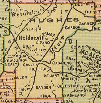
City map Hughes County
Cram, George Franklin/Davis, Ellis Arthur, Public domain – Wikimedia Commons

Hughes County

Hughes County is an Oklahoma county at administrative level 6 with 13,367 residents. It covers 2,110,000,000 square metres and was established in 1907. Holdenville is the county seat.

The county lies in south-central Oklahoma near the North Canadian River. Its landscape combines prairie, wooded creek valleys and rural settlements around Holdenville and Wetumka.

City map Jackson County
Larry D. Moore, CC BY 4.0 – Wikimedia Commons

Jackson County

Jackson County is a southwestern Oklahoma county at administrative level 6 with 24,785 residents. It covers 2,083,000,000 square metres and was established in 1907. Altus is the county seat and largest city.

The county lies near the Red River and the Texas border, with open plains around the North Fork of the Red River. Altus Air Force Base is a major federal installation in the county.

City map Jefferson County
Crimsonedge34, CC BY-SA 3.0 – Wikimedia Commons

Jefferson County

Jefferson County is a southern Oklahoma county at administrative level 6 with 5,337 residents. It covers 2,004,000,000 square metres and was established in 1907. Waurika is the county seat.

The county lies along the Red River near Texas and includes open prairie and agricultural land. The Waurika Lake area and the Beaver Creek basin are important local geographic features.

City map Johnston County
Murray State College, CC BY-SA 4.0 – Wikimedia Commons

Johnston County

Johnston County is a southern Oklahoma county at administrative level 6 with 10,272 residents. It covers 1,705,000,000 square metres and was established in 1907. Tishomingo is the county seat.

The county includes the eastern Arbuckle Mountains and the Blue River. The area around Tishomingo combines limestone hills, wooded valleys and the Blue River State Park region.

City map Kingfisher County
MARELBU, CC BY 3.0 – Wikimedia Commons

Kingfisher County

Kingfisher County is an Oklahoma county at administrative level 6 with 15,184 residents. It covers 2,346,000,000 square metres and was established in 1890. Kingfisher is the county seat.

The county lies northwest of Oklahoma City in the central Great Plains. The Cimarron River crosses the broader region, while agricultural land surrounds Kingfisher and Hennessey.

City map Kiowa County
Crimsonedge34, CC BY-SA 3.0 – Wikimedia Commons

Kiowa County

Kiowa County is a county in southwestern Oklahoma at administrative level 6. Hobart is the county seat, and the county lies north of the Wichita Mountains. Open prairie and agricultural land cover much of the region.

The Washita River crosses the county’s wider landscape. The map records Hobart and rural places connected by roads and paths across southwestern Oklahoma.

City map Latimer County
Thomas & Dianne Jones from Okmulgee, USA, CC BY 2.0 – Wikimedia Commons

Latimer County

Latimer County is a county in southeastern Oklahoma at administrative level 6 with 9,444 residents. It covers 1,888,000,000 square metres and was established in 1902. Wilburton is the county seat.

The county lies in the Sans Bois Mountains near the Ouachita region. Robbers Cave State Park and the wooded valleys around Wilburton are prominent local features.

City map Lincoln County
MARELBU, CC BY 3.0 – Wikimedia Commons

Lincoln County

Lincoln County is an Oklahoma county at administrative level 6 with 33,458 residents. It covers 2,501,000,000 square metres and was established in 1891. The county seat is Chandler.

The county lies east of Oklahoma City and includes the North Canadian River. Chandler is associated with Route 66, while rural communities occupy the surrounding prairie and woodland.

City map Logan County
Steven C. Price, CC BY-SA 3.0 – Wikimedia Commons

Logan County

Logan County is an Oklahoma county at administrative level 6 with 49,555 residents. It covers 1,940,000,000 square metres and was established in 1890. Guthrie is the county seat and a historic territorial capital.

The county lies immediately north of Oklahoma City and includes the Cimarron River. Guthrie’s nineteenth-century downtown is listed as a National Historic Landmark District.

City map Love County
Melodibit, CC BY-SA 3.0 – Wikimedia Commons

Love County

Love County is a southern Oklahoma county at administrative level 6 with 10,146 residents. It covers 1,378,000,000 square metres and was established in 1907. Marietta is the county seat.

The county borders Texas along the Red River and lies near Lake Texoma. The Red River valley and the nearby Arbuckle Mountains shape the local landscape.

City map Major County
Greg Willis from Denver, CO, usa, CC BY-SA 2.0 – Wikimedia Commons

Major County

Major County is an Oklahoma county at administrative level 6 with 7,782 residents. It covers 2,481,000,000 square metres and was established in 1907. Fairview is the county seat.

The county lies in northwestern central Oklahoma between the Cimarron River and the Great Salt Plains region. The Great Salt Plains National Wildlife Refuge lies to the north in the county’s wider geographic setting.

Oklahoma also contains 25 additional subregions whose names and paths were not supplied in the source data; they cannot be described or linked without inventing information.

Data sources: OpenStreetMap (ODbL), Wikidata (CC0)

Oklahoma – Facts

Population 3959353
Area 181195 km²
Subregions 85
Named after Oklahoma Territory
Year built 1907
Elevation 395 m
Located in United States
Country United States
Body of water Arkansas River, Red River, Eufaula Lake, Canadian River
Nickname Sooner State
Native name Oklahoma
Official name State of Oklahoma
Described by The Catholic Encyclopedia, Armenian Soviet Encyclopedia, New Encyclopedic Dictionary, Encyclopædia Britannica 11th edition, Meyers Konversations-Lexikon, 4th edition (1885–1890), 1922 Encyclopædia Britannica, Collier's New Encyclopedia, 1921, New International Encyclopedia, The New Student's Reference Work
Part of contiguous United States

Data source: Wikidata (CC0)

Important and frequently searched streets
Donald Avenue Harvey Road