
Northeast 82nd Avenue in Portland, Oregon
Northeast 82nd Avenue in Portland is a two-lane, asphalted main road. No sidewalks. It runs in a north-south direction and crosses Northeast Schuyler Street, Northeast Beech Street, Northeast Milton Street, Northeast Klickitat Street, Northeast Failing Street, Northeast Skidmore Street, Northeast Sandy Boulevard, Northeast Humboldt Street, Northeast Wygant Street, Northeast Going Place, Northeast Going Street and Northeast Prescott Street. It connects Roseway, Montavilla, Sumner, Portland, Madison South and Cully. Northeast 82nd Avenue is also known as Cascade Highway. This street is part of the highway "213" as well as the Hiking trail "Columbia Slough Trail". Ⓦ.
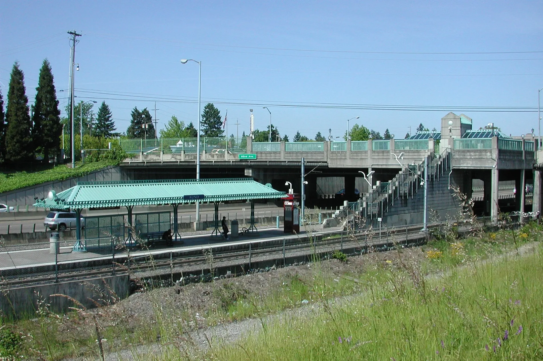
- Road Type
- main road
- Alternate Name
- Cascade Highway
- Bicycle
- yes
- Speed Limit
- 45 mph
- Lanes
- 2
- Route
- north-south
Streets nearby
Northeast 82nd Avenue Frontage Road150 ft
Northeast 79th Court0.2 mi
Northeast 78th Court0.2 mi
Northeast Holman StreetAirport Cafe, Morrison Child and Family Services
0.3 mi
Alderwood Trail0.3 mi
Northeast Alderwood RoadUPS employee parking
0.3 mi
Northeast Marx Drive0.4 mi
Northeast 80th Avenue0.4 mi
Northeast Columbia BoulevardNortheast Columbia Boulevard & 52nd (NAYA), Northeast Columbia Boulevard & 60th, Northeast Columbia Boulevard & 47th, Northeast Columbia & 46th, CCS, Colwood Grill
0.5 mi
Northeast 92nd Drive0.5 mi
Northeast Ambassador Place0.5 mi
Northeast Air Cargo RoadeVgo, Dutch Bros. Coffee
0.6 mi
Northeast Cornfoot RoadFedEx Ship Center, Copart
0.6 mi
O'Conner Way0.6 mi
Northeast Air Cargo Court0.6 mi
Northeast Cascades ParkwayNortheast Cascades Parkway & Mount Hood MAX Stn, Mount Hood Avenue, Buffalo Wild Wings, IHOP, Cascades, 9900 Block Northeast Cascades Parkway, Zabpinto Thai PDX, 10000 Block Northeast Cascades Parkway
0.6 mi
Northeast 82nd Way0.7 mi
Northeast Airport WayPortland International Airport, Sentinels;Habitat Tiles, Cloud Walk, Alamo, National, Hertz, Avis, Budget, Dollar, SIXT, Thrifty, Payless, Rental Car Center
0.7 mi
Buildings nearby
Honeywell0.3 mi
FAA Offices0.4 mi
Marine Recruiting Station0.5 mi
Cook Solutions Group0.6 mi
Car washes nearby
7-Eleven0.6 mi
Colleges nearby
Northwest College of Construction0.2 mi
Commercial areas nearby
Ambassador Business Center0.5 mi
Commercial buildings nearby
Portland International Plaza0.2 mi
PDX Maintenance Annex0.3 mi
Sky Chefs0.3 mi
United States Customs and Border Protection0.3 mi
PS-E0.5 mi
Rentrak0.6 mi
Fast food restaurants nearby
Taco Bell0.6 mi
Golf courses nearby
Colwood Golf Center0.5 mi
Hotels nearby
Home2 Suites by Hilton Portland Airport OR0.2 mi
Red Lion Hotels0.2 mi
Tru by Hilton Portland Airport0.3 mi
Radisson Hotel Portland Airport0.3 mi
Country Inn & Suites0.3 mi
Holiday Inn Portland-Airport0.4 mi
Embassy Suites0.6 mi
Holiday Inn Express & Suites Portland Airport - Cascade Station0.7 mi
Light rail stops nearby
Mount Hood Avenue0.7 mi
Mail depots nearby
USPS Processing & Distribution Center0.3 mi
Military areas nearby
Military Entrance Processing0.6 mi
Retail areas nearby
PDX Travel Center0.6 mi
Streams nearby
Columbia Slough0.2 mi
Warehouses nearby
IKEA Warehouse0.4 mi
Coffee Bean International0.5 mi
Other nearby
Southeast Ramp0.7 mi
| Located in | Portland |
|---|---|
| Country | United States |
Public transit map Portland Legend
| Railway | |
| Bus | |
| Streetcar |
Bicycle map Portland Legend
| Bike path | |
| Bike lane on roadway | |
| Cycling allowed on bus lane | |
| Bicycle street | |
| Open to cyclists | |
| Open to cyclists, good path | |
| Cycling prohibited | |
| Cobblestone |
| Long-distance bike route | (depending on scale) | |
| Long-distance bike route |
Pedestrian map Portland Legend
| Path |
| Long-distance hiking trail | (depending on scale) | |
| Long-distance hiking trail | ||
| Pedestrians prohibited |