
Southeast 34th Avenue in Richmond, Portland, Oregon
Southeast 34th Avenue in Richmond in Portland is an asphalted residential street. The street has sidewalks as well as bike paths (bike lane). It runs in a north-south direction starting from Southeast Stark Street and crosses Southeast Washington Street, Southeast Alder Street, Southeast Morrison Street, Southeast Belmont Street, Southeast Yamhill Street, Southeast Salmon Street, Southeast Main Street, Southeast Madison Street, Southeast Hawthorne Boulevard, Southeast Market Street and Southeast Stephens Street. It ends in a cul-de-sac and connects Richmond and Sunnyside. Southeast 34th Avenue also exists in Creston-Kenilworth and Eastmoreland.
- Road Type
- residential street
- Bicycle
- designated
- Bike Lane
- lane
- Speed Limit
- 20 mph
- Route
- north-south
Image
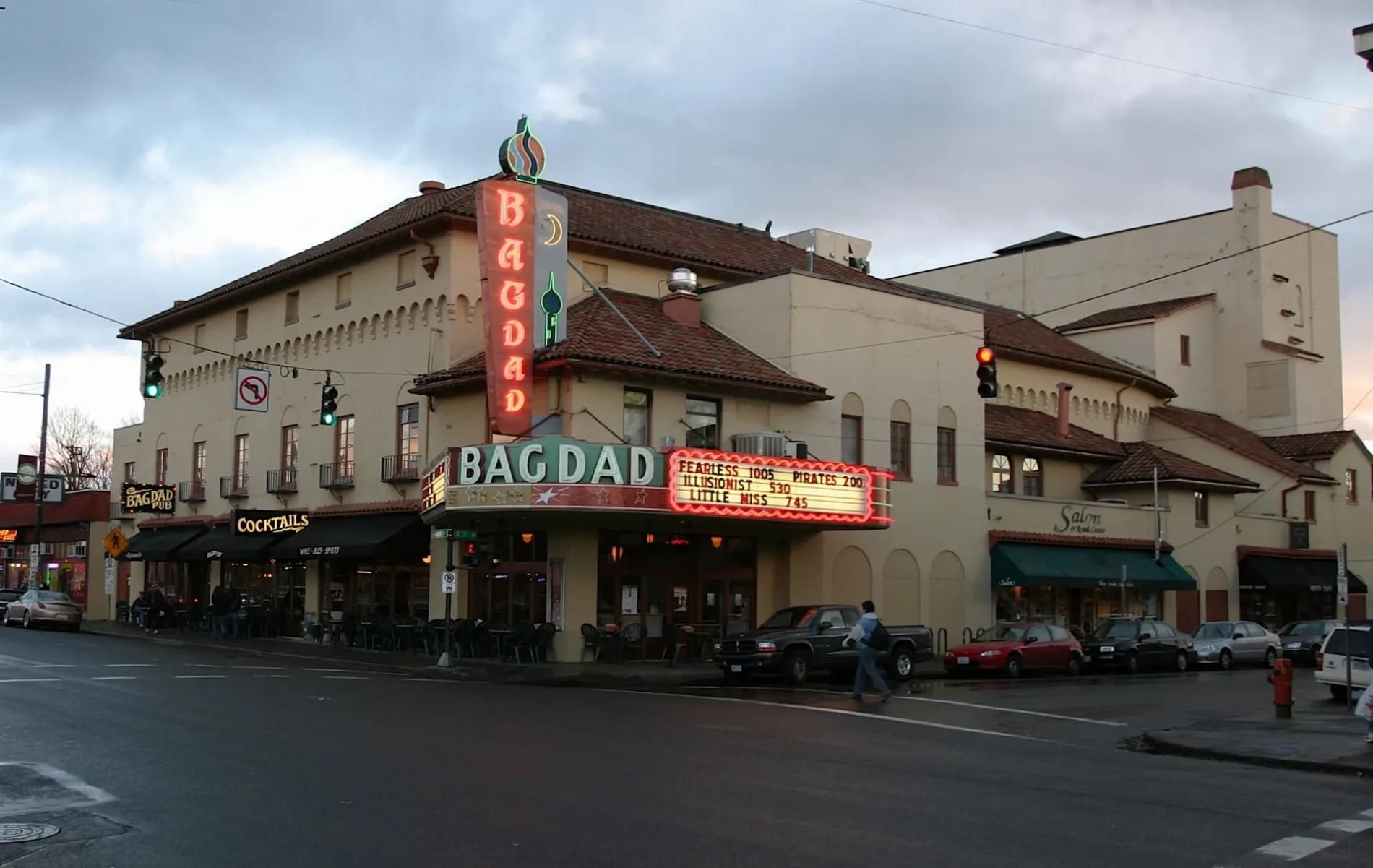
Fast food restaurants
Coffee shops
Restaurants
Shoe stores
Cheese shops
Bus stops
Bakeries
Hair salons
Ice cream shops
Cafes
Doctor's offices
Banks
Clothing stores
Schools
Clinics
Bookstores
Pet stores
Galleries
Streets nearby
Southeast 35th Place0.1 mi
Southeast Harrison StreetHistoric Tattoo
0.1 mi
Southeast Mill StreetSon Imports Inc.
0.2 mi
Southeast 35th Avenue0.2 mi
Southeast 37th AvenueHarlow
0.2 mi
Southeast 38th Avenue0.3 mi
Southeast Clay Street0.3 mi
Southeast Market StreetMultnomah Early Childhood Program
0.3 mi
Shops nearby
Psychic Reader0.3 mi
Apartment buildings nearby
The Renaissance0.3 mi
Bars nearby
Mulligans0.2 mi
Greater Trumps0.3 mi
Bookstores nearby
Powell's Books on Hawthorne0.3 mi
The Needle0.3 mi
Buildings nearby
Peterson Building0.2 mi
Douglas Building0.3 mi
The Frances Building0.3 mi
Cafes nearby
Seven Virtues Coffee Roasters0.2 mi
Mochinut0.3 mi
Mo Beri0.3 mi
Tōv0.3 mi
Clothing stores nearby
Classic Collection0.2 mi
Sloan0.2 mi
Communion0.2 mi
The Red Light0.3 mi
flower0.3 mi
Crossroads Trading0.3 mi
Buffalo Exchange0.3 mi
Florists nearby
Starflower0.2 mi
Gift shops nearby
Potala0.2 mi
Presents of Mind0.3 mi
Hair salons nearby
37th Street Salon0.3 mi
Rudy's Barbershop0.3 mi
Hi-fi stores nearby
Fred's Sound of Music0.3 mi
Ice cream shops nearby
Dairy Hill0.3 mi
Jewelry stores nearby
Oro0.2 mi
Movie theaters nearby
Bagdad0.3 mi
Music stores nearby
Jackpot Records0.2 mi
Hawthorne Game Exchange0.3 mi
Pubs nearby
Portland Cider House0.3 mi
Back Stage0.3 mi
Bagdad Pub0.3 mi
Restaurants nearby
Ding & Spice0.2 mi
Little Griddle0.2 mi
Bread and Ink0.3 mi
Harlow0.3 mi
No Name Pho0.3 mi
Nick's Famous Coney Island0.3 mi
Theaters nearby
Echo Theater0.3 mi
Toy stores nearby
Kids at Heart0.2 mi
Public transit map Richmond Legend
| Railway | |
| Bus | |
| Streetcar |
Bicycle map Richmond Legend
| Bike path | |
| Bike lane on roadway | |
| Cycling allowed on bus lane | |
| Bicycle street | |
| Open to cyclists | |
| Open to cyclists, good path | |
| Cycling prohibited | |
| Cobblestone |
| Long-distance bike route | (depending on scale) | |
| Long-distance bike route |
Pedestrian map Richmond Legend
| Path |
| Long-distance hiking trail | (depending on scale) | |
| Long-distance hiking trail | ||
| Pedestrians prohibited |