
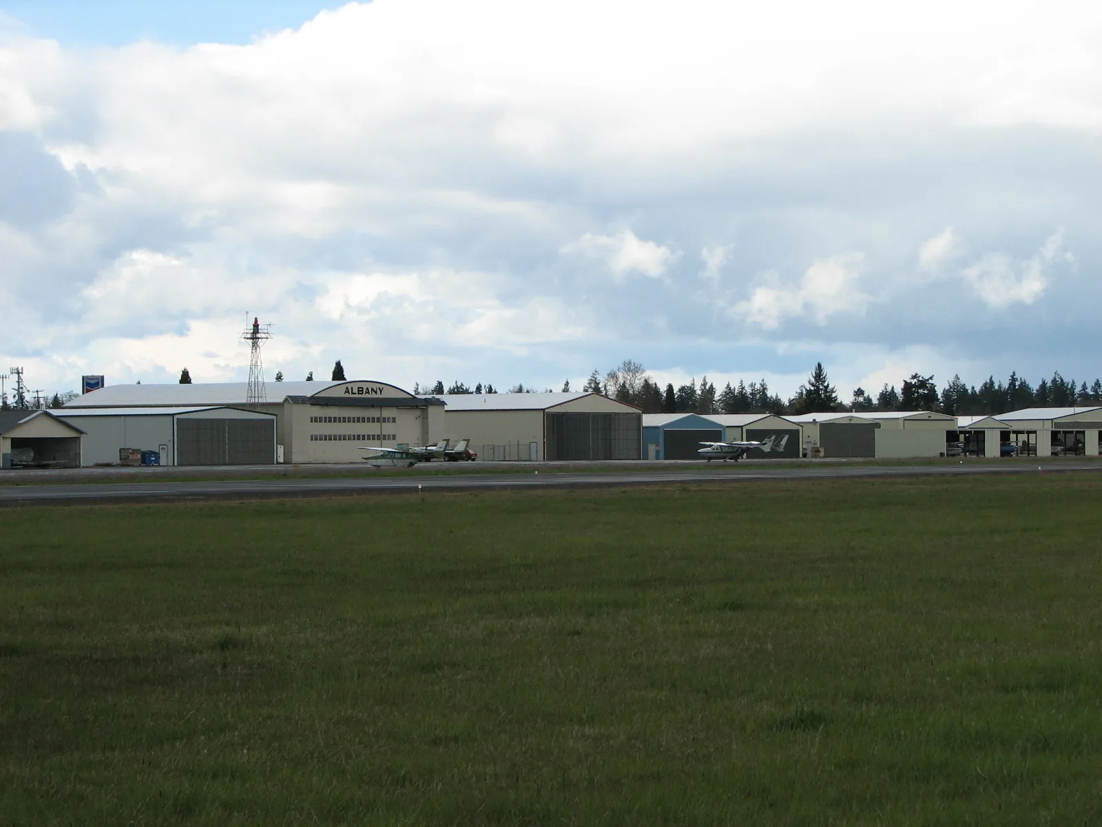
Albany Municipal Airport in Albany, Oregon
Albany Municipal Airport in Albany is an airfield. Ⓦ.
- Operator
- City of Albany
Image
Cafes
Gas stations
Dry cleaners
Schools
Post offices
Fast food restaurants
Tire dealers
Artworks
Pharmacies
Hotels
Banks
Restaurants
Hair salons
Car dealerships
Motels
Liquor stores
Ice cream shops
Streets nearby
Curtis Street Northeast150 ft
Highway #001MW - North Albany Connection #1400 ft
Opal Court Southeast400 ft
Knox Butte Road EastDraperville, Dragon's Brew Coffee
400 ft
Opal Street Northeast400 ft
Manor Street Northeast550 ft
Kathryn Avenue Northeast0.1 mi
Highway #001MY - North Albany Connection #30.1 mi
North Albany Interchange Connection0.1 mi
Expo Parkway Northeast0.1 mi
Aviation Way SoutheastA-4E Skyhawk
0.2 mi
Dunlap Avenue Northeast0.2 mi
North Albany Connection0.2 mi
Timber Street Southeast0.3 mi
Linn Avenue Southeast0.3 mi
Willamette Avenue Southeast0.3 mi
Houston Street Northeast0.3 mi
Fairlane Street Northeast0.3 mi
Price Road SoutheastBest Western Prairie Inn
0.3 mi
Airport Road SoutheastHertz Car Sales
0.3 mi
Western Street Southeast0.4 mi
Clover Ridge Court Southeast0.4 mi
Alameda Court Northeast0.4 mi
Northeast Hummingbird Street0.4 mi
Bentley Drive Northeast0.4 mi
Clover Ridge Road Northeast0.4 mi
Empire Court Southeast0.4 mi
Hummingbird Street Southeast0.4 mi
Dogwood Avenue Southeast0.5 mi
Bentley Court Northeast0.5 mi
Azalea Street Southeast0.5 mi
Kingfisher Court Southeast0.5 mi
Edgewater Drive Northeast0.5 mi
Meadowlark Court Southeast0.5 mi
Goldfish Farm Road SoutheastCoastal Farm and Ranch
0.5 mi
Bellaire Court Northeast0.5 mi
Douglas Street Southeast0.5 mi
Casting Street Southeast0.5 mi
Derby Street Southeast0.6 mi
Hotels nearby
Comfort Suites350 ft
Holiday Inn Express & Suites0.1 mi
Military buildings nearby
Oregon National Guard Armory0.2 mi
Parks nearby
Timber Linn Memorial Park0.3 mi
Residential areas nearby
Timberlinn Apartments0.2 mi
Rosewood Estates0.3 mi
Restaurants nearby
Cascade Grill350 ft
Streams nearby
Burkhart Creek0.4 mi
Cox Creek0.5 mi
Waters nearby
Timber-Linn Lake0.5 mi
| Elevation | 226 |
|---|---|
| Heritage designation | National Register of Historic Places listed place |
| Located in | Albany |
| Country | United States |
Public transit map Albany Legend
| Railway | |
| Bus | |
| Streetcar |
Bicycle map Albany Legend
| Bike path | |
| Bike lane on roadway | |
| Cycling allowed on bus lane | |
| Bicycle street | |
| Open to cyclists | |
| Open to cyclists, good path | |
| Cycling prohibited | |
| Cobblestone |
| Long-distance bike route | (depending on scale) | |
| Long-distance bike route |
Pedestrian map Albany Legend
| Path |
| Long-distance hiking trail | (depending on scale) | |
| Long-distance hiking trail | ||
| Pedestrians prohibited |